-2")

Warm and Unsettled Pattern Returns, Cool Shot This Weekend?
Good Evening!
Today was another beautiful day over the vast majority of the Northeast and Mid Atlantic regions as a large area of high pressure centered over the Ohio valley continues to press eastward, continues to dominate our weather. With relatively clear skies, low humidity, and warm mid level temperatures, highs today across the region were able to find their way back into the mid to upper 80’s. This is another step back up to seasonal temperatures after highs took a pretty large hit late last week and during the first half of this past weekend. These warm temperatures, clear skies, and light winds will last into the evening hours, and should be quite favorable for radiational cooling to take place during the overnight and early morning hours. This should allow low temperatures to fall into the mid to upper 60’s across the area, leading to another comfortable evening across the entire region.
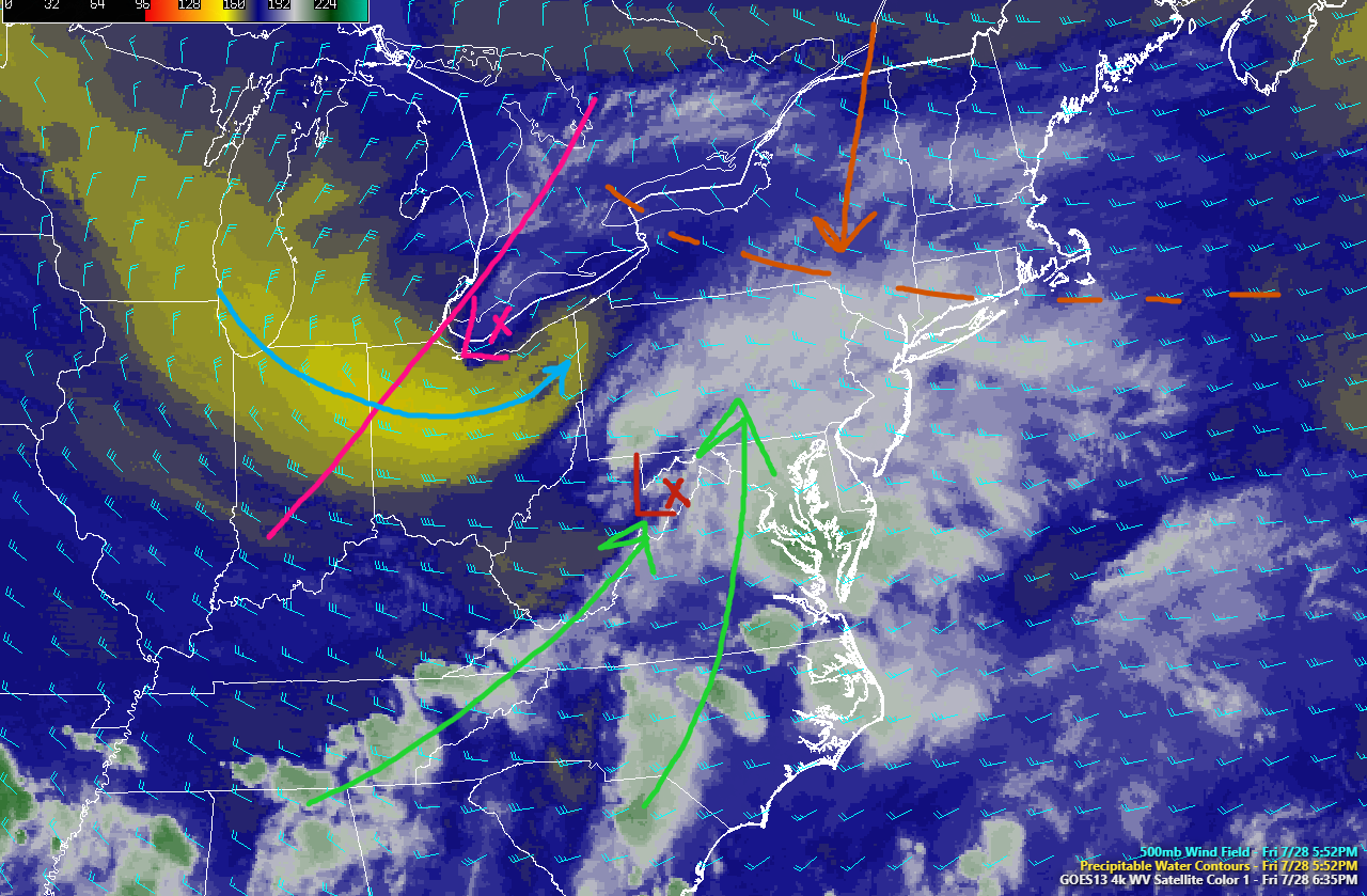
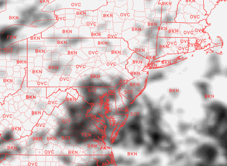
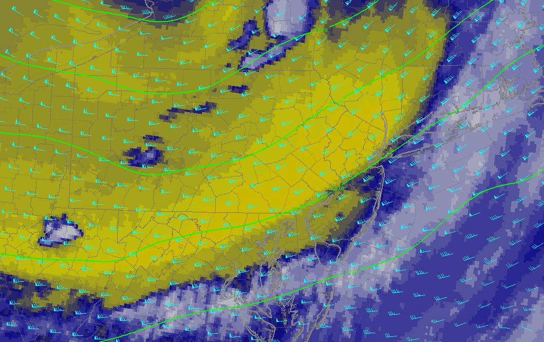
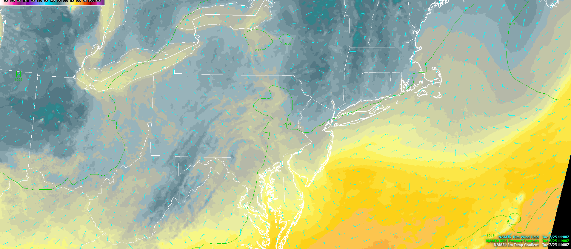
As of six o’clock, there were some heavy showers and thunderstorms located over western New York and central Pennsylvania associated with a weak mid level disturbance. Shear and instability is marginal at best in this region, and as you get further from these storms, atmospheric conditions become very unfavorable to sustain these showers and thunderstorms Therefore, we do not expect any significant shower/thunderstorm activity to move into the region this evening.

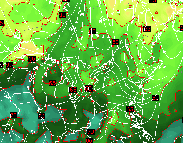
This evenings latest high resolution radar mosaic, visible satellite imagery, and surface observations, showing a very nice and clear day over much of the Northeast. Some showers and thunderstorms were ongoing over portions of PA and NY. but these are expected to dissipate later this evening (Courtesy of Simuawips)
Tuesday and Wednesday
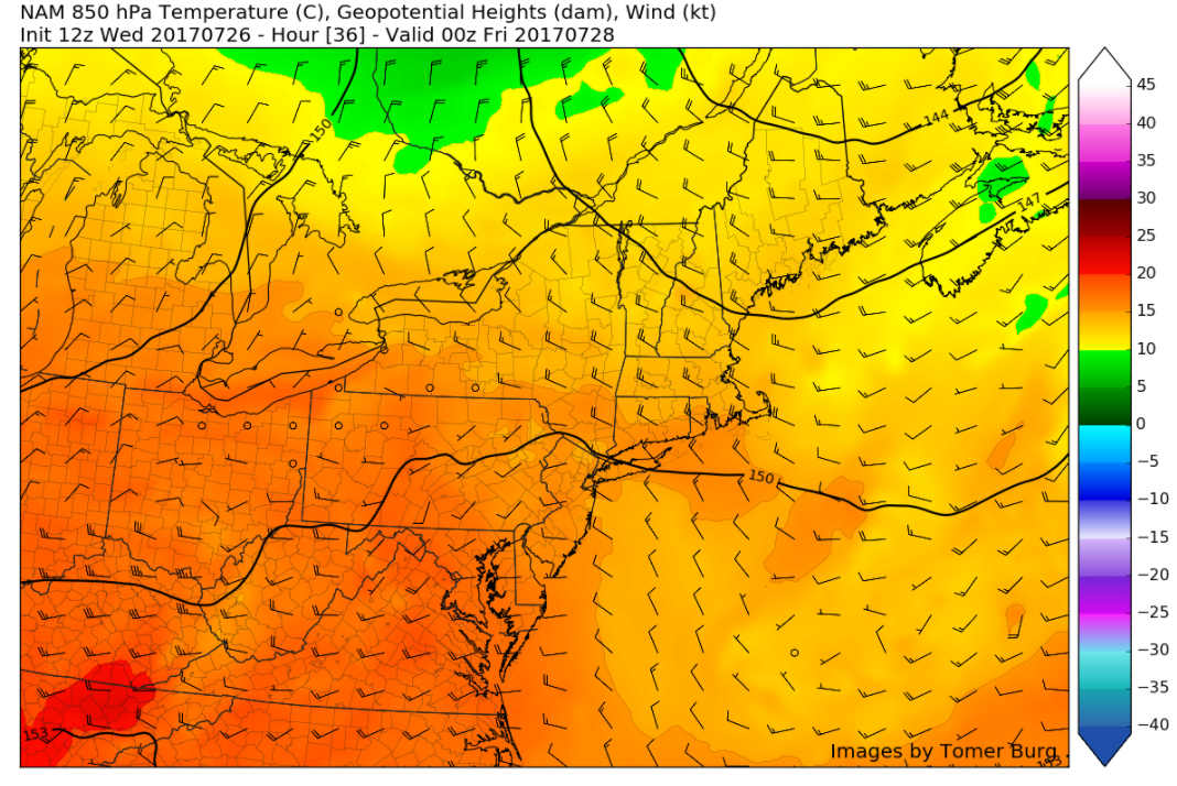
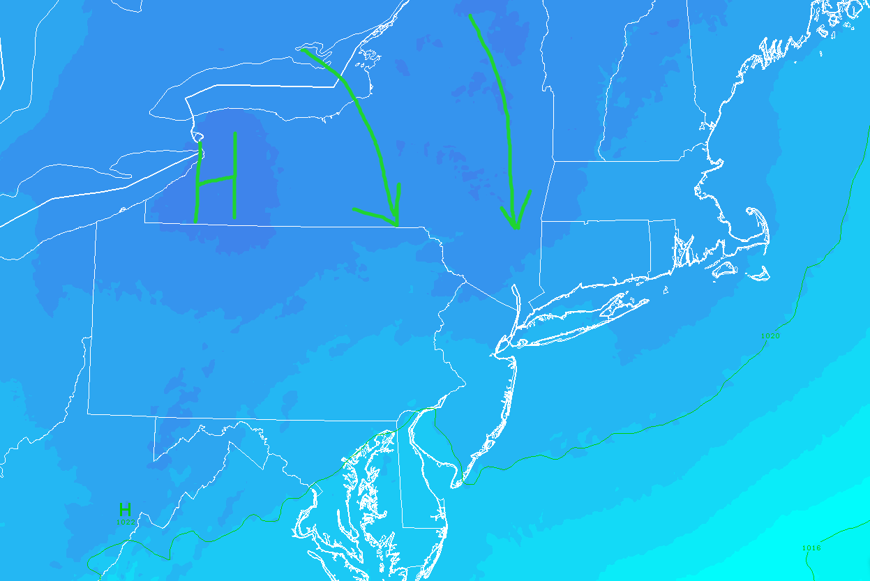
Tuesday morning will likely start off relatively clear, with any low level clouds and residual early morning fog quickly dissipating. The area of high pressure over the Ohio Valley will continue to move to the east and get closer to the region, which should also allow for temperatures to increase a bit more as mid level ridging increases aloft. In addition to warmer mid level temperatures, the high pressure system to our south should allow winds from the west/west-southwest to take over during the day on Tuesday. This will in turn allow for dewpoints to increase to the lower to middle 60’s across the entire region, making for a more muggy feel tomorrow afternoon. Clear skies should allow for highs to quickly rise into the middle to upper 80’s tomorrow-with some locations possibly creeping into the lower 90’s.
With the increasing dewpoints over the area, instability will be on the rise, and we may have to watch for some afternoon shower and thunderstorm activity. At this time, it appears quite likely that any thunderstorm activity will likely be located over portions of Pennsylvania and New York state once again, due to an overall lack of coherent forcing, unimpressive mid level lapse rates, and weak shear values over the NYC metro area. As we head into the evening hours tomorrow, things should remain quite warm as the increased mid level moisture/temps really put a cap on any potential radiational cooling. Lows will likely be stuck in the low to middle 70’s, with more humid conditions taking over. Some patchy fog may try to develop near coastal locations, but widespread fog is not likely at this time.
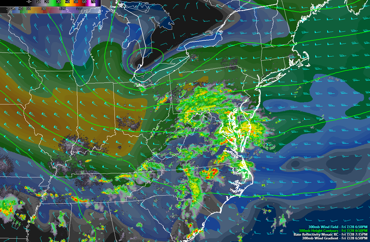
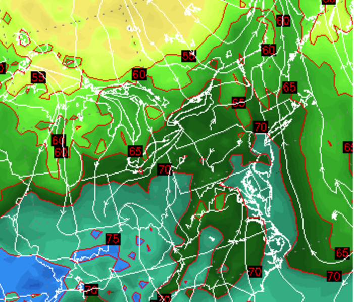
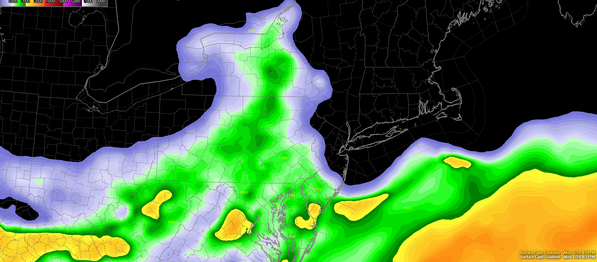
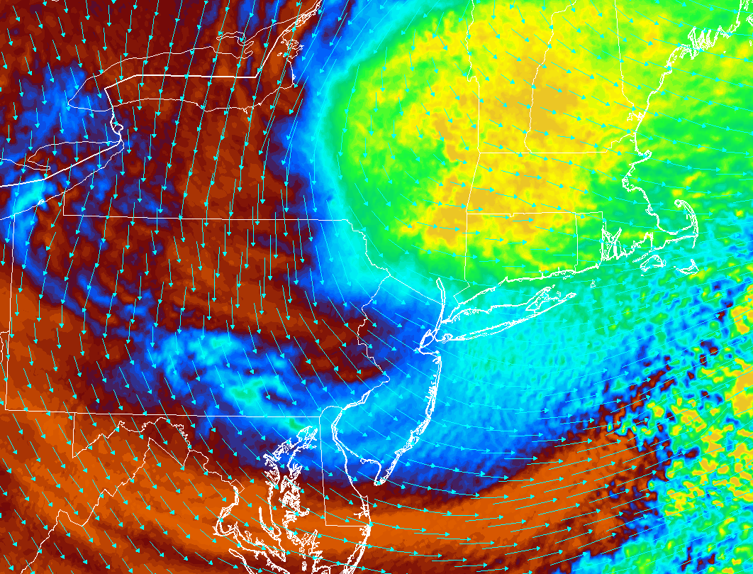
On Wednesday, we can expect yet another sunny start to the day with any early morning clouds and fog quickly burning off by the late morning hours. A weak shortwave trough in the mid levels of the atmosphere will be loving to our west during the afternoon hours, and this trough will have to be watched during as the area begins to destabilize on Wednesday. This afternoons model guidance is not too impressive with shear or overall forcing over our area, but a few small changes over the next 36 hours would yield some different results. At this time, it appears that capping may hold on long enough on Wednesday afternoon to allow for some weak mid level energy to pass to the west of the region, thus setting off the development of some showers and heavy thunderstorms over portions of Pennsylvania, New Jersey, New York, and Connecticut. Wind shear and lapse rates look very marginal at this time, so any storms that do form will likely be “pulse” storms that oscillate in intensity without begin able to move much. This may result in locally heavy downpours in some areas in addition to some brief gusty winds. Regardless, highs should be in the middle 80’s to lower 90’s once again on Wednesday, with another warm and humid evening on tap as well.

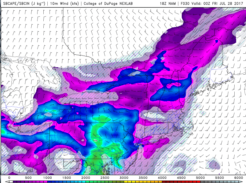
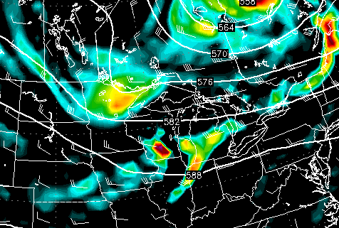
This afternoons RPM model showing the development of showers and thunderstorms over portions of the Mid Atlantic and Northeast on Wednesday. Overall, these showers and thunderstorms should remain below severe limits due to weak shear and poor mid level lapse rates.
Thursday and Beyond
Later in the week, a strong cold front associated with a large northern stream disturbance will begin to track to the south and east. Before the frontal boundary reaches the area, precipitable water values will likely surge once again, possibly edging over the 2″ mark over portions of the Mid Atlantic. This moisture surge will be similar to the one that occurred last week, but with a completely different upper level setup this time. As the front approaches the region on Friday and Saturday, there is the possibility of numerous showers and thunderstorms breaking out as the parameters for thunderstorm development become much more favorable, with a strong upper jet maximum, increased forcing, and better lapse rates. Depending on how this system evolves over the next few days, we may have to watch for another localized flooding event over portions of the NYC metro area.
As this frontal system pushes through on Saturday and Sunday, a large area of high pressure dropping down from Canada will begin to take control, which should provide a nice end to the weekend, with cooler conditions and much lower humidity. At this time, this period of mid temperatures and decreased humidity looks to last into the middle of next week, before we have to worry about our next rain chances.

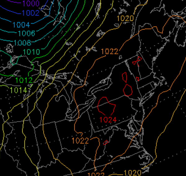
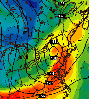
This afternoons European ensembles, showing relatively good agreement on a brief cool down after a frontal passage this upcoming weekend (Courtesy of Tropical Tidbits)
For more information and posts like this one, make sure you sign up for Premium Forecasts — where multiple detailed articles, videos, and interactives are posted each day. Also, come interact with our staff and many other weather enthusiasts at 33andrain.com!
Have a great evening!
Steve Copertino


