-2")

Public Analysis: Third Heatwave of the Year Possible, Increasing Thunderstorm Threats This Weekend
Good Evening!
Today has been another day in this string of hot and muggy weather. This semi-tropical airmass can be attributed to a large area of high pressure over the western Atlantic, which is in a perfect position to pump the uncomfortable dewpoints and heat northward. This airmass is likely to remain in place through the weekend and possibly even into the first half of next week, before a cold front associated with a strong disturbance originating from the Pacific Ocean sweeps through.
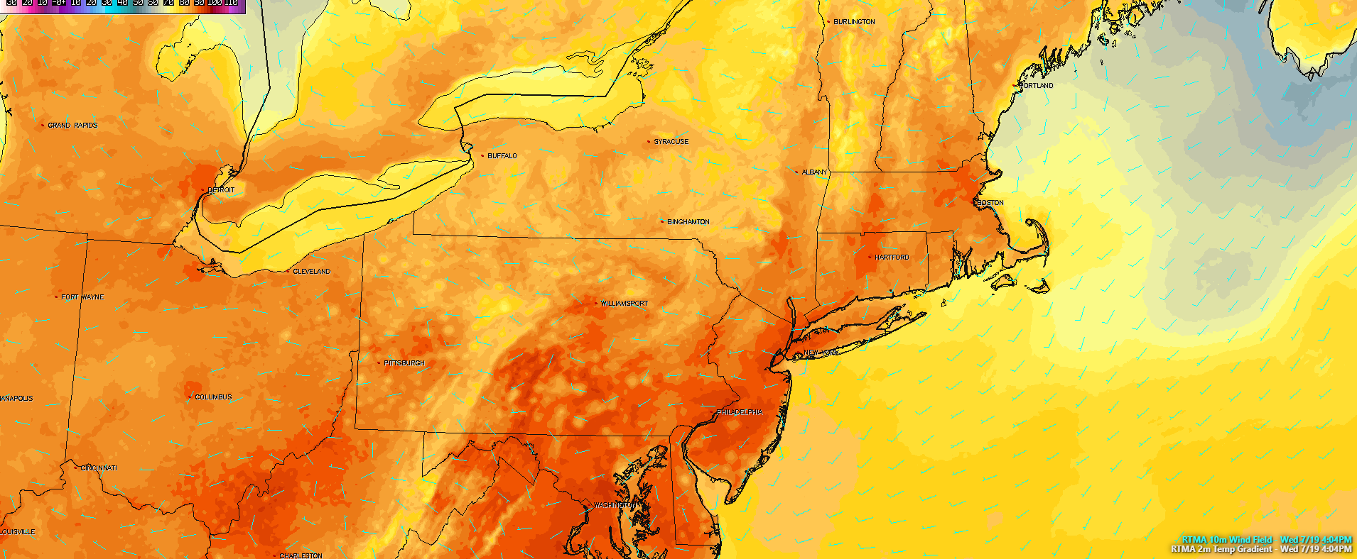
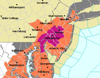
Regardless, after some low level clouds and patchy fog that built up during the early morning hours burnt off, temperatures were able to quickly rise into the upper 80’s and lower 90’s-with some locations reaching the middle 90’s! As stated earlier, the high pressure out in the western Atlantic has been pumping in very impressive dewpoints over the region. Dewpoints will range in the 65-75 degree area, which is right around the “uncomfortable” and “oppressive” tiers of the spectrum for this area. When you take temperatures in the upper 80’s to middle 90’s and factor in these very high dewpoints, the apparent temperature-or how hot it feels rises quite a bit. Due to this, the National Weather Service has issued a Heat Advisory, which will likely last until Thursday evening. Day time highs in the low 90s combined dew point temps around 70 will produce heat index values in the upper 90s across the advisory area, which is forecast to continue through Thursday. “The heat and humidity may cause heat stress during outdoor exertion or extended exposure. Extreme heat can cause illness and death among the at-risk population who can not stay cool.”
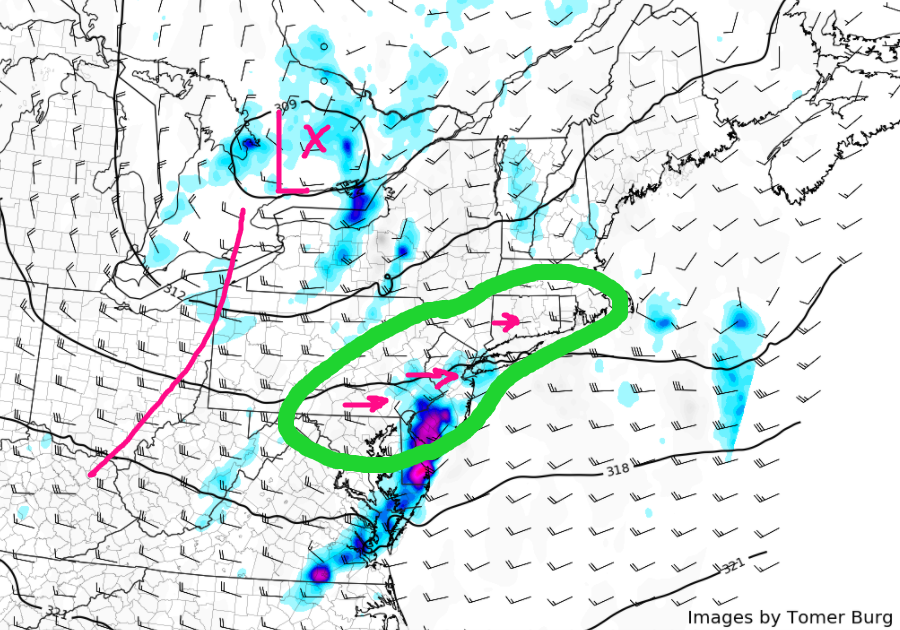
Additionally, all of this low level moisture will allow for instability to rise over the area as well. Some showers and thunderstorms are currently going up over central and eastern Pennsylvania. These storms formed as a result of some residual energy from a dying upper level low interacting with the warm/unstable airmass over the region. Thankfully, the trigger energy from this disturbance is not all that strong or organized, so widespread thunderstorm development does not seem likely over the area. However, any showers and thunderstorms that do develop may have very heavy rainfall associated with them as the atmosphere is loaded with precipitable water.
The hot and humid conditions will last well into the evening hours, likely until sunset, and even then temperatures will be well-above normal tonight as the muggy airmass keeps the entire area locked into the low to middle 70’s for overnight lows.

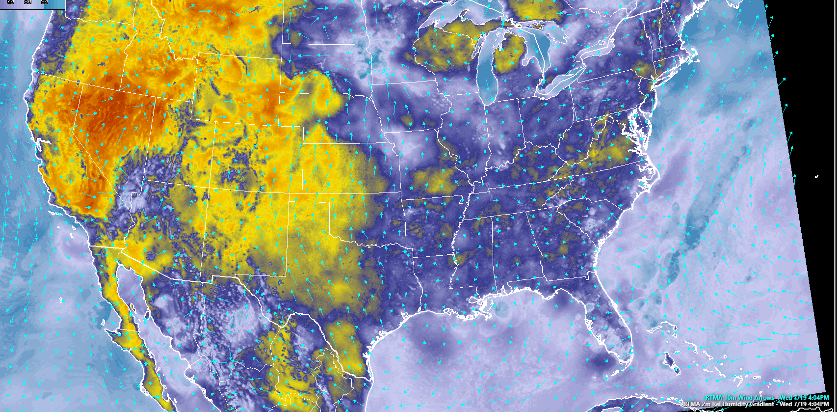
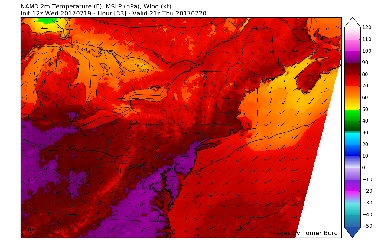
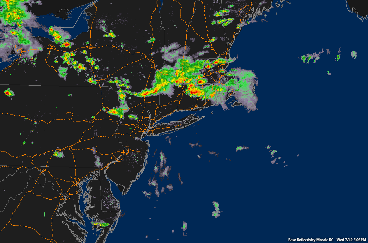
This evenings latest high resolution satellite imagery, regional radar mosaic, and surface observations,showing a very warm and humid day across the area with some scattered shower and thunderstorm activity to our west (Courtesy of Simuawips.com)
Thursday into Friday
Thursday will likely start off quite clear, which should allow temperatures to skyrocket during the early afternoon hours. Light west/southwest winds will also be ushering in another round over very high dewpoints, and with slightly higher mid level temperatures, we expect highs tomorrow to be slightly higher than they were this afternoon, with much of the area in the upper 80’s to middle 90’s. This combination will make apparent temperatures (Real Feel) rise into upper 90’s and even lower 100’s across the area. This heat and humidity combo can be dangerous to some people, so make sure to stay hydrated and do not overexert yourself. Weak seabreeze fronts may develop along the shores of Connecticut, Long Island, and New Jersey, and this could help to knock the temperatures and humidity down a few degrees as the afternoon marches onward.
Instability will once again build over the region, and with an active quasi-zonal flow being established over the region, we may have to worry about a complex of showers and thunderstorms moving through the area late tomorrow afternoon and into the evening. Precipitable water values will still be quite high and there will be some weak shear present, so any showers and thunderstorms that develop will have a risk of torrential downpours that can potentially cause flash flooding, as well as some locally damaging winds.
Friday looks to be another very hot and humid day with clear skies and increased low level moisture. It is looking quite possible that if Thursday and Friday both produce highs in the 90’s, then numerous stations will record their third “heatwave” of the year. It is also quite possible that the Heat Advisory for the area gets extended until Friday evening, as dewpoints and temperatures will still be high enough to make conditions seriously oppressive.

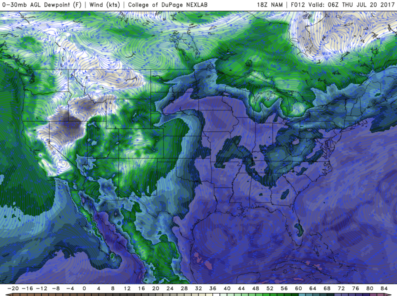
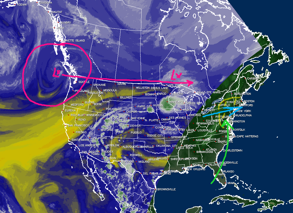
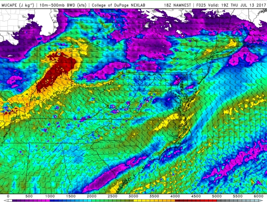
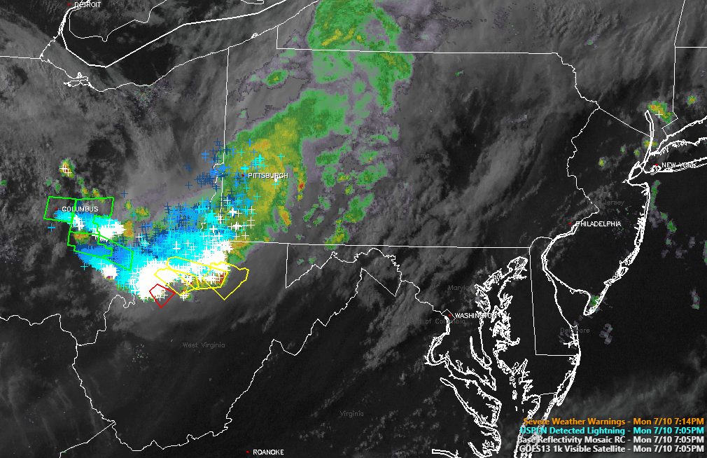
This evenings latest Rapid Precision Model, showing the potential for gusty showers and thunderstorms moving through the area by late Thursday afternoon/evening. Some of the stronger storms may be able to produce flash flooding and locally damaging winds. (Courtesy of WSI)
This Weekends Severe Thunderstorm Threat
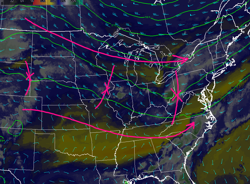
As we mentioned before, the Northeast will be within a west to east “zonal flow” this weekend, which will have numerous short wave trough embedded withing the flow. This looks to change on Sunday, when a large Pacific disturbance (that is currently off the West coast) gets caught in the flow and is located just to our northwest. The massive area of high pressure to our east over the Atlantic will still be supplying very moist and unstable air directly into the area while yet another area of high pressure over the central part of the country advects what is known as an Elevated Mixing Layer (or EML for short). This EML is very favorable for thunderstorm development, especially severe thunderstorm development. With the shortwave to the northwest in Canada providing upper level support and shear, the very moist and unstable airmass being pumped in from the south, and the support from the EML, it seems quite possible that widespread thunderstorm development will be possible on Sunday, with a higher than average chance that at least some of the storms become severe over a good portion of the Northeast/Mid Atlantic.
The main questions right now appears to be just how much influence will the previous nights possible convection last into the day on Sunday, and how far north will the surface low develop to our west. If we can get a strong enough surface low to develop over the eastern Great Lakes region with increased instability, then we may have to watch for the development of quite a few severe thunderstorms capable of wet microbursts, large hail, and flash flooding. We will have an update later this week to go over this potential threat once again.

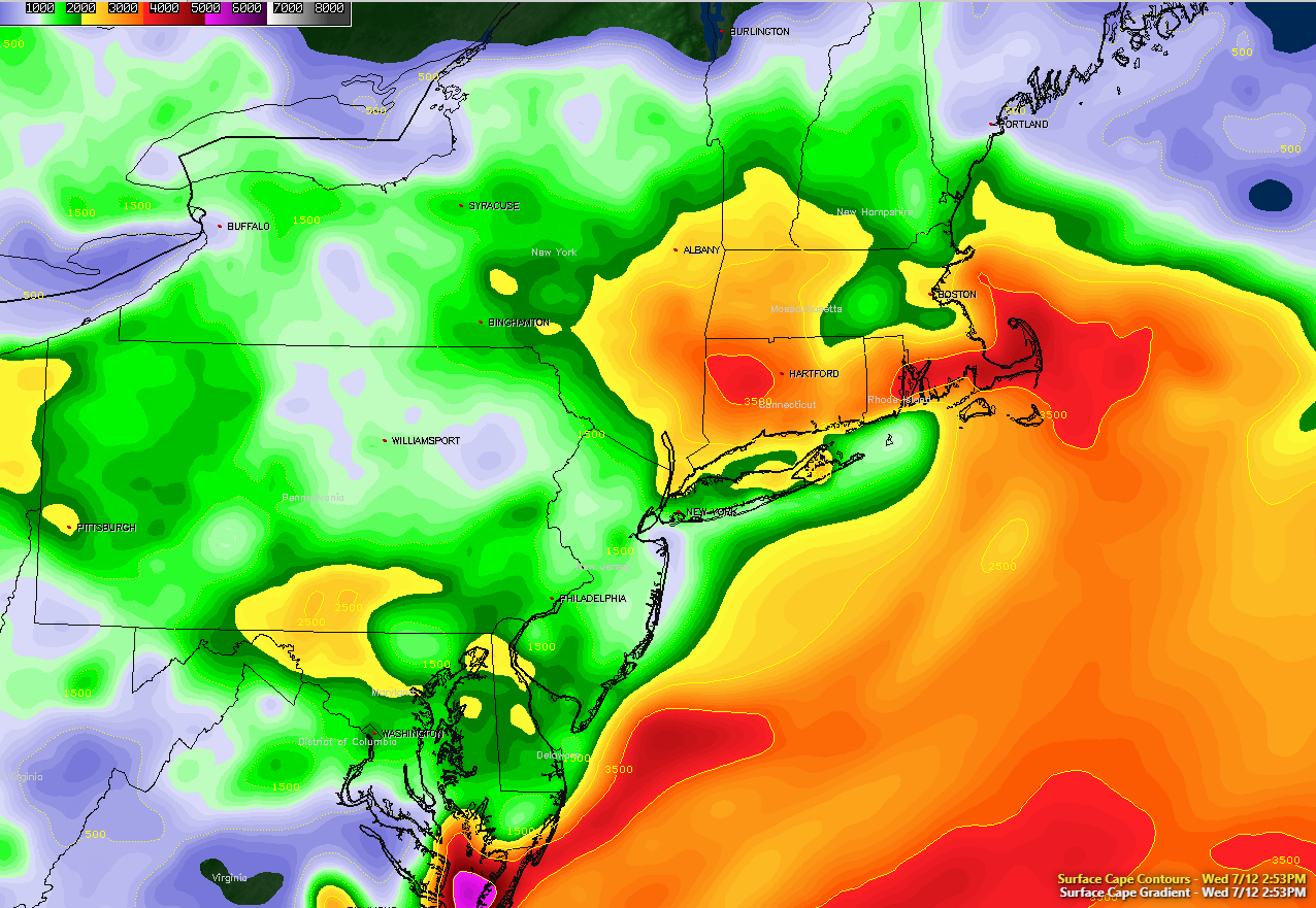
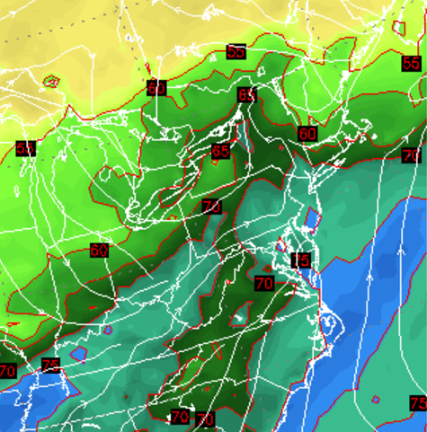
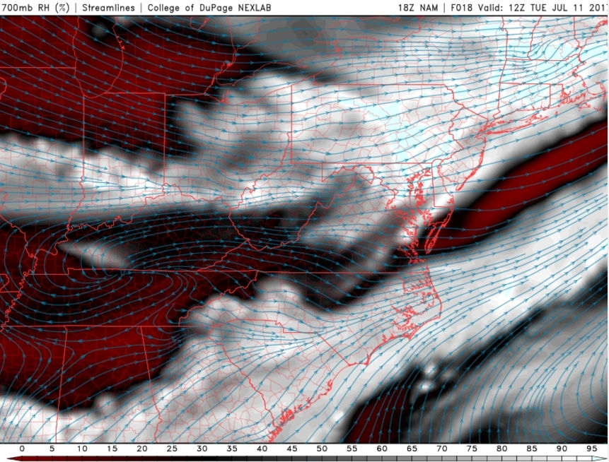
This afternoons European model showing modest amounts of instability, decent wind shear, along with good timing for the possible development of strong to severe thunderstorms over the Northeast on Sunday
For more information and posts like this one, make sure you sign up for Premium Forecasts — where multiple detailed articles, videos, and interactives are posted each day. Also, come interact with our staff and many other weather enthusiasts at 33andrain.com!
Have a great evening!
Steve Copertino


