-2")

Public Analysis: Calm and Cool Conditions Gives Way to Hot and Stormy By Friday
Good Evening!
We had a rather wild Saturday morning this past weekend as the remnants of Tropical Storm Cindy stormed through the area along with a rather strong cold front. All of the deep tropical moisture and forcing from Cindy and the cold front allowed a rather impressive line of torrential rain and embedded thunderstorms to move through the area early on Saturday morning. This area of heavy rain did bring some flooding to locations as rainfall rates increased to over one inch per hour, but also brought some extensive wind damage, along with two confirmed tornadoes in Monmouth county, New Jersey! After the cold front moved through, we saw a much direr air mass take over yesterday, which has persisted through the day today, and should last another 48 hours. Afterwards, it appears that a large area of high pressure will form just off the East Coast and looks to bring above normal temperatures back to the region, with the addition of another muggy air-mass and the threat of some strong thunderstorms towards the end of the week.
———-
This Evening Into Tomorrow
As mentioned, today was a very pleasant day with mostly sunny skies, light winds, and cooler temperatures thanks to a rather moderate and dry air mass in place over the region. High temperatures were able to stick into the mid to upper 70’s, which is slightly-below, or just around seasonable for this time of year. Some locations saw temperatures drop off a bit during the afternoon hours as sea-breezes made their way inland over portions of Long Island and Connecticut. There was some threat of isolated showers and thunderstorms this afternoon, but the lack of a strong trigger and very dry mid levels of the atmosphere seem to point that nothing more than a few cumulus clouds should be expected for the remainder of the day and into the evening.
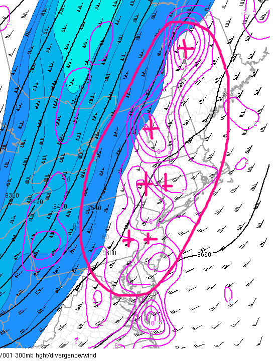
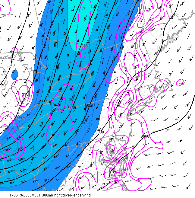
As we continue into the evening hours, a very unusually strong mid level trough for this time of year will continue to pivot eastward, and drags another cold front with it. While this afternoons models were hinting at some rain later this evening associated with this cold front, it seems that the aforementioned dry air should put a kibosh on any precipitation. As the front approached the area, falling heights out ahead of the upper level trough should allow for clouds to increase, but with light winds and a very cool vertical temperature profile in place, overnight lows should drop to below-normal levels, with low to mid 60’s likely for most of the area, and 50’s possible for areas further away from the coast.

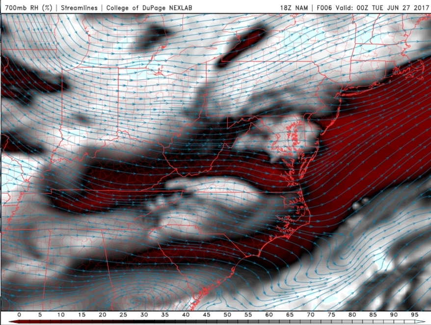
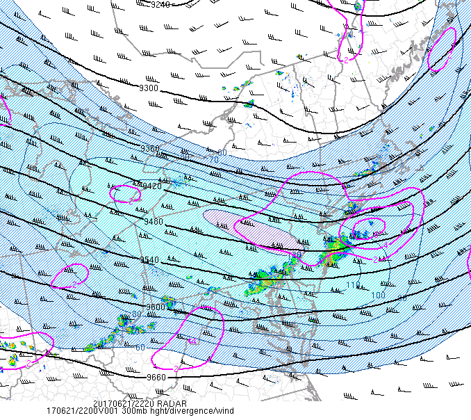
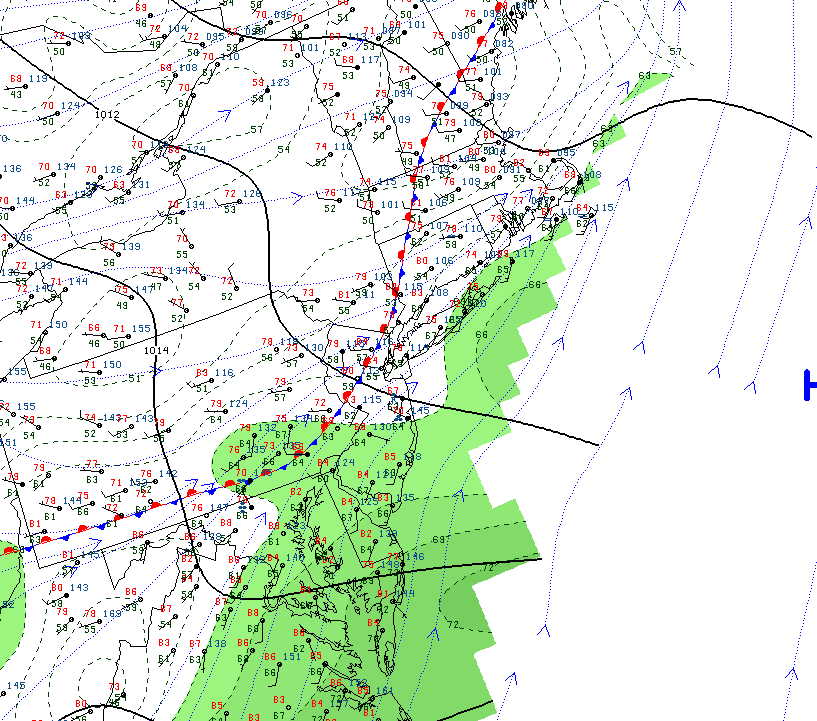
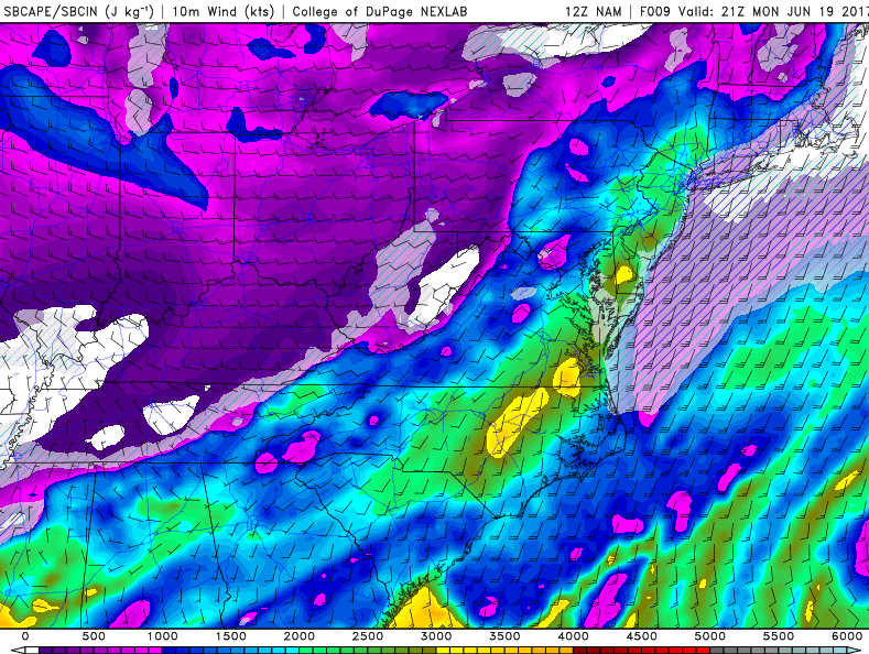
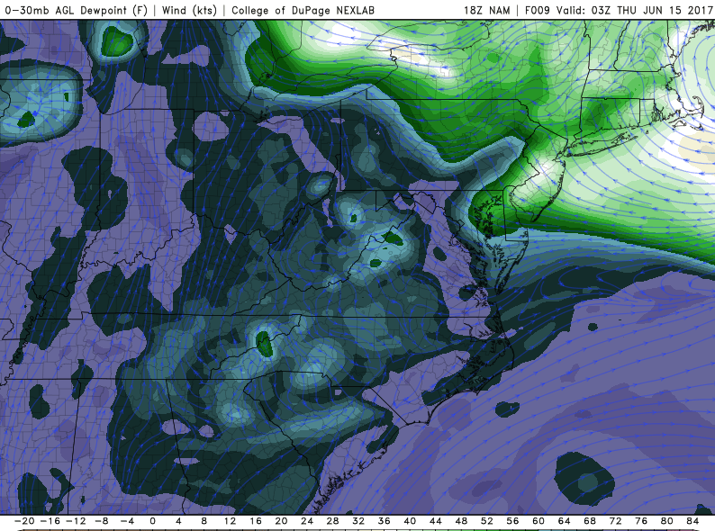
This evenings latest regional radar mosaic, HRES visible satellite imagery, and surface observations showing relatively calm conditions, with some showers and thunderstorms to the north and west (Courtesy of College of DuPage)
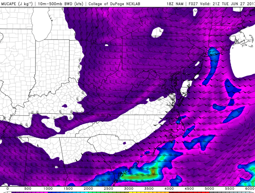
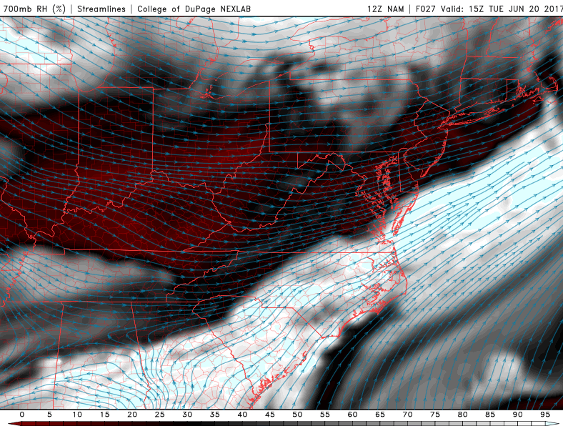
Tuesday morning should feature mostly sunny skies to start the day as a cold front begins to move through the region. By the late morning to early afternoon hours, the anomalously strong trough centered to our north and west will continue to move east and be overtop the area, with very cool mid level temperatures. These cold mid level temperatures will become important tomorrow afternoon as the surface temperatures begin to rapidly warm up, causing a very healthy amount of rising motion in the atmosphere. Combined with very marginal instability, we could see one or two showers or even an isolated thunderstorm pop tomorrow afternoon, but due to continued dry mid levels of the atmosphere and the overall lack of a trigger, the most likely outcome is that clouds should begin to increase, with cumulus clouds becoming quite numerous by the late afternoon. With the cooler mid level temperatures in place and light southerly/southwesterly winds expected to be in place, high temperatures should be able to reach into the mid to upper 70’s, with some areas possibly even hitting the 80 degree mark with prolonged sun.
Otherwise, skies should begin to clear and winds should become calm as an area of high pressure begins to build in behind the cold front to our west. This high pressure system will usher in another cool and dry airmass for the region, which should allow quite favorable conditions for radiational cooling to take place during the evening hours tomorrow. This should allow temperatures to drop into the lower 60’s and even the 50’s once again!

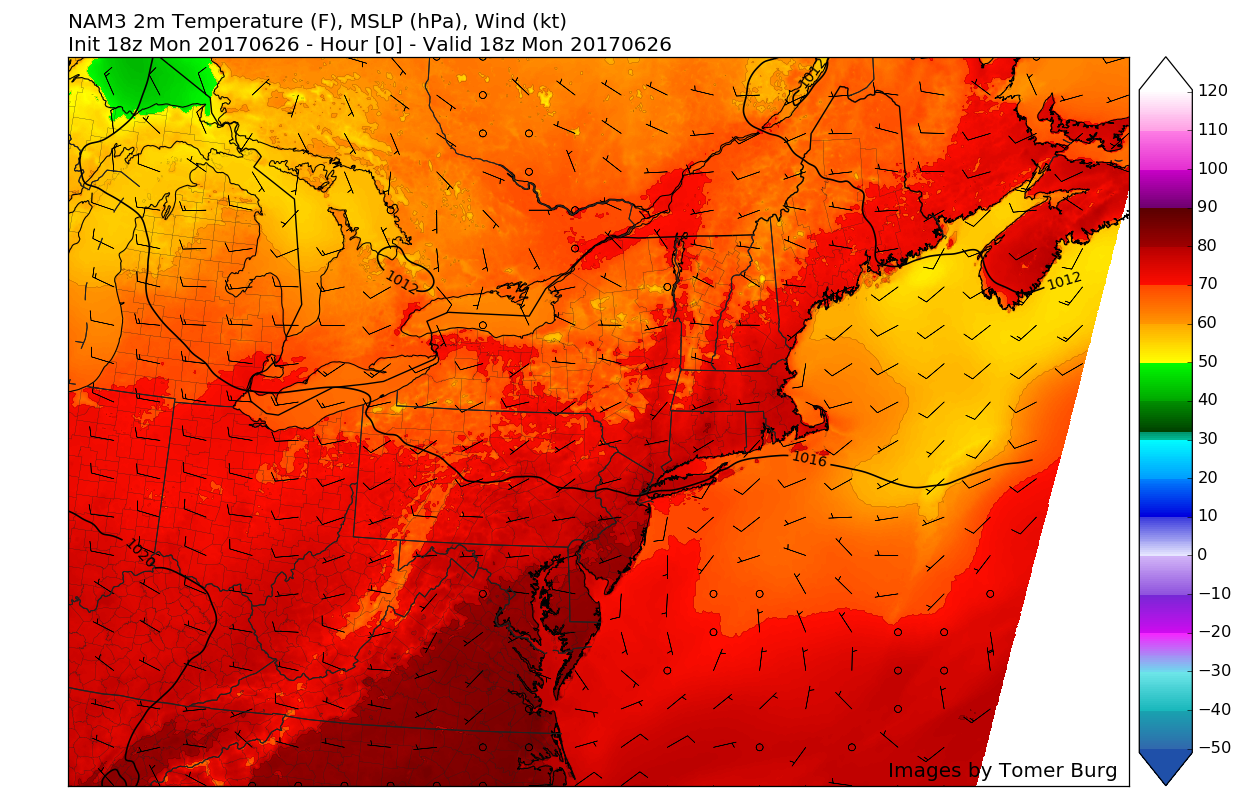
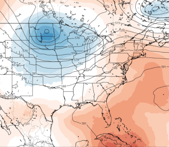
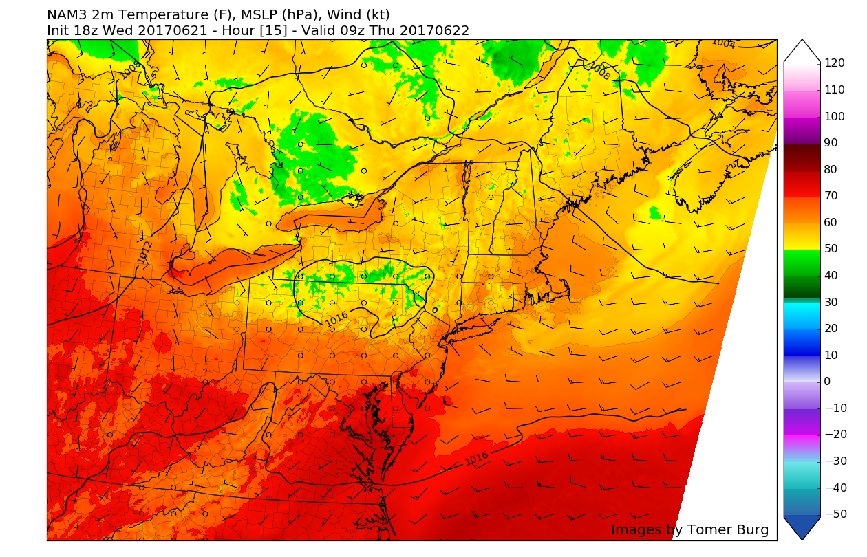
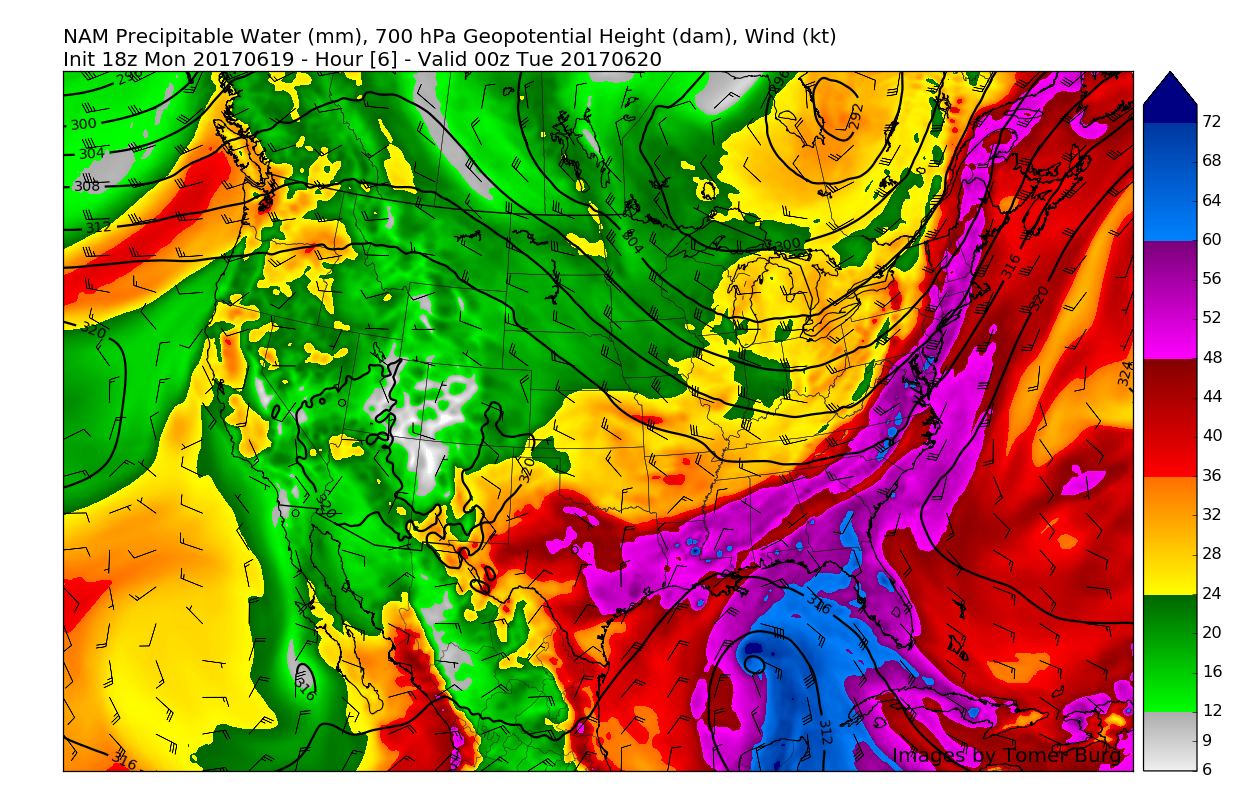
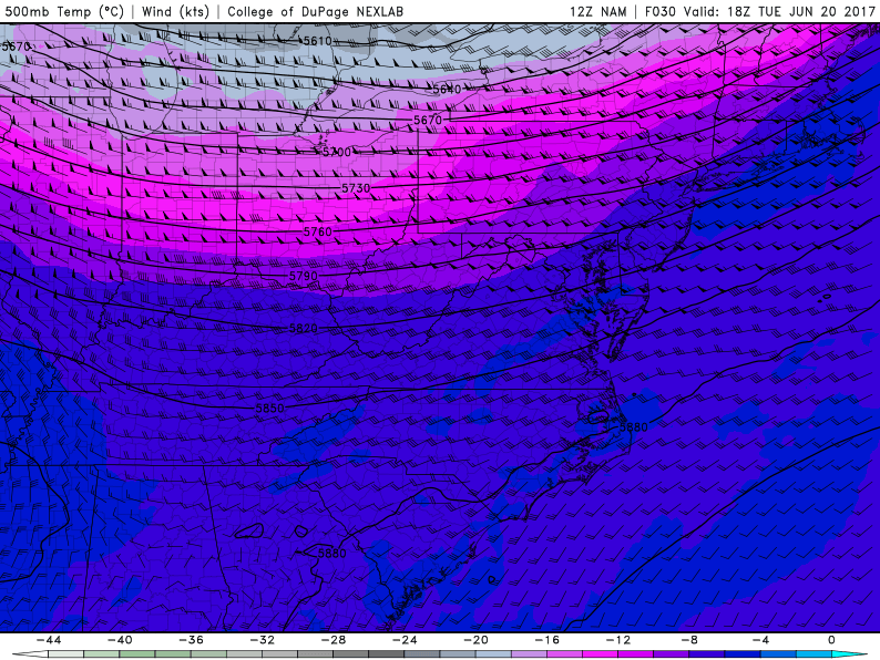
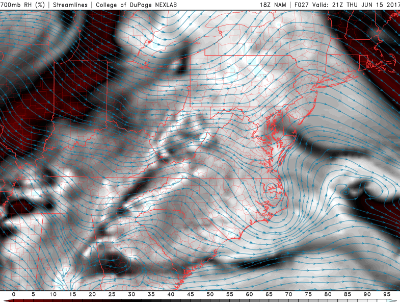
This afternoons high resolution North American model showing a very pleasant day on Tuesday afternoon just before a cold front works its way on in from the west, bringing yet another mild and dry airmass (Courtesy of Tomer Burg)
Wednesday and Beyond
Wednesday will likely start off rather calm as an area of mid level ridging begins to build and move eastward during the day, with high pressure mainly in control. This should allow for mostly sunny skies and light winds from the south/southwest to take over during the day, which will likely bring temperatures in the upper 70’s to the lower 80’s for some of the more southern locations. All in all, Wednesday should be a rather beautiful day, with slightly below-normal highs and building clouds later in the day and approaching the evenings hours as a warm front begins to advance east.
By Thursday, the riding should become stationary over area and make little if any forward progress during the day, so expect winds to become a bit steadier from the southwest. Temperatures aloft will also begin to warm quite a bit, so temperatures will likely be able to climb into the low to middle 80’s during the day Thursday with mostly sunny conditions expected.
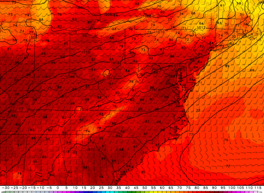
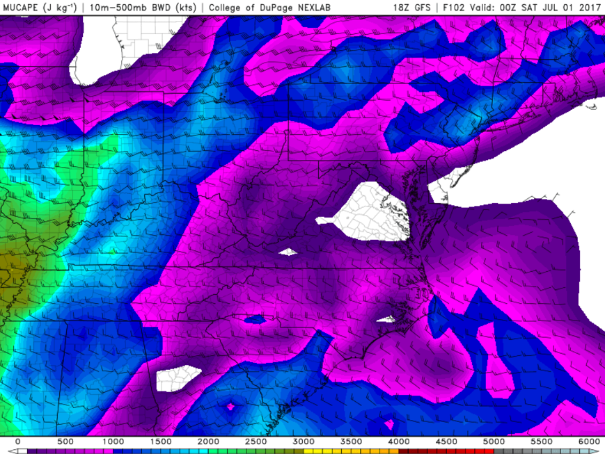
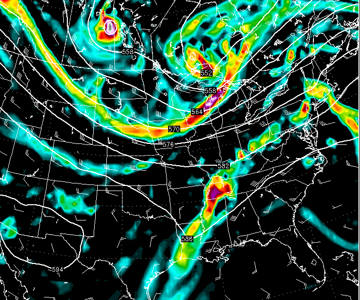
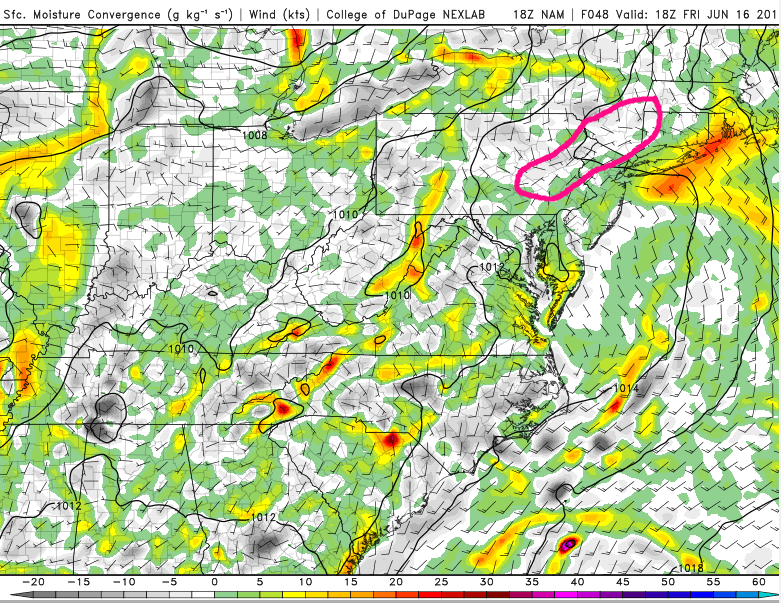
As we get towards the end of the week on Friday, its looking likely that precipitation chances will be on the increase as the area of high pressure along the east coast shifts eastward and allows rich tropical moisture to bleed northward once again. Temperatures will also be on the increase, with highs likely getting into the middle to upper 80’s, with some locations likely hitting that 90-degree mark as well. Friday appears to have more organized instability, better shear, and a more coherent trigger than any day this week, so we do feel that there is an increased risk of strong to possibly severe thunderstorms during the day on Friday, but we will have to revisit this later in the week. Otherwise, this pattern looks to continue through the weekend before another high pressure system moves through and brings a more mild airmass in time for the beginning of next week.

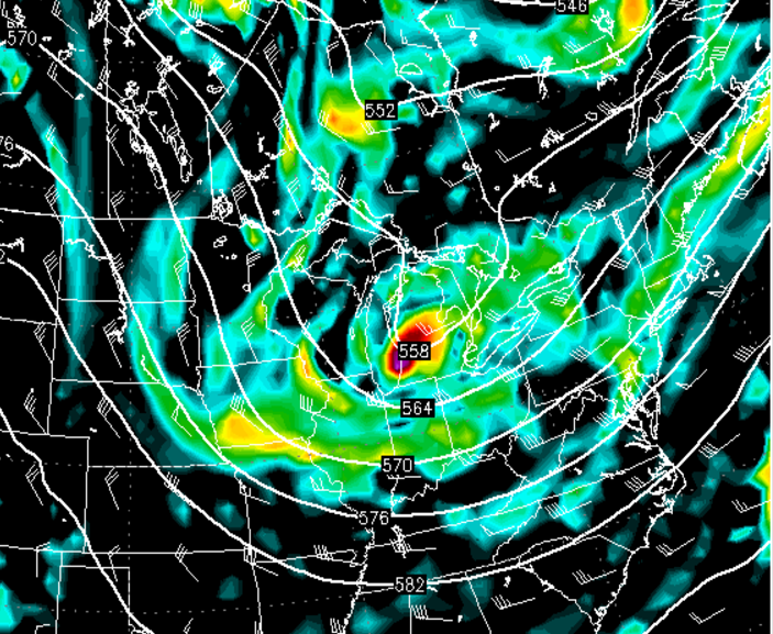
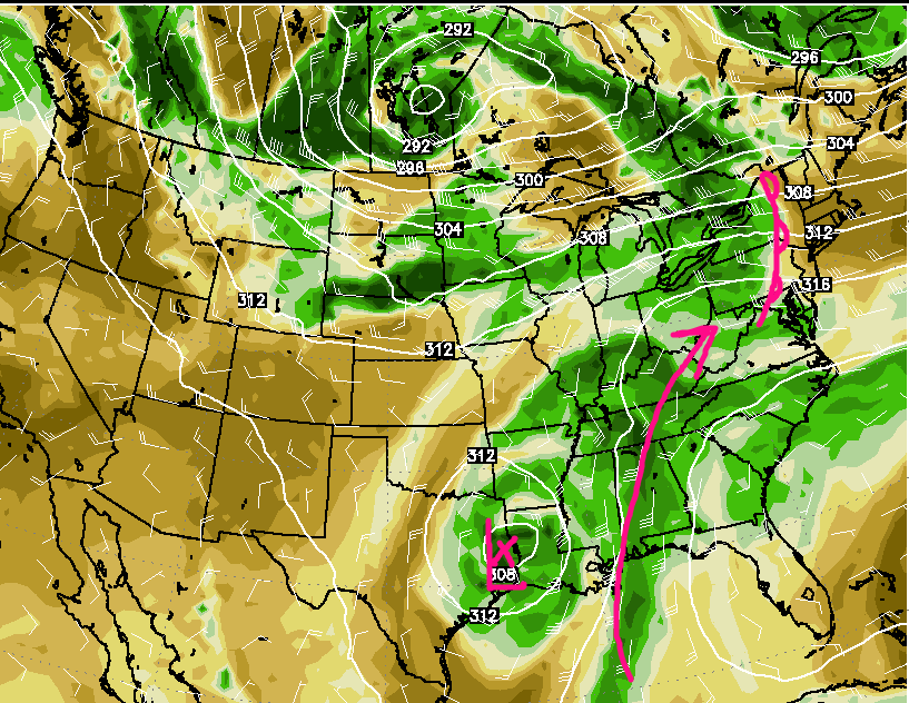
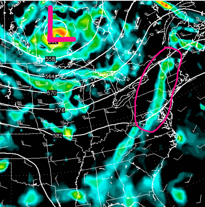
This afternoons European Ensembles showing an increased potential for above normal temperatures by the end of this week and into this weekend (Courtesy of TropicalTidbits)
For more information and posts like this one, make sure you sign up for Premium Forecasts — where multiple detailed articles, videos, and interactives are posted each day. Also, come interact with our staff and many other weather enthusiasts at 33andrain.com!
Have a great evening!
Steve Copertino


