Posts

Mild and Unsettled Pattern Begins to Take Shape

Good evening! 

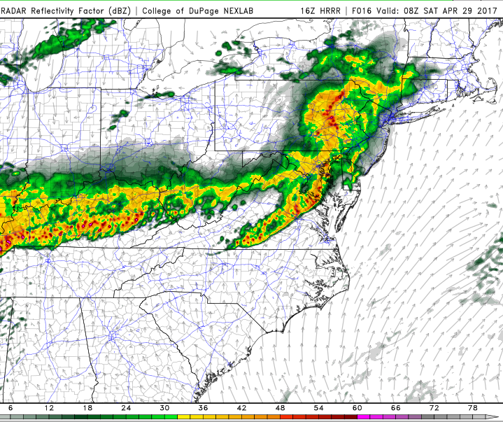
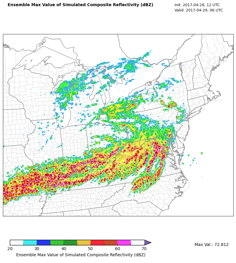
The dreary and wet conditions that took over back on Saturday afternoon have finally begun to break as a cold front pushed through the Northeast this morning and early afternoon. Rainfall amounts were in the moderate range for most of the Mid Atlantic and Northeast, with locations closer to the immediate coast seeing totals in the 2-4″ range. Widespread was not recorded due to most of the Mid Atlantic and sections of the Northeast actually being in a drought do to a lack of any substantial precipitation over the past few months. Luckily, this recent rainfall was very beneficial to the area, and may have been able to knock some locations back to around normal precipitation departures. Regardless, most of the area saw their Monday start off rather mild, with highs being recorded in the morning hours over a large portion of the Northeast. This was due to a cold front that has been lagging begin the main system which actually pushed offshore last night with the remaining bulk of the heavy rain. As this cold front moved through portions of the Northeast, the cold air was quick enough on the backside to catch up to the remaining precipitation and cause a very brief mix of rain/snow/grauple. These spotty areas of mixing were quite light and brief in nature, so no accumulations were recorded. Conditions became rather calm, with even some patchy sun showing up for the middle and later afternoon hours, as temperatures over the region leveled off in the upper 30’s to lower 40’s. Conditions should remain quite dry, but occasionally a bit gusty as drier Canadian air filters into the region tonight. A strong area of high pressure will also be gradually building in over the Northeast from west to east, so this will ease winds overnight and cause clouds to gradually subside. Lows should be rather cold, with location around the NY metro area likely seeing temperatures in the lower to middle 20’s, with locations off to the north and west likely getting down into the teens with good radiational cooling.

This evenings latest surface temperatures from the HRRR with surface observations and the regional radar mosaic showing a rather calm, but cooler night taking shape

This evenings latest surface temperatures from the HRRR with surface observations and the regional radar mosaic showing a rather calm, but cooler night taking shape

Tuesday Into Thursday 

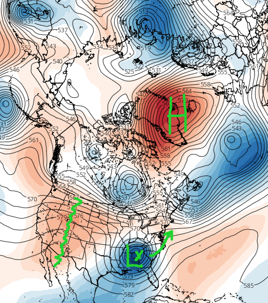
Tomorrow should start off rather clear and cold, as the aforementioned strong high pressure system continues to move over the Northeast. A fast zonal (west to east) jet streak will still be dominating the pattern across the entire country. This mean that any system over the next couple of days will be moving very quickly across the United States, with no time to amplify or strengthen. This will be the case throughout the entire day on Tuesday as some shredded-off energy from a decaying system over the west moves into the Mid Atlantic and Northeast. This energy is too insignificant to cause anything other than some high-level cirrus clouds during the afternoon hours tomorrow as the jet stream roars overhead. Highs tomorrow should be rather seasonable, with temperatures likely staying in the middle to upper 30’s, with some locations off to the south of the city possibly getting into the lower 40’s. Tranquil conditions will last well into the evening and overnight hours, as radiational cooling allows lows to drop once more into the middle to upper 20’s, with locations off to the north and west in the lower 20’s.

Mid level ridging will begin to build over the Plains during the day on Wednesday, leading to southwesterly flow increasing quite a bit over the Mid Atlantic and Northeastern states. This will begin to cause the classic response of mid level temperatures rising as well as moisture beginning to stream northward from the Gulf of Mexico. Showers and thunderstorms will likely begin to develop over the Southeast Wednesday afternoon, with some of that moisture possibly making it into the central parts of the Mid Atlantic before dark. Conditions will likely turn at least mostly cloudy during the day as increased moisture leads to the development of mid level clouds over much of the Northeast. Despite the clouds, temperatures should be quite mild, with highs likely getting into the middle to upper 40’s, with some locations likely hitting the lower 50’s. The threat for some showers will gradually increase as the night goes on, with showers likely moving in around 10pm or so for the New York metro area. Lows will be much more tame on Wednesday night, with readings likely staying in the upper 30’s to lower 40’s.

Thursday will be the first much above normal day in the period as a trough over the Western US states continues to cause the downstream strengthening of ridging over the East. Moisture from the Gulf will continue to move northward over the entire Northeast, likely leading to a wet start to the day on Thursday. As mentioned earlier, the mid level disturbance responsible for this rain will be so disorganized and moving so quickly that only light rainfall amounts are expected. The exact temperature forecast is a little complicated at this time and will depend on just how quickly the rain showers will be able to move out, but it certainly looks like highs should be able to rise well into the upper 50’s and lower 60’s across much of the Mid Atlantic and southern portions of the Northeast. Conditions will likely remain unsettled with spotty showers possible throughout the rest of the evening and overnight hours, as another in a series of weak disturbances pass through the Ohio Valley

This afternoon European ensembles showing a high probability of temperature anomalies reaching 20 degrees above normal on Thursday!

This afternoon European ensembles showing a high probability of temperature anomalies reaching 20 degrees above normal on Thursday!

Mixed and Mild Weekend Ahead 

The same pattern looks to almost certainly continue through this weekend as the southerly flow increases once more on Friday ahead of a large area of disorganized energy out over the Plains . A more moderate rain event may be in the cards starting on Friday as more Gulf moisture becomes available over the South.  A cold front behind this system looks to temporarily cool things down a bit late in the day on Friday, but  Saturday looks to still be a slightly above normal day across the East as mid level ridging starts to buil over the Plains once more. This area of ridging looks to strengthen quite a bit over the east on Sunday, allowing high pressure to get pushed off of the east coast and provide strong southerly flow once more for the entire area. This looks to set the stage for an even larger warm-up next week as some models are depicting a very deep trough to set up in the west, which would be strongly supportive of much above average temperatures lasting through the week next week. In fact, this afternoons European model had many locations across the Northeast well into the 70’s by next Thursday! This can very easily change over the next couple of days, but we will continue to monitor this period of prolonged above normal temperatures!

This afternoons European ensembles showing a very warm pattern shaping up in the medium range across the East

This afternoons European ensembles showing a very warm pattern shaping up in the medium range across the East

Have a great night! 

Steven Copertino

Bulk of Unusual July Storm Stays South, Locally Heavy Rain Still Possible

Good Evening! 

Well the storm that we have been following for the past week or so is in its formative stages as of this afternoon/evening, with heavy rain beginning to break out over portions of the Mid Atlantic states. While the storm should continue to develop and mature through the evening, the overall evolution and impacts that will be accompanying this system have changed quiet a bit. As we outlined on Wednesday in the “What Could Go Wrong” section, we stated that the overall positive nature of the incoming trough was not conducive for phasing of the lead energy ahead of the system, thus making us question the overall likelihood of widespread heavy rainfall over the New York metro area. Since that time, the models have come into line with our previous thinking and have really shifted the upper level features around, which has in turn has had a rather dramatic effect on exactly where the heaviest rainfall will occur tonight and into Saturday morning.

This afternoons and evenings regional radar mosaic, high resolution visible satellite imagery, and surface observations, showing the development of widespread heavy rains over the Mid Atlantic region. This development will continue to ramp up through this evening (Courtesy of Simuawips.com)

This afternoons and evenings regional radar mosaic, high resolution visible satellite imagery, and surface observations, showing the development of widespread heavy rains over the Mid Atlantic region. This development will continue to ramp up through this evening (Courtesy of Simuawips.com)

So what has changed over the past few days? 

For starters, a positively tilted trough approaching the Northeast is never really a great start if you’re looking for a large, lumbering system with abundant precipitation to form off the coast. This is exactly what we have approaching the area this evening, as noted on the latest 500mb analysis as well as water vapor imagery from the non-operational GOES-16 satellite. The next factor preventing this region from seeing a long-duration system is the very fast flow out to the east of the main storm system. This is something that we usually have to deal with when forecasting winter storms, but it also applicable to summer storms as well. This speedy flow can be attributed to a large upper level low in the eastern regions of Canada. As energy in the base of the large upper level system over Canada begins to rotate and shift southeast, it begins to flatten heights to the east out, and this is the exact opposite of what we would need to slow this system down.

Ideally, we would want the Canadian system to be centered more to the west, mitigating the effects of lower heights ahead of the storm, which would allow the system to slow down a bit and have more northward progression. So putting these negative factors all together, we can expect the shortwave over the Ohio Valley to continue to move east quite slowly, and continue to cause the development heavy rainfall over portions of the Mid Atlantic. Instead of amplifying and strengthening to our south and east tomorrow, the mid level system will remain to our west and will likely wind up getting sheared out-which should cause the overall system to decay.

This afternoons NAM, showing the mid level evolution of the storm system over the next two days. Note the lack of phasing and eventual sheared-out look

This afternoons NAM, showing the mid level evolution of the storm system over the next two days. Note the lack of phasing and eventual sheared-out look!

So what are the impacts? 

Despite its obvious flaws, this is definitely an anomalous system for this time of year and it will bring some heavy impacts, but those do not look to be directly aimed at the NYC metro area. As precipitation continues to break out later this evening, they will be in an extremely moist environment characterized by PWATS over two inches in some spots. Additionally, soundings over the Mid-Atlantic region indicate that a deep “skinny” CAPE profile also exists with values around 1500-2300j/kg^2, which will add to the torrential downpour situation as the night goes on. The last major player that is on the table, is an extremely impressive upper level jet nosing in from the the Ohio Valley. As the wind maximum from this upper level jet streak begins to move further east, it will begin to greatly expand the amount of upper level divergence, which will be directly over the heaviest areas of convection (thunderstorms). This strong upper level divergence will support whats known as low level convergent boundaries-which could spark heavy storms with prolific and near-record rainfall rates over portions of the Mid Atlantic.

It is quite obvious that the numerous favorable factors are coming together in just the right manner so that flooding concerns will be extremely high for the MA region. In fact, the Weather Prediction Center has issued a rare High Risk for flooding over portions of the Mid Atlantic! In general, rainfall totals should be around the 2-5″ range, with some localized amounts of 7-10″ possible in the heaviest of rain bands. This will almost certainly create very serious flooding, so please stay tuned to your local NWS!

Further north for the NYC metro area, things will be a bit more tame as we appear to be on the northern fringes of this system. This does not mean that we are exempt from seeing any heavy rains at all, as we will still have a very moist air mass to work with, and the same excellent upper level divergence to promote some convergent boundaries-which may spark some showers and storms. However, we will have to deal with some sinking air over the NYC area, which should prevent any widespread heavy rain from developing. Some isolated pockets of 1-2″ may be possible with the heaviest showers here, but general totals should be around an inch or less.

By tomorrow afternoon, the disturbance should begin to decay and get sheared out, which should gradually put an end to the heavy precipitation across the entire region.

(Again, if you are located in an area prone to flash flooding, please be aware of any warnings issued-ESPECIALLY during the overnight hours) 

Loop of the development and progression of the heavy rain over the Mid Atlantic over the next day and a half

Loop of the development and progression of the heavy rain over the Mid Atlantic over the next day and a half

We will be back Monday with a look at next week and beyond!

For more information and posts like this one, make sure you sign up for Premium Forecasts — where multiple detailed articles, videos, and interactives are posted each day. Also, come interact with our staff and many other weather enthusiasts at 33andrain.com!

Have a great weekend!

Steve Copertino

Public Analysis: Warm End To the Week, Unusual Spring Pattern Setting Up

Good afternoon!

After the dreary and cool weather we’ve been stuck in for the past few days due to the large and sluggish cut-off low pressure system earlier this week, conditions have finally improved rather markedly this afternoon. With clear skies, light westerly/southwesterly winds, and warm mid-level temperatures have allowed highs to reach into the upper 70’s and lower 80’s across the entire area. Some locations along the coast of Long Island and Connecticut have experienced a little more offshore flow this afternoon, therefor temperatures are stuck in the lower 70’s as of 2pm.

As we near the late afternoon hours and early evening, winds may turn more to the southeast ahead of a weak mid-level disturbance approaching our area. With winds out of the southeast, more moisture from off of the Atlantic may be able to work its way into the lower levels of the atmosphere and produce some overcast, especially for coastal sections of NJ and Long Island. After sunset, some locations closer to the coast may also have to deal with patchy fog as that moisture right off of the coast gets brought inland.

Later this evening and into very early tomorrow morning, we may have to watch out for the potential for some possible heavy rain as strong thunderstorms develop later this afternoon over portions of the Ohio Valley. These storms may wind up tracking through our area later on this evening and into tomorrow morning. These residual showers and possible thunderstorms would be fueled by the leftover instability provided by the southerly winds and approaching mid-level disturbance over Pennsylvania. The latest hi-resolution guidance has this activity reaching the area by 4-6 am, but if these storms do manage to maintain themselves, there could pose a threat for locally heavy downpours, gusty winds, and  some thunder. There are still uncertainties regarding these storms as they have not developed yet, but one concern is that they could slip to the south of the NYC area and cause little if any impact . Otherwise, tonight should be relatively warm as clouds work to trap the remaining heat in the low levels of the atmosphere, leading to lows in the upper 50’s and low 60’s.

Current conditions featuring the latest surface temperatures, visible satellite imagery, and regional radar mosaic, showing a very nice end to the work week.

Current conditions featuring the latest surface temperatures, visible satellite imagery, and regional radar mosaic, showing a very nice end to the work week.

Saturday and Sunday

As we move into tomorrow morning, some leftover showers and clouds may linger into the early afternoon hours, especially as a backdoor cold front works its way from north to south. While not as “intense” as the previous backdoor fronts that we have had over the past few weeks, this front will bring a mix of clouds and sun and gusty winds of around 25-35 mph during the afternoon hours. High temperatures tomorrow afternoon will be somewhat tricky to forecast depending on how far south the front can sag to the south, but highs should generally be in the upper 70’s and low 80’s across the entire area. It is worth mentioning that some locations in Southern New Jersey and portions of Southeast Pennsylvania could possibly see highs in the mid-upper 80’s with enough sun.

It is worth mentioning that there is some potential for some isolated showers and thunderstorms late tomorrow afternoon and evening as the backdoor front sags south through Pennsylvania and New Jersey. Instability will be quite high to the south of this front, and wind shear will also be quite supportive of some strong or possibly very isolated severe thunderstorms which may produce some isolated large hail, locally heavy rainfall, and damaging winds. However, due to the lack of a “trigger” to set these storms off, and the fact that the cold front could be well south of the immediate NYC metro area by the time the other ingredients are in place, we do not anticipate widespread significant severe weather tomorrow afternoon. Otherwise, Tomorrow evening will definitely be much cooler than Friday, as the cold front leaves behind cooler winds from the north west, with lows in the lower 50’s to upper 40’s further inland.

On Sunday a much cooler airmass will be over the region as maritime floods the entire area due to winds coming in from the Atlantic ocean. While starting off relatively cool in the morning, a mix of sun and clouds and calmer winds from a high pressure system to the north east will allow temperatures to get into the low to middle 60’s across the area, which is around 8-10 degrees below normal for this time of year!

Later in the evening, we may see the stalled out front over portions of the Mid-Atlantic begin to return northwards with some warmer air and clouds, but at this time the timing and placement of this feature is somewhat uncertain. Overall, we expect cloudiness and possibly some showers to take over during the evening on Sunday.

This afternoons 12km North American model showing a rather significant amount of instability to the south of the NYC metro on Saturday afternoon (Valid 4pm Saturday)

This afternoons 12km North American model showing a rather significant amount of instability to the south of the NYC metro on Saturday afternoon (Valid 4pm Saturday)

Monday and Early Tuesday 

As mentioned, there are some very significant uncertainties as to how far north the front will advance once again on Monday, as this will be crucial in determining how the day plays out. If the front happens to reach far enough north of our region by the afternoon hours, we could see a very warm and pleasant day on Monday with highs in the upper 70’s and low 80’s once again. However, even if this warmer solution is realized on Monday, a very large system is expected to be gathering in the Great Lakes region Monday evening.

As this system continue to move north and east through the Great Lakes region very late Monday and into Tuesday, it should drag a rather strong cold front through our area. This cold front will have access to deep tropical moisture, extending all the way from the Gulf of Mexico, so there is a real threat for heavy rain and potential thunderstorms associated with this cold front as it progresses through our area.  At this time, it appears that the showers and thunderstorms will be passing through during the evening hours, so the overall severity of the associated thunderstorms should be quite limited.

Extended Range

A cooler airmass is expected to trail the front later in the day on Tuesday and into Wednesday, but the main story will be the ensuing pattern that will be taking shape. We have talked about the North Atlantic Oscillation many times in the past, and especially during the winter months since it is such a large factor in helping to get large coastal storms to drop copious amounts of precipitation over our area when it heads towards its negative phase. In an interesting series of events, it now seems that a very large and powerful ridge will be setting up over Greenland during the middle of next week. If this actually does materialize, and most of the computer model guidance does support it, then we could be entering a rather cool and stormy pattern for at least the next 7-10 days across the Northeast.

Interestingly enough, the models have even been beginning to show a series of potential coastal storms in the long range taking tracks quite similar to storm tracks that we would see during the Winter months! We will continue to monitor this very interesting pattern over the next few days and provide updates and more details become available!

GFS and ECMWF ensembles both agreeing on an extended period of a negative NAO, which could promote cool and stormy weather in the east

GFS and ECMWF ensembles both agreeing on an extended period of a negative NAO, which could promote cool and stormy weather in the east

For more information and posts like this one, make sure you sign up for Zone Forecasts — where multiple detailed articles, videos, and interactives are posted each day. Also, come interact with our staff and many other weather enthusiasts at 33andrain.com!

Have a great weekend!

Steve Copertino