Posts

Light Wintry Mix Today, Some Moderation & Late Week Storm in the Northeast

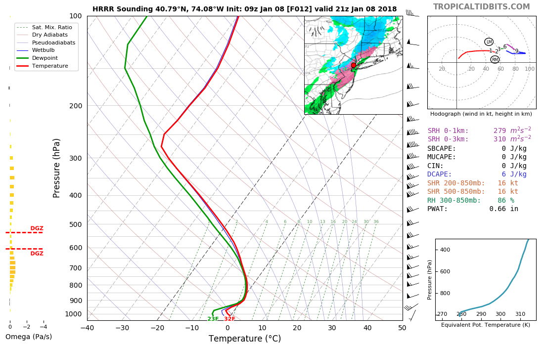
Good morning! Hope you had a wonderful weekend! After a long duration of very cold temperatures, some pattern changes are on the way this week, finally leading to some moderation in temperature. Unfortunately this will come at a price, as unsettled and wetter weather will be arrive late in the week as well. Clouds will increase after some sunshine early this morning, as a cold front associated with a shortwave trough approaches from the west. Overall this front is lacking moisture and dynamics. Therefore we only anticipate some very light precipitation, as this front moves through the Northrast for a few hours this afternoon or early this evening.

Thermal profiles support much of the precipitation falling in the form of light snow. Any snow accumulations are likely to be under 1”. But a warm nose aloft may also lead to sleet or freezing rain to mix in at times, especially along the I-95 corridor and coastal areas. After the bitter cold this weekend, ground temperatures will be below freezing. So this may lead to icy spots on roadways later this afternoon and early this evening.

Read more

Summer-Like Warmth Continues, Hurricane Maria Stays Offshore This Week

Good morning! More summer-like weather from the weekend will continue today, as strong mid-level ridging continues to be over the Northeast and Mid-Atlantic. It will be hot and humid for late September with plenty of sunshine for today. More sea-breezes developing this afternoon, may keep temperatures a little cooler than on Sunday, especially closer to the coast. But high temperatures will likely reach the mid-upper 80s in many areas again. Some inland spots could reach around 90 degrees again. These temperatures will likely be a few degrees short of record highs for today.

Read more

Public Analysis: Coastal storm Saturday, improving Mothers Day, warmup next week

Good evening! We hope you had a wonderful Friday and enjoyed the weather over the past few days. It’s about to go downhill. Clouds will increase this evening as a coastal storm, which has been discussed for several days, begins developing over the Delmarva. A few isolated showers or areas of drizzle may develop overnight as low-level moisture and lift gradually increases. But mainly dry conditions are expected to stay in control. Temperatures will drop into the upper 40s to lower 50s in most areas

Read more

Midday Zones Update: More Warmth Saturday, Cooler Sunday, More Unsettled Early Next Week

Happy Friday! Much warmer weather has returned today and will stick around until Saturday. Then a backdoor cold front will move through region, with a cooler temperatures returning again on Sunday. Another cold front moves through the region with more showers and thunderstorms possible late Monday and into early Tuesday of next week. Get details in latest forecast breakdown below!

Read more