-2")
Bulk of Unusual July Storm Stays South, Locally Heavy Rain Still Possible
Good Evening!
Well the storm that we have been following for the past week or so is in its formative stages as of this afternoon/evening, with heavy rain beginning to break out over portions of the Mid Atlantic states. While the storm should continue to develop and mature through the evening, the overall evolution and impacts that will be accompanying this system have changed quiet a bit. As we outlined on Wednesday in the “What Could Go Wrong” section, we stated that the overall positive nature of the incoming trough was not conducive for phasing of the lead energy ahead of the system, thus making us question the overall likelihood of widespread heavy rainfall over the New York metro area. Since that time, the models have come into line with our previous thinking and have really shifted the upper level features around, which has in turn has had a rather dramatic effect on exactly where the heaviest rainfall will occur tonight and into Saturday morning.
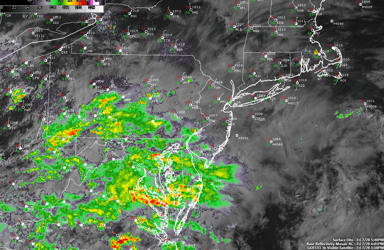
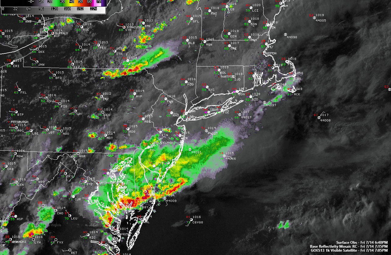
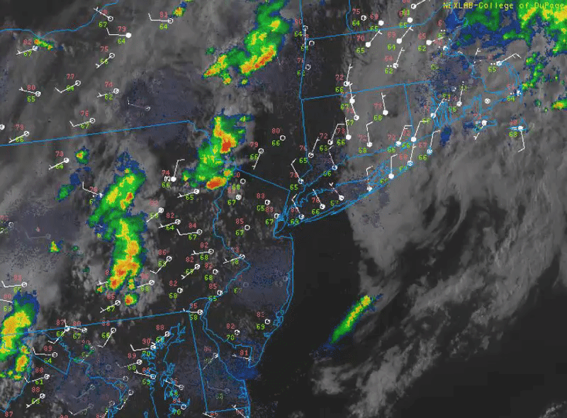
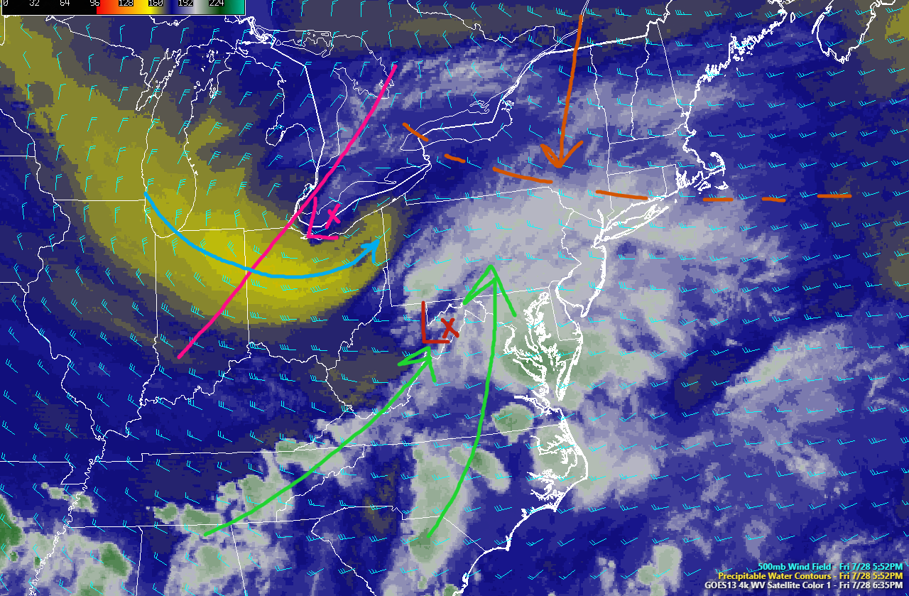
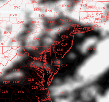
This afternoons and evenings regional radar mosaic, high resolution visible satellite imagery, and surface observations, showing the development of widespread heavy rains over the Mid Atlantic region. This development will continue to ramp up through this evening (Courtesy of Simuawips.com)
So what has changed over the past few days?
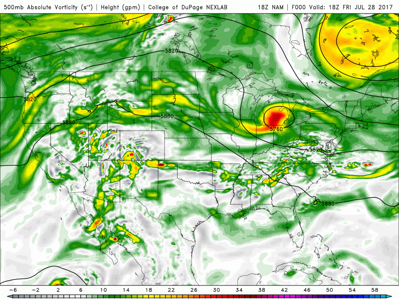
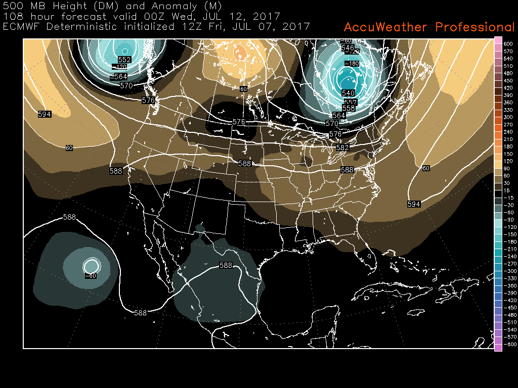
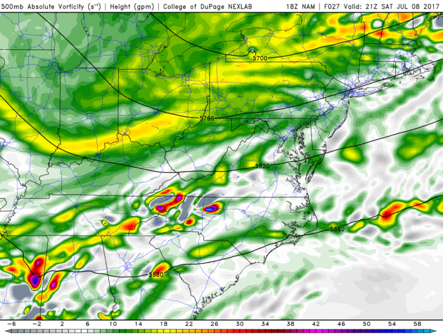
For starters, a positively tilted trough approaching the Northeast is never really a great start if you’re looking for a large, lumbering system with abundant precipitation to form off the coast. This is exactly what we have approaching the area this evening, as noted on the latest 500mb analysis as well as water vapor imagery from the non-operational GOES-16 satellite. The next factor preventing this region from seeing a long-duration system is the very fast flow out to the east of the main storm system. This is something that we usually have to deal with when forecasting winter storms, but it also applicable to summer storms as well. This speedy flow can be attributed to a large upper level low in the eastern regions of Canada. As energy in the base of the large upper level system over Canada begins to rotate and shift southeast, it begins to flatten heights to the east out, and this is the exact opposite of what we would need to slow this system down.
Ideally, we would want the Canadian system to be centered more to the west, mitigating the effects of lower heights ahead of the storm, which would allow the system to slow down a bit and have more northward progression. So putting these negative factors all together, we can expect the shortwave over the Ohio Valley to continue to move east quite slowly, and continue to cause the development heavy rainfall over portions of the Mid Atlantic. Instead of amplifying and strengthening to our south and east tomorrow, the mid level system will remain to our west and will likely wind up getting sheared out-which should cause the overall system to decay.
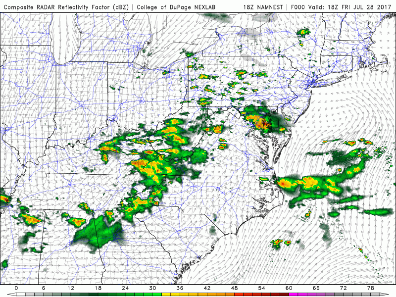
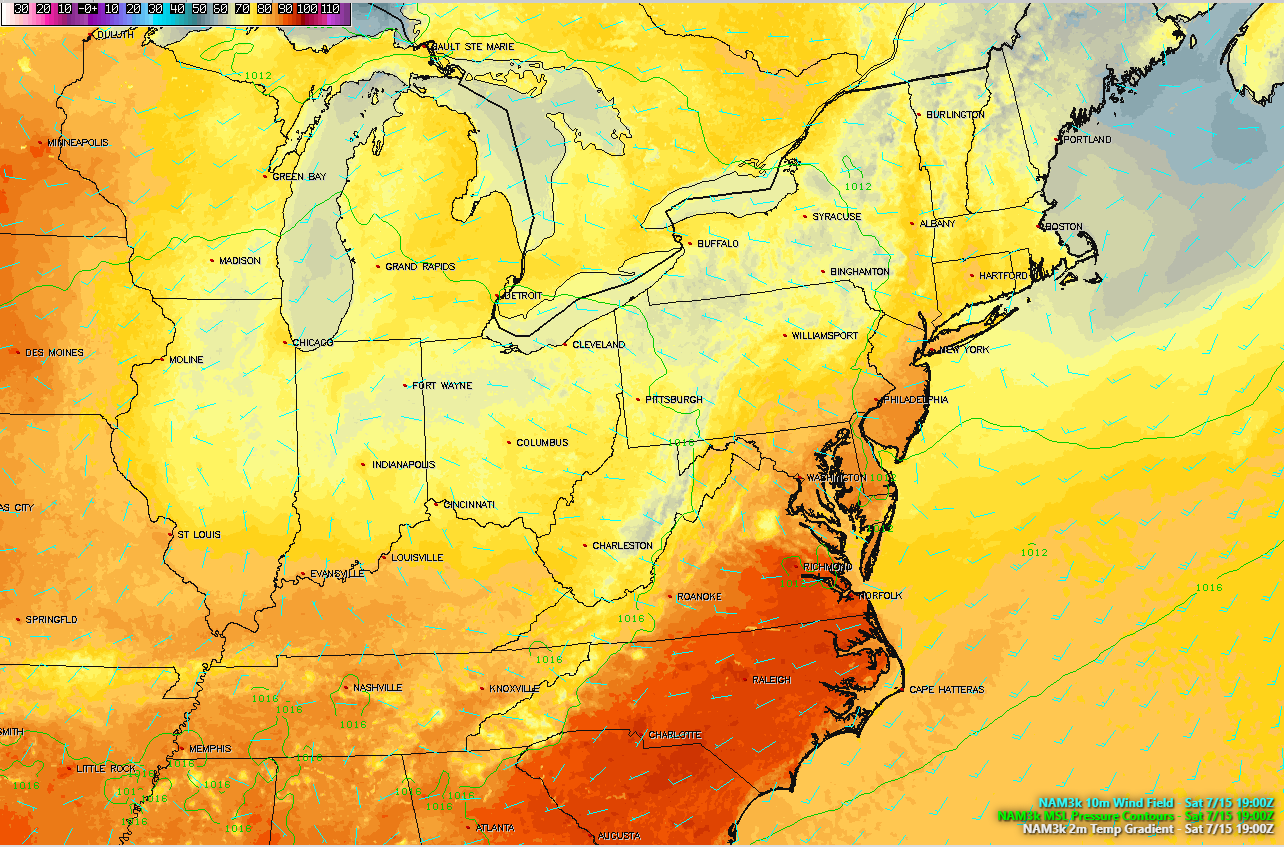
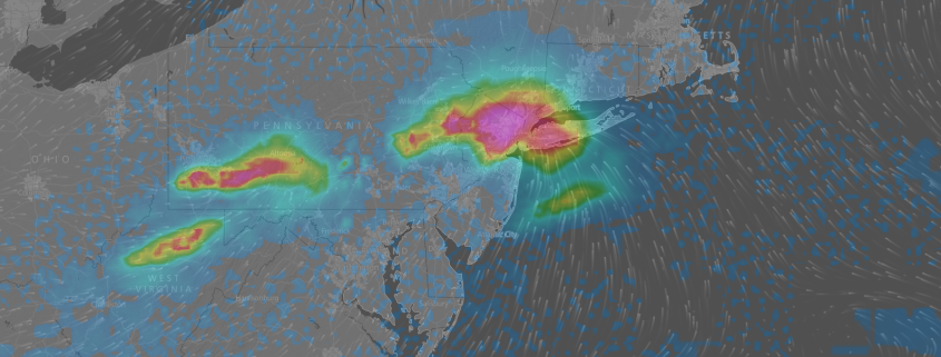
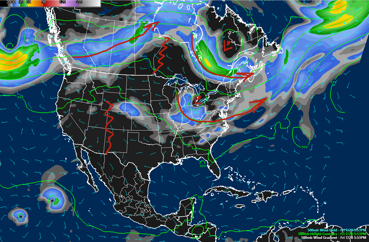
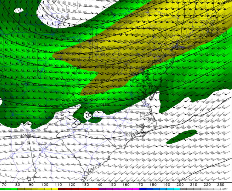
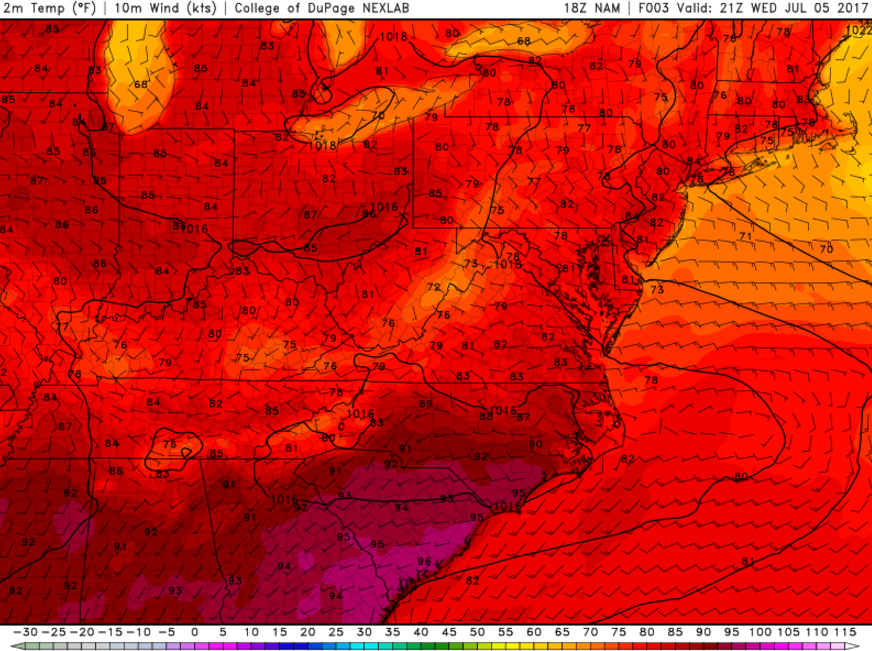
This afternoons NAM, showing the mid level evolution of the storm system over the next two days. Note the lack of phasing and eventual sheared-out look!
So what are the impacts?
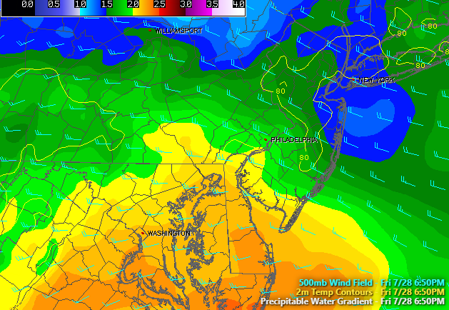
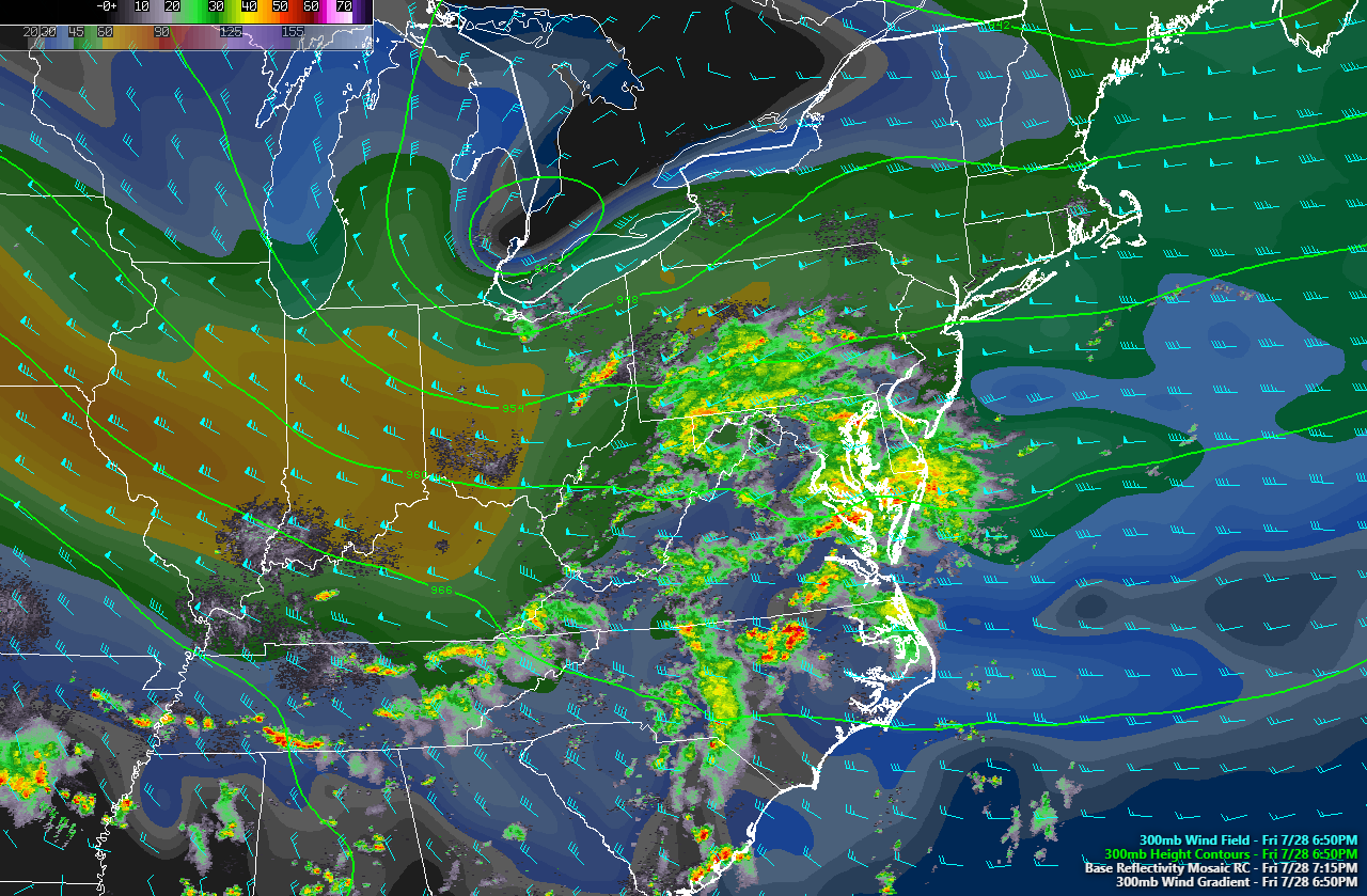
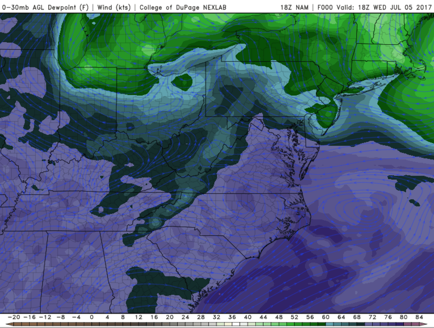
Despite its obvious flaws, this is definitely an anomalous system for this time of year and it will bring some heavy impacts, but those do not look to be directly aimed at the NYC metro area. As precipitation continues to break out later this evening, they will be in an extremely moist environment characterized by PWATS over two inches in some spots. Additionally, soundings over the Mid-Atlantic region indicate that a deep “skinny” CAPE profile also exists with values around 1500-2300j/kg^2, which will add to the torrential downpour situation as the night goes on. The last major player that is on the table, is an extremely impressive upper level jet nosing in from the the Ohio Valley. As the wind maximum from this upper level jet streak begins to move further east, it will begin to greatly expand the amount of upper level divergence, which will be directly over the heaviest areas of convection (thunderstorms). This strong upper level divergence will support whats known as low level convergent boundaries-which could spark heavy storms with prolific and near-record rainfall rates over portions of the Mid Atlantic.
It is quite obvious that the numerous favorable factors are coming together in just the right manner so that flooding concerns will be extremely high for the MA region. In fact, the Weather Prediction Center has issued a rare High Risk for flooding over portions of the Mid Atlantic! In general, rainfall totals should be around the 2-5″ range, with some localized amounts of 7-10″ possible in the heaviest of rain bands. This will almost certainly create very serious flooding, so please stay tuned to your local NWS!
Further north for the NYC metro area, things will be a bit more tame as we appear to be on the northern fringes of this system. This does not mean that we are exempt from seeing any heavy rains at all, as we will still have a very moist air mass to work with, and the same excellent upper level divergence to promote some convergent boundaries-which may spark some showers and storms. However, we will have to deal with some sinking air over the NYC area, which should prevent any widespread heavy rain from developing. Some isolated pockets of 1-2″ may be possible with the heaviest showers here, but general totals should be around an inch or less.
By tomorrow afternoon, the disturbance should begin to decay and get sheared out, which should gradually put an end to the heavy precipitation across the entire region.
(Again, if you are located in an area prone to flash flooding, please be aware of any warnings issued-ESPECIALLY during the overnight hours)
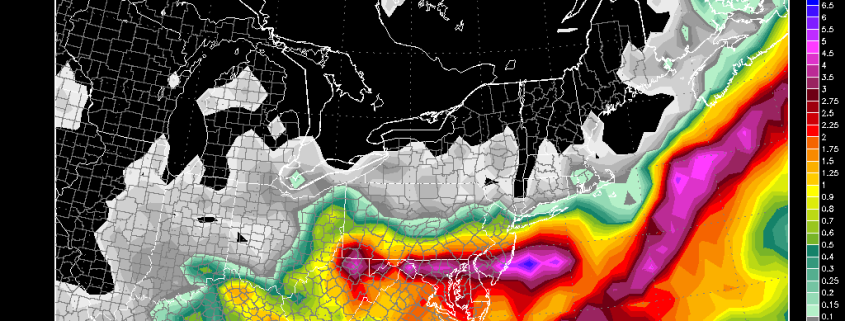
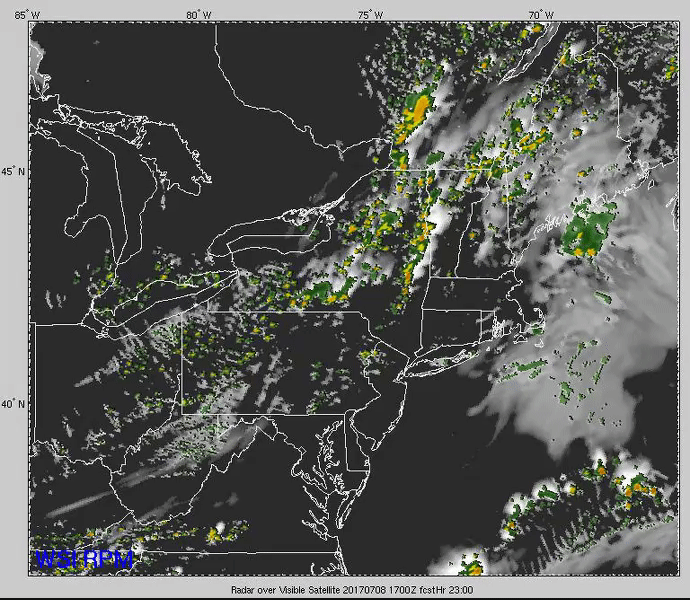
Loop of the development and progression of the heavy rain over the Mid Atlantic over the next day and a half
We will be back Monday with a look at next week and beyond!
For more information and posts like this one, make sure you sign up for Premium Forecasts — where multiple detailed articles, videos, and interactives are posted each day. Also, come interact with our staff and many other weather enthusiasts at 33andrain.com!
Have a great weekend!
Steve Copertino