-2")
Cold, dry weather through weeks end
After the first snowfall of the season on Tuesday, low temperatures fell into the single digits and teens throughout the area by early Wednesday morning. The arctic airmass settling into the area on Wednesday will stick around through the second half of the week, bringing high temperatures down into the upper 20’s and lower 30’s on Thursday. Although there won’t be any harsh biting winds, the snowpack over the interior will make it feel especially cold and will help with radiational cooling during the overnight hours. 850mb temperatures will fall to near -20 C on Thursday afternoon, and temperatures in the teens should be common each morning towards the end of this week.
The calm weather pattern will come as a bit of relief after several days of active weather with a front near the area. Owing to a dominant high pressure over the Northeast US, plenty of sun is likely on each day as we roll towards the weekend. But by the forthcoming weekend, intrigue will again increase as another mid and upper level disturbance tracks from the Central United States towards the Northeast and Mid Atlantic. As a result of this disturbance, a low pressure system is forecast to initially track towards the Ohio Valley. Eventually, a secondary low pressure will redevelop to the east, forced to do so by a strong high pressure to the north and cold air holding firm over New England. The devil is in the details with this system, as the uncertainties suggest potential for a winter weather event, but incredibly low confidence.
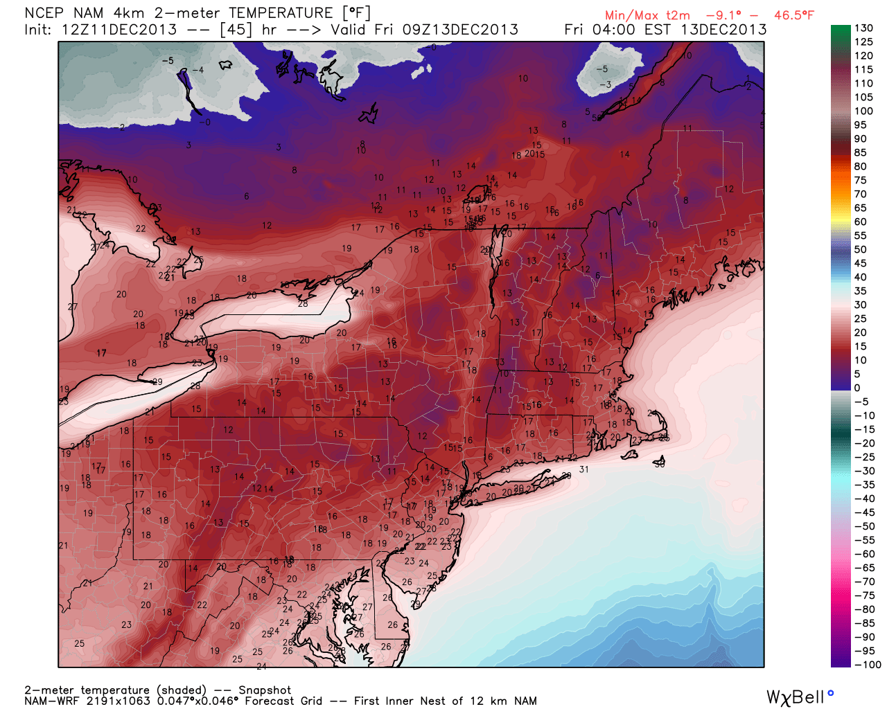
NAM model showing low temperatures in the teens on Friday morning.