Posts

One storm exits, another approaches by Saturday

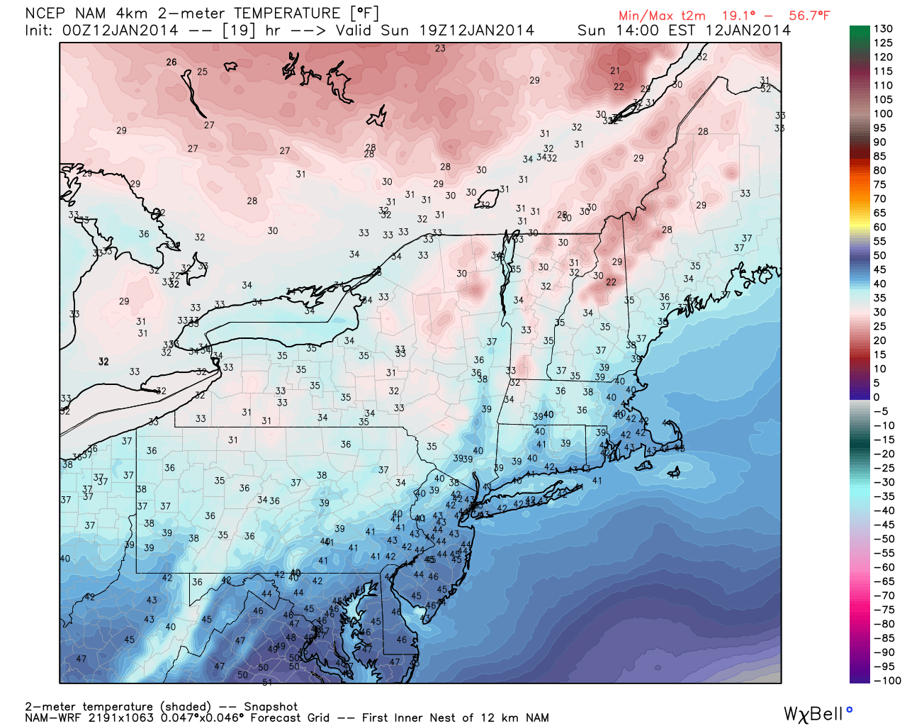
A few weeks ago, we posted that from late January onward our area was likely to receive a very wintry period of weather; cold air, chances for snow. Now that we’ve made it to mid February, most of the area has experienced several significant snowfall events and has experienced the brunt of below normal temperature anomalies.

And we’re not done just yet.

Forecast models have come into agreement on the development of a storm system off the East Coast on Saturday, and although it may not be as strong as the one which passed nearby on Thursday, there is likely to be more precipitation from the system as it strengthens off the New England Coast. The key to forecasting this one, as is the case with many, will be timing how fast the rapid strengthening of the system begins. This will have a major impact on whether or not our area sees bands of heavier snow, or a more broad area of lighter snow.

NAM model showing the development of a Nor'Easter on Saturday.

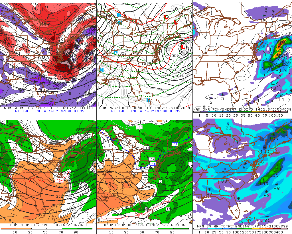
NAM model showing the development of a Nor’Easter on Saturday.


Read more

Cooler, drier weather behind cold front

Warm, humid air with showers and thunderstorms were the main characteristics of the airmass on Saturday — but a distinct cold front moved through the area later on Saturday evening and the airmass has changed dramatically since then. Winds shifted from southerly to west-northwesterly by late Saturday evening into Sunday morning, and temperatures in the mid levels will drop even more considerably Sunday morning. Although overnight temperatures won’ t be frigid (especially in comparison to what we were dealing with 5 days ago), highs on Sunday will only reach into the mid 40’s, considerably cooler than Saturday.

Fair weather will be the main weather story through early week, despite the potential for a few showers on Monday. Sunday looks quiet, with around average temperatures and a westerly breeze. With no precipitation or hazards expected, it will be a sufficient close to a weekend which had only featured unsettled and dreary conditions to this point.

NAM model forecasting high temperatures in the mid 40's on Sunday afternoon.

NAM model forecasting high temperatures in the mid 40’s on Sunday afternoon.

Read more

Mid January thaw a transient interruption in the pattern

The pattern over recent weeks has proven to be an interesting one across the majority of the United States, as the record cold temperatures and plentiful snow has visited folks from the Mid-west, Great Lakes, and the Northeast. Our significant snowstorm last week was due in large part to the negative EPO / positive PNA regime in concert with a well-timed Greenland block, allowing short wave amplification to occur on the mid atlantic coast. Since that time, the Greenland block has dissipated, and the western ridge will collapse in a few days, not before a near record / record cold airmass arrives Monday night.

(Log in to view this post, or purchase it for $.99 !)

[s2Member-PayPal-Button sp=”1″ ids=”4153″ exp=”72″ desc=”View this Premium Long Range Post for only $.99!” ps=”paypal” lc=”” cc=”USD” dg=”0″ ns=”1″ custom=”www.nymetroweather.com” ra=”0.99″ image=”default” output=”button” /]

Read more

Snow lingers, but cold air becomes main story

After a significant winter storm blanketed the area overnight (snowfall totals and maps forthcoming later today once we gather more data), some snow still lingered across the area early this morning. The snow was falling mainly along the New Jersey shore and Long Island as a result of an inverted trough, or an area of lower pressure and forcing which extends away from the main low pressure system. In this case, the main surface low pressure is well east of our area, but the inverted trough extending westward towards the coast is allowing for some continued precipitation.

Filtered sun will give way to clearing by later this afternoon throughout much of the area as the storm system finally pulls away. But by tonight, cold air will become the dominant story. Forecast models are in good agreement on a very cold airmass and classic northerly winds settling into the area — but with the new snow pack,  temperatures could take a historic tumble. Forecast guidance is indicative of low temperatures dropping below 0 F during the overnight from Friday into Saturday, putting some low temperature records in jeopardy. The air will feel even colder due to the aforementioned winds, with wind chill values well below zero through the entire area.

NAM model forecasting low temperatures below zero through much of NJ and NYC tonight.

NAM model forecasting low temperatures below zero through much of NJ and NYC tonight.

Read more