-2")
Forecast: Clearing, but cold & wintry pattern ahead
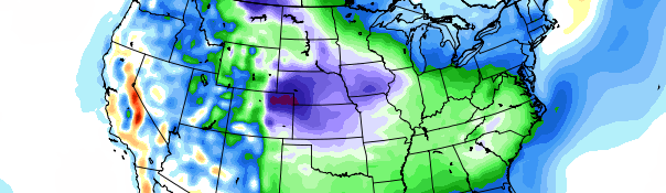
GFS Model showing below normal temperature departures throughout the majority of the United States through the first week of Spring. Image courtesy Ryan Maue and Weatherbell.
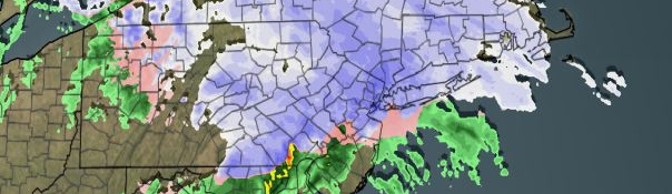
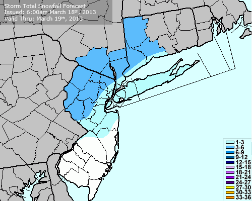
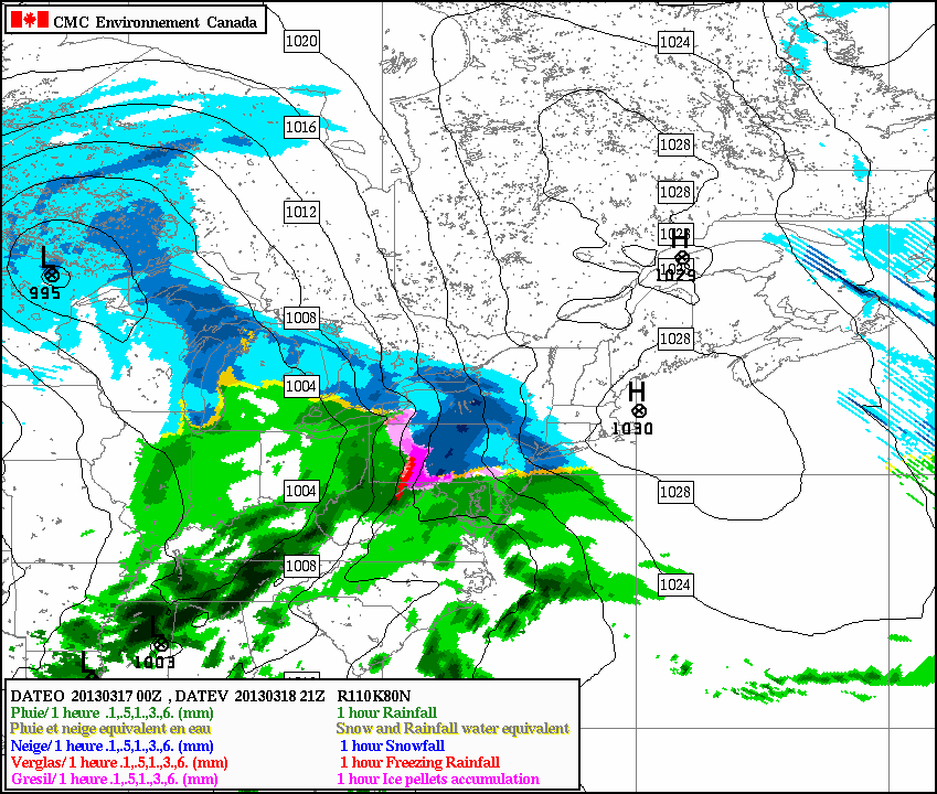
Rain and snow lingered through the area on Tuesday morning, in the wake of a storm system which dropped a few inches of snow in most locations before a changeover to rain occurred Monday Night into Tuesday morning. Some snow still remained on the ground (and roads) but rain and the presence of some sun later today should help to melt whatever is left, aside from the areas across the interior which accumulated several inches of new snow. The bands of snow and rain are expected to pull away from the area by the afternoon hours on Tuesday, with clearing reaching the area by late afternoon. West winds and some sun could allow temperatures to reach into the middle 40’s on Tuesday afternoon.
The winds will strengthen Tuesday into Wednesday and could become quite breezy at times, with gusts to 30 miles per hour as the new cold airmass enters the area behind the storm system. All eyes will then turn to the potentially wintry pattern towards the end of the week into the weekend. The first system of interest comes as early as Wednesday Night into Thursday, with a weak low pressure system forming offshore. Some light rain or snow is possible along the coast as the storm develops well out to sea and a weak inverted trough passes over the area. No accumulations are expected.
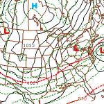
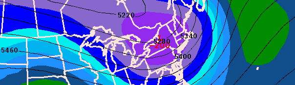
Almost all forecast models show a low pressure system on the East Coast this weekend.
The second, and likely more impactful, potential system won’t impact the area until later this weekend. A strong disturbance will eject out of the Pacific Northwest into the Central United States by Saturday — and then track eastward towards the East Coast by Sunday and Monday. Uncertainty still exists in regards to exact track and strength of the disturbance. Most notably, an upper level low to the north of our area is very important in determining where the system will eventually track. An upper level low farther south over New England will act to suppress the storm, while one farther north will allow the system to come up the coast. In addition, the exact positioning of the strong blocking (discussed in previous posts) will have an impact on the eventual strength of the surface low pressure as it nears the area.
Regardless of exact track, forecast models are in good agreement on an eventual low pressure system passing somewhere to our south off the East Coast late this weekend or early next week. The details should be ironed out over the coming days, and we’ll be sure to keep you updated.