-2")
Arctic front on the way, heavy rain possible on Wednesday
If you thought today was chilly, just wait until tomorrow. The much-advertised Arctic cold front is on its way, which will bring bitterly cold temperatures, and strong northwest winds. There may be a few scattered snow showers or snow flurries associated with this front, especially north and west of the city.
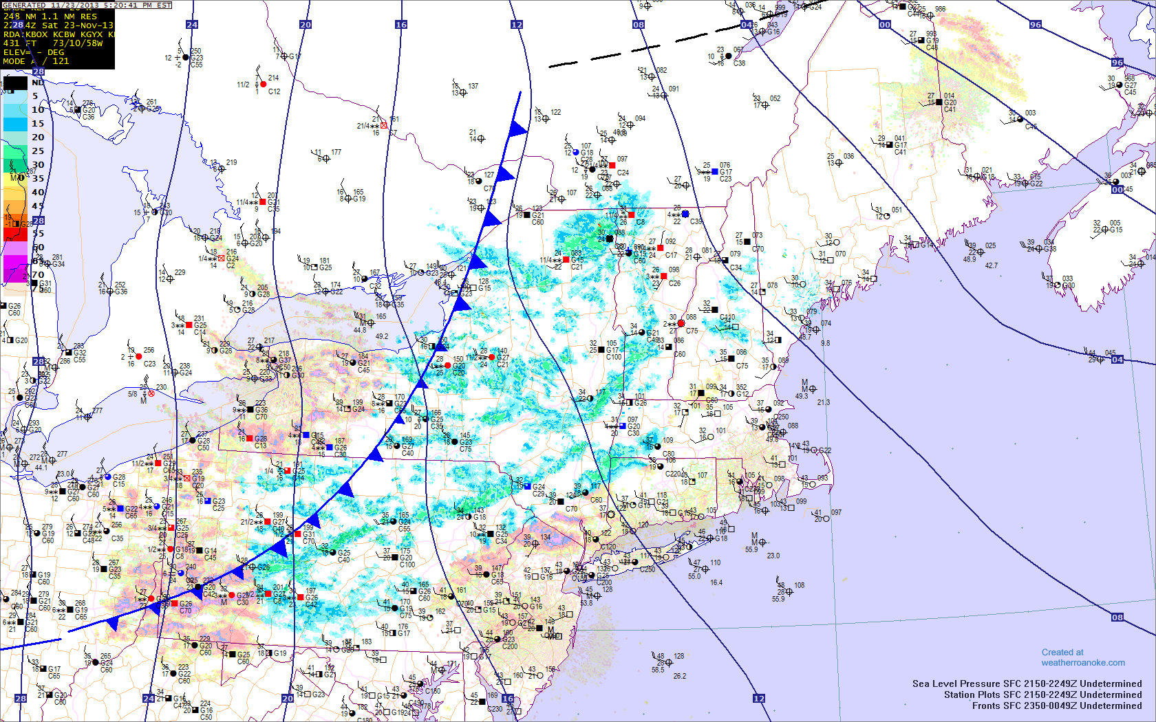
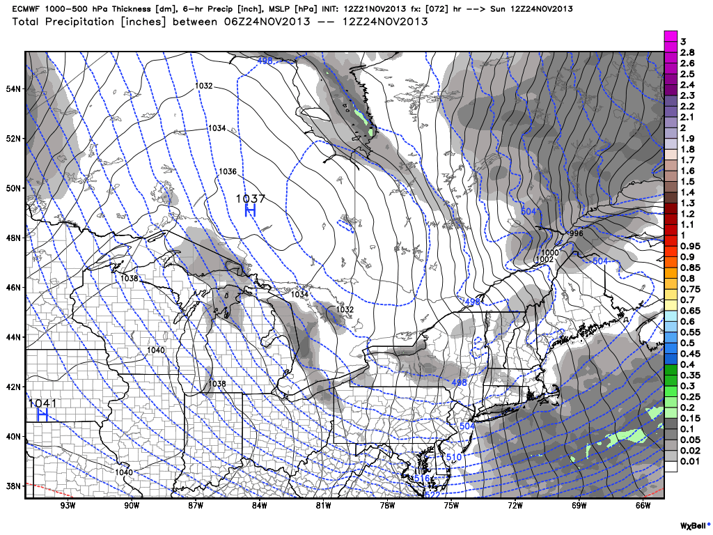
The Arctic front is approaching the region and will be crossing over the next few hours. Temperatures will plummet behind it. Additionally, snow showers can be found, indicated by the blue patches. Any snow showers should primarily remain north and west of the city. Image credit goes to weatherroanoke.com
Any snow showers should primarily remain to the west of the city, given that precipitation tends to dry out once it heads east of the Catskill and Adirondack mountains in a northwest flow. That being said, do not be surprised if a stray snow shower or two does survive a bit further east. Areas in NW Jersey may see a brief period of steady snow covering the ground and reduced visibilities, so any motorists should take caution if they run into this band of snow. Winds will also be gusty, further contributing to any loss in visibility.
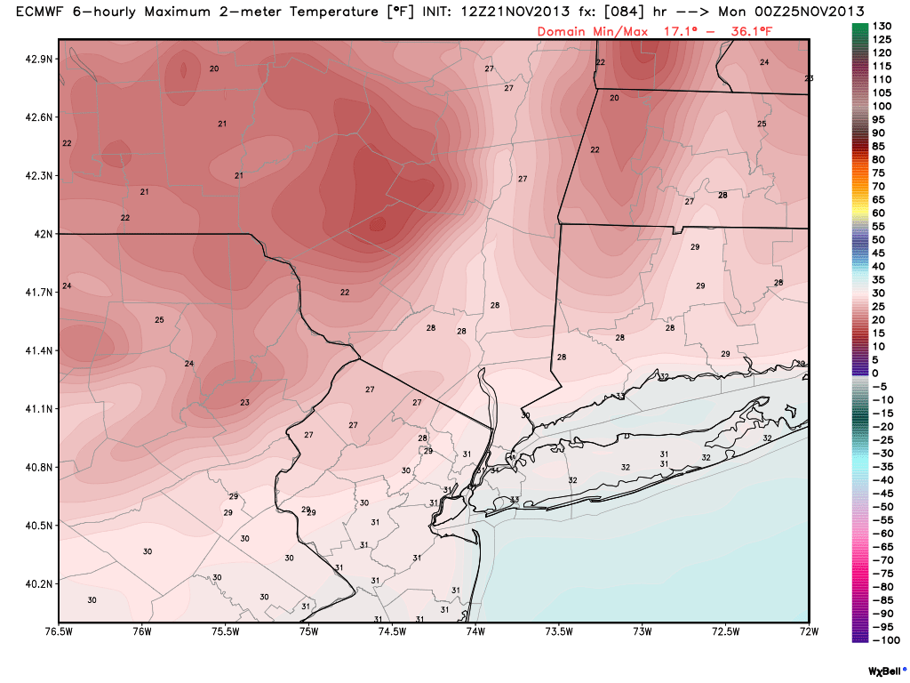
Temperatures will drop quickly this evening through the 30s, and our high temperatures tomorrow will actually be occurring at midnight, when temperatures will be in the mid 30s at midnight, and around 30 north and west. They will fall into the upper teens by morning north and west, with wind chills in the single digits, and mid 20s along the coast, with wind chills in the teens. Winds will be sustained between 20-25 miles per hour, with gusts around 35-40 miles per hour. Tomorrow, highs will only be in the upper 20s to lower 30s across the region, as seen in the image below.
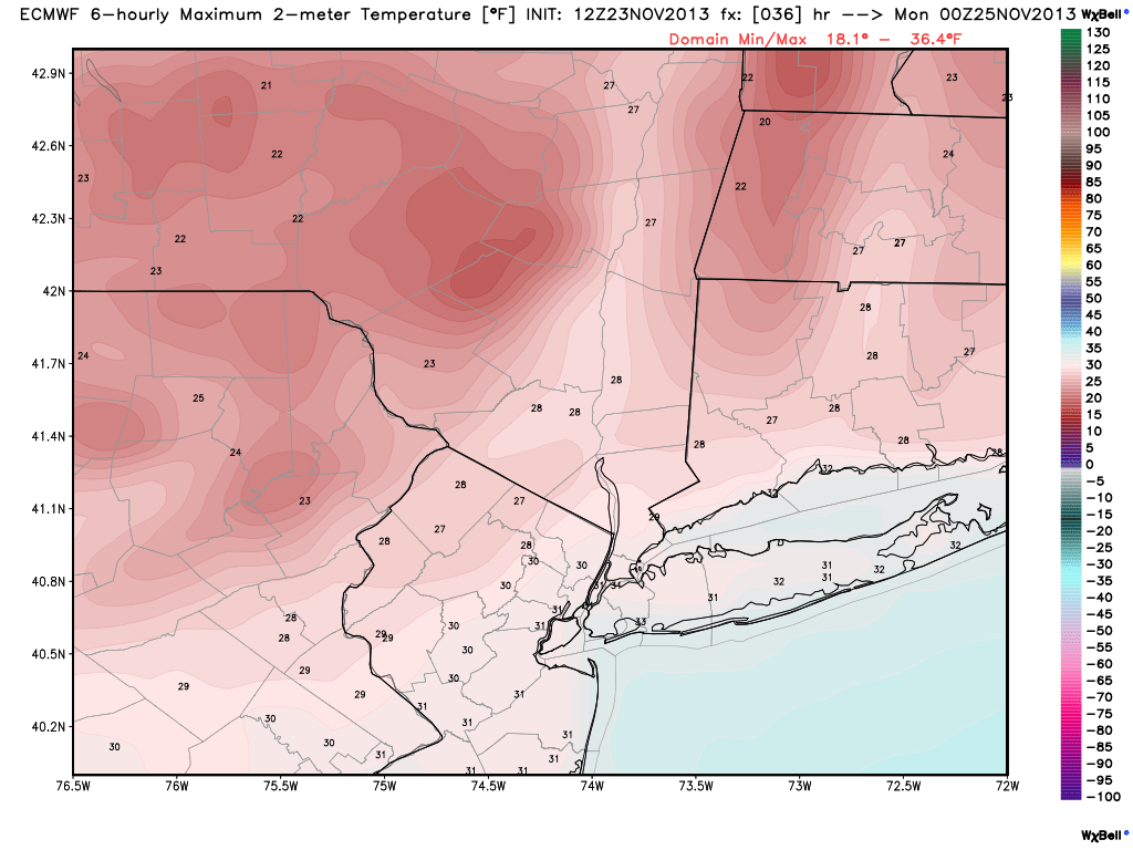
Today’s 12z European model shows temperatures remaining below freezing tomorrow afternoon. Image credit goes to weatherbell.com
Winds will become even stronger tomorrow during the day, with winds sustained between 25 and 30 miles per hour, with gusts as high as 40-50 miles per hour. This will keep wind chills in the teens throughout the entire day. Make sure to bundle up!