-2")
Forecast: Quiet Monday, potential significant storm mid-week
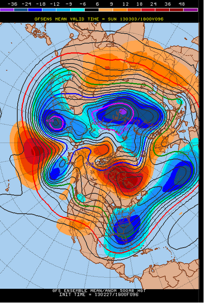
We kick off the new work week with a rather calm and benign weather day on Monday, with plenty of sun despite cool temperatures. Our area remains underneath an upper level low that has weakened, but between two disturbances. The result is continued northwest winds and cool air, but less clouds and dry weather with little chance of precipitation. High temperatures in the upper 30’s to low 40’s will be common throughout the area. Overnight, clear and breezy conditions are expected to continue with lows falling into the 20’s to near 30 in the city and near the coast. Much of the same is expected on Tuesday, although high temperatures could be a few degrees warmer as the airmass modifies a bit — with some areas reaching the low to middle 40’s by afternoon. The main story, however, will be a potentially significant storm system which will be brewing to our south by late Tuesday.
Today: Mostly sunny, brisk, cool. High temperatures in the upper 30’s to lower 40’s. Northwest winds keeping things blustery…around 10 to 15 miles per hour.
Tonight: Clear and cool, but still a noticeable northwest wind around 10 miles per hour. Low temperatures falling into the 20’s and 30’s throughout the area.
Tuesday: Mostly sunny, with some increasing clouds later in the day. A bit warmer, with highs in the upper 30’s to mid 40’s. Winds shifting from northwest to east throughout the day.
Midweek Uncertainties: The forecast becomes increasingly complicated by the middle of the week. A very strong storm system moving through the Plains and Tennessee Valley will move towards the Mid-Atlantic States by Tuesday. As it
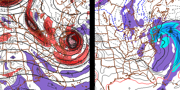
GFS Model showing a significant storm impacting our area Wednesday Night into Thursday morning with rain, snow, and strong winds.
heads towards the coast, and interacts with several different pieces of energy to the north, forecast models are struggling to pinpoint where the surface low will head off the coast — and whether or not heavy precipitation will reach our area. If it does, precipitation type looks to favor rain and snow along the coast and mostly snow inland. If not, light rain is possible everywhere as the storm moves offshore. In addition to the threat for precipitation, high winds would be likely along the beaches and shores if the storm tracks farther north. We are continuing to monitor the situation very carefully through today. We expect to have a new Hazardous Weather Briefing out around 2pm, with a Storm Alert posted by tonight if necessary.
Wednesday: Mostly cloudy with a 50% chance of rain and snow. High temperatures in the upper 30’s to low 40’s throughout the area. Blustery northeast winds from 20 to 25 miles per hour are possible.
Thursday: Mostly cloudy and breezy with a 50% chance of rain and snow early. High temperatures in the upper 30’s to low 40’s. Blustery north winds from 20 to 25 miles per hour.