Heavy rain, strong winds, and potentially thunder highlight Saturday

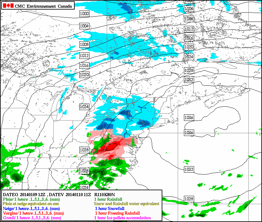
The snow and freezing rain this morning has left the immediate area, and gave most areas a coating to 1″ of snow, and also very treacherous roads. Now that the warm front has passed the area, temperatures have risen above freezing, moisture has increased, and dense fog is beginning to develop. An extremely saturated low-level profile will continue to promote an increase in fog as the night goes on, so all motorists should be extremely careful when traveling tonight, as visibilities will be below 1/4 of a mile at times.

However, a freezing rain advisory still exists for interior Central and Northern NJ, interior southern NY, and interior southern CT, as cold air has still remained at the surface. Areas close to NYC should change over to plain rain by midnight with less than a tenth of an inch of ice, and areas a bit further inland may remain below freezing until 4:00am, as a tenth of an inch of freezing rain could fall. Travel especially carefully in these areas. For more information on these advisories, see the embedded links. 

Moving forward to tomorrow, the weather will continue to get worse. A storm system will be deepening and cutting into the Great Lakes, leaving a cold front in its wake — all the way down to the Gulf of Mexico.

Today's 18z NAM valid for tomorrow at 1:00pm shows a 988mb low in SE Canada with a cold front draped across the Appalachians.

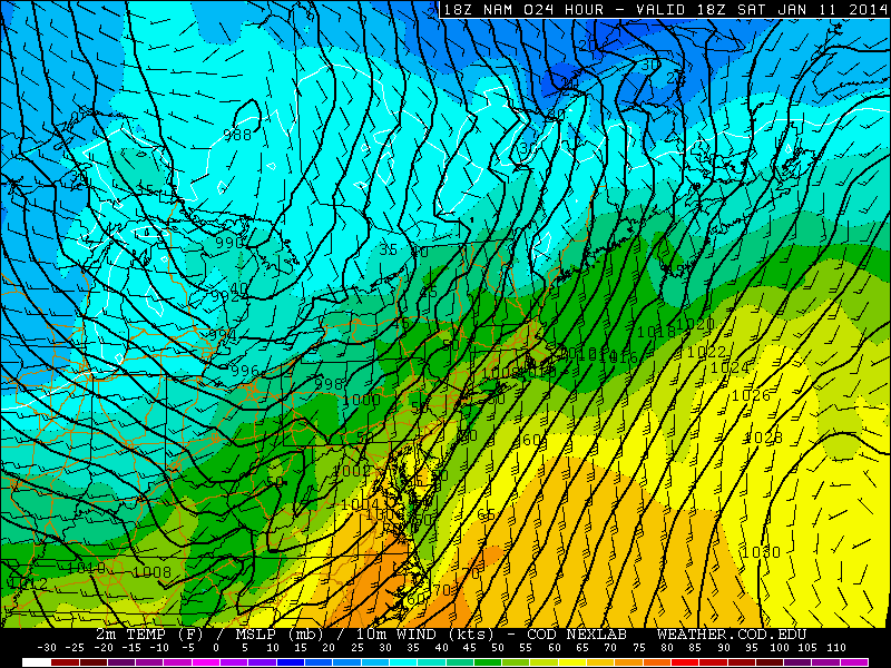
Today’s 18z NAM valid for tomorrow at 1:00pm shows a 988mb low in SE Canada with a cold front draped across the Appalachians.

The NAM model shows the cold front quite well. East and southeast of the 988mb low in SE Canada, winds are generally southerly and southeasterly; whereas to the south, west, and southwest of that low, the winds are generally westerly and southwesterly. Additionally, a classic indicator of a cold front is a pressure trough. The isobars are the solid black lines. In the area where the different wind directions are converging, there is a very well-defined pressure trough in Ohio and Kentucky, further proving the location of the cold front. It perfectly matches the region where the wind is changing in direction.

Today's 18z NAM valid for 4:00pm tomorrow shows an area of very high precipitable water values streaming into the northern Mid Atlantic, an indicator of a significantly moist atmospheric column. This supports the potential for heavy downpours.

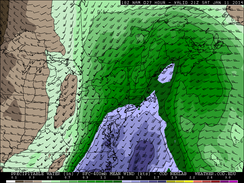
Today’s 18z NAM valid for 4:00pm tomorrow shows an area of very high precipitable water values streaming into the northern Mid Atlantic, an indicator of a significantly moist atmospheric column. This supports the potential for heavy downpours.

Although there is not a whole lot of cold air behind the front, the front is still powerful due to significant moisture differences, as well as an abundance of warm air and moisture out ahead of the front. The high preciptable water values shown above, as well as surface temperatures rising into the upper 50 and low 60s leads to low-density air that can easily be lifted. This warm and moist air being lifted by the cold front will help to trigger an area of heavy rain, and potentially enough convection to lead to a squall line with embedded thunderstorms.

Read more

Ice Jam continues, wintry mix tomorrow morning, and a major storm on Saturday

The ice jam along the Delaware River has continued to worsen, as Flash Flood Watches have been upgraded to Flash Flood Warnings in Mercer County in New Jersey, and Bucks County in Pennsylvania. Flooding has been reported at Route 29, and some roads have been closed. For more details on the Flood Warning, click this link. Otherwise, a Flash Flood Watch still exists in Mercer, Northwest Burlington, Philadelphia, and Lower Bucks County. For more information on ice jams and their potential severity, check out our article from yesterday, and today’s video discussion, which also highlights the storm potential on Saturday.

Moving forward to the weather for the rest of today, it certainly feels more comfortable than it has been with sunny skies and temperatures around or just above freezing. Continued warm air advection will prevent temperatures from dropping too much during the overnight. However, the warm and moist air approaching the still relatively cool airmass will help to trigger a weak warm front. Out ahead of this warm front, light precipitation will be falling and considering temperatures will still be around freezing, a light round of wintry precipitation can be expected late tonight and tomorrow morning.

Today's RGEM model valid for 6am tomorrow morning shows some light snow passing just to the north of NYC.

Today’s RGEM model valid for 6am tomorrow morning shows some light snow passing just to the north of NYC.

It’s a bit of a tricky forecast due to the fact that the precipitation is relatively light, scattered, and disorganized — so the exact location and timing of precipitation is uncertain. The earlier it arrives, the more wintry the scenario; the later it arrives, the rainier the scenario. Warm air moving in both aloft and at the surface will eventually change any light precipitation over to liquid by later Friday. Today’s 12z RGEM model shows the snow remaining to our north, with only a few passing flurries for NYC. However, today’s European model showed the early-morning batch of precipitation a tad further south, which allows our area to pick up a coating to 1″ of snow.

Moving forward a few hours later, the RGEM model suggests things will be getting a bit icy.

Today's 12z RGEM valid for 11am tomorrow morning shows some significant icing for the NYC area.

Today’s 12z RGEM valid for 11am tomorrow morning shows some significant icing for the NYC area.

Read more

Ice Jam along Delaware River raises major flood concerns

Observations from this afternoon confirmed a major ice jam along the Delaware River near Trenton, and concern is rising for flooding potential along and near the river and its banks as the ice melts. Water levels have risen over 7 feet since last night. Latest reports suggest initial flooding occurred this afternoon near Market Street and Route 29. The National Weather Service has issued Flash Flood Warnings along the Delaware River from Trenton southward to Philadelphia for the potential of river flooding. The warnings continue through the morning hours on Thursday January 9th.

An ice jam occurs when pieces of floating ice, carried with the stream’s current, accumulate at an obstruction to the streams flow. The ice cams can develop near river bends, banks, mouths, or even points where the slope of the river decreases. The water held back can rise rapidly and cause significant flooding. Moreoever, if the obstruction breaks suddenly, flash flooding can rapidly occur downstream. This is the concern of forecasters this evening.

Ice jam on the Delaware River near Trenton as photographed on January 8, 2014.

Ice jam on the Delaware River near Trenton as photographed on January 8, 2014.

Read more

Slow thaw will lead to warm weekend

There is much still to be said and analyzed about the actual impacts of the polar vortex’s pass through our area early this week, but for now – the main story will become its exit and the ensuing warm up. High temperatures on Wednesday have already rebounded several degrees, and less aggressive wind gusts have allowed wind chills to warm up as well. Don’t get us wrong — the airmass remains downright frigid — but the record breaking cold is moving out of the picture. The polar vortex is already retreating well to our north and will continue to do so through Thursday and Friday.

Temperatures in the mid levels of the atmosphere will respond, and warm, as the week comes to a close. Forecast models are in good agreement that surface temperatures will, as well. Highs should slowly warm into the 30’s by the end of the week. The pattern, then, will begin to change. The first sign will be a weak storm system which will slingshot towards our area from the Mississippi Valley on Friday, and may provide a period of light snow. Minimal accumulations are expected. But by this weekend, a stronger storm system will be organizing over the Central United States and the southerly flow ahead of it will begin pumping warmer air into our area.

GIF image animation showing rising temperatures at the 850mb level on Wednesday.

GIF image animation showing rising temperatures at the 850mb level on Wednesday.

Read more