-2")
Polar air brings first record low to NYC since 1996
New York City had not broken a record “low” temperature since March 9, 1996. That’s almost eighteen years ago, which is hard to fathom especially when considering the amount of high temperature records which have fallen in the time since then. Yet the daily record low temperature for January 7, which was previously 5 degrees, fell on Tuesday when Central Park’s temperature dropped to 4 degrees — breaking the near eighteen year streak. The previous low of 5 degrees was set 118 years ago, during very early observations at Central Park.
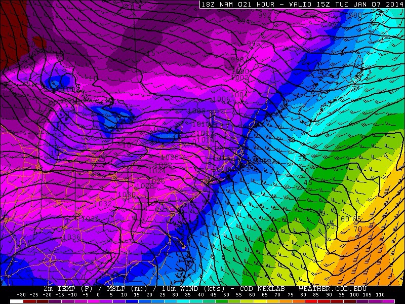
More impressive, without a doubt, were the widespread single digit temperatures and strong winds which combined to yield wind chill values from -10 to -25. The arctic front which passed through the area early on Monday brought gusty west winds and 850mb temperatures of -25 to -30 C, by far the coldest air of the season to date. The airmass wasn’t unprecedented, however, as these type of polar intrusions have certainly occurred before. The piece of the polar vortex which surged through our area tucked to the south of a powerhouse low pressure system bombing out over Eastern Canada, which helped strengthen the pressure gradient and surface winds.
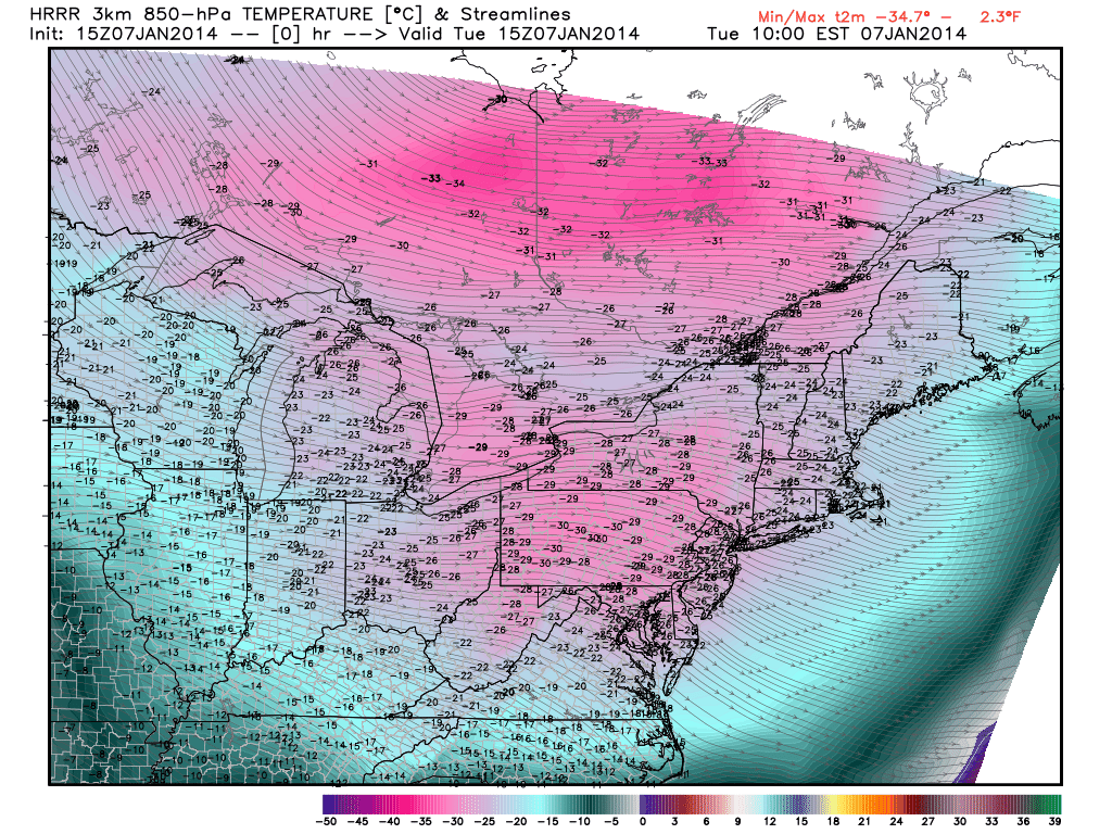
850mb temperatures dropped to near -30 C throughout the area on Tuesday morning as a piece of the polar vortex shifted overhead.