-2")
Heat with afternoon thunderstorms today and Wednesday
A warm and muggy airmass has its grip on our area, and combined with a slowly approaching cold front and a disturbance aloft, some showers and thunderstorms will be triggered. For most of the day today, the cold front will still be a bit far to our west, which will generally lead to mostly sunny skies, hot temperatures, and a delay in any thunderstorm activity.
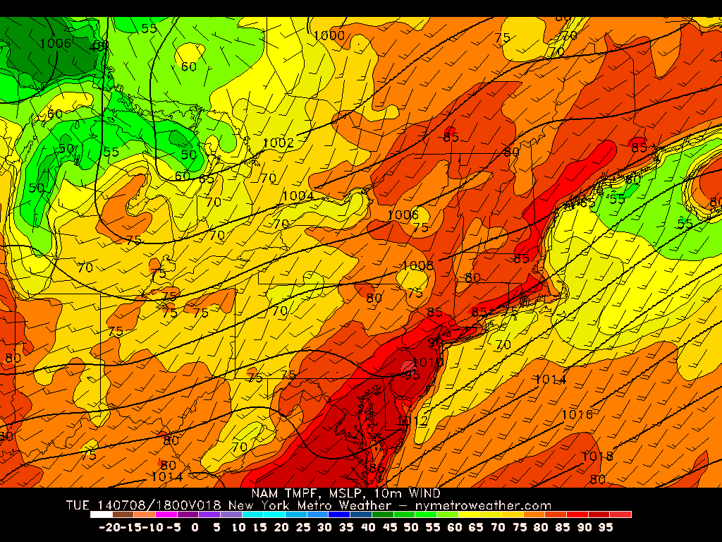
NAM model valid for 2:00pm shows temperatures in the low-to-mid 90s in our area, with 80s along the shores.
850mb temperatures of 18C with sunshine support high temperatures in the low-to-mid 90s, which will generally be commonplace throughout the area. The one exception will be for most of Long Island and the immediate Jersey Shore beaches, where temperatures will stay in the 80s, due southerly winds from the ocean bringing in slightly cooler temperatures.
Initially, the highest 500mb vorticity and core of the trough are still to our west, as evidenced in the image below. The cold front is associated with the low pressure system well to our northwest, and we have a warm, southwesterly flow out ahead of it. However, there is a weak surface pressure trough in the Mid Atlantic — which combined with a weak 500mb vorticity maximum — may act to try and force some convection during the evening.
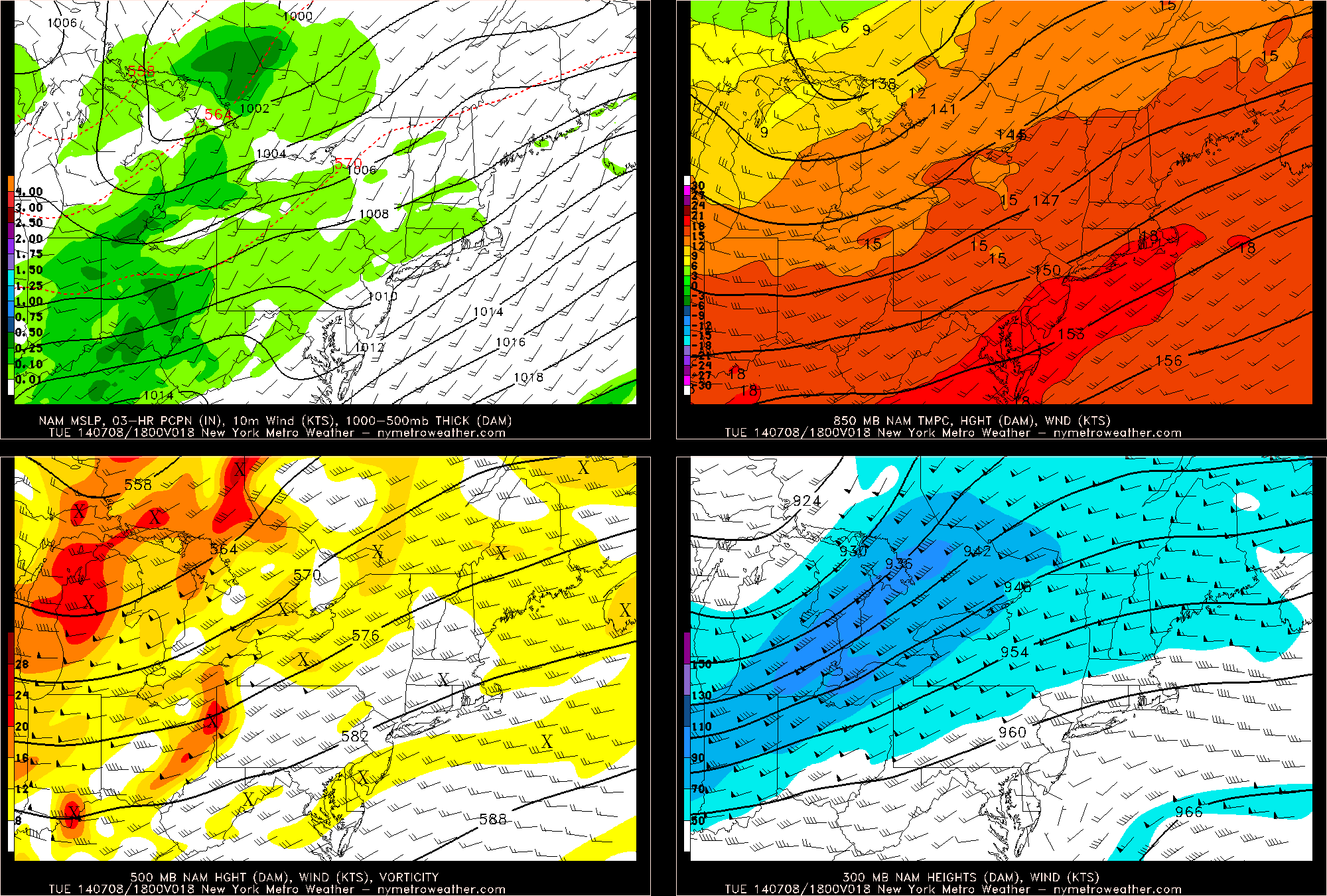
NAM model showing a weak surface trough and weak area of vorticity, which may help to trigger some thunderstorms. The core of the trough will remain to the west for most of the day, which will delay the thunderstorms somewhat. Additionally, 18C 850mb temperatures will lead to quite the hot afternoon.
As far as the type of thunderstorms that can be expected, some may produce some some strong winds and very heavy rain, due to sufficient wind shear, moderate instability, and very high precipitable water values. Read more