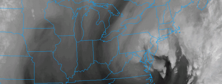
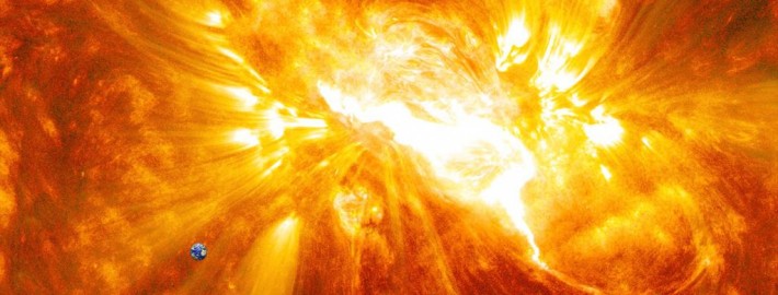
Huge X-Class solar flare erupts from the sun

A gigantic sunspot, first noted by astronomers several days ago, has unleashed another X-Class flare this morning. This one, classified at X1.6, has a much greater breadth than its predecessor. The flare may be Earth-directed, but we are still awaiting more information as it becomes available this afternoon. Luckily for us, space weather data allows us to pick up on this information rather quickly. Radio blackout information was detected within minutes of the flare. And sensors picked up on the X Class flare and its strength almost instantly.

Whether or not the X-Class flare is Earth-Directed, and whether it not it featured a CME (or Coronal Mass Ejections) will obviously have impacts on what we experience here. Luckily, our atmosphere protects us from most of the potentially harmful impacts of an Earth-directed major solar flare. But the magnetic field can still produce widespread aurora, radio and GPS blackouts and effects, and satellite interruptions. If the flare is not Earth-directed and/or doesn’t feature a CME, we will either experience fringe effects (nothing notable) or nothing at all

Read more

Coastal storm to bring rain, wind through Thursday

A rather impressive mid and upper level trough is developing through the Mid Atlantic and Northeast States today, with a surface low pressure developing off the Mid-Atlantic coast. An inverted trough, extending northwestward from this surface low, is aiding in the development of very heavy rain along much of the area coasts including New Jersey and New York. Places to the northwest and interior have been able to escape the heaviest rain. But the low level jet will continue to support this heavy rain through the morning hours.

Later today, this rain will begin to swing southwest and wrap closer to the surface low. The low level winds which are currently moving in from the southeast (onshore) will shift to a more northeasterly direction and the inverted trough will swing southward, with the best lift for precipitation shifting away from the area. Still, showers and some thunderstorms will be possible throughout the day as the upper level low moves overhead and the surface low continues to develop.

Read more

Hail, waterspouts and rainbows all made an appearance today

A developing coastal system produced an array of weather conditions throughout the area today. Beginning in the morning, showers and thunderstorms developed as a result of daytime heating at the surface and cold air moving in aloft. The developing system aided in lift which allowed for these storms to form. The cold air aloft, meanwhile, aided in not only the storms development, but the threat for some hail. As the storms progressed through parts of New Jersey and then out to sea, some low level shear allowed for waterspouts to develop.

When colder than normal air exists in the mid levels of the atmosphere, developing thunderstorms will often produce hail as the ice in the cloud becomes much more thick than usual due to the colder temperatures. This often occurs in the transitional seasons of Spring and Autumn in our area, when cold pools move overhead and the surface can still become unstable.

Meanwhile, scattered showers and storms continued to develop throughout the area during the afternoon hours. Multiple rainbows were seen throughout the area. Currently, a convective system south of Long Island is moving northward toward the Central and Eastern parts of the Island. Stay tuned to our Twitter account for up to the minute information on these storms.

Read more

SPC Outlooks will change starting this Wednesday

The Storm Prediction Center has used the same risk categories for a large part of most of our meteorological careers. Although they have adjusted the probabilities, percentages, and yes even the colors — the categorical risk areas have remained the same. On this coming Wednesday, that will change. The Storm Prediction Center currently uses a simple categorical risk system which highlights the potential for severe thunderstorms across the country. The risk areas of Slight, Moderate and High are triggered by percentage chance of a type of severe weather within 25 miles of any point. And while the newer outlooks also highlight the potential for general non-severe thunderstorms across the country, Wednesday will mark a dramatic change in the way these outlooks are viewed and understood.

The main change will be the addition of two risk levels, both falling on opposite sides of the “Slight” risk of severe thunderstorms. “Marginal”, a new risk category, will highlight the potential for severe thunderstorms that includes a 5-10% chance of wind and hail and a 2-5% chance of tornadoes — but does not trigger a Slight Risk. “Enhanced” falls on the other side of “Slight”; in other words the risk levels are enhanced (30-45% risk) but not organized or widespread enough to trigger a Moderate Risk.

Read more