Potential week-long heatwave begins today

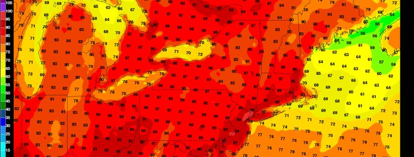
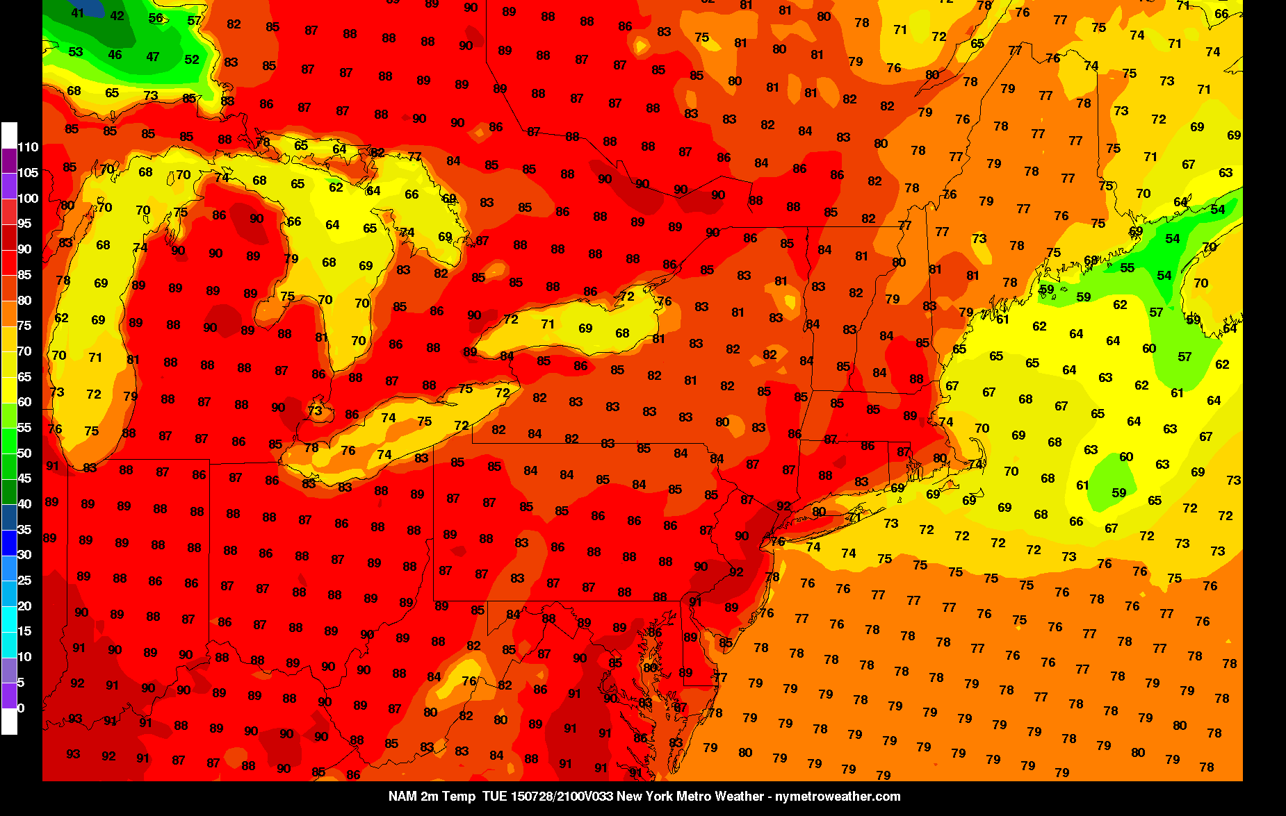
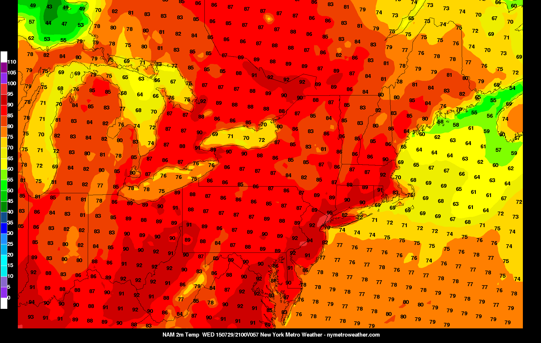
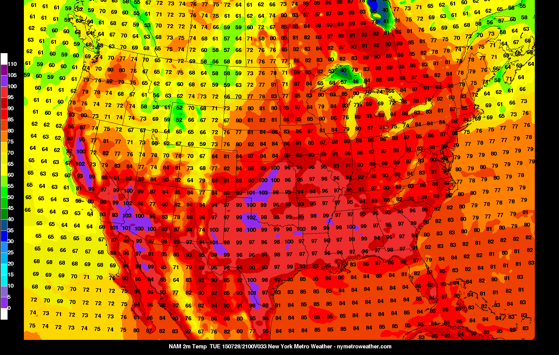
In what has generally been a summer lacking heatwaves, this week looks likely to be an exception. While not everyone in our area will reach or exceed 90 degrees every day, many locations in New Jersey probably will — possibly for five days straight.

Every summer, a feature affectionally known as the “death ridge” sets up in the Southern Plains. It’s a persistent area of strong heat ridging where a trough crashes into the western half of the US, and a consistent source of heat is pumped out ahead of it. Depending on other aspects of the weather pattern, this ridge can expand and/or head northeastward. If upper level winds are slow, and there is another trough to its east to “sandwich” it, then it can stall over an area for a prolonged period of time.

While record heat is unlikely, a stretch of 90+ degree weather is likely over the next seven days.

Read more

Afternoon roundup: Awaiting the return of heat

The stretch of pleasant, low humidity weather is officially over, and now we await the incoming heat this week. A changing atmospheric pattern will promote the advection of a warmer, more humid airmass into our area this week. As a ridge over the Central United States collapses northeastward, warmer air will be on the move toward our area. High temperatures in the 80s on Monday will rise toward the 90s on Tuesday — and remain in the mid to upper 90s on both Wednesday and Thursday. Showers and thunderstorms will also be a possibility each day, owing to the increased humidity and atmospheric instability. Here are some highlights from around the meteorology community:

  • Highs in the 80s today, but showers and storms will still be possible during the afternoon and evening hours. They will be isolated in coverage, but could be locally strong and slow-moving. This could mean flash-flooding and dangerous lightning. This threat will last until midnight.
  • A heat ridge builds in on Tuesday, which will end any threat of showers or thunderstorms. After morning temperatures in the low 70s, highs could hit 90 or the low 90s in some spots with mostly sunny skies and high humidity. Afternoon southerly winds could make areas along the coast a bit cooler.
  • Some record heat is possible on Wednesday, with many areas reaching the upper 90s, with low to mid 90s along the coast. Humidity will be a tad less than on Tuesday, but heat indexes could still approach 100 degrees.
  • After a very warm morning on Thursday with temperatures in the upper 70s, temperatures should once again soar into the 90s. But it will be a tad cooler than on Wednesday due to afternoon cloudcover and a chance of afternoon showers and thunderstorms as a shortwave passes by to our north.
  • Friday and the weekend look sunny and not as humid, but it will still be warm — temperatures in the upper 80s to around 90.
  • A significant heat wave has been occurring in the Southern Plains, as high temperatures exceeding 100 degrees look to be common tomorrow.

Humidity, storms will return on Sunday

It has been quite a stretch of pleasant weather. In fact, stretches of low humidity weather with sunshine and warm temperatures like we just experienced are quite uncommon during this time of year. The good news? This stretch isn’t quite over yet. The pleasant and low humidity weather will continue through Friday evening and into Saturday, as high pressure remains in control. Mid level temperatures, however, will slowly warm up over the next few days.

By Sunday, the atmosphere will become increasingly perturbed. By Sunday afternoon, instability will begin to build as a weak trough and disturbance approach the area. And with that, will come a break in the stretch of pleasant and dry weather. Although shear remains weak for storm organization, pulse thunderstorms, some strong, appear likely on Sunday afternoon. Some of these could contain heavy rain and frequent lightning.

Read more

Morning Roundup: Cooler, pleasant, sunny

Much cooler, more pleasant, and enjoyable weather is finally here! After several days of humid and very hot weather with unsettled weather, a cold front moved through on Tuesday evening. While showers and thunderstorms were not numerous, they were present. In fact, storms dropped hail and caused isolated wind damage in parts of Southeast New York as they moved through an unstable atmosphere during the mid evening hours. This morning, the humidity and oppressive airmass is long gone.

Today will be a true winner of a day, when it comes to summer weather. High pressure is settling in, bringing with it a northwesterly breeze and much cooler air aloft. At the surface, the air will still warm into the middle 80’s during the day under full sunshine. It is hard to get a day like this in the middle of July, but it looks like we will run off a string of them over the next few days. You won’t find us complaining about that! Some weather highlights: