NYC goes for an official heatwave today

After two days with temperatures in the lower 90’s, Central Park is vying for an official heatwave today as the warm and humid airmass takes one last stand. Temperatures this morning are already in the lower to middle 80’s throughout the area, but clouds and showers are meandering around the forecast area within the warm sector — or the area of warm, humid air ahead of a cold front.

Later today, however, drier mid level temperatures are expected to promote more sunshine. With warm air still present at many levels of the atmosphere, forecast models are in good agreement that high temperatures will approach 90 degrees once again. Areas in urban Northeast NJ and southwestward toward Central NJ are likely to see temperatures reach into the lower 90’s as well. This third straight day of 90 degree temperatures at Central Park would secure an official, mid-summer heat wave.

Read more

Morning Roundup: The heat continues

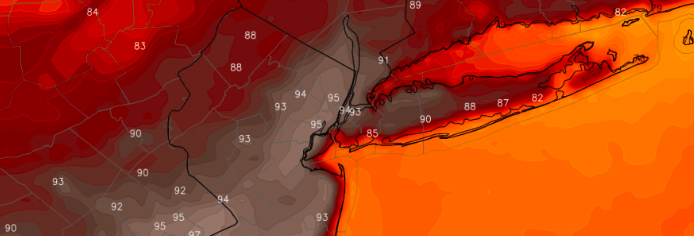
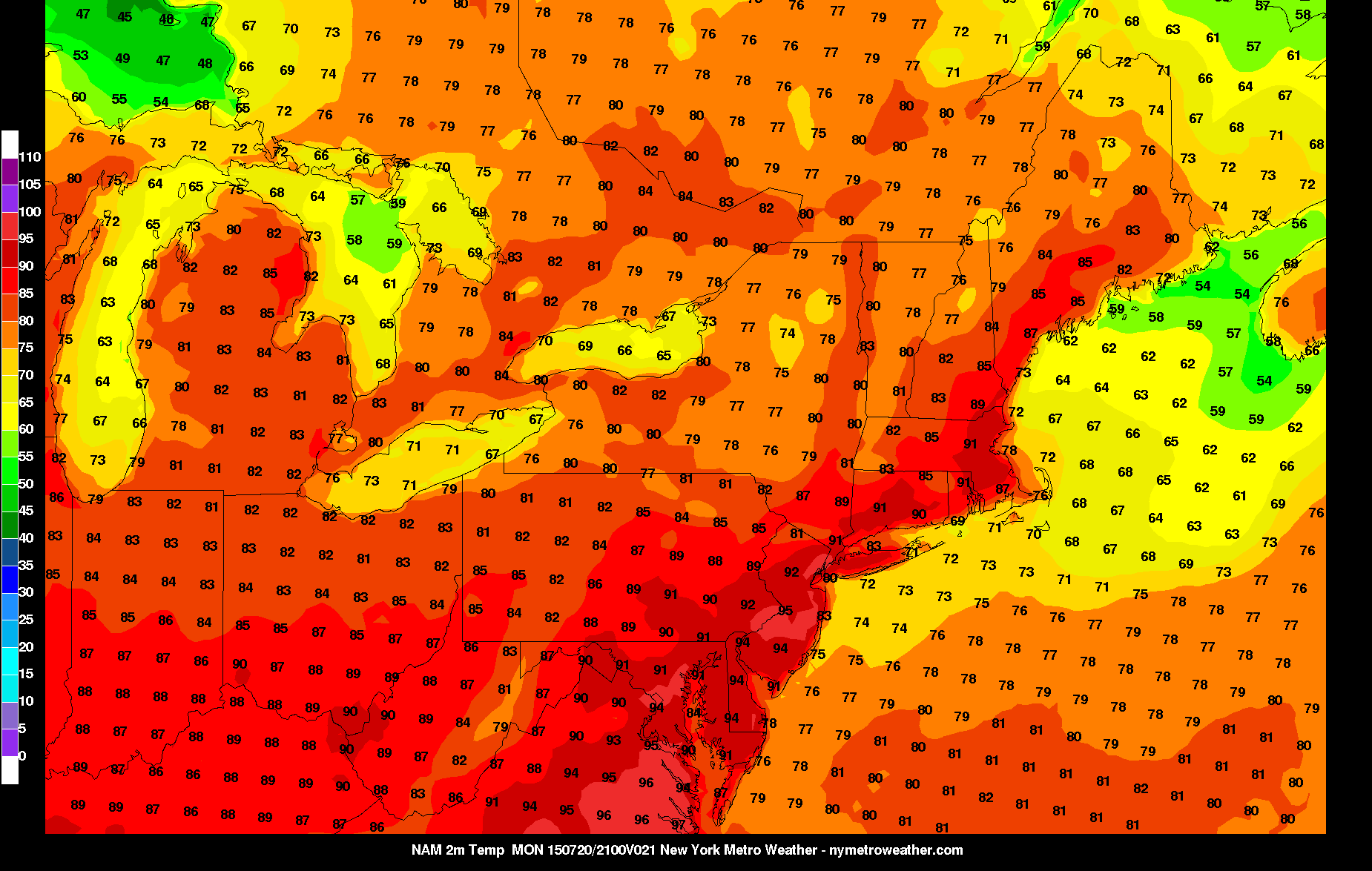
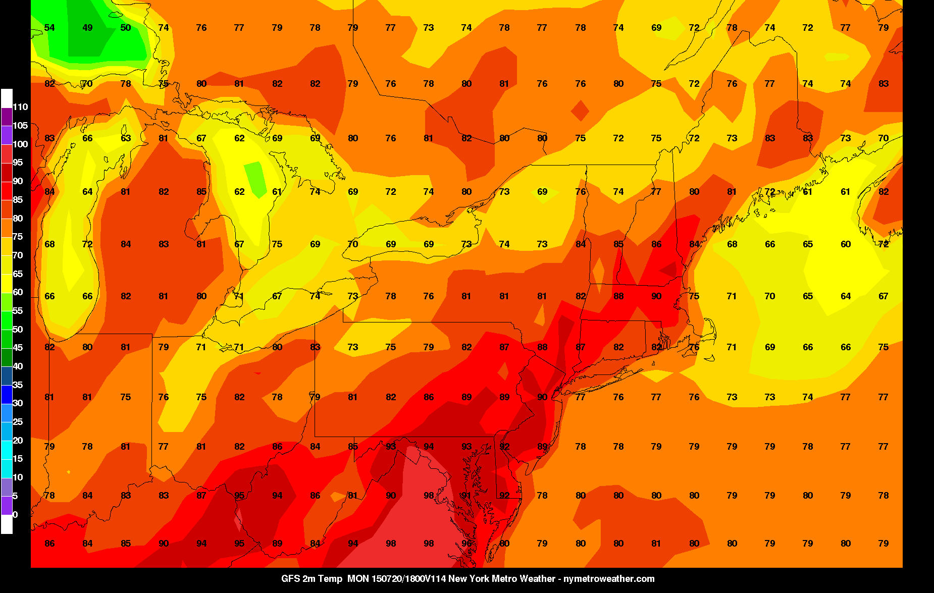
After what has been a summer without much in the way of excessive heat, this current weather has gone against that theme. Yesterday’s high temperatures soared well into the 90s in many locations, and when combined with dewpoints in the low 70s, heat indexes were often above 100 degrees. Some areas such as Newark and Central Park had its warmest temperature readings in almost two years.

Some highs from yesterday:

Newark, NJ: 98

Central Park, NY: 93

LaGuardia Airport, NY: 94

JFK Airport, NY: 89

Much of the same looks to continue for today, with temperatures soaring well into the 90s. In parts of NE NJ and other areas in and around NYC, mid to upper 90s are likely. Once again, it looks to be a day where it is very important to stay hydrated and not overly exert yourself if you are outdoors.

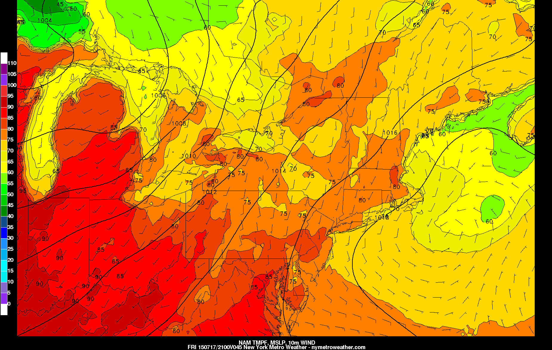
The one bright side is that dewpoints will be a little lower today than yesterday. This is because a cold front will be approaching from the west, which will help the winds have more of a westerly component, which is a dry wind that downslopes off the Appalachian Mountains. Thus, heat indexes probably will be a few degrees lower today than yesterday. However, this also means that coastal areas will be a few degrees warmer than yesterday; so whoever did not reach 90 degrees yesterday will most likely reach it today.

Other weather highlights include:

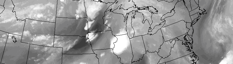
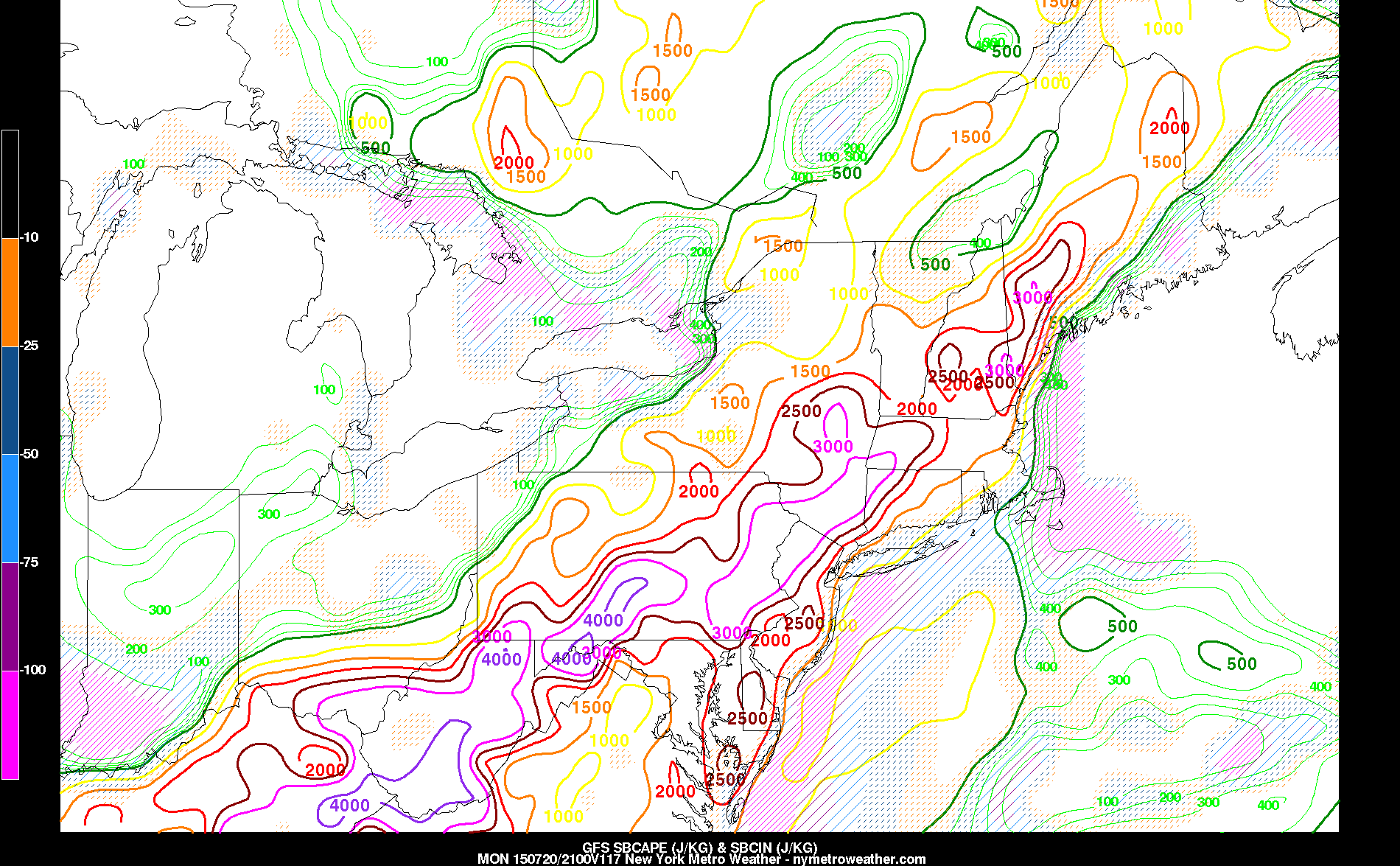
  • Daytime heating and the approaching cold front could trigger some isolated showers and thunderstorms, some of which could produce heavy rain. However, the front will be weakening and the westerly winds will be causing our low-level moisture to mix into the rest of the atmosphere as opposed to staying trapped at the surface. Thunderstorms like a moist surface and dry mid-levels, so these westerly winds and the weakening front will remove some of those favorable conditions. This will keep most areas dry and any thunderstorms relatively weak.
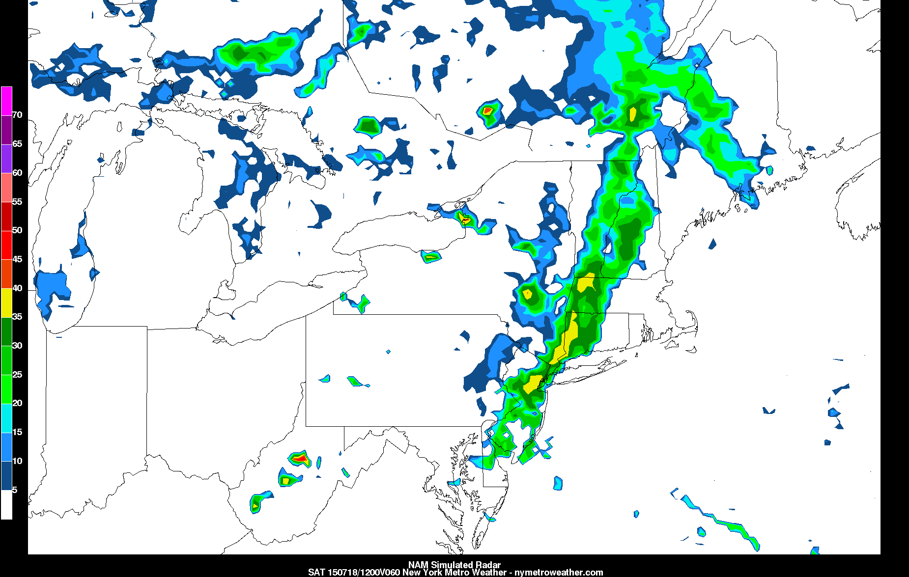
  • A shortwave disturbance looks to move in on Monday night and early Tuesday morning. This could trigger some showers and thunderstorms, though the drier air plus it being nighttime (no heating from the sun) could keep this activity weak, albeit not as isolated as the activity this afternoon.
  • Tuesday looks to be another hot day but even less humid than today, and also a few degrees cooler. Temperatures could still hit 90 degrees. A secondary cold front may trigger more showers and thunderstorms in the late-afternoon or early-evening, but these are also not expected to be strong.
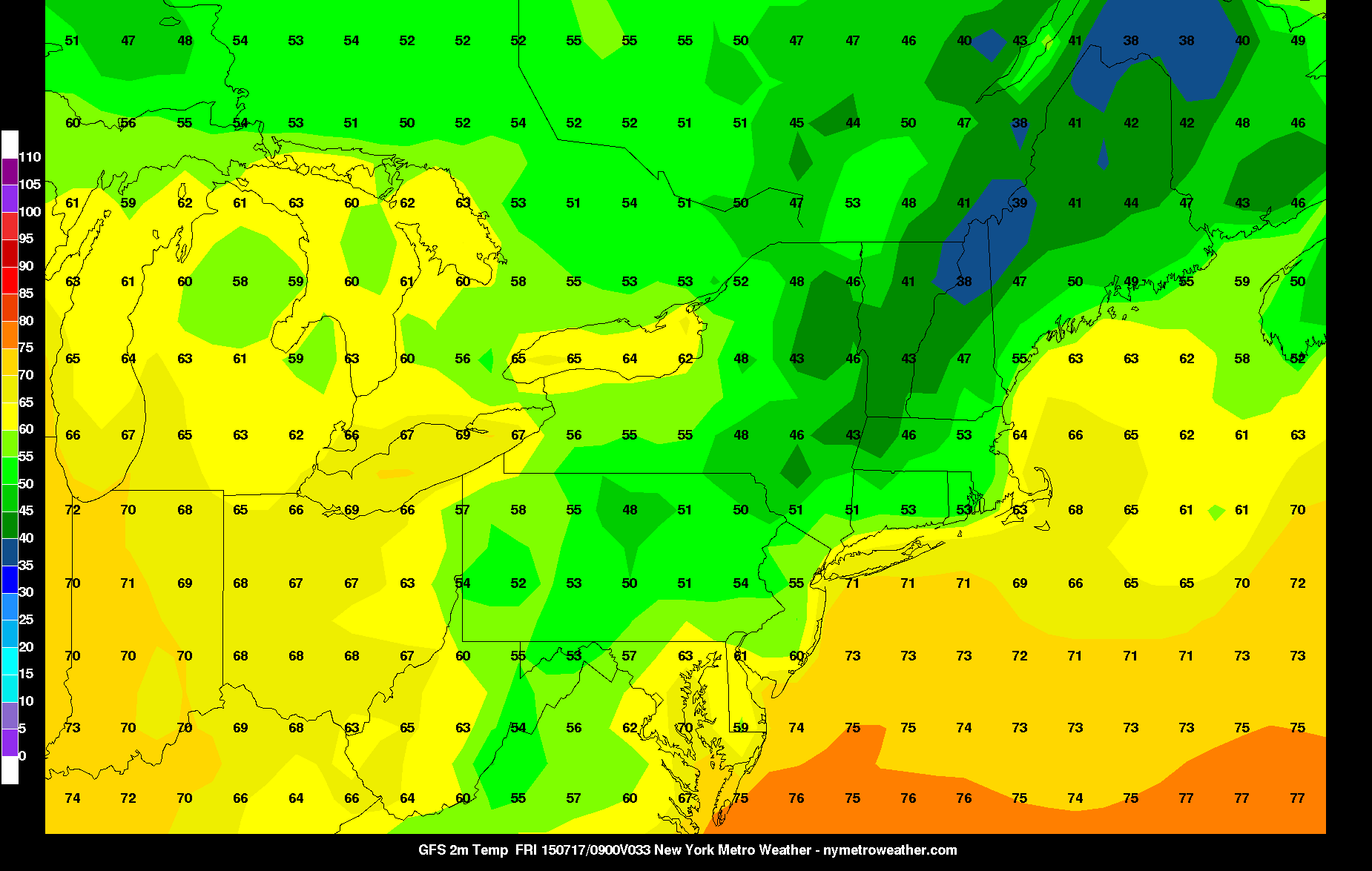
  • Cooler, less humid, and more pleasant weather builds back in for Wednesday through Friday. An upper-level low to our north may provide some cumulus clouds from time-to-time; however, but we should remain rain-free. Temperatures will generally be in the l0w-to-mid 80s during this period.

Morning Roundup: Hot, stormy weekend on the way

A drifting high pressure system will keep weather fairly pleasant on Friday, a nice end to a week which featured unpleasant conditions for multiple days. After morning clouds and localized fog on Friday morning, temperatures will warm up into the 70’s and 80’s throughout the area. Calm winds will be shifting directions throughout the day, but there will be no sustainable seabreeze or prolonged clouds. Instead, the weather will remain generally pleasant with lower than normal humidity for this time of year. This weekend, however, the game changes: A hot airmass moves in, as does the support for severe weather from essentially Saturday through Monday. Some highlights from around meteorology are below. Have a great Friday!

  • Pleasant, warm weather will dominate the day today. Highs in the upper 70’s to lower 80’s will be common throughout the area. Variable winds and not too many clouds means Friday afternoon activities should be very pleasant. Any chance of precipitation holds off until Saturday.
  • On Saturday, the weather begins to change dramatically. Temperatures warm up into the 80’s and 90’s with atmospheric instability rapidly increasing. Humidity will rise notably as well. The potential exists for strong to severe thunderstorms, with hail, lightning and gusty winds.
  • The potential for severe weather and heat will continue on Sunday. Temperatures will reach into the lower and middle 90s, with strong to severe storms possible again during the afternoon. And, again, these storms will be capable of producing torrential rain, lightning, hail, and strong winds.

Morning Roundup: Dry, pleasant weather returns

Good morning! After many areas received  thunderstorms with heavy downpours — owing to high humidity on Tuesday and Wednesday, Thursday looks much more pleasant. A cold front charged through the area yesterday evening straight from the north, helping to advect a truly dry Canadian airmass, rather than one that gets modified in the Midwestern states. This dry air helps temperatures to drop more quickly at night, leading to quite the refreshing morning, while drastically lowering the humidity. This is why you’re feeling much more comfortable this morning than the past several more humid days. 

Despite the relatively chilly airmass, temperatures will still be able to recover to around 80 degrees this afternoon. Dry air leads to larger temperature changes, since it has a smaller heat capacity than water. This means a large range in low and high temperatures (an extreme example to draw upon is deserts having such large temperature ranges). An area of high pressure behind the front will provide a nice stable layer in the atmosphere, preventing any cloud formation. This should keep skies almost 100% clear and blue, with around a 10mph northerly breeze — when combined with dewpoints in the low 50s, it will be one of the most pleasant days of the year. The north wind also halters seabreezes, making today a lovely beach day.

Other weather highlights include:

  • Another chilly night is expected tonight. Clear skies, dry conditions, and diminishing winds will allow suburbs to have radiational cooling. This means that many western suburbs and the pine barrens could fall into the upper 50s, while mid 60s will again be found in Urban areas
  • Friday looks splendid as well. Winds will have shifted to the south and southeast as high pressure scoots offshore. This should make most locations a few degrees warmer than on Thursday. However, the southeast wind flows with the seabreeze, making it chillier and windier along the beaches.
  • A warm front looks to go through the region late on Friday night/early Saturday morning. This could trigger some overnight thunderstorms with loud thunder and heavy rain, but not severe. It will also be ushering in much warmer and humid air from Saturday and onward, when a several-day stretch of upper 80s to low 90s with high humidity is possible.
  • With this warm and humid airmass, the threat of thunderstorms will have to be watched from Saturday through Tuesday — as of now, the two days for severe weather would be on Saturday and Monday. There are a lot of model discrepancies, however, and the latest NAM model has backed off somewhat for Saturday. A more detailed article will be written about these threats if they gain more traction, but as of now there is not enough concrete evidence for severe weather to write one. That being said, while the GFS is too slow to bring us the extreme instability to make Saturday a threat, it does look quite potent for Monday. It’s only a matter of time before one of these events pan out.