PM Update: Increasing clouds, unsettled weather returns

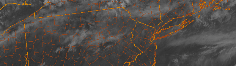
So, we lucked out on Wednesday. A very weak mid level ridge and transition between disturbances allowed for pleasant conditions and high pressure. Temperatures fell several degrees from the past few days, but more notably, so did the humidity. Highs in the upper 70’s and lower 80’s were commonplace throughout the area Wednesday afternoon. Partly cloudy skies brought pleasant conditions as well, with a light breeze. It was, by all means, a winner of a day.

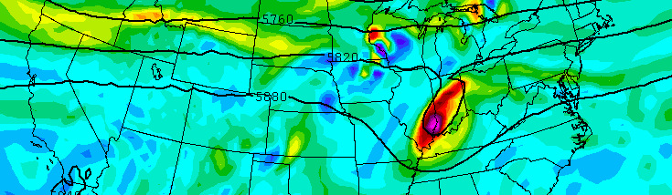
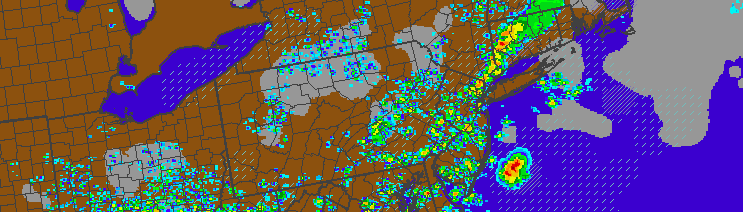
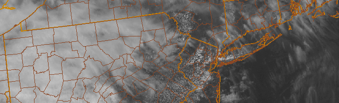
The same won’t be true for Thursday. Beginning tonight, high clouds will stream in as a disturbance approaches from the Ohio Valley. Moisture will return to the air and showers will be possible as early as overnight Wednesday. With the increased moisture, showers, and clouds, will come high temperatures only int he 70’s on Thursday. No severe weather threat is anticipated, with cooler more stable air in place throughout the area.

Read more

Remnants of TS Bill will impact weekend forecast

While Tropical Storm Bill is making headlines today impacting parts of Texas, with rains expected in the Plains this week, we aren’t out of the woods here in the Northeast. A Tropical Storm thousands of miles away will eventually become engulfed in the mid and upper level atmospheric flow, bringing tropical moisture northeastward into the Ohio Valley and eventually the Northeast. For our area, this will have a major impact on the weekend forecast.

Forecast models are struggling with the exact intensity of TS Bill as it moves inland, as well as the timing of it’s absorption into the mid and upper level atmospheric flow. These two factors are very important for our areas forecast, as they will dictate the timing of a surge of tropical moisture into the Northeast US. Showers, thunderstorms, and even areas of heavy flooding rains are possible near where the center of the remnant low pressure tracks.

Read more

PM Update: Departing storms, continually unsettled

Showers and thunderstorm, none severe, moved through the NYC area during this afternoon and early evening. Sparked by a mid level disturbance and surface cold front, the storms were mainly of the “Garden variety”, although some of them packed some gusty winds. Tropical moisture in place added to threat for heavy rain, which did result in some localized flooding. But overall, a lack of instability in the atmosphere kept any severe weather threat from materializing.

The same was not true over Southern NJ, where better surface instability led to the development of a few supercells, which caused wind damage over Southern New Jersey earlier today. For most of the region, however, the good news is this: This front will slide southward and bring cooler, less humid, and more stable to the area tonight.

Read more

Heat, unsettled weather will continue this weekend

After our area was able to escape strong to severe thunderstorms on Thursday, many expected Friday to be cooler and more refreshing. You were wrong. Mid level temperatures remain hot — even behind the wind shift boundary that was able to touch off some severe thunderstorms in Pennsylvania on Thursday. As it turns out, mid level capping and dry air in those levels of the atmosphere was able to suppress any thunderstorm development in our area.

Friday will feature conditions quite similar to Thursday. Temperatures will rise into the upper 80’s and lower 90’s away from the area beaches. Humidity values, though lower than Thursday, will still make the air feel somewhat uncomfortable. The air quality will also remain poor. Heat Advisories are in effect to the south and west of New York City, nearer to the Philadelphia metropolitan area.

Read more