-2")
Record-breaking cold tonight, followed by an active weather pattern
The theme for this month so far has been cold, cold, and more cold. And that is expected to continue. Most locations in the NYC area are running around ten degrees below average, which currently places us in the top-5 for coldest Februaries on record.
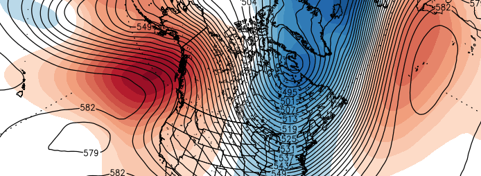
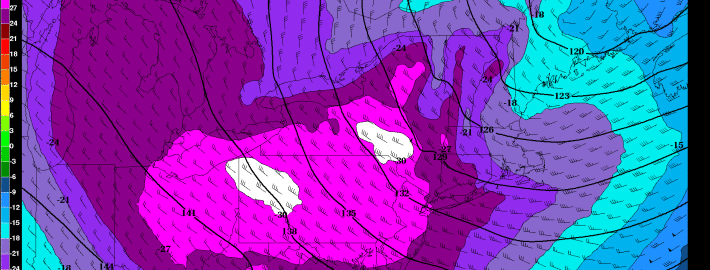
Tonight, another Arctic blast is on its way, as a large chunk of the Polar Vortex will dive into the US. This is the most impressive Arctic blast yet. Had last year’s Polar Vortex phenomenon not been so strong, this Arctic outbreak would be getting a lot more attention. The Arctic cold will be combined with NW winds at around 20mph, gusting to 30mph, leading to dangerously cold Wind Chills.
The big question among us meteorologists is whether NYC will hit 0 or below tonight. The airmass looks cold enough, as 850mb temperatures (about 4500 feet in elevation) look to drop to -27C at 1:00am, and 925mb temperatures (about 2200 feet in elevation) look to fall to -26C at 7:00am.