-2")
Snow, cold, strong winds possible this weekend
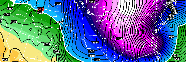
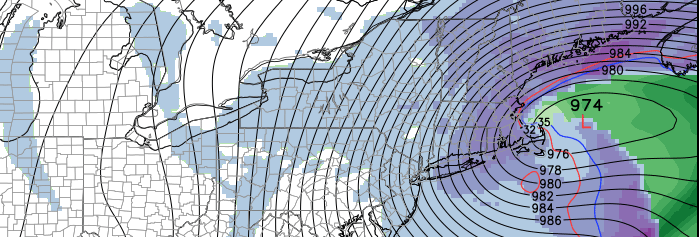
Forecast models have come into much better agreement on the eventual track and intensity of a powerful storm system, which will develop from the Great Lakes off the Northeast Coast on Sunday. The track of the storm is quite unusual, with the surface low tracking from Southeast Canada to a position off the New Jersey Coast and eventually into the Gulf of Maine. A powerhouse mid and upper level low will amplify eastward from the Great Lakes, underneath Long Island, and eventually to a position just south and east of Cape Cod, aiding the strengthen an already powerful storm system.
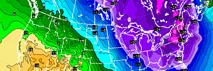
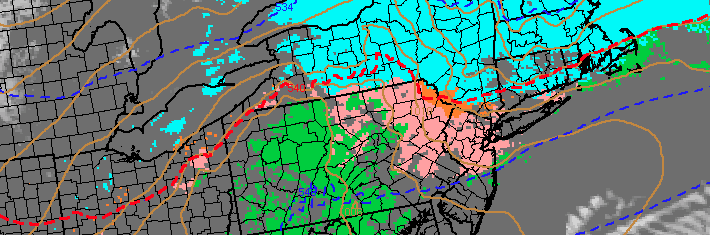
The result will be the potential for snow from Sunday into Monday, with moderate snowfall accumulations and the potential for higher amounts farther east. But in addition to the snow will come strong, damaging wind potential as the system deepens offshore. Finally, behind the storm, a polar airmass will move southward — possibly the coldest in many years — and the coldest air of the season will sink into the area on Monday when temperatures may struggle to get out of the single digits.