-2")
(Premium) Increasing Potential for A Damaging Wind Event Saturday Night & Sunday
Over the past few days, we’ve been discussing on our new hazards dashboard the possibility for high winds for late Saturday night and Sunday. As we’ve gotten closer, model guidance continues to be consistent on this event. Therefore the National Weather Service has issued a High Wind Watch for the entire region late Saturday and Sunday morning. Details are still coming into focus, but confidence is growing that this could be a very strong if not damaging wind event for parts the area.
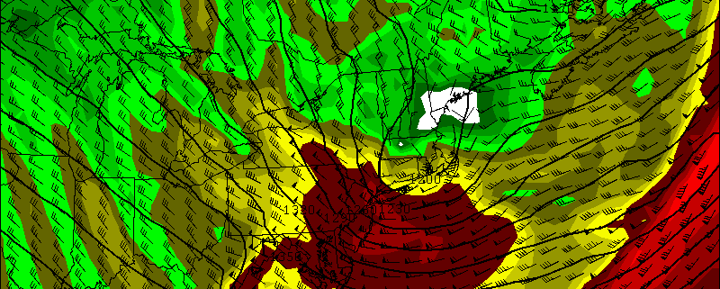
A vigorous mid-level shortwave will amplify and cause a surface low pressure coming east out the Great Lakes Saturday night to deepen rapidly over Southern New England Sunday morning. This will create extremely low mid-level heights and thus a frigid cold pool aloft — aiding in instability and dynamics, especially when combined with the off-the-charts vorticity being shown. An Arctic front accompanying this low will also move across the region late Saturday night with some rain showers, then perhaps a change to snow showers, during late Saturday night. Steep low-level and mid-level lapse rates and total totals in 50s show enough instability for snow squalls with gusty winds and possibly even thunder.