Weekend Overview: Strong to Severe T-Storms Possible Today

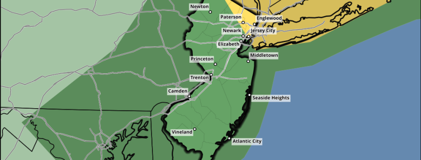
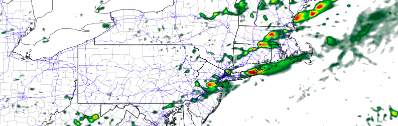
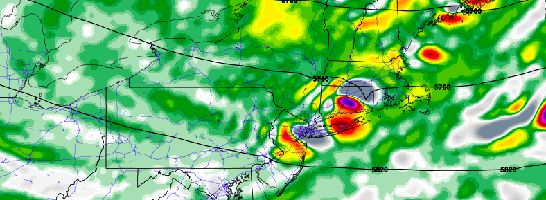
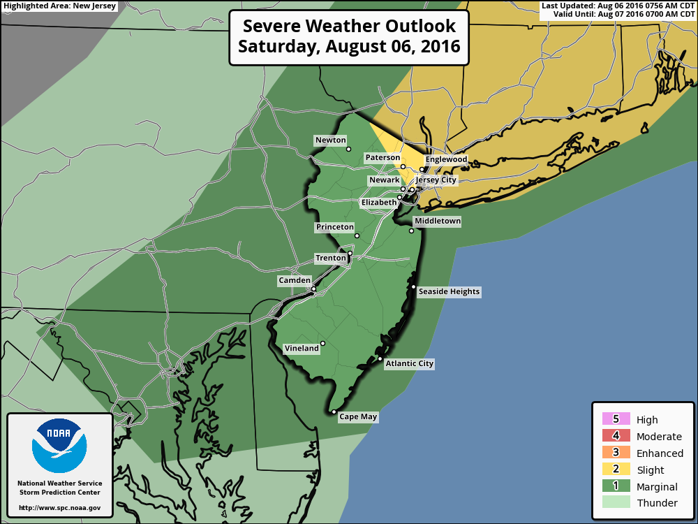
Hot and humid conditions start the weekend today, with some sunshine mixing with clouds. A cold front approaching from the west will likely trigger some showers and thunderstorms over the region this afternoon. At this time, it appears some instability with stronger shear and forcing will have a higher chance of coming together over NYC metro, Long Island and further northeast into Lower Hudson Valley and Connecticut for more organized severe thunderstorms this afternoon. Thus the Storm Prediction Center has upgraded to a slight risk for these parts of the region  But some isolated strong or severe thunderstorms are still possible further south and west into New Jersey. The main threats will be strong or damaging wind gusts, heavy rainfall and frequent lightning. One caveat, is if more clouds are around this afternoon hampering instability, then the severe weather threat will be reduced over the region. Stay tuned for more updates this afternoon, as necessary.

Any lingering showers and thunderstorms will come to an end by early this evening, as the cold front pushes through region. Skies will clear overnight with temperatures dropping into 60s in the suburbs to closer 70 over NYC metro. High pressure will over the region providing more sunshine, less humid weather on Sunday with temperatures rising into the middle 80s and alight northwest breeze. Some other highlights.

Read more

Heat returns, scattered severe storms Saturday afternoon

A transitional ridge will build into the area from Friday Night into Saturday, with warming temperatures and increasing moisture expected. While this ridge won’t be necessarily large, it will bring much warmer air in both the mid and lower levels of the atmosphere. This will lead to increasing instability late Friday into Saturday, ahead of an approaching cold front which will be lingering to our north over Southeast Canada.

This front will begin sagging southward on Saturday morning and afternoon, with showers and thunderstorms likely to develop near the area during the early afternoon. Moderate instability in the atmosphere is expected to juxtapose with favorable wind shear to support the development of these strong and severe storms, which will sink southeastward through NJ, NYC and Long Island.

Read more

Strong and severe thunderstorms possible Saturday

While lower dew points have been very well received in our area over the past several days, a warming trend will be underway once again by Friday. Increasing temperatures and moisture will become notable as winds, which had been coming inland off the area waters for the past few days, with to a warmer southwesterly direction. A transient ridge building overhead will aid in the warming temperatures moving into the Northeast US on both Friday and Saturday.

To our north, meanwhile, an expansive disturbance over Southeast Canada will begin shifting southeastward through parts of the Northeast US. While forecast models don’t currently show a strong or robust area of vorticity with this disturbance, the very broad disturbance has expansive height falls of its own. These act to supplement lift in the atmosphere along a cold front, which will be dropping southeastward through the Northeast states on Saturday.

Read more

Perseid outburst expected to make 2016’s shower special

The Perseid meteor shower is always a highlight of the astronomical year, frequently bringing one of the most consistent meteor showers to the night sky in late summer. The warm weather and often favorable moon phases mean the Perseid’s are also one of the most comfortable meteor showers to enjoy. 2016 is expected to be even better than usual: An outburst of meteors is forecasted, resulting in nearly double the typical rate of meteors per hour during the showers peak from August 11th to 12th.

The meteor shower occurs each year as Earth passes through the debris tail of Comet Swift-Tuttle, resulting in meteors for several days with a peak of 1-2 days typically in mid-August. Comet Swift-Tuttle is the largest known object to repeatedly pass by Earth, with a nucleus about 16 miles wide. It last passed by in 1992, and won’t pass again until 2126. Our respective orbits, however, mean that Earth passes through the debris trail of the comet every year.

Read more