Wednesday Overview: More Heavy Rain and Possible Thunderstorms Through Tonight

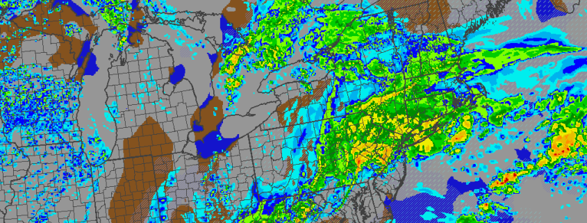
A large complex storm system continues to impact the region today. Some patchy and dense fog from early this morning has now given away more rainfall as another warm front moving slowly northward over the region this afternoon. Rain will likely fall heavy at times, leading to some minor flooding in poor drainage or low-lying areas. Despite the rain, temperatures will gradually rise into upper 50s to middle 60s over the region this evening, winds becoming more southerly.

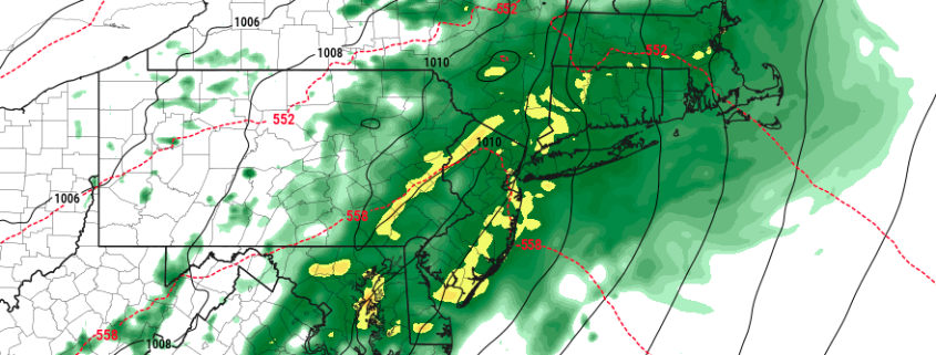
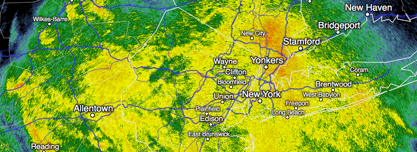
Then a cold front will begin approaching the region early tonight. Models show more lift and instability increasing ahead of this front the during the evening hours. This might a support a line of  thunderstorms that could contain very heavy downpours and some gusty winds later this evening. Rainfall totals could exceed over 1.00″ again. Currently the Storm Prediction Center has issued a marginal risk for a few thunderstorms with isolated damaging wind gusts over Central and Southern NJ this evening. Some other highlights over the next few days:

Read more

More heavy rain expected in the Northeast on Wednesday

A complex storm system will continue its evolution throughout the United States from later Tuesday into Wednesday. The first round shifted northeast of the Mid Atlantic this evening, moving towards Southern New England. A strong low level jet associated with this system aided in the development of widespread heavy rain, with many areas receiving well over 1″ of rainfall by the time the system ended.

Another disturbance, embedded within the same storm system, will approach the Northeast US on Wednesday. Ahead of its arrival, southwest winds will commence and warm, moist air will push northeast late Tuesday Night into Wednesday ahead of a warm front. This will allow some areas of dense fog to develop during the overnight period and into the morning hours of Wednesday.

Read more

Tuesday Overview: Dreary, rainy conditions continue

A complex and large storm system sprawled across the United States will continue to affect the area for the remainder of the day today. Periods of heavy rain are likely to continue, especially across parts of Long Island and Connecticut as the evening goes on. The area should see a gradual drying trend by this evening as this first disturbance moves away.

Another one is right on its heels, however — and although things will feel a bit warmer on Wednesday, they will also be more humid and more unsettled. Heavy rain with embedded thunderstorms will again be possible Wednesday afternoon and evening before a cold front clears the area Thursday morning. Here are some weather highlights. As always, sign up for Premium to get detailed posts, videos, and more! 

Read more

The importance of a cross polar flow and Aleutian ridge in December

Multiple ensemble guidance indicate a major pattern change over the Pacific region. A ridge will builds near Aleutians then poleward into the Bering Strait and the Artic Ocean next week. This will cause cross-polar flow to finally setup over the North America.  All the anomalous cold air that is has been over much of Eurasia for the last several weeks with finally see an open gateway into North America. Temperatures departures are forecast to between 10 to 20 below average over parts of the Rockies and Northern and Central Plains over next weeks.

Read more