Monday Musings: Progressive Pattern For This Week

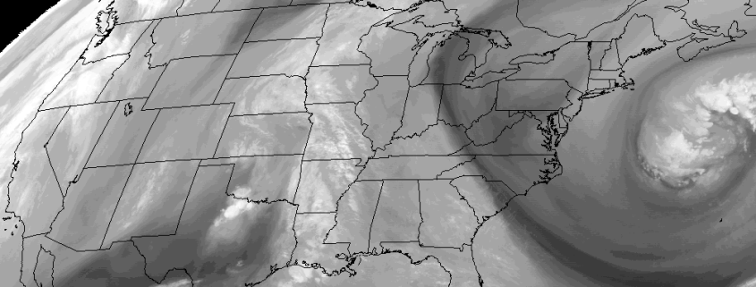
Despite another cooler airmass over the region today, the pattern overall will be progressive this week, with a number of upper-level disturbances and frontal boundaries moving through Northeast. For today, high pressure will be in control with plenty of sunshine. After some cold temperatures early this morning, temperatures will rise into the middle 50s over much the region this afternoon. Winds will be out north and lighter than over the past few days. So it will feel a little more pleasant today.

Mostly clear skies and calmer winds tonight will allow for temperatures late tonight and early tomorrow fall again into the 20s and lower 30s over interior locations, as well as over the Pine Barrens. Mid-upper 30s to lower 40s closer to NYC and urban areas. More sunshine is store for Tuesday with high pressure in control. But it will milder tomorrow afternoon, with more mid-level ridging and west-southwest winds,  helping temperatures warm into the lower to middle 60s. Some other highlights for this week:

Read more

Winter Forecast 2016-2017

Seasonal forecasting is one of the most misunderstood aspects of meteorology. Not only is it a difficult task for the meteorologists themselves, but it is often difficult for readers and public viewers to understand the nature of the forecast. The root of the problem lies in the fact that seasonal forecasting is based on many different methods — all of which have tremendous variability and low percentage verification. Seasonal forecasting begins with an analysis of current conditions and atmospheric circulations, similar to any daily forecast. Beyond this point, forecasters use variables such as sea surface temperature anomalies, analogs, and comparative methodology to compile a forecast.

Some forecasters have detailed the mentality very well when they have stated that long term forecasting is very much about “What can go wrong” as opposed to “How will the forecast be correct”. Our job as meteorologists is to detail the aspects that have formed the foundation for our forecast, express our concerns and confidence in all aspects, and deliver the ideas which we have formulated as a result of our research and work in attempting to understand the patterns evolution over the next several months.

We will begin by highlighting several variables which we have researched. Each variable will be listed with a conclusion and prediction on its state during the winter, as well as the methodology and reasoning behind that forecast.

Read more

Premium: Warming trend in the East will be short lived

Weather news this week has been centered around the presence of a large ridge, building into the Central United States. This ridge will reach eastward to the Ohio Valley, with tremendously warm temperatures surging from the desert southwest into the heart of the country. In the East, however — especially the Northeast — this warm air will be short lived. An active pattern throughout the Northern jet stream will keep the upper air pattern very active, and the amplification of the pattern will allow colder air to surge into Southeast Canada and the Northeast.

Much of this will be centered around a cold front, which will move through the Northeast US on Thursday afternoon and evening. Temperatures will warm up throughout the East on Wednesday and Thursday. Thereafter, on Thursday afternoon and evening, an  impressively strong system in the mid and upper levels of the atmosphere will drop southward into Southeast Canada and eventually the Northeast, interacting with moisture and providing sufficient lift for heavy rain.

Read more