-2")
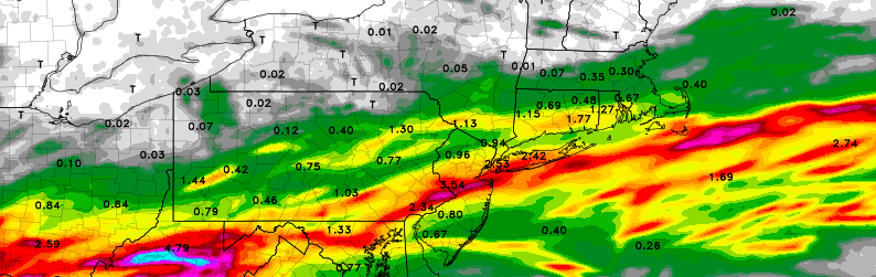
Building ridge will bring heat, severe wx chances through July
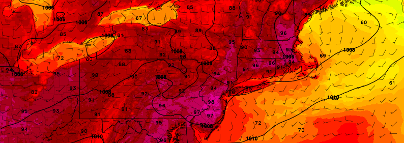
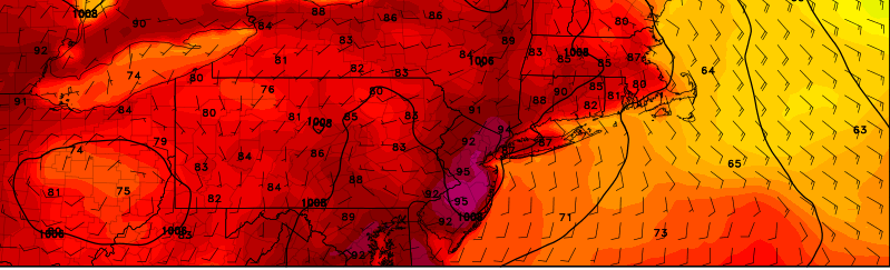
Within a pattern which has been well discussed for a week or more, changes are afoot during the middle to latter part of this week. The troughing and cooler air, which had become a mainstay over the Northeast US over the past several weeks, will be replaced by increased atmospheric ridging. Warmer air and heat, with temperatures over 90 F, is expected to push into the area by the middle part of this week, and last through the weekend.
This airmass will be marked by mid level temperatures warming up quite dramatically. Temperatures at the 850mb level, or 5000 feet above the ground, will warm to 20 C or above – often times the “demarcation line” for a heatwave in this part of the country. On both Wednesday and Thursday, 850mb temperatures will approach or exceed this 20 C threshold over parts of the area, and not surprisingly forecast models have indicated temperatures in the mid 90’s on both days.
