500mb Vort

Monday Musings: Pleasant, warm weather continues today, more showers & t-storms possible by Tuesday

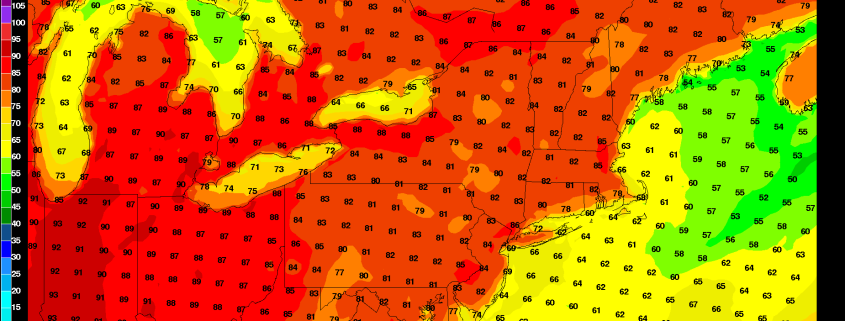
We know it’s the Monday blues for many of you. It was a beautiful, pleasantly warm weekend that we just didn’t want to end either.  For the most part, today will continue our stretch of pleasant, warm weather with more sunshine and temperatures rising into lower to middle 80s again this afternoon. Southerly winds will keep areas over Long Island and other south-facing shores possibly in the 70s.

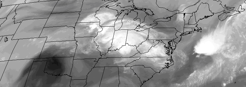
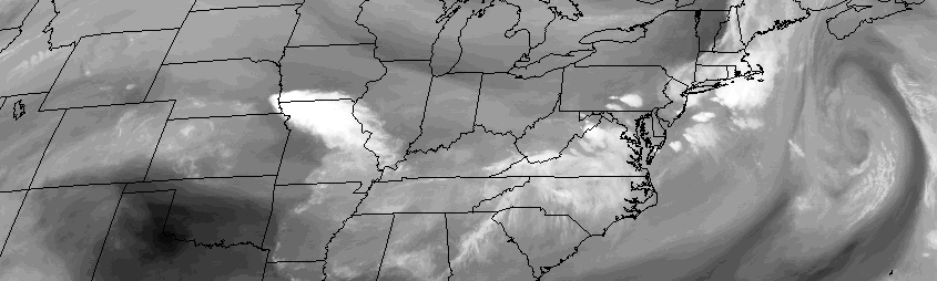
A storm system slowly approaching from the Great Lakes will begin to cause some clouds to increase and thicken later this afternoon. There is a slight chance of some scattered showers and thunderstorms in parts of the region late this afternoon or this evening with a weakening cold front or pre-frontal trough approaching from the west. But most of this activity should remain well north and west of NYC.

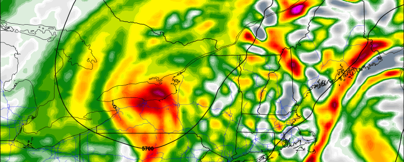
Dew points will remain low and this should generally prevent any showers from making it through the region during the daytime hours. Instead, showers should remain focused near areas of better lift for precipitation, over Eastern Pennsylvania and Western New Jersey. Some weak shortwave energy moving over the region could lead to more scattered showers and thunderstorms later tonight and early Tuesday morning.

Read more

Friday overview: Pleasant, warm weather through the weekend

Good news for beautiful weather lovers! High pressure to the north will provide the region with pleasant, warm weather today. Some more clouds may show this some weak passing with a weak upper-level disturbance passing through region. But overall expect sunshine to dominate today with temperatures reach in the lower to middle 80s this afternoon.

Now here’s some better news! This weekend will be gorgeous for most outdoor plans, as high pressure remains in control. High temperatures for much of the region, will be in the lower to middle 80s each day through Sunday. But if you are heading down to shores or beaches this weekend, temperatures will likely be a little cooler with a persistent light onshore flow, each day. Here are a few other highlights today for the region:

Read more

Wednesday Overview: Pleasant, bigger storms west and south

An extremely pleasant summer day is expected to unfold today, with plenty of sun and dry conditions throughout the area. This will come as welcome news to many, especially those in Southern NJ who experienced yesterdays strong and severe thunderstorms. The same cannot be said for areas to our west, over the Great Lakes and Ohio Valley. There, a severe weather outbreak is anticipated and the Storm Prediction Center has issued a Moderate Risk for severe thunderstorms today and tonight.

That same disturbance will approach our area through Thursday morning, but luckily the intense dynamics and atmospheric instability will track well south of the area — as we have been discussing for a few days now. This means we’ll be able to avoid big time thunderstorms. Heavy rain may still move through parts of New Jersey. Here are the highlights:

Read more

Tuesday Overview: Unsettled today, severe storms nearby Thursday

After some morning showers and thunderstorms (a severe thunderstorm warning was actually issued for parts of Long Island and the NJ Shore, with no reports received yet), clearing is anticipated over the next few hours. In fact, the sun is likely to return by mid morning for much of the area. Temperatures will warm into the 80’s once again. A cold front stalled near the area from west to east will spell problems for parts of Southern and Central New Jersey later today.

With atmospheric instability building once again, scattered strong and severe thunderstorms may redevelop across those areas later today. These storms are likely to develop near and south of the frontal boundary — well to the southwest of New York City. After a brief respite on Wednesday, another powerful disturbance approaches the area as it swings through the Northeast US. The exact track of the storm system will determine the details, but severe weather is possible from the system — most likely across the Mid Atlantic and parts of South/Western New Jersey once again. Here’s the lowdown on the weather stories today:

Read more