Finally: Spring like weather will arrive next week

It’s been a long winter. Although we have generally avoided prolonged periods of cold and snow (86% of New York City’s seasonal snowfall to date has come from one storm), it has been a while since we have been able to enjoy a period of warm temperatures that didn’t feature rain, wind, or thunderstorms. Forecast models agree that will change next week.

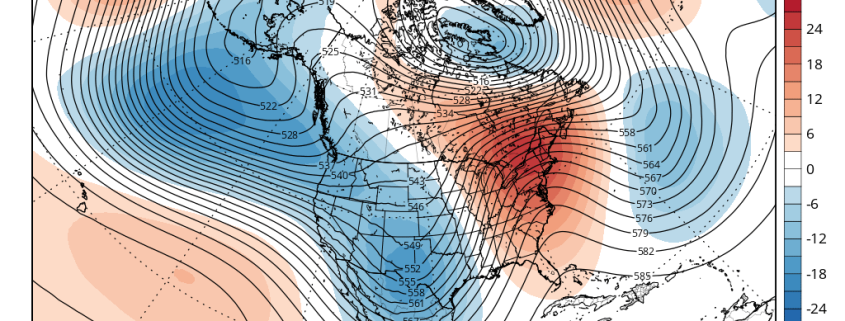
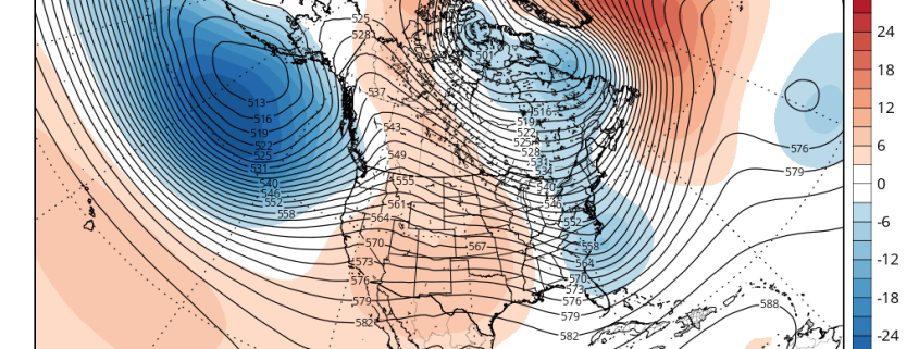
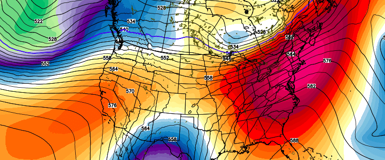
A collapse of the west-coast ridging pattern will allow for a large ridge to build into the Eastern United States, beginning late this weekend and continuing into the early and middle part of next week. Surface temperatures will respond, likely by Tuesday, with highs exceeding the 50’s and approaching the 60’s. By the middle of the week, high temperatures could approach 70 in many locations.

Read more

Colder Weather Returns…Light Snow Likely Friday

After a nice period of warm weather, a cold front came through this morning, allowing a Canadian airmass to build into the region.  Strong cold-air advection will cause temperatures drop through the 40s and into the 30s later this afternoon and evening. Windy conditions will continue with northwest winds 20mph to 30mph gusting to possibly near 45mph at times this afternoon. Temperatures will drop into the lower to middle 20s tonight, with northwest winds diminishing to 10mph to 20mph. Tomorrow will be mostly sunny with high pressure remaining in control. High temperatures will be in the middle to upper 30s — well below average for this time of year.

Model guidance is in agreement that a low developing over Southeast US will track well south and east of the region on Friday. This is because while the polar vortex will be lifting out Southeast Canada, the flow is too progressive to allow the upper-level trough to amplify enough for the storm to track closer to our region. Another disturbance rolling over the West Coast ridge, will keep this storm moving out into the Western Atlantic.

Read more

(Premium) Long Range: Is the End of Winter in Sight?

In the world of meteorology, Spring begins on March 1st. While the calendar doesn’t turn until the end of the month, meteorologists end winter statistics on the last day of February. Some winters, however, have featured major cold or snowstorms well into March and even April. Remember last year? Still, a year makes a big difference, as they say, and there are growing signs that after this week, cold and snow will become increasingly unlikely.

Looking back at February, temperatures will likely average above normal throughout the area. While we saw the first below zero temperatures in New York City in over two decades on Valentines Day, much of this month featured near or above average temperatures. Artic cold airmasses didn’t hang around for more than a few days. A couple of winter storms we saw earlier in the month tracked too far east to give the entire region of significant snowfall. And in the past two weeks, we have seen a storm track farther west with warmer air and heavy rainfall, as cold air moves in behind the storms.

Read more

(Premium) Will There Be An East Coast Snowstorm March 4th-5th?

After the midweek storm which is likely to be all rain, we are watching for the potential for storm system to develop near the Southeast US in the March 3-5 period.

Strong high pressure with much colder air will follow behind the midweek storm. Meanwhile, a shortwave will dig downstream off the West Coast ridge over the Rockies. This shortwave will become part of the southern stream and cause a low pressure storm system to develop over the Central or Southern Plains. Models indicate this storm will track towards Southeast or Lower Mid-Atlantic coast by Friday.

Read more