5.13 PM Zones: Cool and unsettled now, big warmup looms

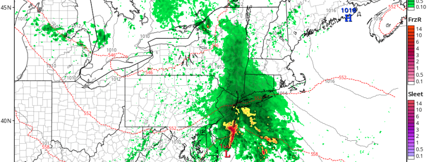
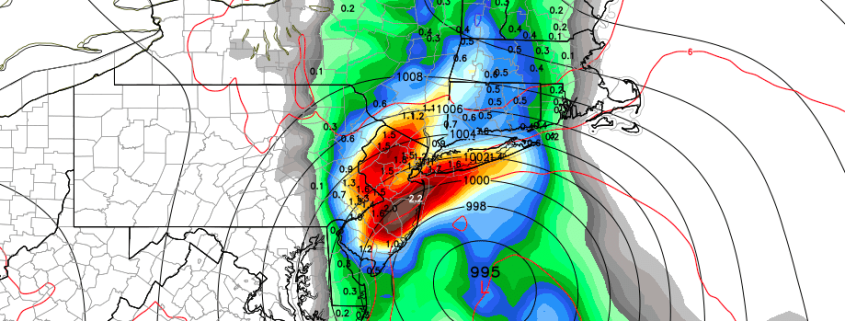
Good evening! It has been a dreary, rainy, damp Saturday as a low pressure system developed off the coast of New Jersey. A storm which has been discussed for several days certainly lived up to its billing. Gradually improving weather is anticipated later this afternoon and into this evening, but improving is a word that will be used lightly, as drizzly and damp weather is expected to persist despite the heavy rain ending.

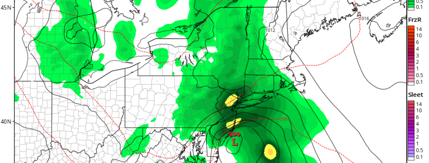
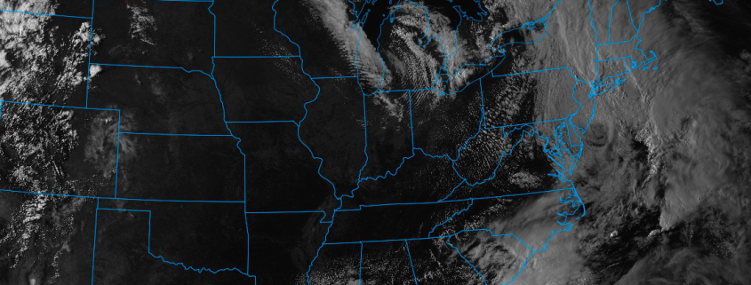
As Sunday approaches, the overall weather is expected to improve in the Mid Atlantic states. While coastal New England will still be feeling the effects of a low pressure system developing in the Gulf of Maine, areas further southwest will see more sunshine — which could fuel the development of a few storms capable of producing small hail and gusty winds.

Read more

Public Analysis: Coastal storm Saturday, improving Mothers Day, warmup next week

Good evening! We hope you had a wonderful Friday and enjoyed the weather over the past few days. It’s about to go downhill. Clouds will increase this evening as a coastal storm, which has been discussed for several days, begins developing over the Delmarva. A few isolated showers or areas of drizzle may develop overnight as low-level moisture and lift gradually increases. But mainly dry conditions are expected to stay in control. Temperatures will drop into the upper 40s to lower 50s in most areas

Read more

5/11 AM Zones Update: Coastal Storm on Saturday, Warming Trend Next Week

Happy Thursday! Sunshine will be mixing with more clouds today, as disturbance passes to the south and west of the region. Some showers from this disturbance may move into far western and southern parts region today. But a confluence backside around the upper-level low over the Gulf of Maine should keep the rest of the region. High temperatures will be in the lower to middle 60s over most of the region with mostly light and variable today.

Read more

Impactful coastal storm likely this weekend

A happy Wednesday afternoon to you! Relatively calm and stable weather has settled into the Northeast states over the past few days, despite the presence of a cold trough lingering over the region. Higher pressures have remained in control, with only a few weak and dissipating disturbances meandering nearby. This has kept the weather quiet, albeit cooler than normal, and created a bit of a facade in front of how the atmosphere is truly behaving as this week goes on.

In truth, the hemispheric height pattern is in quite a disturbed state as we speak this afternoon. A potent, anomalous high latitude block has developed from Greenland into Central Canada, disrupting the wave pattern and height field throughout the Northern hemisphere. This has led to the development of one of the strongest -NAO’s on record for the month of May, and is the impetus behind the colder than normal air which has settled into the region this week.

Read more