-2")
Weekend of Unsettled Conditions and Temperature Swings, Potential Cool Shot Next Week?
Good Evening!
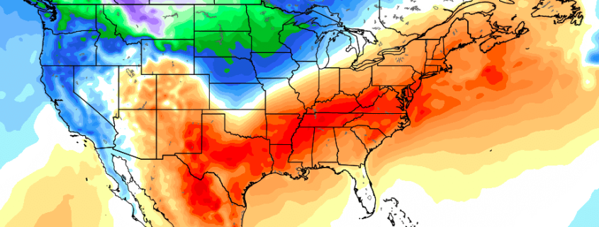
Today has has been a rather decent end to the work week with above-normal temperatures and light winds from the east. A warm front moved through the region the other night and introduced much warmer temperatures and higher dewpoints across much of the Northeast. This increased moisture from the southwesterly flow also allowed for more clouds to develop as well, but this did not stop highs from reaching into the middle 60’s to middle 70’s, which is a good deal above normal for this time of year. However, changes are on the way this evening, with a cold front currently located moving through central Pennsylvania. While this cold front isn’t all that strong, it will be strong enough to drop temperatures later tonight as well as knock dew points down to more seasonable levels. Additional, high pressure will begin to build in behind this front, so this will set up a strong enough pressure-gradient to create some gusty winds in the 15-25 mph range late tonight and into early tomorrow morning. Temperatures should be able to drop into the lower to middle 40’s tonight, with locations more north and west of the city likely seeing lows in the middle to upper 30’s. while conditions would otherwise be quite favorable for radiational cooling and some frost, the potential for gusty winds across the area should limit both of those possibilities.
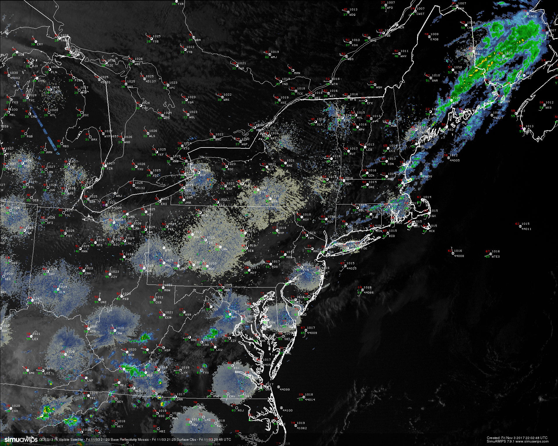
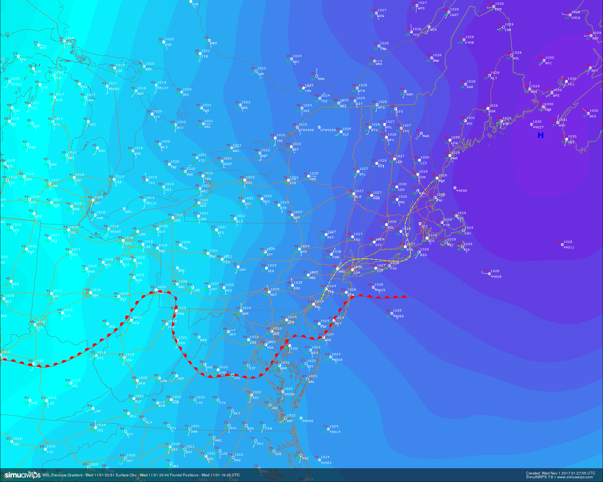
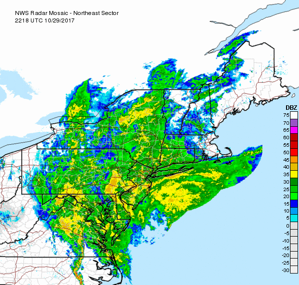
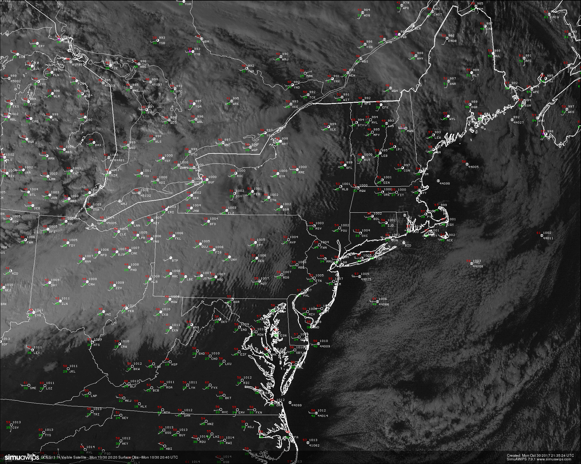
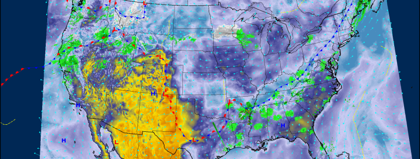
High resolution visible satellite imagery, surface observations, and regional radar mosaic (Courtesy of SimuAWIPS)
Saturday Into Sunday
Saturday should have a nice and crisp start to the day as the northwesterly flow from Canada kicks in over the Northeast with winds still gusting in the 15-20 mph range. High pressure will also continue to build over the area, which should help promote sunnier skies and calm weather during the first half of the day. As we move deeper into the day tomorrow, winds should gradually shift from northerly to easterly, which will signify the start of another warm from passage. Dewpoints will also begin to increase once again as marine air works its way west, which will also work to gradually increase clouds by the late afternoon hours. Highs will likely reach the middle to upper 50’s tomorrow, with some locations closer to the coast likely making it to the 60’s. As the warm front begins to work its way inland, some weak low level energy will be present, which may help to increase the threat of showers across the area. These conditions should last into the evening hours, with lows staying in the middle to upper 40’s-some locations closer to the coast will likely be stuck in the 50’s due to warmer marine air aloft.
Sunday should start off quite the opposite of how Saturday did, as an approaching mid level warm front will increase moisture and available lift. This will cause an increased threat for showers, especially across western New Jersey and portions of eastern Pennsylvania. The overall progression of the front is still in question, but Sunday certainly looks to be quite a few degrees warmer than the previous day, with highs making it up into the middle to upper 60’s, which will be above average once again despite the increased threat for showers and cloudiness. Lows will likely stay rather mild with temperatures dipping into the upper 40’s and lower 50’s.
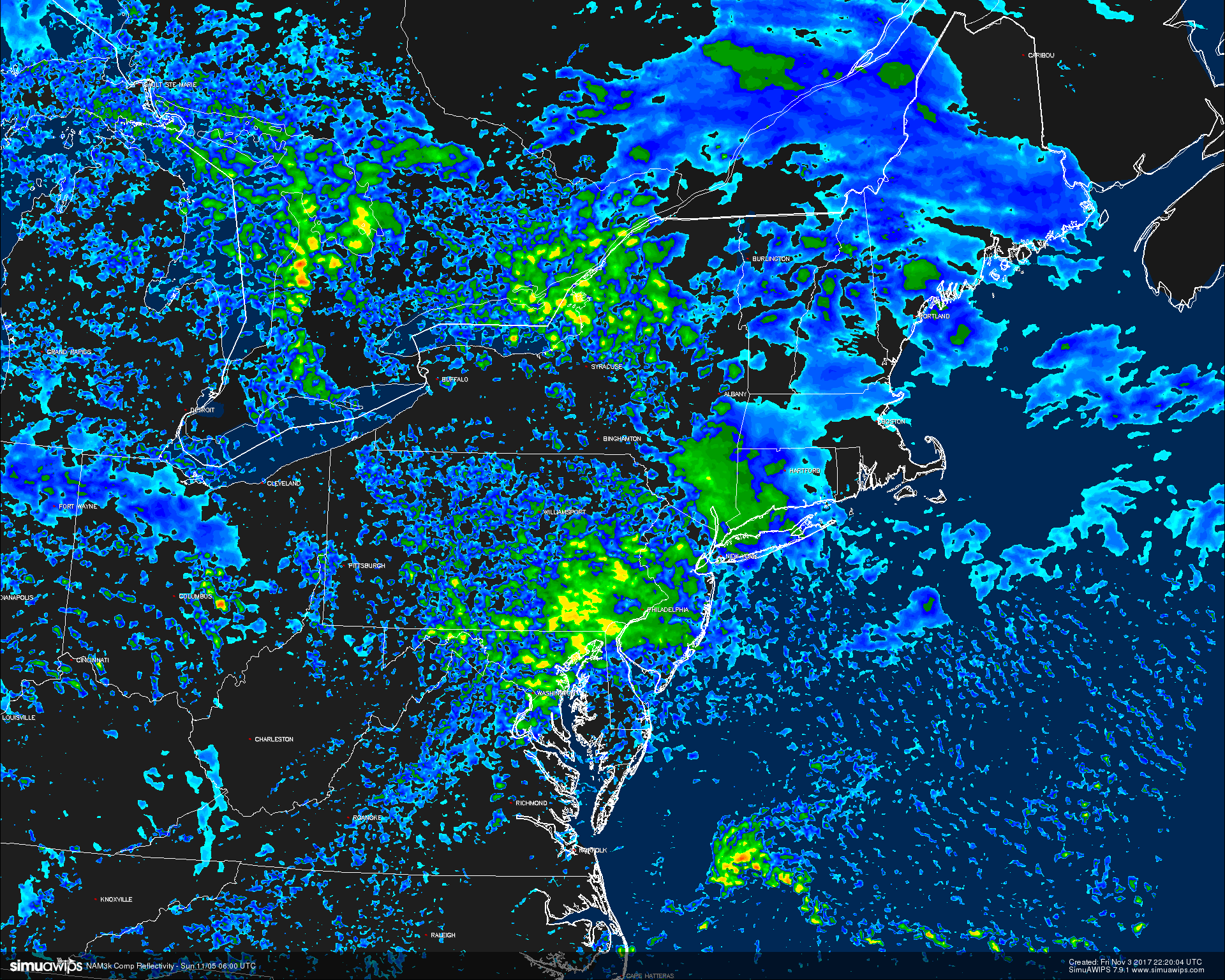
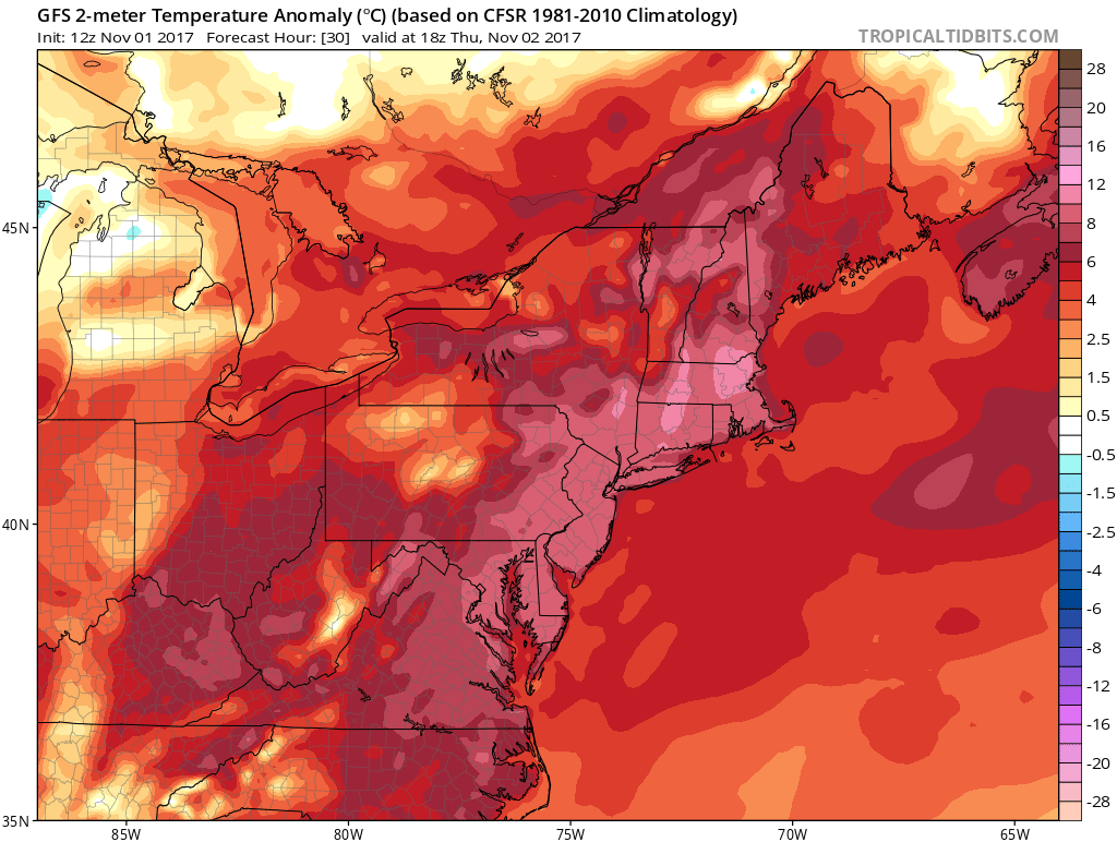
This afternoons high resolution NAM model showing showers located over eastern PA and potions of NJ early Sunday morning
A Look Into Next Week
By Monday, most of the Northeast should be well within the warm sector of the warm front, so expect warmer temperatures once again for the region, with 70’s quite likely-which will be a good deal above normal. Later in the day on Monday, an area of energy associated with a trough in southern Canada will be moving our area and will enhance southwesterly flow ahead of an approaching cold front. While this front will be weakening quite a bit from when it moves on in from the Ohio Valley, it certainly will have the potential to bring some showers later in the day as it approaches the coast. As the front pushes offshore by Monday evening, dry northwesterly winds will once again take over and provide a chillier airmass for the entire Northeast as Canadian high pressure builds in.
Conditions will then turn rather zonal from Tuesday until Thursday, with the jetstream generally blowing from west to east across the nation. This should allow the area of high pressure to stick around for a majority of the week, with mainly dry conditions expected over the region. Temperatures should generally stay near-normal during this period as cooler air from Canada bleeds south ever-so-slightly. Thursday may have a shot at rather cold lows as an approaching trough from Canada starts to move southward.
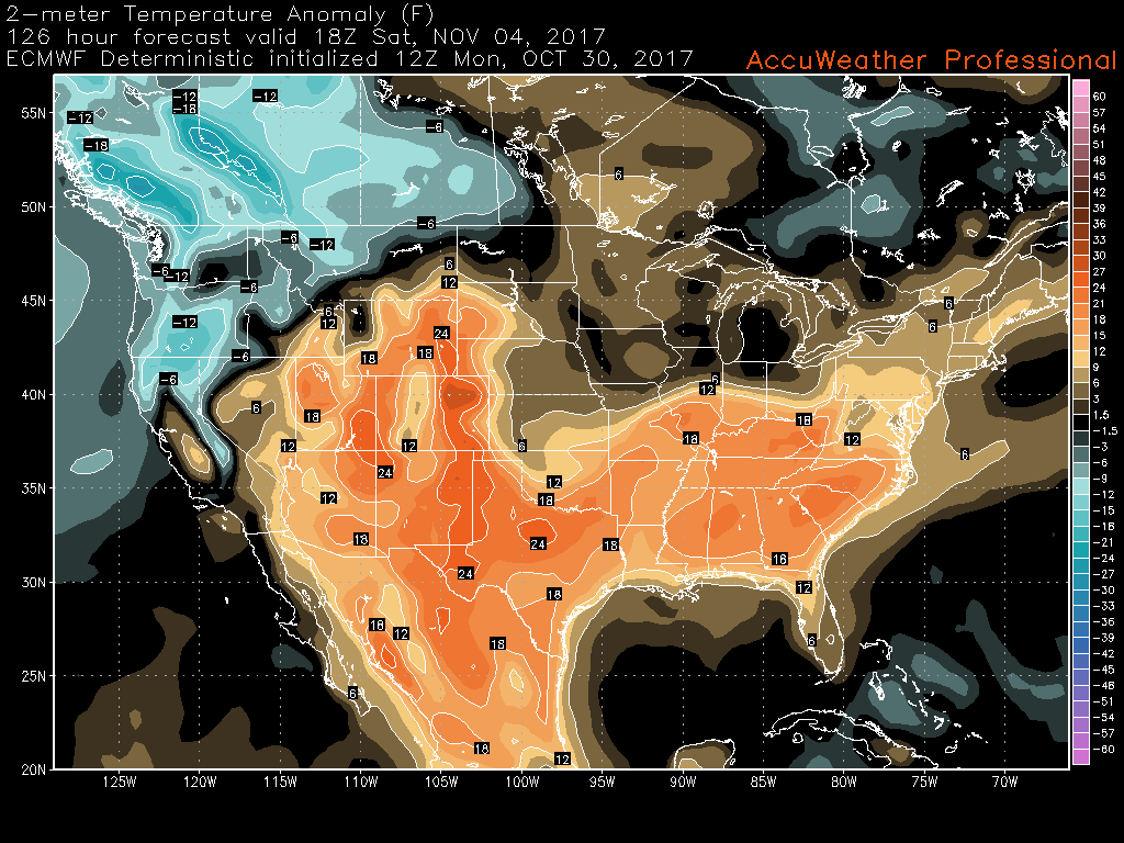
By Friday, things begin to get interesting as the models have been keying in on a deep trough moving in over the East and bringing a nice shot of unseasonably cold weather. Western ridging will improve just enough to allow the cold that has been trapped to our north to quickly come down south by Friday night in the form of an arctic front, which will likely drop lows below freezing across the entire zone, with some locations well off to the north and west seeing lows in the 20’s and even teens. Depending on how much low level moisture hangs around before this Arctic front moves through, some locations could actually see flurries or snow showers, but this is something that we will have to revisit next week. Regardless, the chances of a widespread freeze are increasing for the later part of next week.
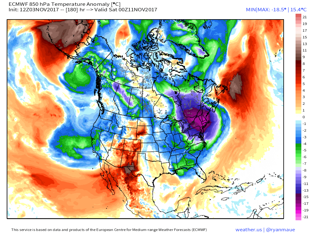
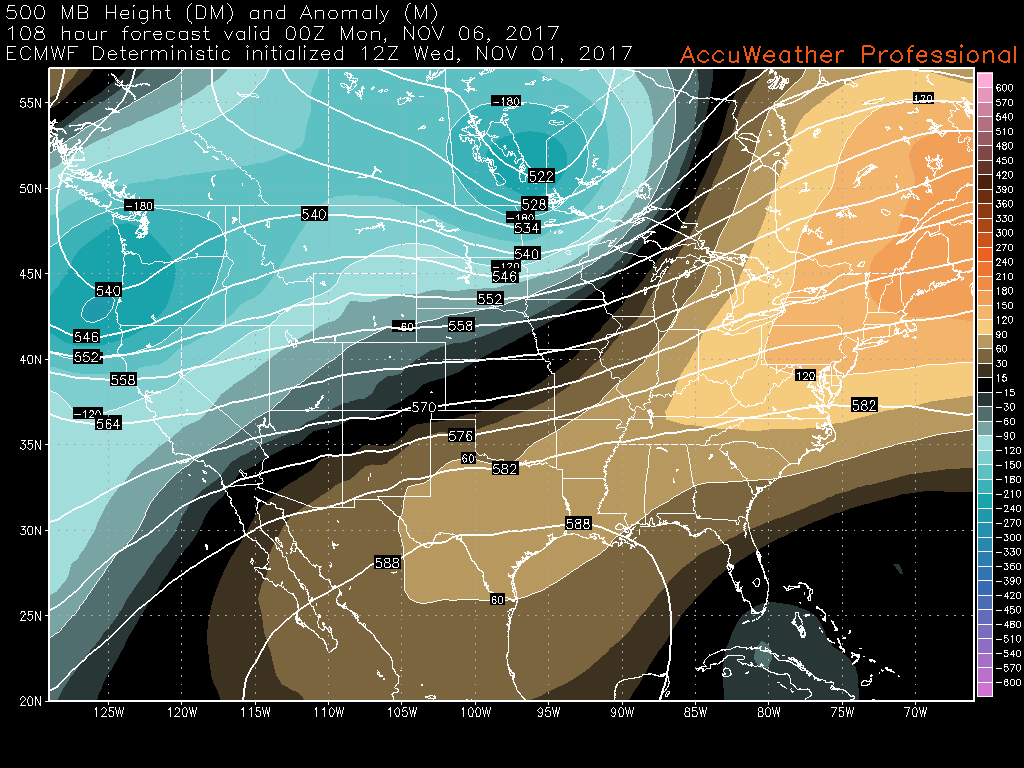
This afternoons ECMWF model showing a sharp shot of cooler temperatures over the Northeast by the end of next week
For more information and posts like this one, make sure you sign up for Premium Forecasts — where multiple detailed articles, videos, and interactives are posted each day. Also, come interact with our staff and many other weather enthusiasts at 33andrain.com!
Have a great night!
Steve Copertino