-2")
Public Analysis: How Long Will the Cooler Weather Last? Increasing Storm Threat Later This Week
Good Evening!
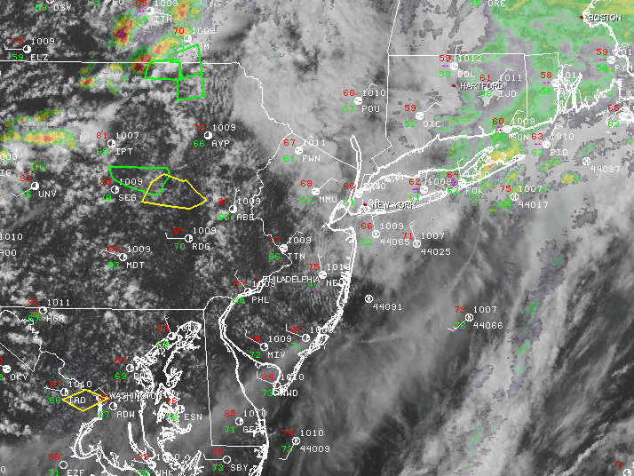
Last evening we saw the development of numerous showers and heavy storms primarily focused to the south of the immediate NYC metro area. These showers and embedded thunderstorms were responsible for producing absolutely torrential downpours over southern Pennsylvania, southern NJ, and as well as Maryland. A record 4.27″ of rain fell between 6-7pm, with 1.83″ of that falling in just 21 minutes! Radar estimates also showed numerous areas of intense rainfall ranging from 4-6″/hr in some locations which caused localized street flooding into the early evening hours. In addition to the very heavy rainfall last night, there were actually two cases of low-topped supercells developing over NJ and Maryland, one of which actually dropped a strong tornado that injured one person and caused damage to a few homes. This tornado was given a preliminary rating of an EF-2 on the Enhanced Fujita scale, with winds topping out around 125 mph! The second tornado supercell formed right near Ocean City, New Jersey and may have produced a brief, weak tornado over that area before moving off the coast where it looks to have strengthened according to radar observations.
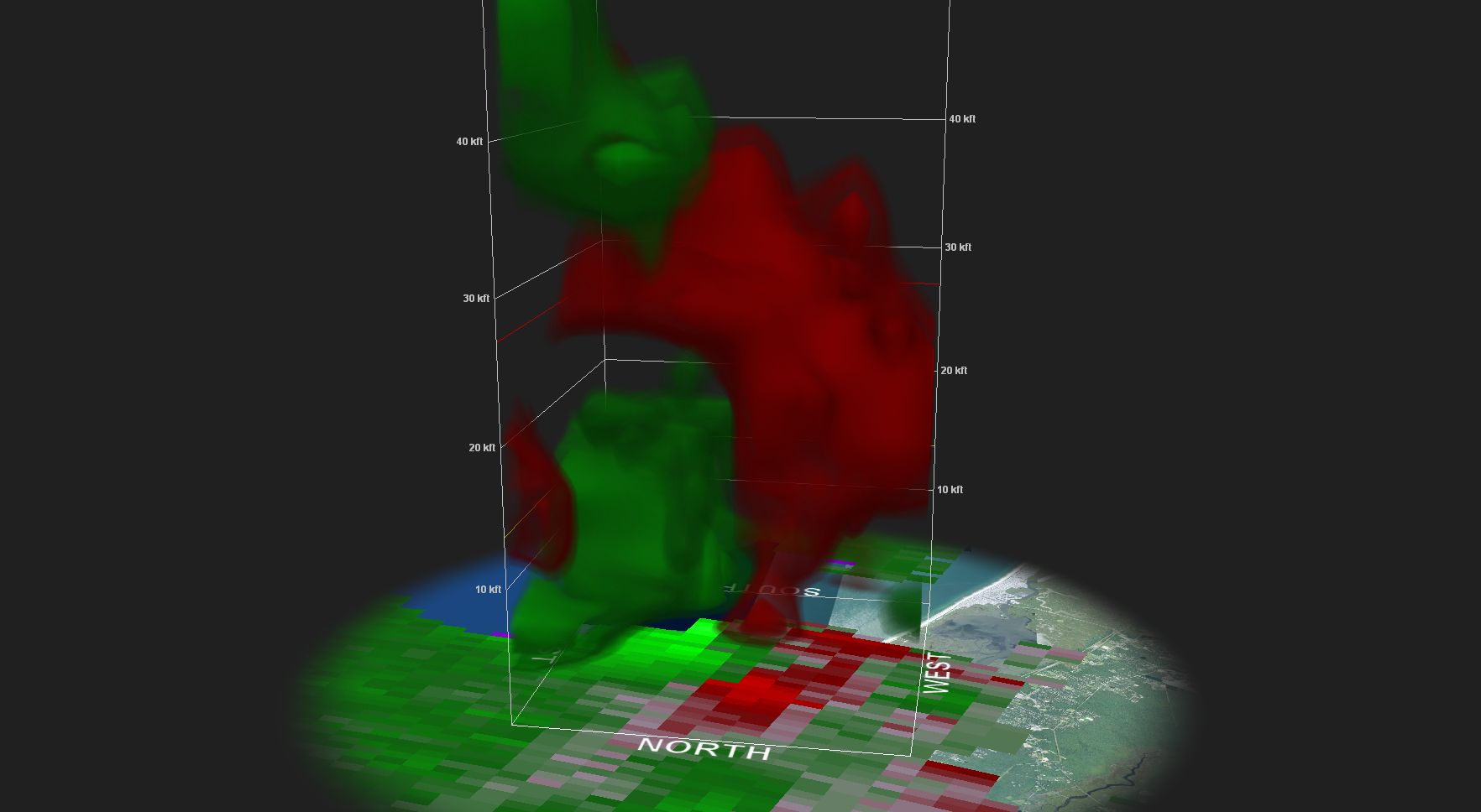
Three-Dimensional Volumetric Scan of velocity data from KDIX, showing a rather pronounced mesocyclone reaching towards the surface levels last evening near the New Jersey coast (Courtesy of GRLevel2AE)
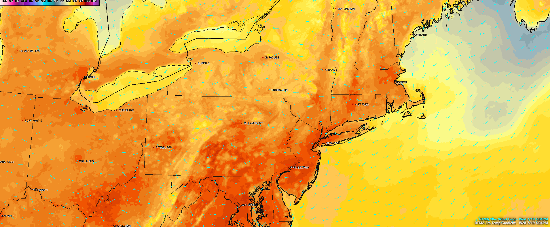
As the evening hours progressed, the upper level disturbance moving through the Northeast wasn’t quite as organized as most guidance had showed, thus the overall widespread heavy rain and flooding threat was much lower than what it could have been. Eventually showers and storms did redevelop over Central Pennsylvania and gradually moved eastward, affecting the NYC metro early this morning with gusty winds and localized heavy rainfall. The area gradually cleared out, with only gusty showers left by noon. During the afternoon hours, we saw a pronounced dry patch associated with the upper level jet streak begin to punch its way over the area from west to east.
This dry punch allowed for skies to become mostly cloudy, but with occasional peeks of sunshine mixed in. Additionally, synoptic winds (not associated with thunderstorms) began to increase, which made today feel quite cool as high temperatures were only in the upper 60’s with some locations just hitting the 70 degree mark! This is an incredible difference from a few days ago when we were discussing highs in the middle to upper 90’s combined with high dewpoints, allowing for heat indices to reach into the lower 100’s!
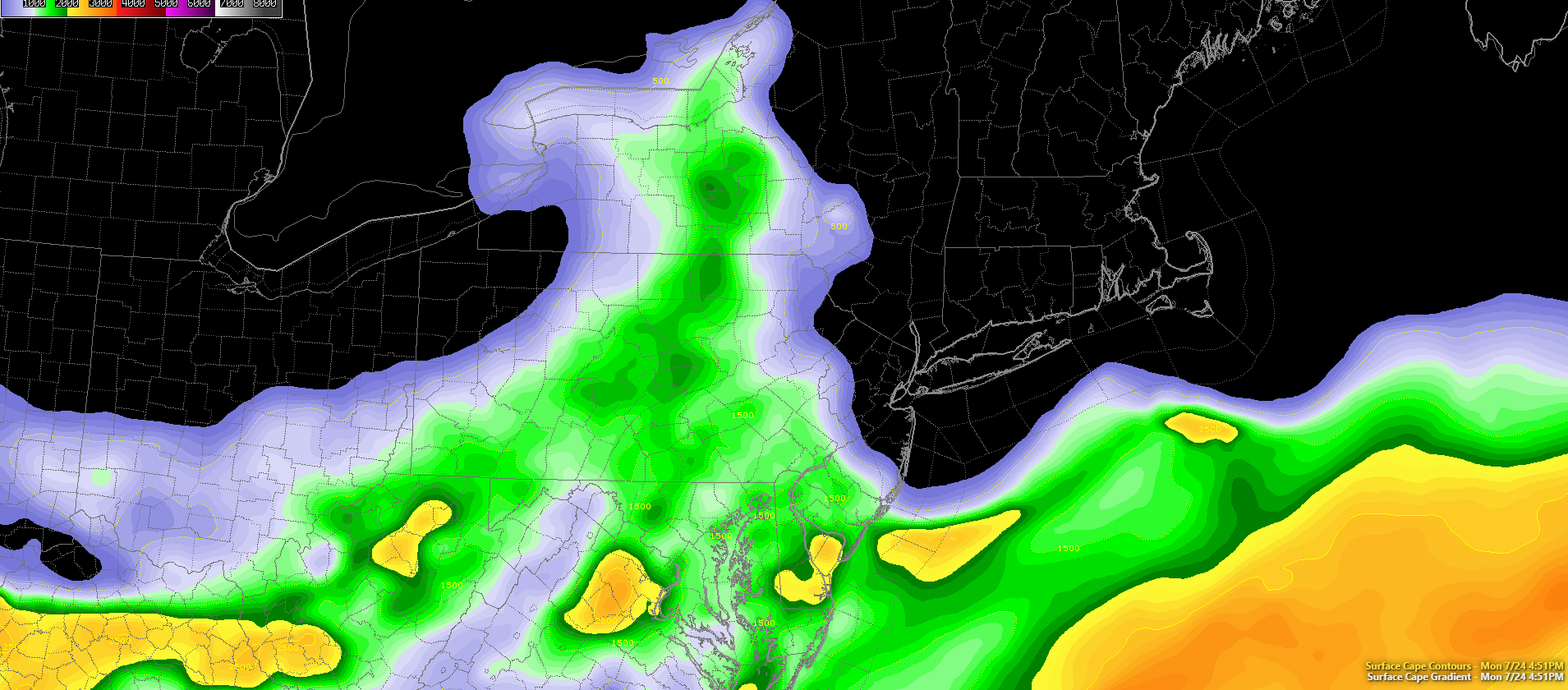
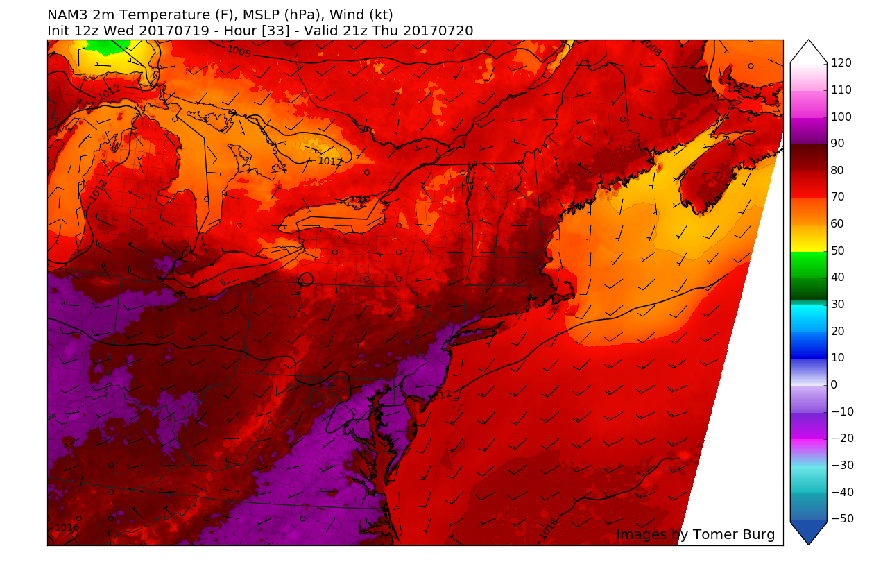
During the late afternoon hours, we saw a relatively similar setup to yesterday, with a wedge of instability located over Pennsylvania, and modest wind shear overspreading the warm sector. With a shortwave trough working its way in from the west, we saw the development of a sew severe thunderstorms over Central PA, with a few cells even becoming tornado warned due to the rather decent surface to 500mb vertical wind shear. As the late afternoon and evening marches on, these showers and thunderstorms should continue to gradually head east/east southeast, and weaken with time as they run into a more stable airmass over the NYC metro area by an area of high pressure to the north. While it is quite likely that these showers and thunderstorms will dissipate before reaching the area, some heavy rain and gusty winds may be possible with any stronger remnants of these storms. The aforementioned high pressure will allow for tonight’s lows to remain 5-10 degrees below normal, with lows ranging in the upper 50s, to lower 60’s across the area.
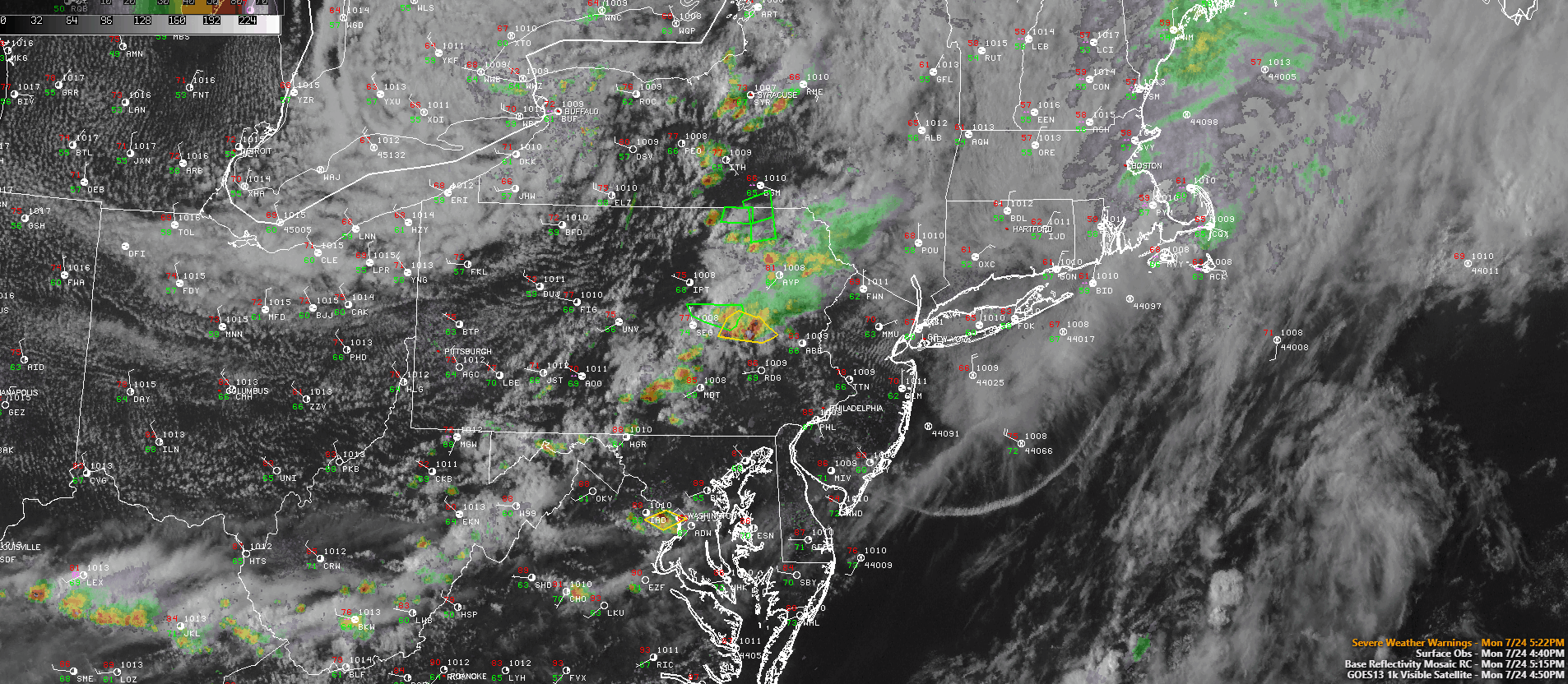
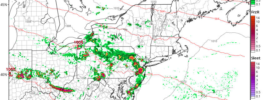
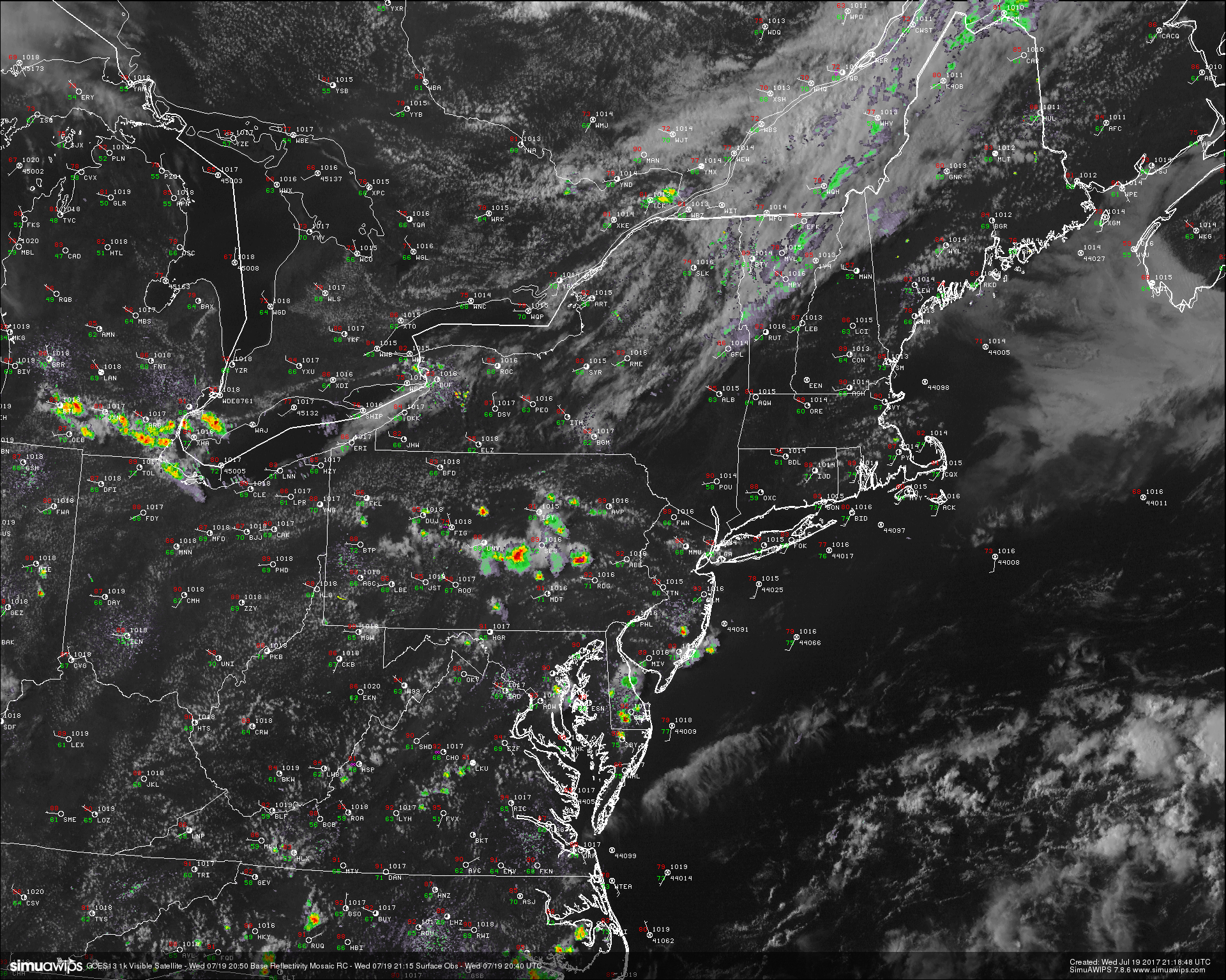
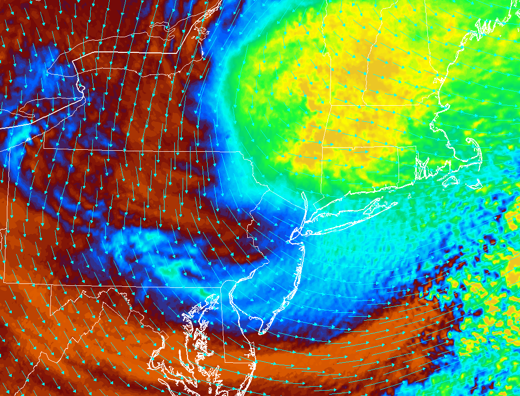
This afternoon/evenings latest regional radar mosaic, high resolution visible satellite imagery, and regional surface observations, showing the redevelopment of showers and thunderstorms over PA. These storms are expected to weaken before reaching the NYC metro area (Click to Animate)
Tuesday into Wednesday
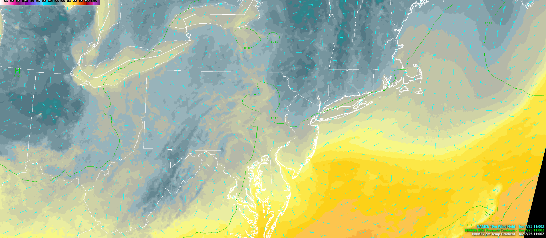
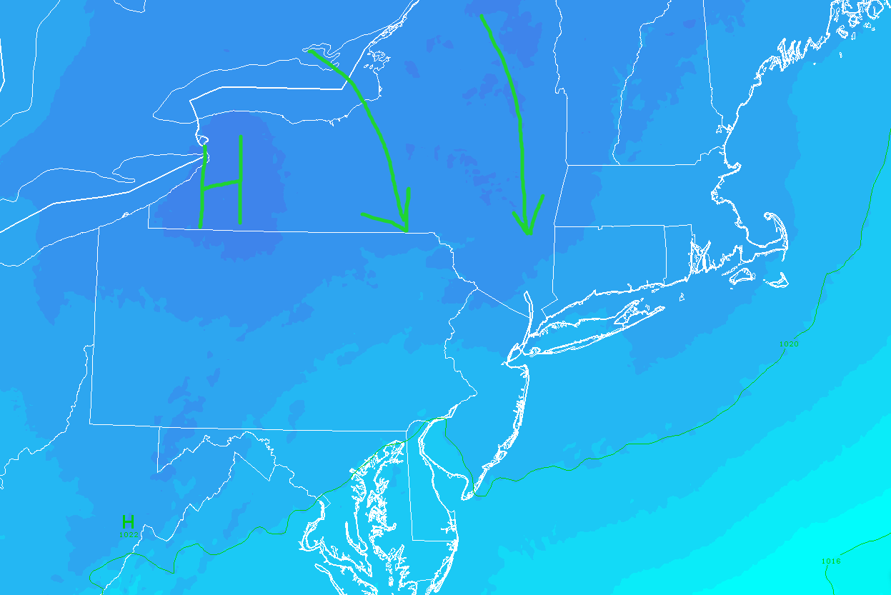
Tuesday morning should start off rather cloudy, with overcast likely in some places as the lower levels of the atmosphere remain quite saturated. A weak area of low pressure may be located just to our tomorrow morning, and this should allow winds to funnel from a much cooler airmass located to the north. With the skies likely only improving ever so slightly, temperatures tomorrow afternoon should only be able to rise into the upper 60’s to middle 70’s, which will be well-below normal for this time of year (10-15 degrees). Some locations may be able to rise into the upper 70’s tomorrow afternoon depending on just how quickly the residual mid level moisture decides to move. If things are able to dry out sooner, than cloud cover may become more scattered, with peeks of sunshine likely. Additionally, some added sinking air courtesy of a building high pressure system from the west ma also allow some improving conditions later in the day, but at this time widespread clearing does not seem all that likely for the entire region. Tomorrow evening should be yet another well-below normal night in terms of low temperatures, as the area of high pressure continues to build in from the west and clears out the area.
Wednesday will likely be the most quiet day in this forecast period as the area of high pressure fully extended over the region and takes control of our weather. We may start off the day with a few clouds due to the northwesterly flow, but as the column begins to dry out and the sun starts to warm things up, we should see a transition to cool, but relatively sunny day with scattered clouds and light winds. Wednesday will likely also be the nicest day of the week due to the low chance of rain, low humidity, and sunny skies. Highs will likely range from the low to middle 70’s, with some locations with prolonged sunshine possible reaching a few degree warmer. Wednesday evening will likely be below normal once again, but it is uncertain as to how much below normal temps will be able to reach. The models suggest that some increasing cloud cover may exist over the area as the high pressure system begins to move to our east, ushering in a more southerly flow. If this does indeed occur, then lows will likely be right around normal, with temperatures getting down to the middle to upper 60’s.
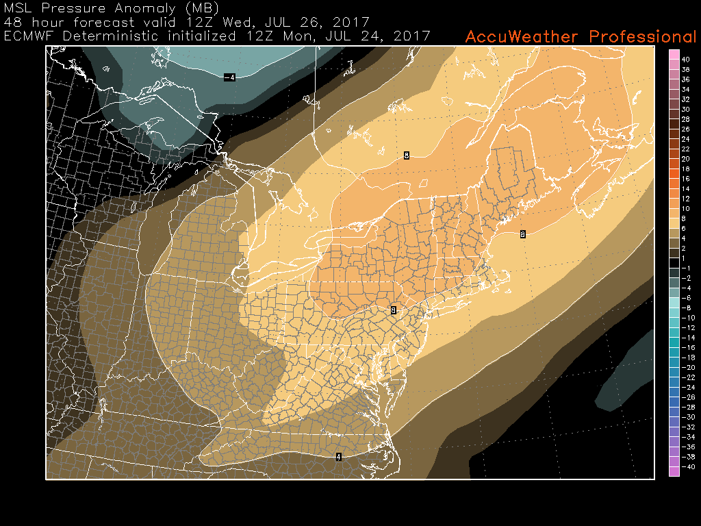
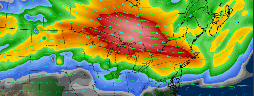
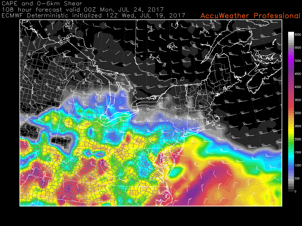
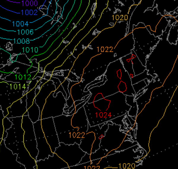
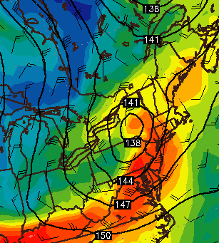
This afternoons European model showing a large area of high pressure moving in over the Northeast during the early morning hours on Wednesday, making for a very cool and pleasant day with low humidity and few clouds! (Courtesy of Accuweather Pro)
Late Week Rain Threat
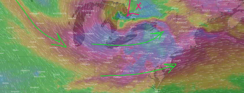
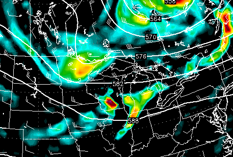
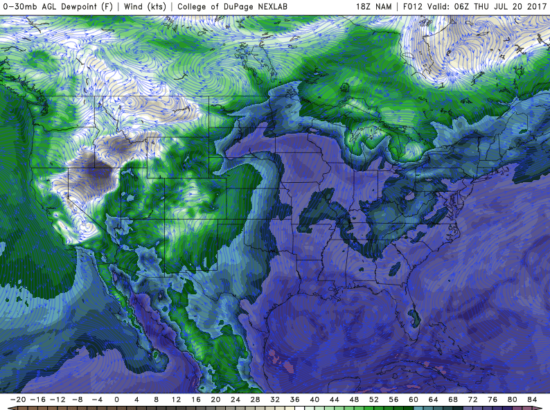
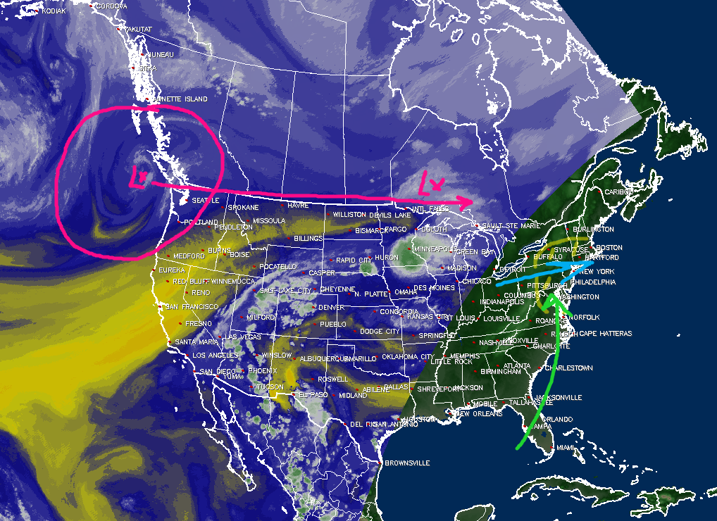
Later in the period, the models suggest that the near-zonal pattern that we’ve been stuck in for the last week will produce yet another heavy rain threat late Thursday evening, and possibly into Friday morning. Energy from a monsoonal system currently located over the desert Southwest will begin to move north and east around the northern periphery of a large heat ridge centered over Texas over the next few days. As it does so, another disturbance will be moving briskly across southern Canada to the east. Depending on the degree of interaction between these two systems, the mid level disturbances may briefly phase over the Ohio Valley, allowing for the development of a surface low pressure system to form. A blend of this afternoons European/NAM models shows that as this low pressure moves over western New York, it would begin to drag up a very moist airmass from the south. Additionally, an impressive upper level jetstreak may be positioned over the Northeast, which could promote modest amounts of lifting in the atmosphere.
Though the exact details of this scenario will largely depend on small details like the degree of interaction, timing, and location of each disturbance, there does appear to be an increasing threat of heavy rain late Thursday evening, and into the morning hours on Friday, especially for locations to the North and West. We will continue to monitor this potential storm system over the next few days and provide more details on potential impacts!
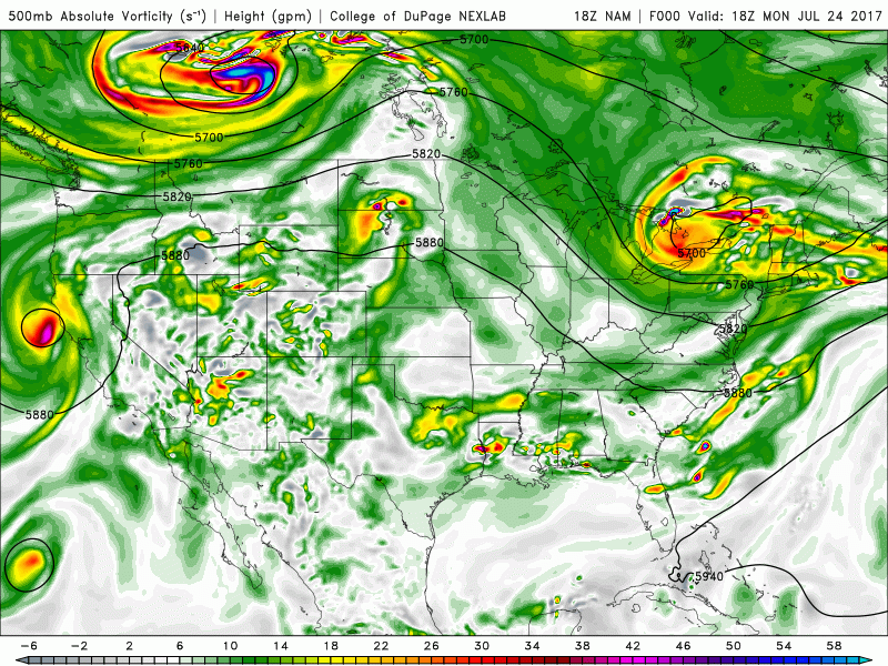
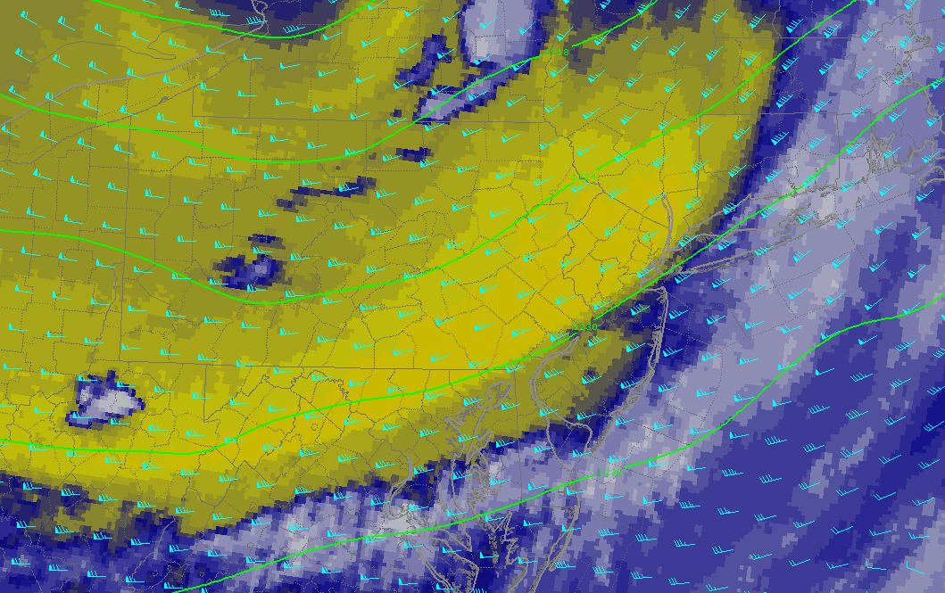
Evolution of the mid level disturbance first tracking north, then east over the large ridge centered over the Plains states. Depending on the degree of interaction with another northern stream disturbance, this system may be another heavy rain producer
For more information and posts like this one, make sure you sign up for Premium Forecasts — where multiple detailed articles, videos, and interactives are posted each day. Also, come interact with our staff and many other weather enthusiasts at 33andrain.com!
Have a great day!
Steve Copertino