2/8 Afternoon Zones: Significant snow likely Thursday

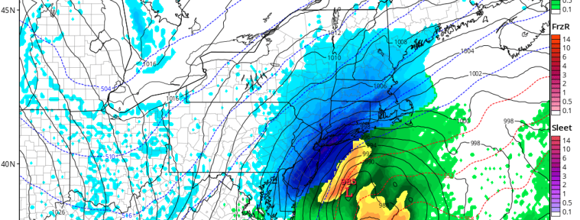
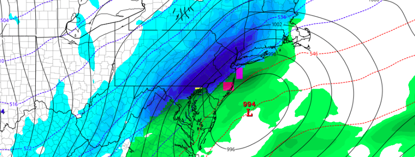
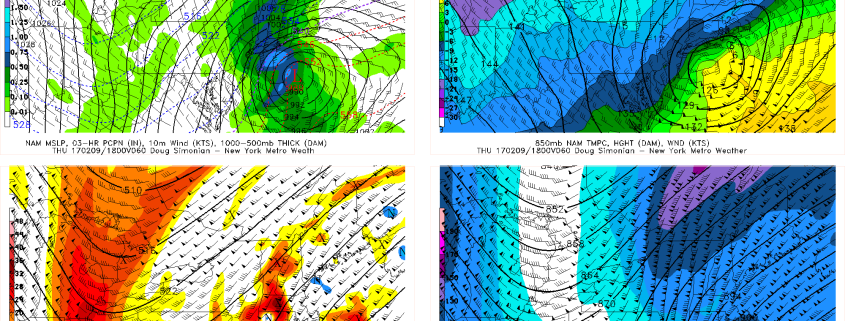
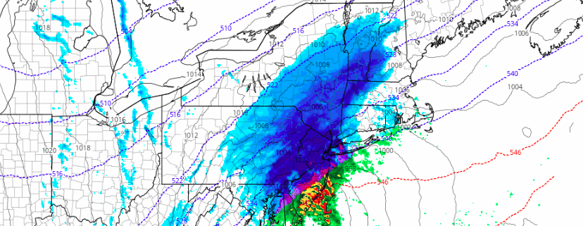
Significant snow is expected on Thursday, as a low pressure system moves from the Mid Atlantic to a position east of the New Jersey coast. The low pressure system will deepen rapidly, as a result of increasingly favorable dynamics in the atmosphere’s mid and upper levels. As the storm moves off the coast of New Jersey, bands of very heavy precipitation are expected to rotate inland, resulting in widespread heavy snow.

The event will begin as mixed precipitation, especially in Southeastern New Jersey and along the area coasts. Elsewhere, the mixed precipitation should transition fairly rapidly to snow, which will quickly become steady and eventually very heavy. Dynamic cooling will change rain and mixed precipitation to snow gradually in all areas, slowest over portions of Southern New Jersey on Thursday morning.

Read more

AM All Zones Update: Significant Snowfall Expected Late Tonight into Thursday

A warm front will likely make little progress northward this morning, before a cold front moves through during the midday hours today. Drier northwest winds behind this front, will cause low clouds and fog to clear for more sunshine later this morning and afternoon. Temperatures will still rise into the 50s and some even lower 60s this afternoon, with a downslope flow. Then a colder airmass will begin moving into the region tonight.

Read more

Afternoon All Zones: Significant snowfall increasingly likely Thursday

Forecast models have trended in favor of a stronger, more impactful storm system moving through the Mid Atlantic states on Thursday, and confidence is increasing in a significant snowstorm for a large majority of the forecast area. The potential exists for 9-12″ of snow in parts of the area, and higher amounts cannot be ruled out where bands of heavier snow develop.

The story of the storm system begins over the Midwest states, where a disturbance in the mid levels of the atmosphere develops on Wednesday. This energy moves eastwards from the Midwest through the Ohio Valley, and eventually to a position off the Mid Atlantic Coast. As it does so, interaction with a disturbance in the northern jet stream will cause the energy to deepen.

Read more

AM All Zones Update on Potential Snowstorm Late Wednesday Night into Thursday

A storm system tracking over the Great Lakes, will bring some periods of rain with possibly freezing rain over Interior this morning. Some very mild and record breaking temperatures also possible on Wednesday. But more attention is already on possible snowstorm starting late Wednesday night and last into Thursday. Details are still yet to be ironed. But confidence is growing on moderate to significant snowfall for parts of the area.

Read more