In about 10 days time, all reliable forecast model and ensemble guidance suggests the development of an impressive Sudden Stratospheric Warming event (SSW) across the higher latitudes of North America, the Arctic, and the North Pole. The stratospheric polar vortex is set to split in two, as anomalous warming occurs in the stratospheric levels of the aforementioned regions. This will send the vortex, which has recently strengthened and tightened up over the Arctic regions, spiraling southward toward North America.
These events are not rare – but have not been a common occurrence over the past several years. The last SSW which occurred in the fashion which is being depicted by modeling to occur in several days was in 2009 – and even then, the atmospheric base state was quite different to what we see now. Truthfully, it has been some time since we have seen a SSW, especially during February. So what exactly does it mean for the weather across North America as we move forward in the back 1/3 of winter?
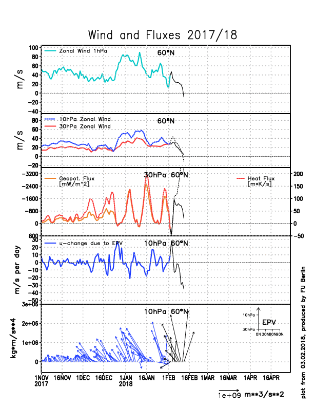
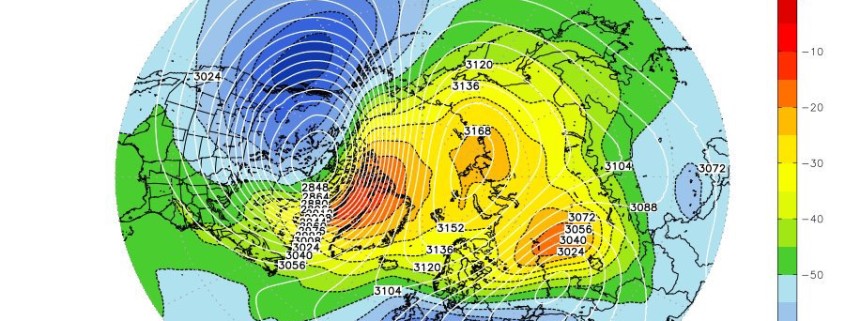
The latest European Model analysis shows a strong increase in heat flux (third panel) in a very poleward manner (bottom panel), which ultimately helps to significantly weaken the Stratopsheric Polar Vortex, evidenced a large drop in zonal winds (fourth panel). (FU Berlin)
The answer, as you may have already imagined, is quite complicated. There are many factors that act to determine exactly how a SSW behaves, including its origin, its evolution, and its eventual location, displacement, and form. It helps, then, to understand the base state of the atmosphere prior to the SSW occurring, and to understand the processes that are at work during the SSW itself. Then, we can understand the impacts that may occur down the road to our sensible weather patterns.
The stratospheric vortex has, for the most part, been perturbed during this year, particularly across the Pacific Ocean. Multiple anomalous, poleward-building ridges in the Pacific Ocean have sent waves into the stratosphere that have disrupted and elongated the stratospheric vortex throughout the winter. This has weakened the vortex itself, but has not completely split it at any point. In fact, of late, the vortex itself has tightened up and is expected to retract a bit over the next few days.
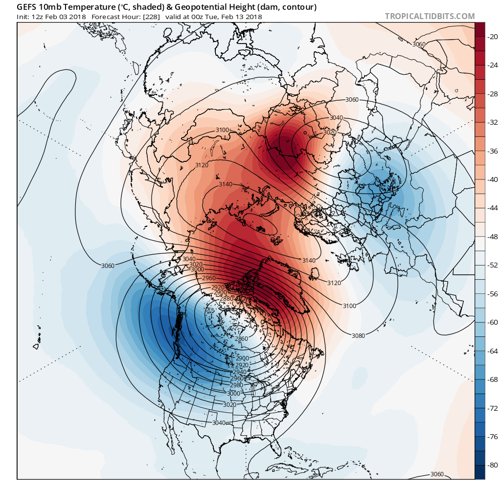
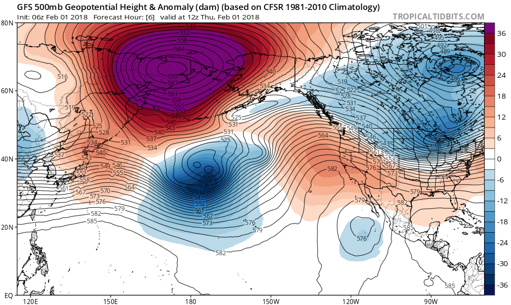
Today’s GFS ensemble mean valid on February 12th shows a significant warming in the Stratosphere, allowing the Stratospheric Polar Vortex to split into two pieces (Tropical Tidbits).
Forecast models suggest that a burst of anomalously warm air will push into the stratosphere during the middle of the month of February. This may occur concurrently with the very impressive, near record-breaking MJO pulse in Phase 7. Research has suggested (Wheeler/Hendon et al, 2004) that MJO bursts into Phase 7 with impressive amplitude can be predecessors to SSW events. Warmer anomalies in the lower polar stratosphere have been shown to suddenly and rapidly develop – mainly as a result of constructive interference between mid latitude circulations and a anomalous convection in the tropical Pacific Ocean.
The latest observations and short/medium term model guidance show impressive “coupling” of the troposphere and stratosphere. This is important — in simple terms, it means that the troposphere (where our weather occurs) and the stratosphere are working in-sync. This significantly increases the possibility that the SSW will have an impact on the weather across the Northern Hemisphere – and rather quickly.
Evidence of these impacts occurring relatively quickly can already be found in some of the latest forecast models from around February 15th, and beyond. There may be an MJO –> Stratosphere –> MJO feedback, which could give new life to what was once forecast to be a weakening MJO pulse.
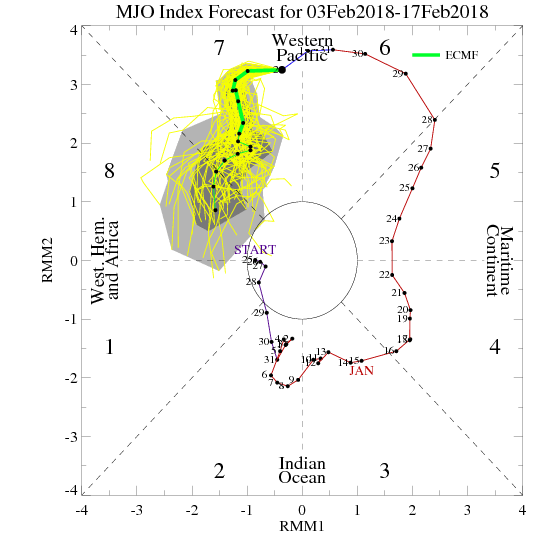
The new ECMWF MJO forecast shows it becoming strong again as it heads into phase 8. This tends to lead to increased high-latitude blocking. (CPC)
Previous forecasts had the record-breaking phase 7 MJO pulse dying before it reached phase 8, and now newer forecasts show it progressing into phase 8 in a very healthy matter. This is because of the alterations the models are making with the stratospheric forecasts, showing that the tropical forcing in the troposphere, and the stratospheric warming are very much in sync.
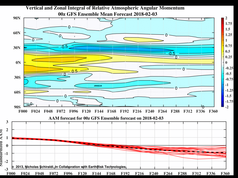
We see further evidence of this by the fact that the latest forecasts are showing a significant decrease in Atmospheric Angular Momentum (AAM) in the Arctic. Mean atmospheric flow trends to run from west to east, and pretty fast in the Arctic — especially within the polar vortex, so a +AAM is faster than average west to east flow.
An animated gif, comparing the AAM forecast from 5 days ago, to the most recent forecast. Notice the increased -AAM anomalies near 0 degrees latitude (the Arctic).
The forecast from five days ago showed a strong +AAM, and in the cross section, we can see that it was very much located within the high-latitudes from 30N to 0N. But notice on the most recent forecast, how those warm colors almost completely evaporate, in favor of the cold, blue colors in those same locations. This means we are now seeing a -AAM take place in the high-latitudes, and towards the Arctic. This is a direct byproduct of the SSW event, which decreases the mean west to east zonal winds within the Polar Vortex. The fact that this is translating to the AAM budget is very significant going forward, in that it further proves the Troposphere and Stratosphere coupling.
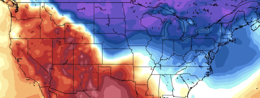
The forecast decrease in AAM means we have less mean west to east flow in the high-latitudes, which significantly helps to weaken the polar vortex, and helps lead to more stagnation in the mean flow in general — since the “momentum” (thus the ‘M’ in AAM) is being slowed down. This inherent stagnation to the pattern in the Arctic leads to more high-latitude ridging and blocking to develop.
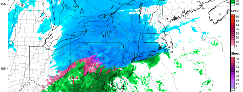
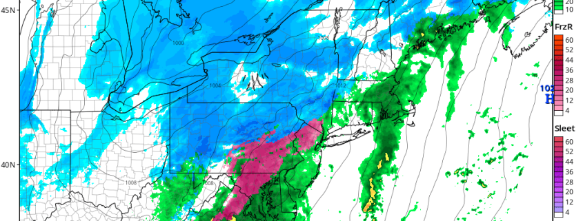
Thus, it is fair to say that this SSW episode, combined with a coupling within the Troposphere, should help lead to increased high-latitude blocking fairly quickly, as we approach February 20th. This could mean an increase in opportunity for cold and a significant snowfall in the February 20th through March 10th period.
This post was written by John Homenuk and Doug Simonian
-2")