Good evening!
After the cool and dreary conditions over the past couple of days, today was a slight improvement for much of the Northeast as a cold front gradually passed through the region, signaling a change to the sensible weather pattern. This front was luckily rather tame in nature, as the energy associated with the front was strung-out and not well-organized. This allowed for only moderate changes to gradually take place during the course of the day, with a rather cloudy and cool start to the day. As the day continued on, we saw high to mid level clouds lessen with time, eventually giving way to some peaks of sun. Winds shifted to the northwest behind the front, with more dry and cool air filtering into the Northeast. Modest cloud cover and a renewed airmass from Canada kept temperatures in check, with highs ranging from the lower to upper 40’s, with some locations reaching the 50 degree mark. Dry air from the north and west should continue to mix out any residual low level moisture over the next 6-12 hours, leading to mostly clear skies this evening. Additionally, an area of high pressure will be building in over the Mid Atlantic and Northeast tonight, so expect any winds to gradually diminish over time. These conditions will be quite favorable for radiational cooling to take place overnight, with temperatures likely dropping quite a bit into the lower to middle 30’s over much of the area. Some locations off to the north and west will likely drop into the middle 20’s this evening, causing any residual moisture on roadways to freeze, so please watch out for slick patches if you’re driving tonight.
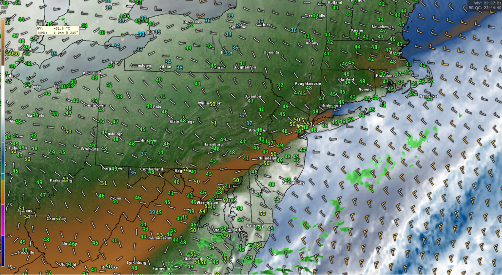
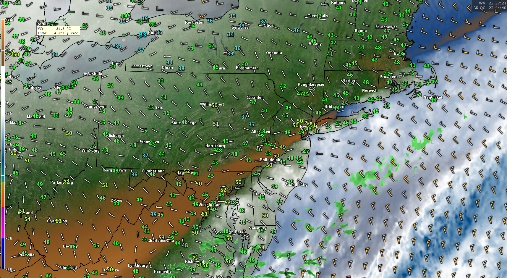
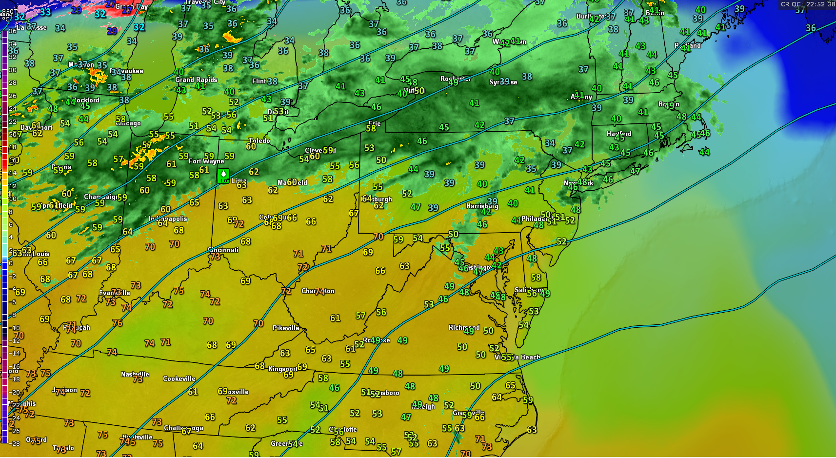
This evenings latest high resolution water vapor imagery, surface observations, and surface winds, showing a more calm temporarily setting up.
Tuesday through Thursday
Tuesday will likely start off quite chilly, but clear as the area of high pressure continues to build and move eastward with time tomorrow morning. Conditions will be quite dry throughout the majority of the atmosphere, so skies will likely remain mostly sunny for the majority of the day, with a few upper level cirrus clouds passing through. The fresh Canadian airmass in place in combination with the high pressure will work in tandem to keep conditions cool, but not too cool over the entire Northeast. Highs tomorrow afternoon should remain in the middle to upper 40’s, with some inland locations likely hitting the 50 degree mark again. All in all, tomorrow should be a rather nice day, but will likely still require a light jacket to stay comfortable. Tomorrow night looks to be calm and cool as well, but not quite as cool as tonight. Lows will likely dip down into the middle to upper 30’s for the majority of the Northeast, with some locations possibly just getting below freezing.
Wednesday looks to be one of the more mild days of the week as the area of high pressure that has been dominating the east begins to move off the Mid Atlantic coast. This should create more southerly flow in the mid to low levels of the atmosphere, bringing in slightly warmer highs for the afternoon hours. Moisture looks to also increase with the southerly flow as a shortwave trough digs into the desert southwest, sending some residual energy into the east. This energy out ahead of the main system should allow for some clouds and even a few isolated showers to develop in the late afternoon hours, but not significant rain is expected. Highs will likely be able to rise into the lower to middle 50’s across the vast majority of the Northeast. Cloudy conditions will likely continue throughout the overnight hours, with the threat of a couple of showers lasting into the early morning hours. Cloud cover and southerly winds should keep lows from dipping too much, with readings likely staying in the middle to upper 30’s-with some locations seeing lows in the lower 40’s.
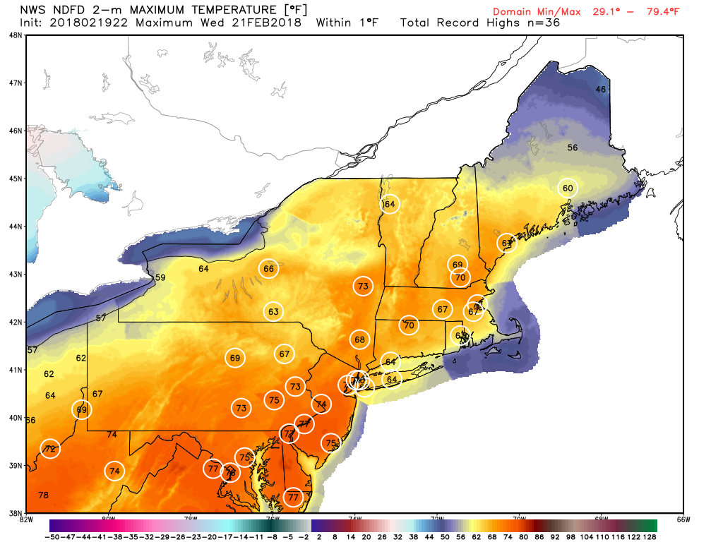
Things begin to get a little more interesting on Thursday, as the system that was in the southwest begins to move into the Plains and interacts with another shortwave coming down from Canada. As these systems interact and attempt to phase, a primary surface low pressure system should form over the Great Lakes region, with a large area of rain expected over much of the Southeast. As this low moves closer to the Northeast, cloudiness will likely increase in addition to the threat of some showers as we head into the late afternoon hours. Later in the evening, this area of low pressure should continue to intensify, as the mid level system becomes much more organized. This process should continue into the overnight hours, as a stationary front likely sets up over the Mid Atlantic, which may become the focus for a secondary low pressure system to form. Temperatures on Thursday will likely remain mild, with highs in the lower to middle 50’s over the entire Northeast.
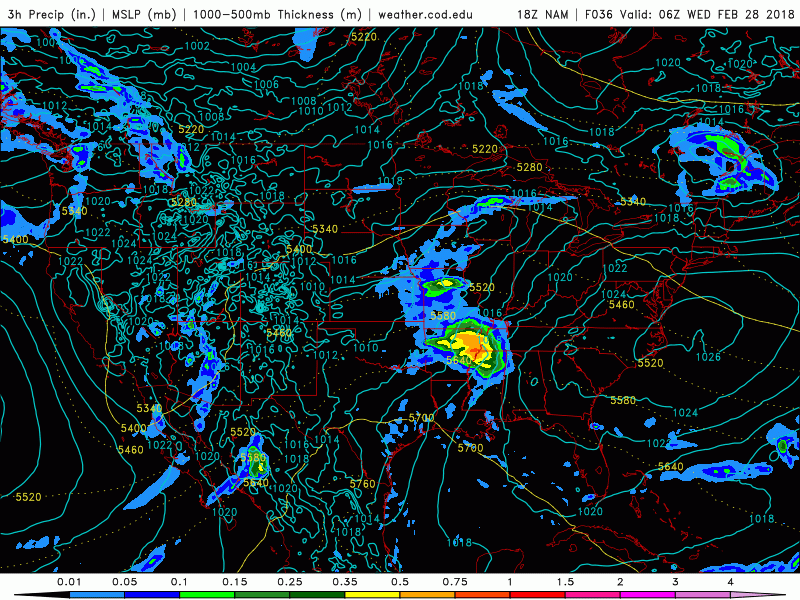
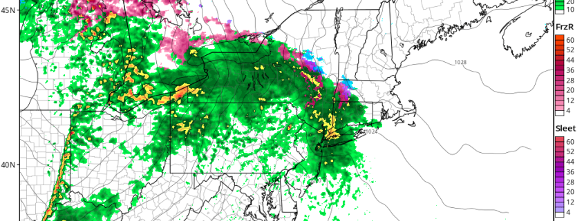
This evenings NAM model showing the development of a potentially impactful system for the Northeast
Potentially Impactful Coastal System Shaping up for Friday
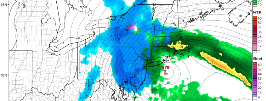
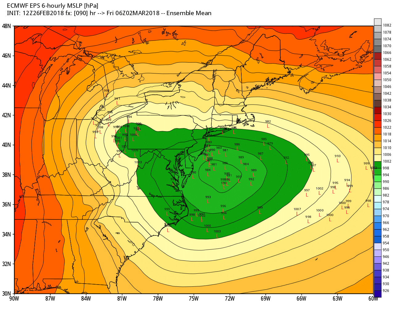
This afternoons model guidance continues to show the potential for the primary low pressure system that travels over the Ohio Valley to redevelop just off the Mid Atlantic coast early Friday morning, but there are still a large amount of uncertainties with this forecast. Regardless, what we do know is that an area of blocking will be located over Greenland, which will act to slow down the mid level system and allow it to strengthen as it nears the coast. This should lead to the development of a strong low pressure system adjacent to the Mid Atlantic coast during the day on Friday, likely leading to a wide range of impacts. Almost all of the model guidance shows an impressive swath of winds just above the surface with this system due to a tight pressure gradient. Additionally, this system will be capable of tapping moist air from the south, so it will likely have a good amount of moisture to work with, leading to the development of widespread moderate to heavy precipitation. Lastly, winds out over the ocean will likely be directed towards the coast, which will create at least a moderate threat of coastal flooding as we enter a full-moon phase. One of the main things we do not know at this time is exactly when and how much phasing will occur with the two original disturbances over the Ohio Valley. A quicker phase would lead to a stronger coastal low tucked right along the coast, while less/delayed phasing will likely lead to a weaker and more elongated system.
There is also the question of precipitation type, which is something that seems to be highly sensitive at this time. While a stronger system would be able to create enough dynamic cooling for some snow to fall, this solution would also mean that the primary low in the Great Lakes sticks around longer, which creates more warm air for the coastal plain. At this time it does not seem like a widespread significant snowfall is likely from this system, but there could be some locally heavy snow in the higher terrains of the Northeast if conditions line up correctly. We will be keeping a very close eye on this system this week and will continue to provide updates as they become available!

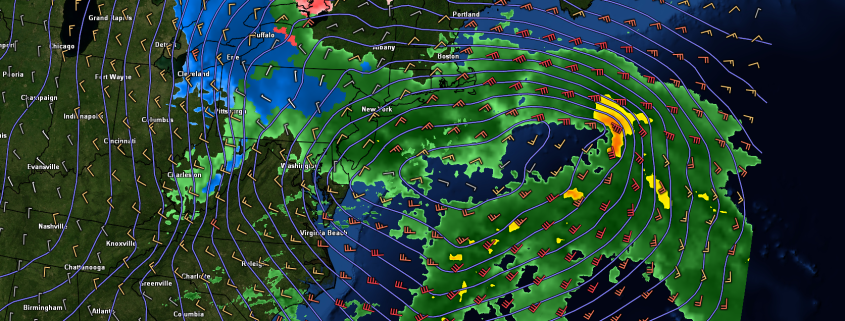
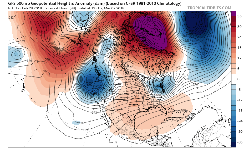
This afternoons European ensemble individual members showing a wide variety of solutions for Friday’s system
Have a great night!
Steve Copertino
-2")