-2")
NYC Area Forecast: Warmer, Unsettled Weather Arrives
Happy Tuesday! We come bearing some good news, as a warming trend with temperatures begins today. Unfortunately, weather conditions will also become more unsettled during the next few days. For this morning, sunshine has already become filtered by some high cirrus. These clouds will gradually thicken and increase this afternoon as a frontal system approaches from the west. Despite cloud cover, some warm-air advection with mid-level ridging will support temperatures rising into the upper 40s to lower 50s for highs this afternoon.
Later tonight, the weather will deteriorate in the Northeast states. Showers are expected to become more widespread, then continue into the overnight hours as a frontal system moves through. Moisture and dynamics with this system aes limited, so we only anticipate a light rainfall for most areas. Temperatures, aided by more cloud cover tonight, will only drop into the upper 30s to lower 40s. Over some of the higher elevations inNorthwest New Jersey and the Lower Hudson Valley, temperatures may drop into the low to middle 30s, where some pockets of freezing rain can’t be completely ruled out. Use caution driving in these areas tonight.
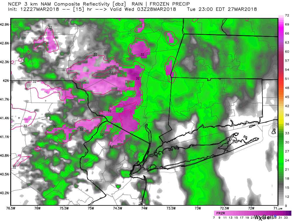
3km NAM model showing showers over the region tonight with some areas freezing rain over higher elevations of Northwest NJ and Lower Hudson Valley
Showers should begin tapering off by Wednesday morning as the frontal system begins move to the east, but cloud cover will remain throughout the day as a frontal boundary will be lingering just south of the area. A weak wave of low pressure running along this boundary may trigger more scattered showers during the late afternoon and evening hours again, but most of the Northeast should remain dry into Wednesday night. Despite cloud cover, warm-air advection will be increasing with southwest winds, so temperatures will likely get into at least the lower to middle 50s, over most of region.
On Thursday, a large upper-level trough with shortwave energy will be amplifying to the west, resulting in a stronger storm system developing over the Ohio and Tennessee Valleys. This storm system will be moving to the northeast into New England, causing a warm front to lift northward into the Northeast states. This front will aid in lift and advection of moisture, with some showers arriving Thursday afternoon or evening. Mets fans, there is a chance these showers could arrive during the Mets home opener at Citi Field on Thursday. Check out our SportsCast page for more forecast updates on this game.
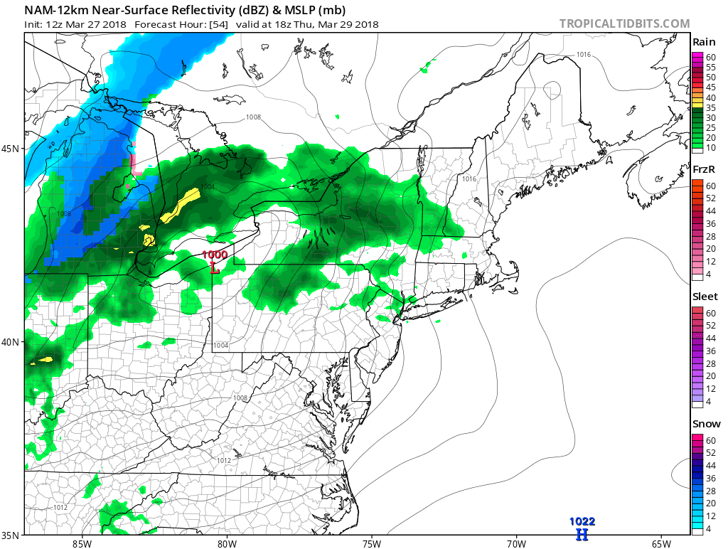
Latest NAM model showing showers arriving ahead of the next storm system Thursday afternoon over the Northeast.
Thereafter, a cold front associated with this storm system moves through during the day with additional showers expected on Friday. There is the potential for steadier and rainfall with this part of the storm, as moisture from the Gulf of Mexico and Atlantic will be feeding into this system. Heavy or widespread rain isn’t expected, as the best dynamics pass to the northwest into Canada. Temperatures both Thursday and Friday are likely to continue to moderate at least into the mid-upper 50s. Some spots may get into the 60s , especially in parts of Southern New Jersey and Southeast PA any places where the clouds break for some sunshine.
Behind this storm system will come the return of cooler air on Friday night and Saturday, with temperatures falling back toward seasonal levels. Another frontal system will be moving through sometime over Easter weekend with additional rain showers. Currently there is some model disagreement on the exact timing of this system – forecast details will be fined tuned as we move closer to the weekend.
Colder, drier weather is likely to return by next week, as high-latitude blocking begins to return with A cross-polar flow developing over Northern Plains to Northeast. Those are not words you want to hear if you are waiting for Spring weather. Below normal temperatures and more storm threats with wintry precipitation chances are expected to return to the forecast in parts of the Northeast during the first few weeks of April. More to come this week!
Trackbacks & Pingbacks
1blackmail
Comments are closed.