-2")
PM Update: Heat continues, brief respite expected this weekend
The Heat Index reached well over 90 F in the NYC Metro Area again today, and the temperature reached over 90 F for the 20th time this season in Central Park. It was another oppressive day, and the weather pattern that has been providing those temperatures is expected to continue for the next few days. Heat and humidity will be commonplace, and although temperatures on Wednesday will be several degrees cooler than today, the humidity levels will still make it uncomfortable.
Opportunities for showers and thunderstorms will begin to increase late week, and thereafter we anticipate a brief respite in the heat. Brief will be the most significant aspect, once again, as the heat and humidity look likely to return again in the Days 7 to 10 time frame. The pattern overhead is stagnant, and it doesn’t look to be going away any time soon.
Heat continues, some storms possible Thursday
A very warm evening is anticipated once again with temperatures well above normal. The potential will exist for a few isolated showers and storms, but coverage is expected to be very limited. The warm temperatures will continue into Wednesday, but it won’t be nearly as hot. You can thank an onshore flow for that – models are in good agreement that the low level winds will shift to favor a more easterly direction.
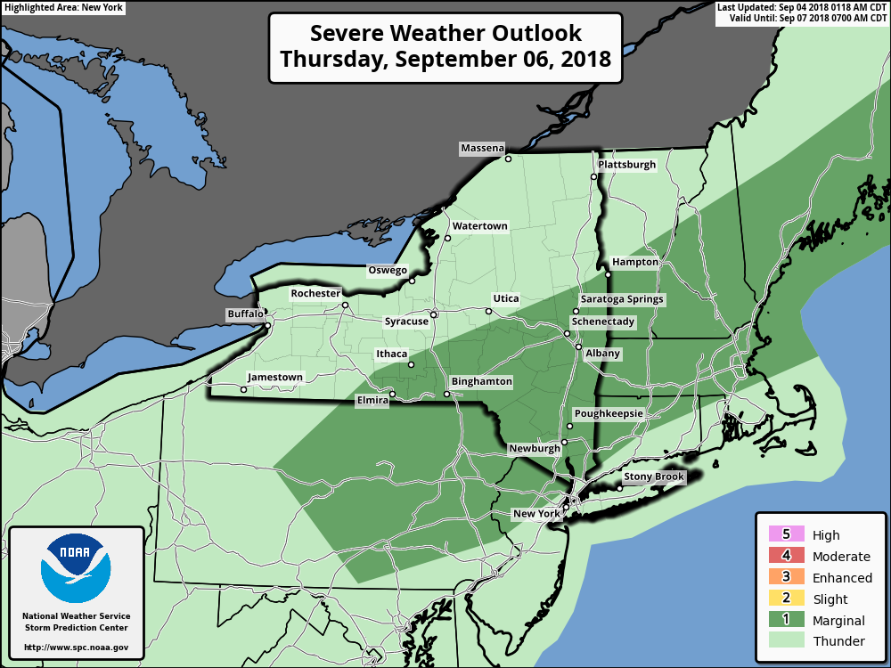
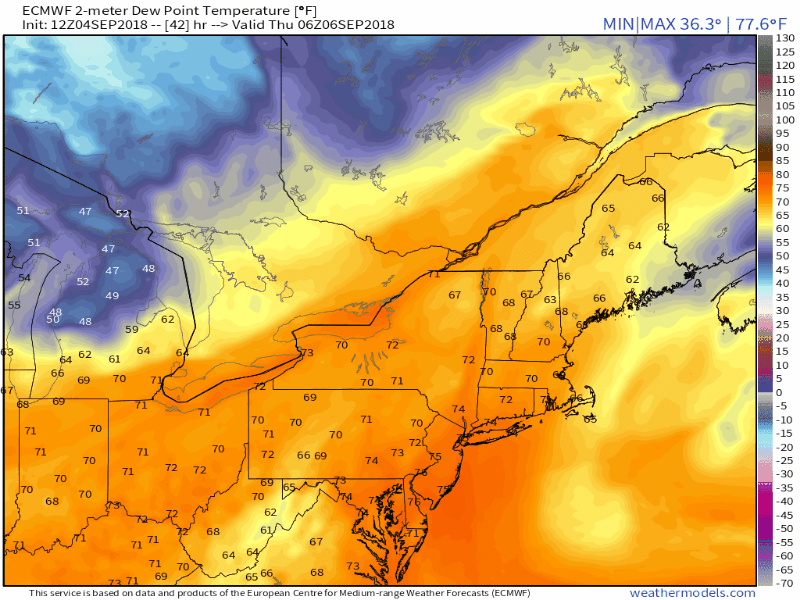
The warmth will return again on Thursday. Temperatures will reach back into the 90’s and dew points will increase once again. A frontal boundary will come marching southward from New England, weakening as it does so, but is likely to provide just enough lift for the development of scattered showers and thunderstorms during Thursday afternoon and evening.
Weak shear in the atmosphere is expected to limit the severe weather threat overall – but strong instability and enough lift along the front could promote the development of some stronger storms. The Storm Prediction Center has, accordingly, placed parts of New England and the NYC Metro Area in a “Marginal Risk” for severe thunderstorms with damaging winds the main threat.
Cooler weather briefly returns
Cooler weather finally moves in this weekend, as brief as it is likely to be. Forecast models suggest temperatures will fall a few degrees below average for the first time in over a week! In fact, high temperatures during the weekend may only reach into the middle 70’s – with lower humidity values. This airmass will certainly feel refreshing – and unfortunately, it doesn’t look to last.
Models are in good agreement that heat and humidity will return once again the medium range, as another large ridge builds over the country during the medium range. This ridge will again help to advect in warmer, more humid air via southerly winds – and temperatures are expected to average well above normal once again during this time.
For more detailed information – whether it be for your company, or personal use – contact us regarding our Consulting options.
Trackbacks & Pingbacks
3watchfulness
Leave a Reply
Want to join the discussion?Feel free to contribute!