-2")
NYC Area Weekly Planner: Heavy Rain & Flooding Concerns to Start the Week
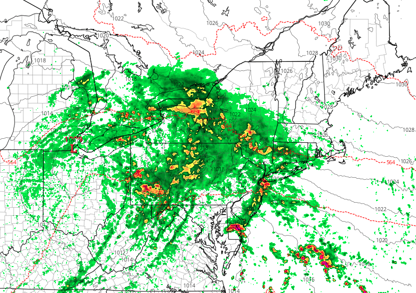
Good morning and Happy Monday! It’s a rough one out there this morning. Showers continue throughout the Northeast and Mid Atlantic, with temperatures in the 50’s and a very damp airmass in place. This weather is generally expected to persist today, but it will be particularly cool this morning. Bring a jacket and an umbrella along with you.
Tropical moisture from the remnants of Tropical Storm Gordon, which moved inland along the Gulf of Mexico coast last week, will be running along a warm front today. High precipitable water values suggest some areas could see between 1” to 3” inches of rainfall. Thus some localized flash flooding is possible, especially over parts of New Jersey, Eastern Pennsylvania and into New York State where more upslope lift from a strengthening low-level southeasterly jet is likely to enhance heavy rainfall.
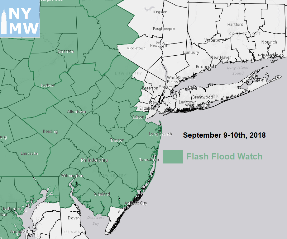
Flash Flood Watches for today and Monday over much of Eastern Pennsylvania, New Jersey and into Central New York State
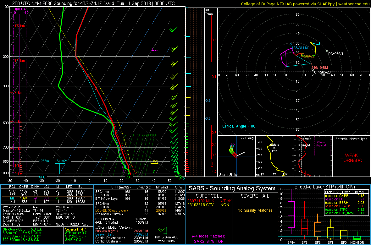
In addition, as the warm front moves closer to New Jersey and the NYC metro area later today, instability will begin to increase. This could lead to some isolated thunderstorms with torrential downpours developing over parts of the region during the late afternoon and evening hours. Although instability will be marginal, strong directional shear and low LCLs will be present along the warm front. An isolated strong to severe supercell thunderstorm with some strong, gusty winds or a weak tornado isn’t out of the question. This threat will be monitored more closely during the day on Monday, and we will be sure to keep you updated. Otherwise, temperatures on Monday be warmer — into the low to mid 70s — as the warm-air advection increases aloft from the warm frontal passage.
As the week goes on, a strong ridge will begin building over the Western Atlantic. This will cause a cold frontal boundary to slow down or stall to our west on Tuesday, before finally moving off the coast on Wednesday and Thursday. Thus, there will be probably be a chance of some showers or thunderstorms each day, especially over the Interior, as the ridge may keep the frontal boundary further west and put a tighter lid on shower or thunderstorm activity closer to the coast. Regardless, it will likely be warmer again with a more return flow around the Western Atlantic ridge each day. High temperatures are likely to reach into the middle 80s, with at least some sunshine mixing with clouds.
We will also continue to monitor Florence out in the Atlantic, which has been upgraded to a hurricane again. This storm is expected to rapidly intensify back into a major Category 4 hurricane, as upper-level shear weakens and the storm moves west-northwestward over warmer ocean waters. Florence is likely to have major direct impacts somewhere along the Carolina or Virginia coasts later this week, as the Western Atlantic ridge will prevent the storm from escaping out to sea. It remains somewhat uncertain if and where exactly Florence will make landfall, as steering currents will likely weaken later this week as well. If Florence moves inland, it could stall or meander for a few days after weakening, producing prolific rainfall totals and major flooding over parts of the Southeast US and Southern Mid-Atlantic.
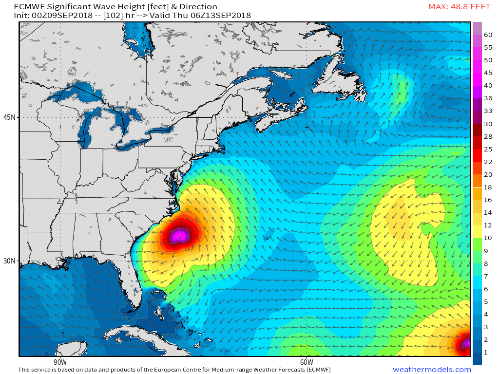
ECMWF model showing swells from Hurricane Florence with significant wave heights and high surf along the East Coast later this week
At this time, we expect the Western Atlantic ridge to block Florence from tracking further north into the Northeast US. Thus, we aren’t anticipating any direct impacts locally, outside of some enhancement of showers and thunderstorms, if it were to interact more with the aforementioned frontal boundary. With Florence approaching the East Coast, swells from the storm will also result in high surf and rip currents along the beaches this week. A combination of onshore winds and higher tides with the new moon this weekend will lead to some areas of minor to moderate coastal flooding and beach erosion, especially along the New Jersey and Delaware shores.
Stay tuned for more local forecast updates on our public blog and social media accounts throughout the week. If you are interested in more detailed forecasts on a daily basis for your location or business, take some time to check out our consulting page for more product information.
Leave a Reply
Want to join the discussion?Feel free to contribute!