-2")
NYC Area Forecast: Nor’Easter increasingly likely this weekend
A colder than normal pattern has become well established throughout the Northeast states over the past few days – in case you haven’t noticed yet -and will remain established for the remainder of the week. In fact, a low pressure system is expected to strengthen in the Gulf of Maine later tonight into Wednesday, producing the first accumulating snowfall of the season for parts of Maine.
Meanwhile, the weather pattern across the Central and Southern United States is forecast to become more amplified. Forecast model guidance suggests that a few disturbances will eject southeastward from the Pacific Ocean into the Central United States, and a second disturbance will linger off the Southeast Coast. The interaction of these two features will aid in the development of a low pressure area off the Southeast US coast by Friday.
A brief technical discussion on the storms formation
All of these pieces of the “Weather puzzle”, as we often call it, are coming together for a reason. In a post earlier this week, we explained by blocking in the higher latitudes is so important to our weather here in the Northeast states, and this storm system is a great example of it. Anomalous heights in the higher latitudes of North America – from Western British Columbia to Central Canada – significantly adjust the pattern across the Untied States.
In this case, blocking progressed from British Columbia to Central Canada, near Hudson’s Bay, and it has resulted in a colder than normal pattern across the Northeast states this week. Finally, multiple troughs moving slowly out of New England and elongating in Eastern Canada near the 50 latitude/50 longitude region (a “50/50” low) will act as a transient source of blocking on the Atlantic side.
The combination of all of these features will to act to help disturbances from the Pacific slide “underneath” the blocking heights in Canada, into the United States. It will also help to foster a pattern that will allow disturbances to amplify off the East Coast – resulting in the development of a Nor’easter off the coast this weekend.
A simpler breakdown of the storm – it may be significant
As a low pressure system forms off the Southeast coast this weekend, the weather pattern is expected to amplify and allow the storm to gradually strengthen on its move northward toward the Mid-Atlantic and New England. Moisture (some of which is enhanced by the remnants of Hurricane Willa) will surge up the East Coast, with heavy rainfall likely in the Mid Atlantic by later Saturday as the Nor’Easter climbs northward.
The mid and upper level jet stream will also become more amplified, and as the low pressure strengthens, rain will move northward into New England and the Northeast. Periods of very heavy rain are possible, with localized flooding in some areas as well.
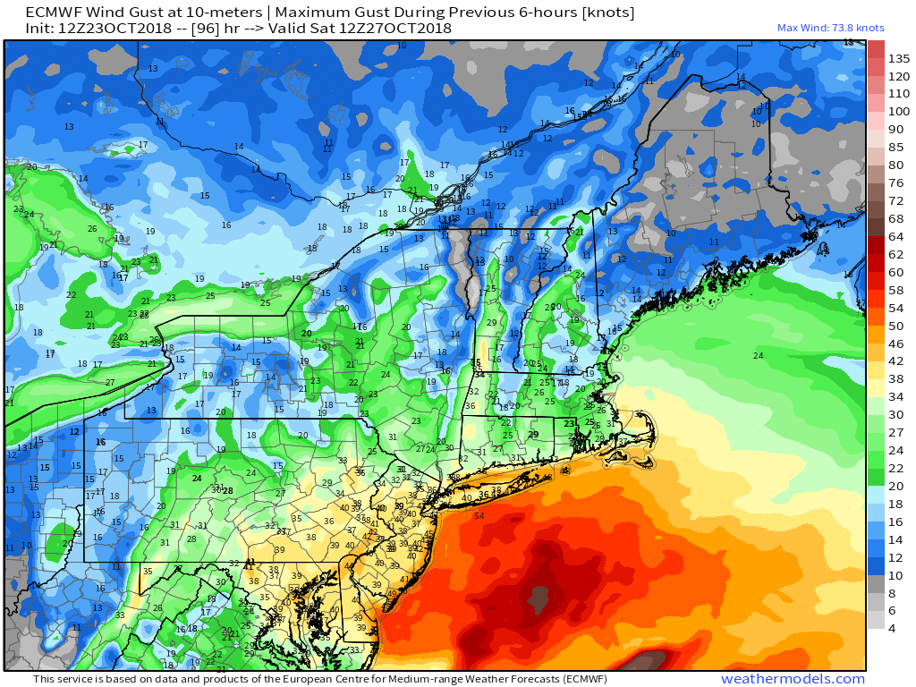
In addition to the heavy rain, forecast model guidance currently suggests that the low pressure system will tuck inland near the Chesapeake. This would lead to an onshore flow with the potential for strong winds and coastal flooding in parts of Delaware, New Jersey, and Long Island. The threat for heavy rain and gusty winds could continue through Sunday.
What about wintry precipitation chances?
Despite the fact that a Nor’Easter appears increasingly likely, the airmass in place prior to and during this storm is still seasonable. In other words, don’t expect an anomalous early season winter storm. The system could, however, deliver wintry precipitation to the higher elevations of the Northeast.
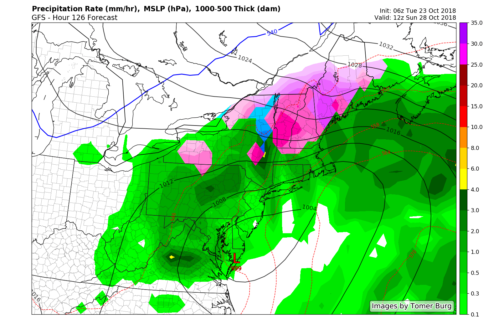
This may be particularly true in Northern New England, where precipitation could surge into parts of Vermont, New Hampshire, the Catskills and Maine as snow or mixed precipitation before changing over to rain. We’ll continue to closely monitor the potential for wintry precipitation on the front end of the storm as we draw closer.
All in all – a significant storm appears increasingly likely this weekend. For most, the end result will be a rainy weekend with the potential for gusty winds. Along the shores, the weather may be particularly bad, with coastal flooding and strong, gusty onshore winds. And in the interior, the potential exists for some wintry precipitation before a change to rain occurs.
Stay tuned for more details over the next few days!
As these storms become more frequent, make sure you are registered for our Consulting service. Don’t let the weather negatively affect your business any longer.
Trackbacks & Pingbacks
1islands
Leave a Reply
Want to join the discussion?Feel free to contribute!