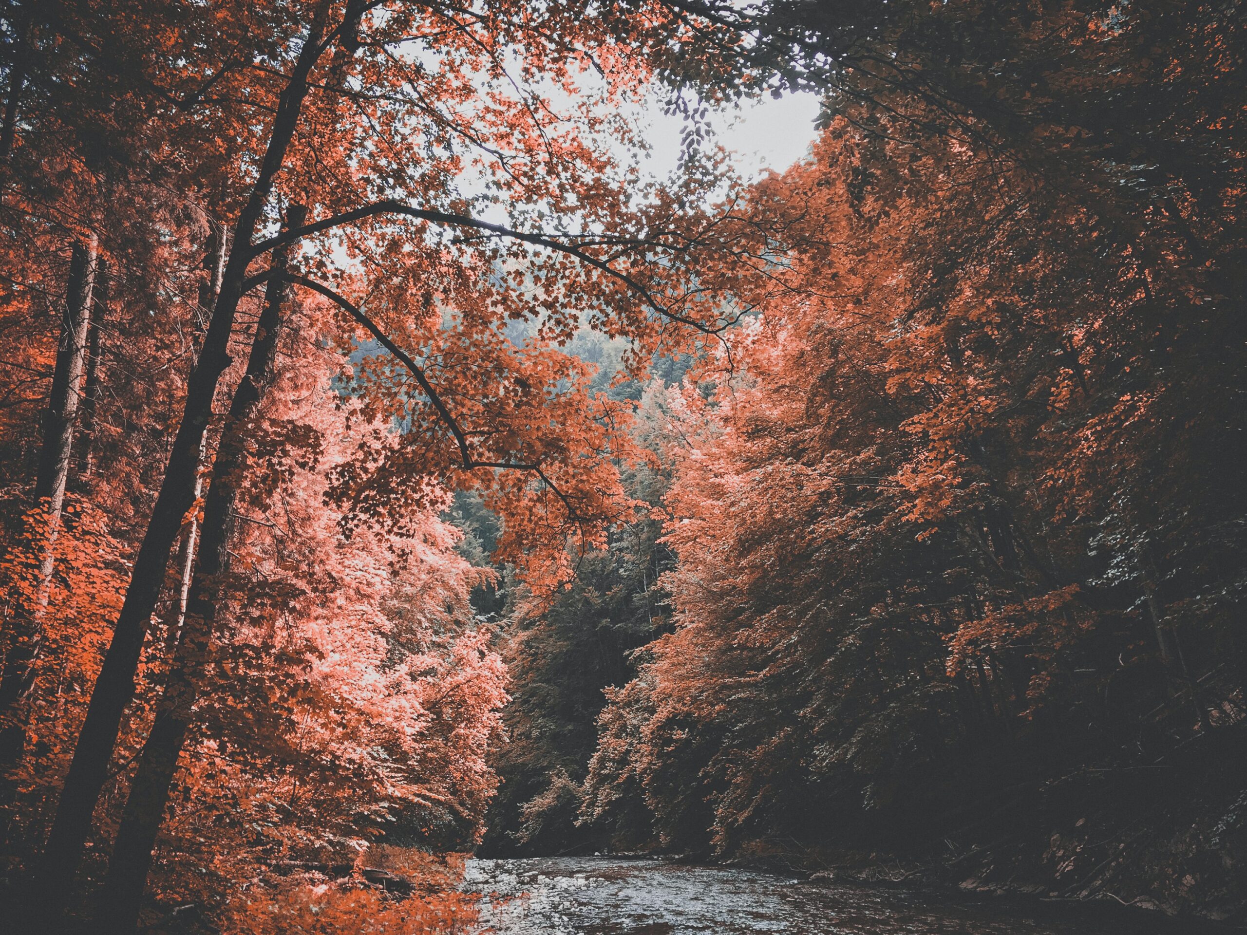
Fall Foliage 2020: What to expect in the Northeast and New England

Fall foliage is undoubtedly one of natures greatest displays. Each Autumn, the landscape is flooded with gorgeous color as trees prepare themselves for winter. In the Northeast states, the colors are a spectacle that is unanimously appreciated and respected. Hundreds of thousands of visitors flock to view the bursting colors in New England each year, and 2020 will be no different.

The weather, both during the growing season and fall foliage season itself, has a tremendous effect on fall foliage. The conditions which the trees and leaves endure during the Summer can have lasting effects on how the leaves appear in the Autumn. Similarly, conditions during the Autumn months can greatly impact how the trees behave.

Why do Autumn leaves change color in the first place?

The science behind trees and their leaves is fascinating, and at its most compelling during the Autumn months. One of the central processes at work is photosynthesis. Many trees and plants perform this process to generate food and energy necessary for cellular growth.

The process of photosynthesis requires a few key components: Energy from the sun, carbon dioxide, and water. Most notably for our consideration, the process takes place in many cells which contain chlorophyll, which aids the plant in producing glucose (a.k.a plant food). The chlorophyll cells are responsible for the leafs green appearance.

But chlorophyll naturally breaks down, and as Summer turns to Autumn the temperature and water balance changes. As days become shorter and the sunlight less intense, the production of chlorophyll eventually slows to a halt. Other compounds which always exist in the leaf – namely Carotenoids and Anthocyanins – begin to become dominant.

The Chemistry of Autumn Leaves. Image via Compound Interest.

These compounds are responsible for the vivid orange, red and yellow colors that burst to life in the Autumn months. In fact, each individual compound is responsible for a certain color! Flavonols are known for their yellow color and Beta-Carotene helps produce oranges, for example.

Eventually, as the Autumn months wear on, perennial plants and trees begin to drop their leaves. Other trees (pines, spruces, and firs) are evergreens throughout the Winter season. It is an incredible process to consider – by dropping leaves, trees are very literally preparing themselves for Winter. The trees close off the veins providing nutrients to the leaf, and eventually the individual leaves fall to the ground.

Once on the ground, leaves break down into the earth around the trees, providing nutrients to the ground and soil. These nutrients stay near the tree through the Winter months and well into the Spring and next growing season. The process continues year after year.

What should we expect from fall foliage in 2020?

The summer of 2020 was warm and relatively dry throughout New England. Precipitation numbers have crept upwards over the past few weeks, but 3-month departures are still solidly below normal. Drier weather can lead to faster changing and somewhat less vibrant autumn colors.

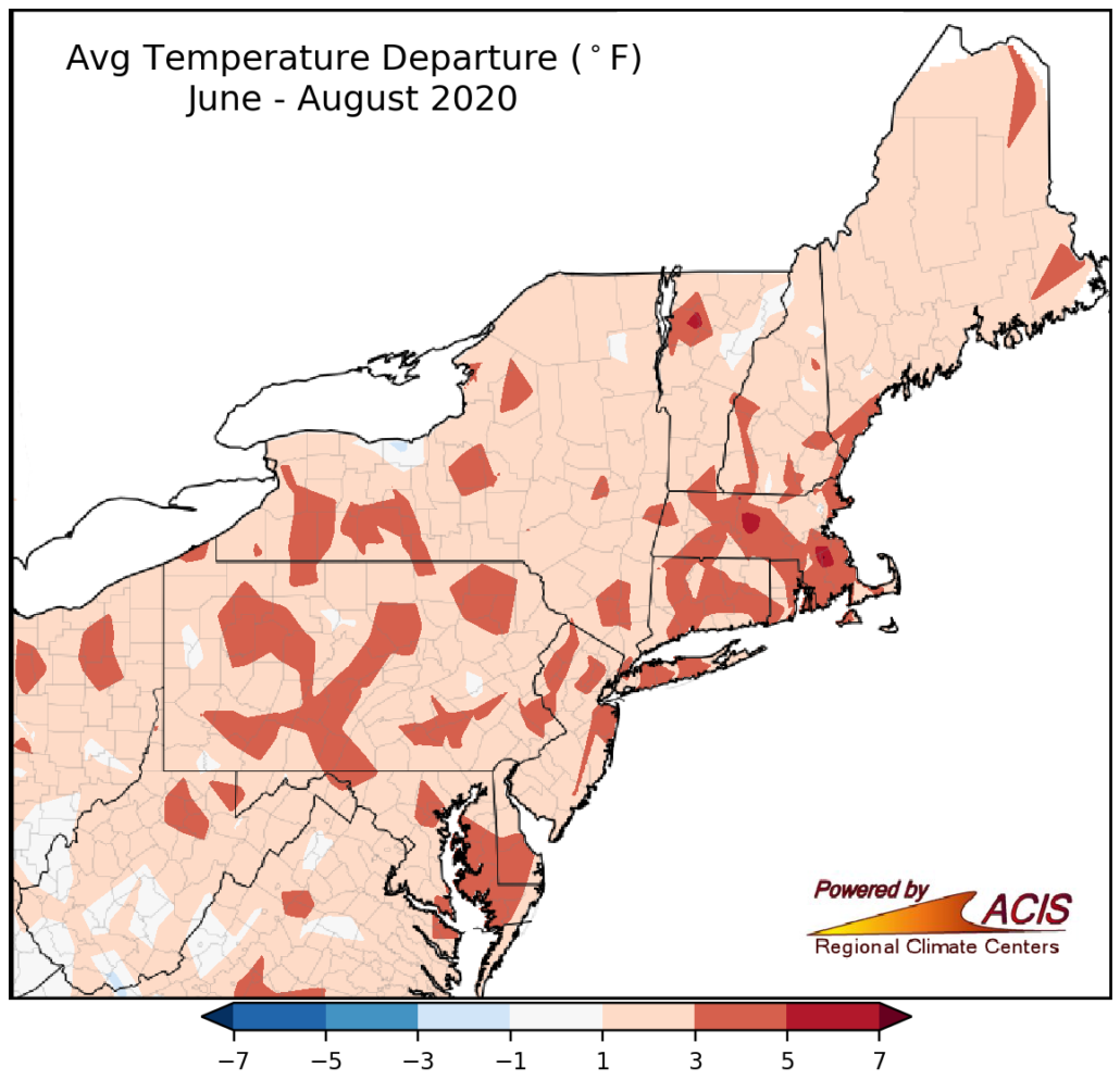
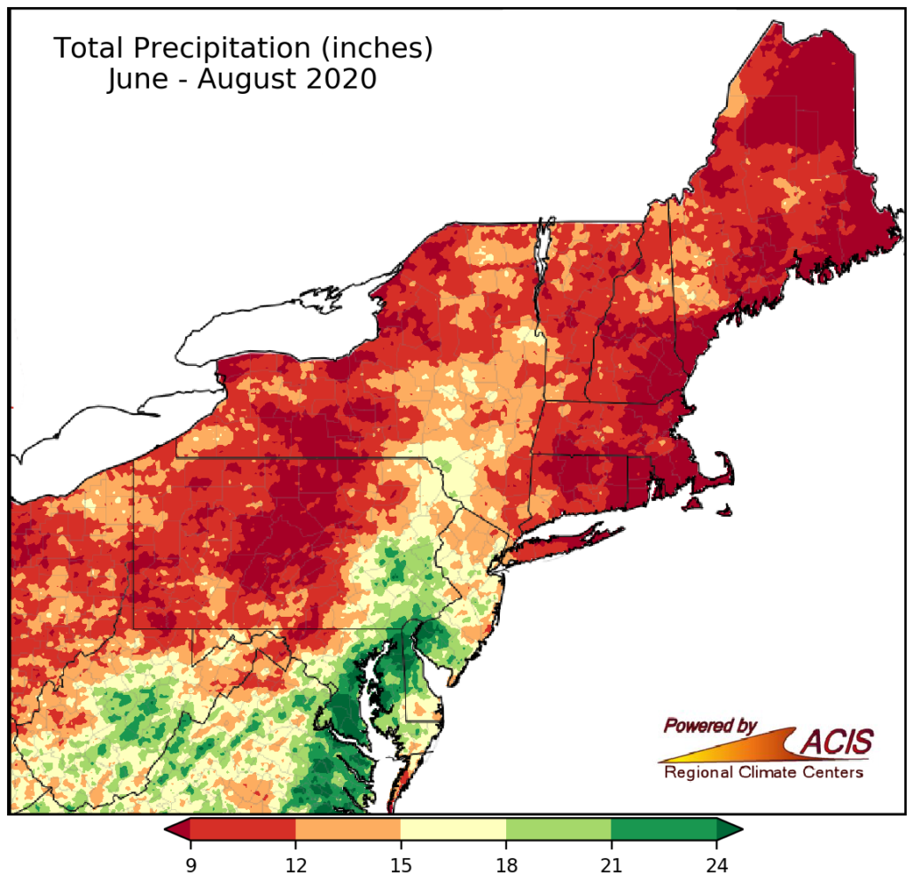
With that being said, the weather pattern is expected to remain warm and active over the next few weeks. This should lead to some recovery of dry 3-month averages throughout New England, and fall foliage may also trend more vibrant as a result.

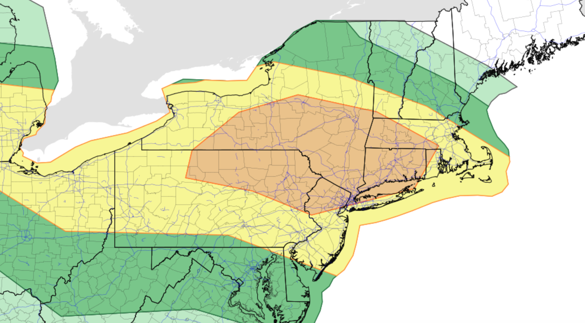
Fall foliage typically peaks during the last week of September and first week of October in New England, spreading from north to south. Peak foliage begins earlier in places like Maine, New Hampshire and Vermont and gradually moves southward into Pennsylvania, New York and New Jersey.

It remains to be seen exactly how the colors will emerge, but at this moment there is no reason to believe colors will be much earlier or much later than average. We’ll have further updates as we head through the next few weeks!

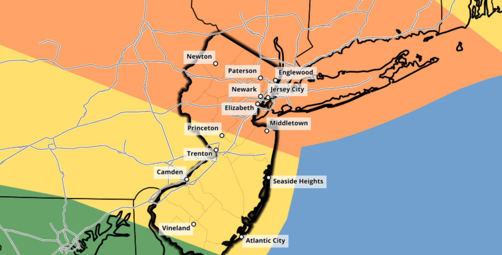
You can check out state-by-state current conditions by visiting this website.

Enhanced Risk for severe thunderstorms in the Northeast today

Briefing: Showers and thunderstorms will develop this afternoon throughout New England. The combination of ample atmospheric instability and strong shear will lead to severe thunderstorms. These storms will be capable of producing strong winds, large hail, and a few tornadoes.

Timing: Initial thunderstorm development will occur between 1pm and 2pm across the Central New York capital region. These storms will quickly progress south and east along a warm front, towards the Lower Hudson Valley. Storms will reach Western Connecticut by mid-afternoon. Additional development will occur in the Lower Hudson Valley, movieg toward Long Island during the late afternoon and early evening.

Hazards: Damaging winds and large hail are the main threats, but a few tornadoes cannot be ruled out. Dangerous lightning and torrential rain is also expected.

Technical: Complex setup this afternoon

Mesoscale analysis this morning shows a warm front pushing northward through New England, with a moist and unstable airmass trailing it across the Mid-Atlantic states. Moisture advection in the mid/low levels of the atmosphere is increasing behind this front and will continue to push towards Central New England as the morning goes on. Forecast model guidance has been bouncing back and forth with the positioning of the effective warm front later today. Most recent guidance has settled in on a position near the New York Capital region.

There are some showers and thunderstorms ongoing along the warm front this morning as well. These are expected to persist in parts of Northern and Eastern New England, keeping many of those areas stable throughout the late morning and early afternoon. Gradually, the Capital region of New York, Lower Hudson Valley, and parts of Western Connecticut and Massachusetts should see clearing skies and increasing instability today.

Later this morning, atmospheric disturbance will shift into New England from Southeast Canada. This disturbance is easily recognizable on most recent short term models and observations. Height falls and lift associated with this disturbance are expected to aid in the development of thunderstorms later today.

The atmosphere near and south of the warm front will be characterized by moderately unstable air and impressively strong deep layer wind shear. Forecast soundings suggest mixed layer CAPE values over 2000 j/kg in some locations, juxtaposed nicely with 40-60kts of effective bulk shear. Some curving of low level wind fields is also present.

What does all of this suggest? In a nutshell, we can expect the development of strong to severe thunderstorms by early afternoon – and they should have no problem becoming organized and severe quite quickly. Supercells are possible initially, especially in the Capital region of New York. These storms will be capable of all severe weather hazards including a few tornadoes, large hail, and strong winds.

That leads us to around 4pm. From that point forward, uncertainty increases quickly. It remains unclear exactly how organized storms will be, and whether or not bowing clusters or segments can organize. Veering wind profiles and shallow low level moisture on some forecast soundings in the warm sector suggest that while wind damage is possible, storms may tend to remain a bit unorganized once they pull southward off the warm front. This means that we could see outflow boundaries or gust fronts surging southward from storms themselves, ending the severe weather threat for areas to the south.

If storms do organize – and perhaps a cold pool can organize in one or more complexes of storms – then a more substantial/widespread damaging wind event would be possible. Otherwise, individual storms near the warm front will be capable of all severe hazards before outflow boundaries and gust fronts begin to stabilize the atmosphere near/south of the front later in the afternoon.

Forecast of focused severe weather potential today. Refer to the Storm Prediction center for official forecasts.

Overview and what to expect

The main focus area for severe weather potential remains relatively unchanged, and in fact has become a bit more clear since yesterday. This focused area of potential arcs from the Capital region of New York southeastward into the Lower Hudson Valley. It then continues into parts of Western Connecticut. Damaging winds, hail, and a few tornadoes are expected in this region.

Further south, the severe weather potential remains more unclear. The possibility exists that gust fronts and outflow boundaries (winds being pushed out from other storms) could stabilize the atmosphere in this region and negate a more substantial threat. Still, isolated to scattered damaging wind and hail is possible this afternoon.

The Storm Prediction Center maintains an Enhanced Risk of severe weather for much of the aforementioned region.

Stay weather aware throughout the entire highlighted threat region and have a way to get weather warnings. If a warning is issued for your area, know where to go in your home to be safe until the storm has passed.

Dangerous hurricane Laura quickly approaching TX/LA coasts

Hurricane Laura strengthened into a major Category 3 hurricane this morning, and the system is still strengthening as of early this afternoon. The National Hurricane Center forecasts the storm to make landfall as a powerful Category 4 hurricane from later tonight into Thursday morning. The storm will pose a significant threat to life and property along the Texas and Louisiana coasts.

Latest observations and trends

Hurricane Laura began rapidly strengthening last night, and has continued to do so this morning. Satellite data shows a powerful hurricane, with cold cloud tops marking intense convection and favorable outflow channels allowing the storm proper ventilation.

Airplane recon data collected from the most recent pass in the storm shows continued strengthening. Maximum sustained winds at both flight level and estimated at the surface have increased. The storms pressure is falling and cloud tops are warming as Laura tries to clear out an eye.

Secondary wind maxima slightly further away from the main eyewall suggested the possibility that the storm may eventually undergo an eyewall replacement cycle, but recent trends suggest that the wind field may simply just temporarily become larger. Concentric eyewall features have not yet been observed.

An eyewall replacement cycle occurs when convection develops outside the hurricanes eyewall and becomes more robust and organized – just enough so to remove some of the intensity of storms within the eyewall itself. The original eyewall then proceeds to collapse, and a new eyewall (usually a larger one) develops from the new thunderstorms.

Eyewall replacement cycles are relatively commonplace in strong hurricanes, but we don’t truly have a complete understanding of them yet. Sometimes, stronger hurricanes don’t undergo eyewall replacement cycles as frequently as we think they will – instead, stronger thunderstorms outside the eyewall simply merge into the original eye.

If an eyewall replacement cycle does take place with Laura over the next 12 hours or so, the structure of the storms core would slightly change. Intense winds within the eyewall would decrease ever so slightly (ex: from 130 to 120mph), but the radius of the strong wind field would expand. While eyewall replacement cycles often weaken the intensity of the most severe winds, they allow “still-severe” winds to expand outward from the storms center.

Eyewall replacement cycle breakdown (Zhang, Tau, 2016)

It remains to be seen if an eyewall replacement cycle will occur with Laura today. In reality, the storm may not have enough time to begin or complete one. But satellite trends and observations will be continually monitored as the storm continues to evolve through this evening.

More reading on eyewall replacement cycles is available here.

The forecast for Laura over the next several hours features continued strengthening. The National Hurricane Center expects the storm to reach Category 4 status before it makes landfall along the Texas or Louisiana coastline. There is some hope that strengthening southwesterly wind shear could at least disrupt the storm as it approaches the coast, but the storm is still expected to maintain wind speeds as high as 145 miles per hour as it reaches the coastline.

Significant threat to life and property as Laura makes landfall

Hurricane Laura is forecast by the National Hurricane Center to make landfall as a dangerous Category 4 hurricane. Maximum sustained winds over 135 miles per hour will be capable of producing widespread damage and destruction. In addition, catastrophic storm surge from 9 to 15 feet above ground is forecast along parts of the Texas and Louisiana coast – an additional threat to life and property.

From the National Hurricane Center: “Unsurvivable storm surge with large and destructive waves will cause catastrophic damage from Sea Rim State Park, TX to Intracoastal City, LA.”

As it stands this afternoon, the landfall location of Hurricane Laura appears likely to be somewhere between Port Arthur, TX and Lake Charles, LA.

Residents in the path of Laura are urged to follow the advice of local governments and heed evacuation warnings and requirements. If you are still in the area and live along the coast, it is too late to make hurricane preparations – now is the time to evacuate.

For the latest, we recommend heading to the National Hurricane Center website and reviewing their latest briefings.

NYC Forecast: Severe thunderstorms possible on Thursday

After a dry and cool day on Wednesday, an active weather pattern will return. Strong and severe thunderstorms are possible on Thursday. The Storm Prediction Center has highlighted the region in an Enhanced Risk for severe weather. Unsettled weather will persist into the weekend, with additional severe weather possible on Saturday.

Read more