-2")

Heavy rain, flooding possible from strong coastal storm early this week
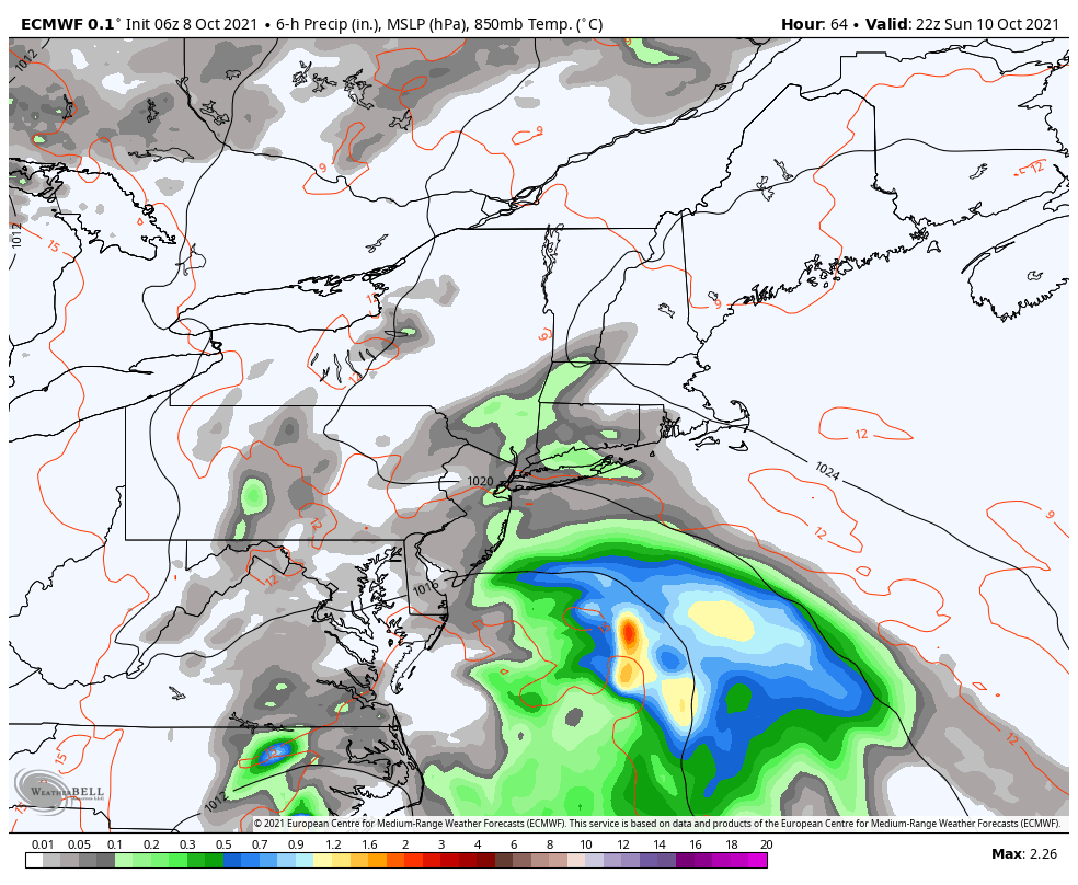
Forecast model guidance has come into better agreement this weekend on a pattern evolution that will aid in the development of a strong coastal storm early this week. The most recent model guidance suggests the possibility of widespread heavy rain, flooding, and blustery winds. The worst of the storm looks to impact NYC from late Monday Night into Tuesday.
While impacts from the storm are now highly likely, the exact details of how impactful the storm will be remain unclear. Bands of torrential rain are expected, but the exact track and intensity of the coastal storm will determine exactly where those bands set up.
How is the storm forming?
A strong mid level trough will drive southeastward into the Ohio Valley and Mid Atlantic states over the next two days. This trough and associated energy will eventually phase, or merge, with another disturbance which will be situated off the Mid-Atlantic Coast. As they phase, a strong low pressure system will develop.
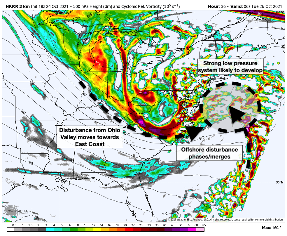
The phase of these two disturbances and the powerful low pressure system that form will also be accompanied by impressive jet dynamics. These powerful jet streaks aloft act to enhance precipitation. As moisture gets rapidly drawn into the system, the powerful jet dynamics will lead to the development of bands of torrential rainfall.
The expectation is that the low pressure system will rapidly strengthen off the Mid Atlantic coast, and then – depending on the exact details of the phase between the two disturbances – it could be tucked back towards the coast on Tuesday. If this were to occur, torrential rain and flooding would become likely in the NYC Metro.
What are the potential impacts and timing?
The most obvious anticipated impact from the coastal storm will be heavy rainfall and associated flooding. In addition, strong wind gusts will be possible, especially near the area shores.
Rain is expected on Monday morning as a warm front lifts north of the region. This is likely to be non-impactful from the standpoint of weather hazards, but is part of thee development of a larger storm system.
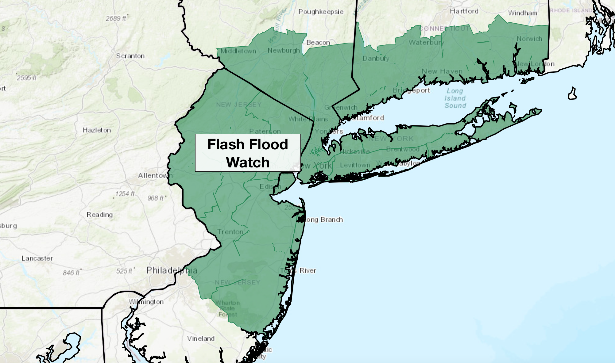
Heavier rainfall will return late Monday Night, after sunset, and will pick up in intensity through Tuesday morning. Torrential rainfall is possible on Tuesday morning and early afternoon. Flooding is a distinct possibility, and the NWS has issued a Flash Flood Watch for the entire NYC Metro as a result.
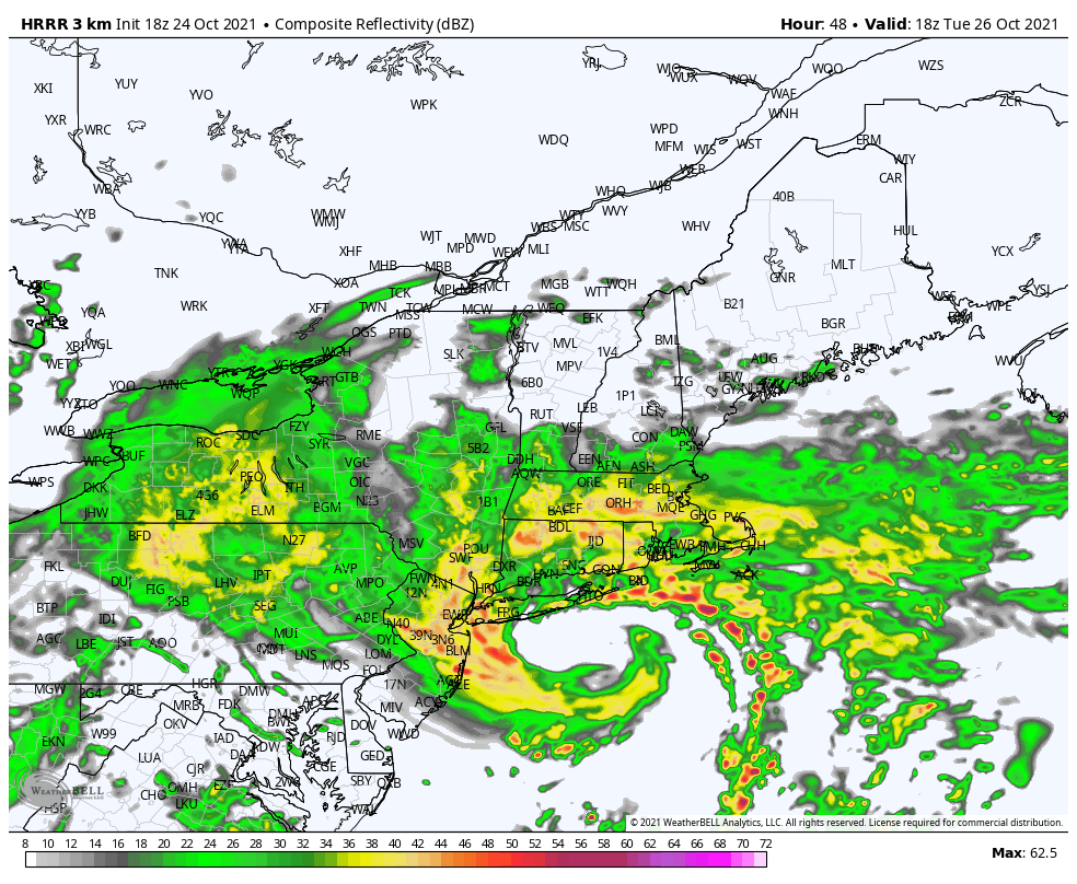
Strong, gusty winds will be possible on Tuesday as well – specifically on the NJ Coast and Long Island. Gusts over 40mph are likely, and the possibility exists for gusts over 50mph as well. Coastal flooding and some beach erosion will be distinctly possible.
Torrential rainfall will likely become more sporadic and rainfall rates will taper off by Wednesday morning. Blustery winds will continue, and the weather will remain damp as the storm exits the area.
What preparations should I take in advance of the storms arrival?
The most impactful threats from this storm are expected to be heavy rain and gusty winds. The best way to prepare for hazardous weather is to have a plan in place. That means knowing what to do if conditions go downhill in your area. If you live in a flood zone, have an action plan that you can quickly kick into action should flooding begin.
Never travel through flood waters, or attempt to pass through flood waters. We saw the deadly impacts that bad decisions can have when it comes to flooding as recently as a month and a half ago. Know how to keep your household safe from water especially if you live near a flood zone.
Coastal residents should also prepare for strong wind gusts. Bring in outdoor objects and tie down items that may be moved by winds outside. When winds increase in intensity, stay away from windows and stay in a sturdy room near the center of your house.
The majority of people in the NYC Metro Area will not be severely impacted by this storm. However, everyone should have a plan in place and know what to do if flooding or strong winds do occur where you are.
What kind of warnings may be issued during the storm?
There are sevreal different products that the National Weather Service issues to warn of impeding hazardous weather. Understanding how they work and what theye mean is critical.
Flash Flood Watch: A Flash Flood Watch means that flash flooding may occur during a specific time period (in this case, on Tuesday), but is not imminent. Take precautions and have a plan if flooding does occur (that’s what we are doing now).
Flash Flood Warning: A Flash Flood Warning is issued when a flash flood is imminent or occurring. If you are in a flood prone area move immediately to high ground.
Flash Flood Emergency: A Flash Flood Emergency means that a life-threatening flash flood is occurring. Immediately get to safety or safely evacuate the area.
That’s all for us this evening. We’ll have further updates on Monday morning as the storm system draws closer. For now, have a great Sunday evening.