
Much colder air on the way to NYC next week
A large ridge in Alaska and the development of a cross-polar flow will deliver the coldest air of the season (so far) to NYC next week.
Read more-2")
A large ridge in Alaska and the development of a cross-polar flow will deliver the coldest air of the season (so far) to NYC next week.
Read more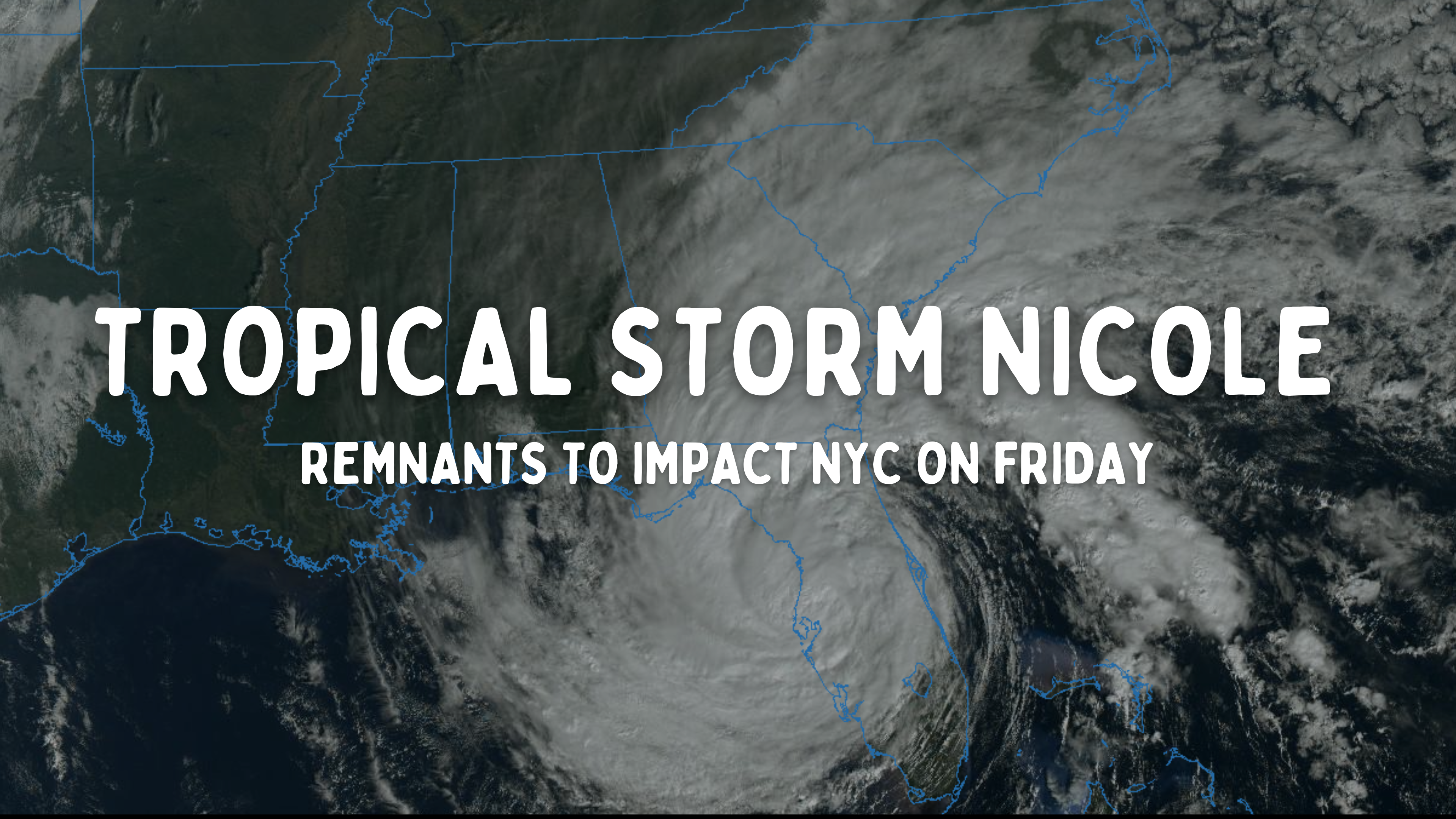
Tropical Storm Nicole was briefly a hurricane last night, but has since weakened upon making landfall in Florida. The storm is expected to continue tracking northwest before curving northward and moving into the Southeast United States later today and tonight.
The storm systems impacts are beginning to spread away from the center as the small tropical core unravels. Over the next several hours, rain and wind are forecast to spread northward from Florida towards the the Southeast United States and eventually the Mid Atlantic.
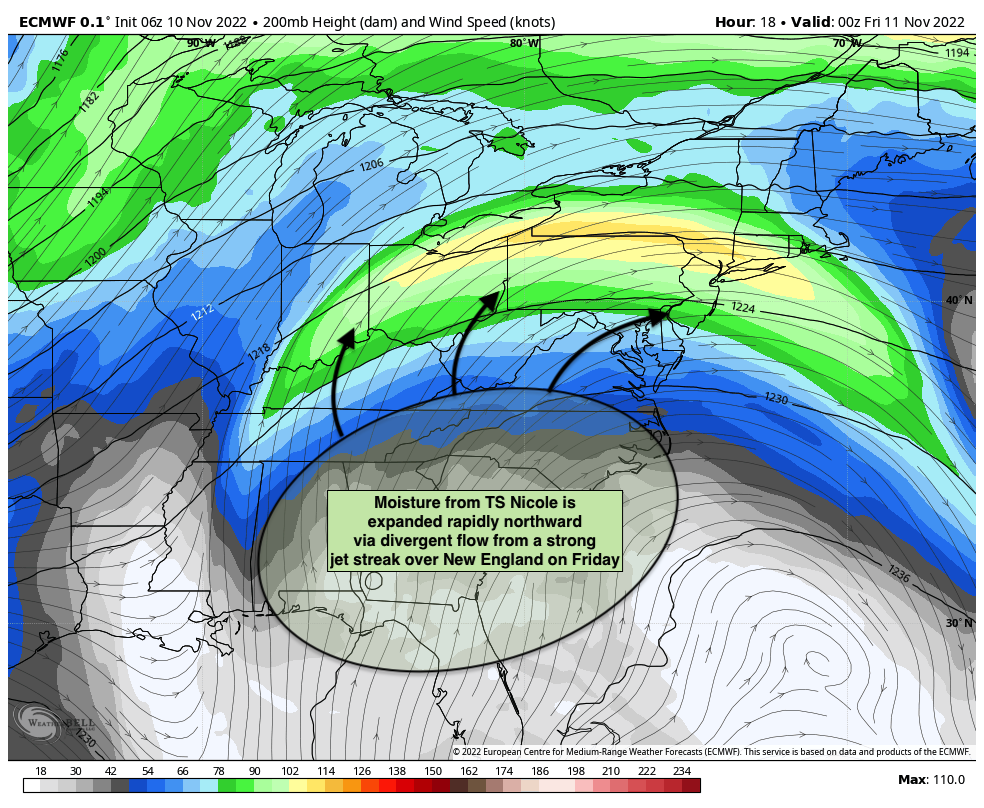
The systems northward expansion is getting a boost from a very impressive upper level jet streak. The expanding upper level jet adds to divergence and lift in the atmosphere which helps to rapidly expand precipitation several hundred miles away from the center of low pressure.
As a result, rain is forecast to quickly spread northward into the Mid Atlantic States tonight and towards the Northeast states on Friday morning. Periods of heavy rainfall will make their approach towards our area by the early morning hours on Friday.
One of the most impressive facets of this system will be the northward advection of anomalous tropical moisture. Model guidance suggests that precipitable water values (a measure of moisture depth in the atmospheric column) will approach or possibly exceed 400% of normal. This airmass is highly unusual for our part of the country during this time of year!
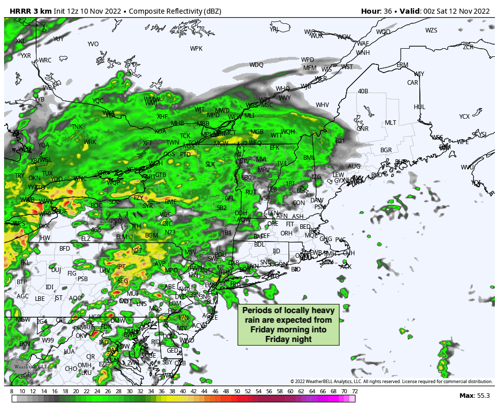
Needless to say, with plenty of lift in the atmosphere and anomalous tropical moisture present, the potential for heavy rainfall exists. Rainfall will be intermittent but could be heavy at any time from Friday morning through Friday night. A particularly heavy period of rainfall could occur Friday afternoon as a warm front approaches.
While the severe weather threat isn’t very high, it also is not zero. Model guidance has been hinting at the presence of some instability – which given the amount of wind shear and moisture in place could support some severe thunderstorms. The potential for an isolated tornado can’t be ruled out given the environment in place, so we’ll have to keep a close eye on that as Friday goes on.
In addition to rain and severe weather, we’ll also have a threat for strong wind gusts near the coast. With the remnant low pressure tracking inland, winds will turn southeasterly on Friday evening and Saturday morning. This is particularly concerning near the coast where an on shore flow could lead to both strong wind gusts and some localized coastal flooding. The strongest winds currently look to occur during the early morning hours on Saturday.
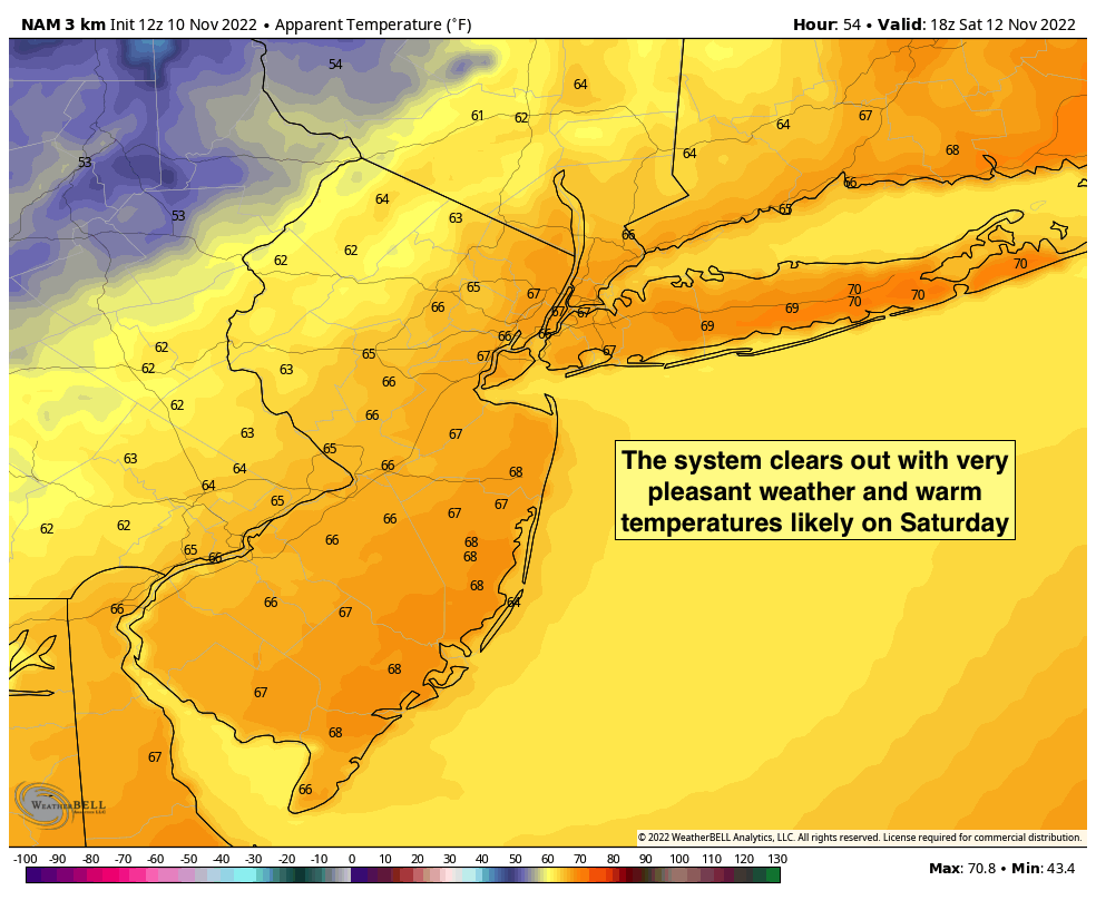
One last batch of heavy rain and strong wind gusts will swing through the early during the early morning hours on Saturday – likely between 3am and 5am. Once this passes, conditions will rapidly clear out and winds will flip to westerly. That will usher in much drier air and lead to a pleasant (but blustery) day on Saturday with highs in the 60’s and sunshine.
The last several weeks have featured abnormally warm conditions in the NYC Metro – and the entire Northeast US. The pattern across the Northern Hemisphere is changing, and we’ll start to see the effects of that as soon as next week.
The main culprit is a huge ridge of high pressure building along the western shores of North America, extending all the way up into Alaska and the Arctic. This ridge will dislodge cold air from the Arctic and force it southward, with deep cold bleeding into the United States.
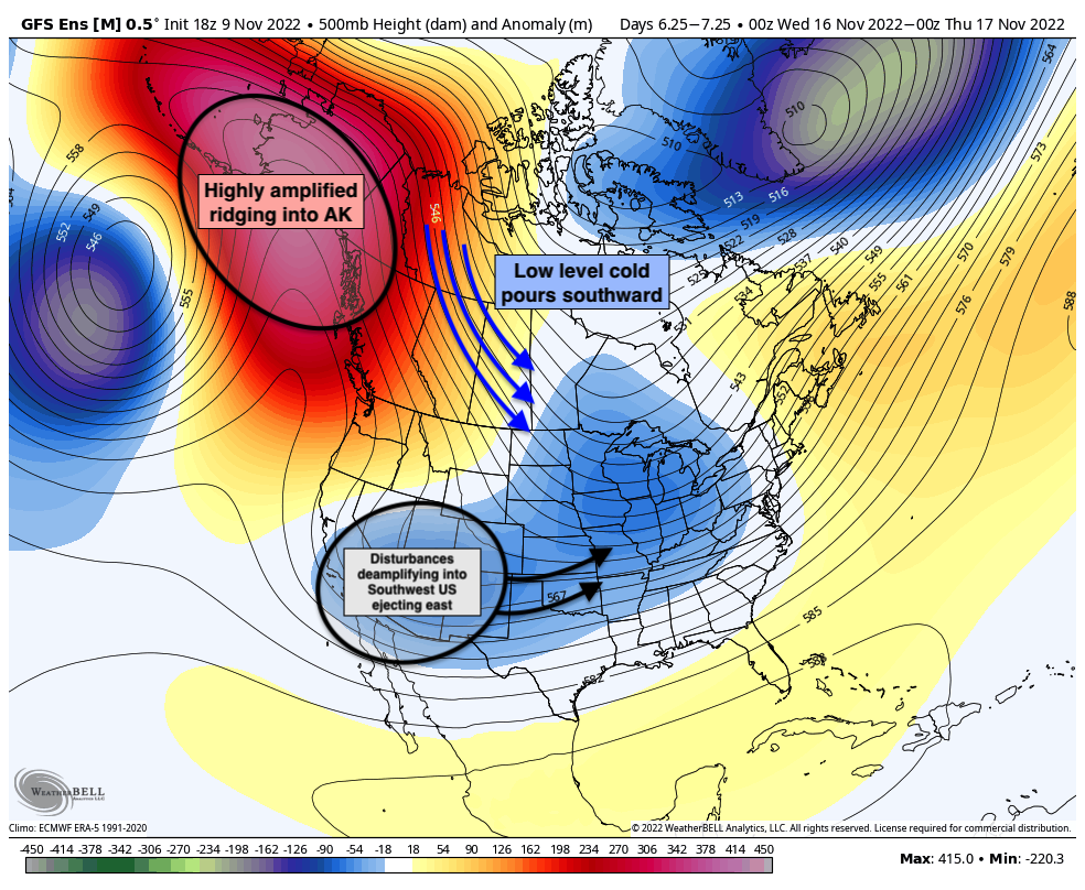
That cold air will reach our area next week, with temperatures falling several degrees below normal for this time of year. While it’s early, we also can’t completely rule out the possibility of some wintry weather in the interior from late next week into next weekend as an active storm track continues and plenty of cold air remains settled in to the area.
Fall is known as a season of volatility and change when it comes to the weather, and it will certainly live up to that in the next couple of weeks. Buckle up, kids!
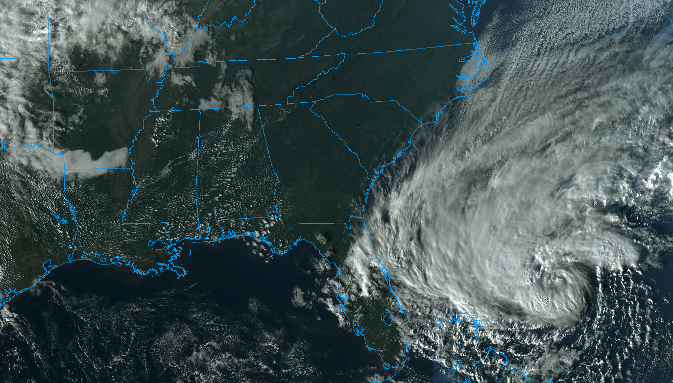
Tropical Storm Nicole formed earlier this morning in the Southwest Atlantic Ocean, and is expected to gradually strengthen as it moves towards Florida over the next few days. Moisture from the storm system will eventually be carried northwards towards the NYC Metro area late this week and weekend. Periods of heavy rain and gusty winds are possible from late Friday into Saturday.
Read more
Good morning, NYC!
Another gorgeous fall day is in progress with comfortable temperatures and low dew points. Clouds will begin to increase as the day goes on today, signaling the approach of a weak storm system from the west and southwest.
Read more