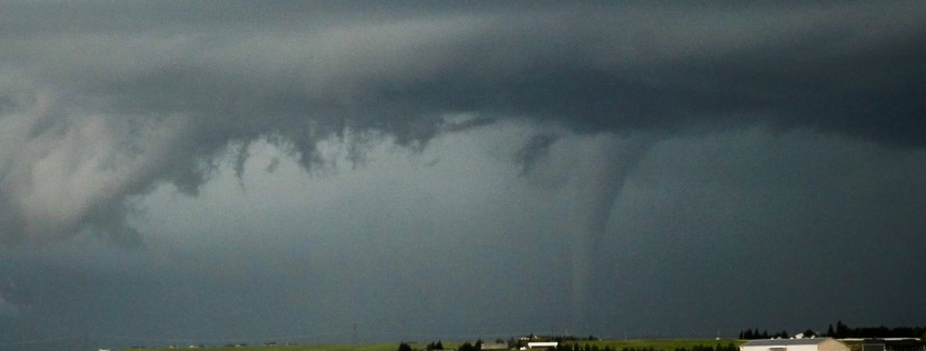
Cope, CO | 5/28/2018

It was fairly clear from the start that this day had the potential to be significant. Most short term forecast models were in good agreement on an area of favorability – with impressive kinematic and thermodynamic support in parts of Eastern Colorado. We had set up camp in Denver the night before (a really nice convenience), so the drive out for these storms was only going to take an hour or so.

The day began with some concerns regarding clearing in the warm sector. We were warm front chasing – and that’s always a bit of a nightmare. The low cloud deck was stubborn even as we drove east on I-70. Initially, we decided to set up just off the road in Seibert, CO. This gave us room to maneuver to the north or east as needed.
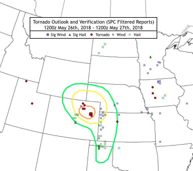
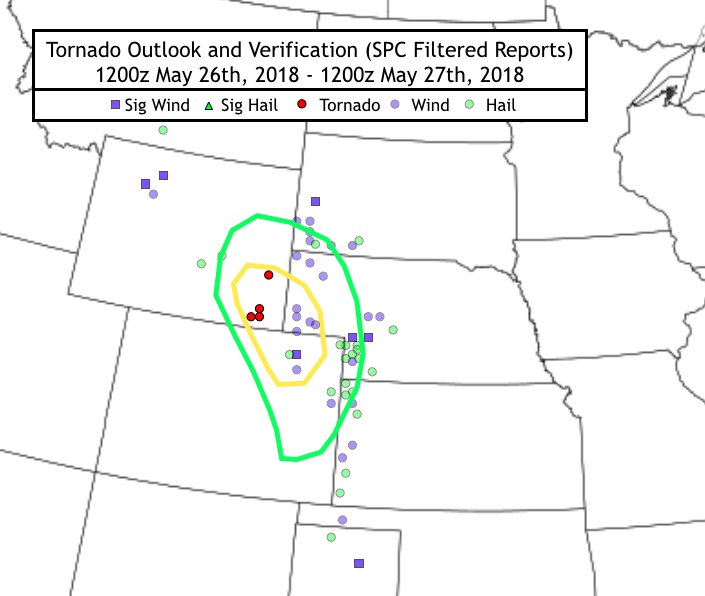
Our local target forecast from the morning of 5/28 (The dates are wrong on the top of the image) and verified storm reports.

Our initial target was solid – we met up with a few other chasers that were in a similar position. I-36 and I-70 run parallel to each other in Eastern Colorado, but there are very few paved roads in between (maybe one every mile or so). This meant we needed to plan our target and routes a bit more carefully. It became apparent as the lower level cloud deck began to clear that the boundary we were near was lifting northward.

We began to re-position further north and closer to I-36. This left us in a position somewhere equidistant between Cope and Seibert (our initial position). Initiation began along the boundary at this time, and with ample kinematics in play the storms quickly became severe and began rotating. Tornado warnings were issued fairly quickly.

Low level shear was very supportive of rotation but the overall intensity of the day was a bit capped by the mid level flow being quite weak. What we got instead was an explosion of landspouts and weak tornadoes. In fact, the NWS would go on to confirm over 7 landspouts and weak tornadoes in the area we were chasing. At some points there were 3 or more on the ground at once.
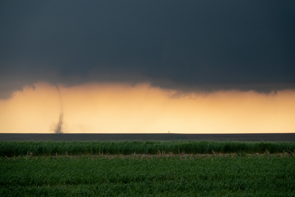
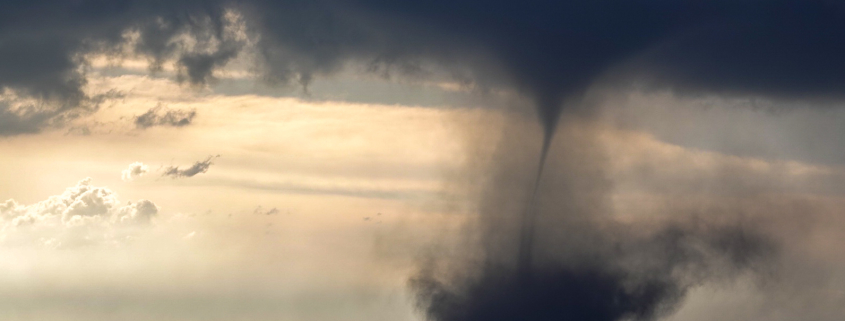
A landspout forms just west of Cope, Colorado (John Homenuk).

It was truly exhilarating and calming at the same time – we knew we were seeing something amazing, but we also knew the intensity of the tornadoes was somewhat capped (no violent tornadoes expected). The landspouts and tornadoes also were in a scarcely populated area, which is a chasers dream – no damage to property.

We chased these landspouts until they began to weaken and the boundary began to shift, allowing storm mode to change. Hail quickly became a problem and storms began to congeal – which meant it was time for us to get the heck out of there. That is exactly what we did, and our trip back to Denver was accompanied by a fantastic sunset.

Heck of a day.

Cheyenne, WY | 5/28/2018

This was a tough one. We began the day in Eastern Nebraska, and it wasn’t for a lack of effort. A few days earlier, we had set up camp in Minneapolis, expecting a relatively quiet weak and planning to take things day by day. The pattern was not truly conducive to tornadoes – as you probably already know, the 2018 season was insanely quiet, and our week was appearing to be no different.

Things would end up changing rather quickly. About 24 hours prior, while conducting standard analysis, it became clear that a small tornado threat would evolve in Eastern Wyoming and perhaps parts of Colorado on May 28th. With nothing to lose, we decided to leave Minneapolis the evening prior, which led us into Nebraska by the morning of May 28th.

[mapplic id=”32695″]

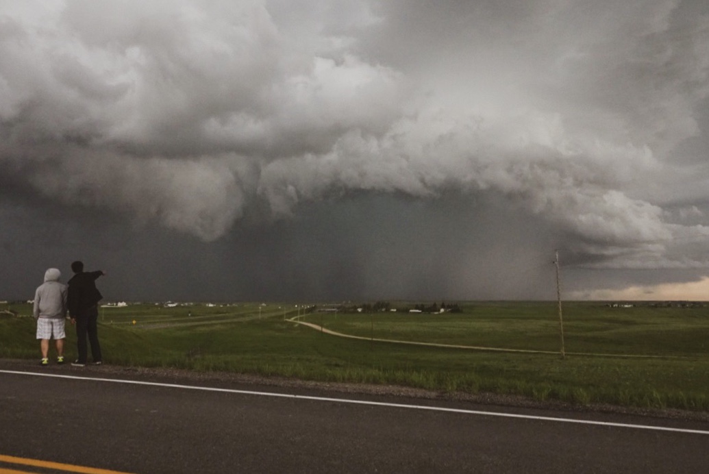
We were playing catch-up on this storm by the time it rolled off the higher terrain, but doing it well. The systems structure quickly became apparent and we knew we were in a good position. We did make an interesting decision to stay to the Southeast of the storm – which ended up obscuring our view quite a bit. The structure of the storm changed dramatically in very short periods of time, as it almost appeared to cycle a bit before turning into a full blown HP.

Still, we were able to view a very distinct and well formed tornado from the Southeast for about 5 minutes. This ended up verifying as an EF-1 tornado, and a few other chasers who approached it from the opposite angle  were able to get a much better view. After several minutes we were greeted by a beautiful rotating HP core, followed by 50-60mph wind gusts. They were chilly wind gusts too, with air flowing in right off the mountains.

Our forecast from May 27th – with severe weather reports overlayed

We were able to escape the large hail and get a (relatively distant) view of a tornado. Not bad for the first chase day of our trip! As mentioned, we also were fortunate enough to view a very impressive rotating supercell with high precipitation characteristics.

There was very large hail reported here, so we were glad to be standing relatively far away from it. This was one of the main reasons we chose the eastern side of the system.

May 2018 Recap

We have a long way to go to detail and document our May 2018 chases, and to be completely honest, we’ve been busy – on the road, working, processing all of our photos and videos. But tonight, I wanted to put together a bit of a retrospective for the past month. We started Gravel & Grace just over a month ago, and already the response has been overwhelmingly positive. All different types of people have reached out to us to support what we are trying to organize.

Read more

Day 2: Chasing Reverie

Okay, lets just start by saying this about yesterday: WHAT A DAY! After much deliberation and thought, we made the decision to chase in Southeastern Wyoming. There were many factors (logistics, landscape, meteorology, etc) but we were comfortable with our decision throughout the majority of the day. Until an isolated supercell formed in Colorado and produced a wall cloud. I would be lying if I said I didn’t consider shooting south to catch this discrete storm.

In chaser lore, this would have been known as the “decoy storm”. And it was. The updraft that had been rooted near an upslope boundary in Wyoming began to strengthen again as inflow into the storm system increased. We positioned ourselves just to the east/southeast of the storm and began observing increasing rotation. Just around that time, the storm itself separated from the upslope and began shifting east – it was now on its own.

Read more