One year ago today: A storm chase to remember

Last spring, between May 22-30, a few of my storm chasing buddies and I went storm chasing in the Great Plains. Exactly one year ago today, we saw an EF4 wedge tornado in Bennington, Kansas. The sights we saw last year were unbelievable, and I figured I would share some of my favorite shots from last year’s trip. All of the photos posted are from myself and Jenny Kafka. For more of Jenny’s photos, you can visit jennykafta.com.

May 25, 2013 — South Dakota.

May 25, 2014. (Doug Simonian)

May 25, 2013. (Doug Simonian)

May 25, 2013. (Doug Simonian)

May 25, 2013. (Doug Simonian)

May 25, 2013. (Jenny Kafka) For more of Jenny's photos, you can visit jennykafka.com.

May 25, 2013. (Jenny Kafka) For more of Jenny’s photos, you can visit jennykafta.com

May 25, 2013. (Jenny Kafka)

May 25, 2013. (Jenny Kafka)

Read more

Scattered showers and thunderstorms this afternoon, beautiful and warm Sunday through Tuesday

As many of us look for outdoor activities during Memorial Day Weekend, the weather forecast becomes a bit more important. Fortunately, for the most part, this weekend looks great.

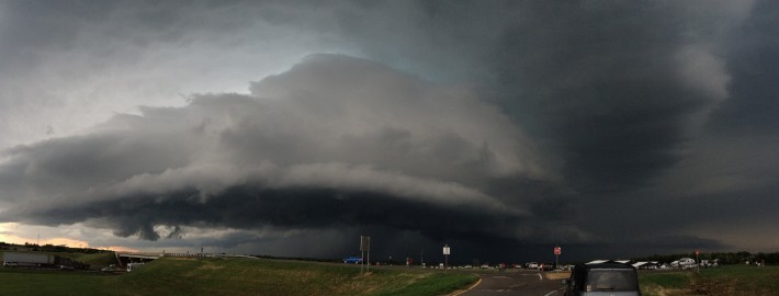
We do have to get through a chance of showers and thunderstorms this afternoon first, however. Similar to yesterday, there is still plenty of instability in the atmosphere, some moisture at the surface, but drying in the mid-levels of the atmosphere. There is also very little in the way of wind shear, which although can prevent storms from becoming too strong, it also makes them slow to move, and trains them over the same areas. Thus, the threat later this afternoon is for pulsing thunderstorms with the potential for flash flooding and small hail, but not much in the way of strong winds.

fgdgdfgdfg

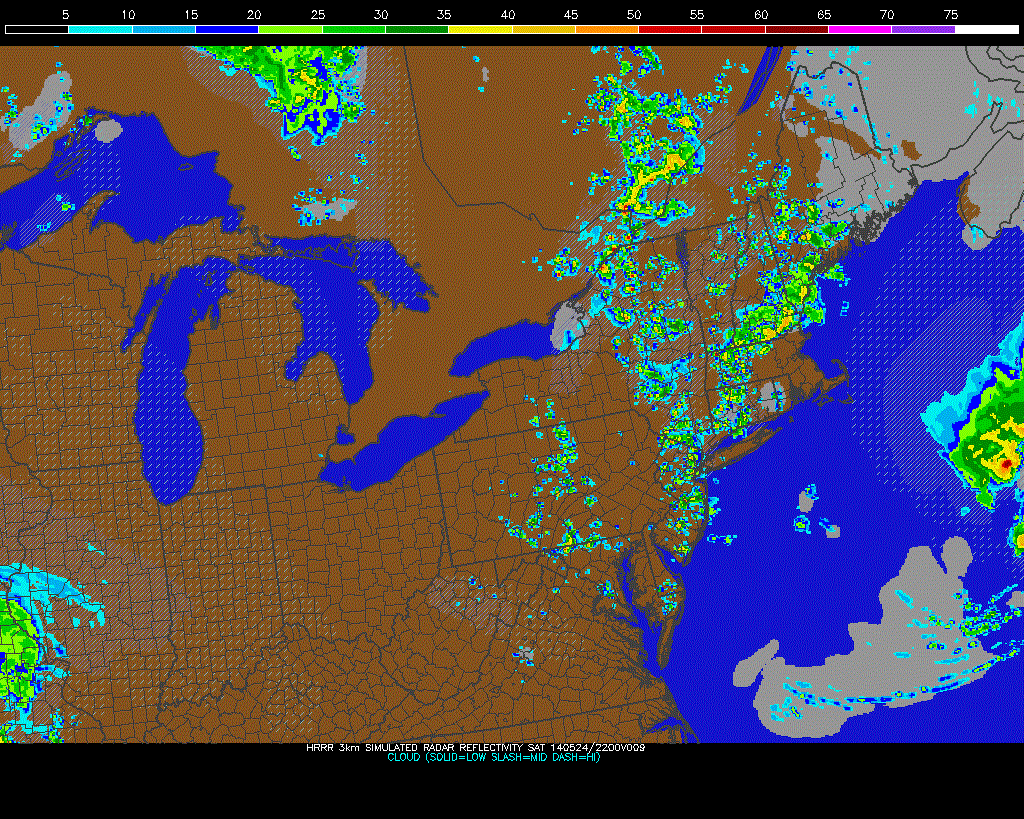
Today’s HRRR model shows scattered showers and thunderstorms in the area developing later this afternoon (PSU E-Wall).

Most models target the NE NJ area, NYC, and SW CT, though other areas are at risk, too. Fortunately, not all of us will get these storms, but it might be a good idea to have umbrellas, just in-case. This afternoon should be a similar, but slightly lesser version of yesterday afternoon.

Moving forward to the rest of the weekend is when the weather looks great. The upper-level troughing will finally move out, and bring in ridging and a deep westerly flow. Deep westerly flow in the presence of a ridge is often some of our warmest setups, as winds flowing from an already warm source are able to downslope as they head towards our area, leading to further warming. Plus, westerly winds can somewhat mitigate sea-breezes.

gfdgdfgdfgd

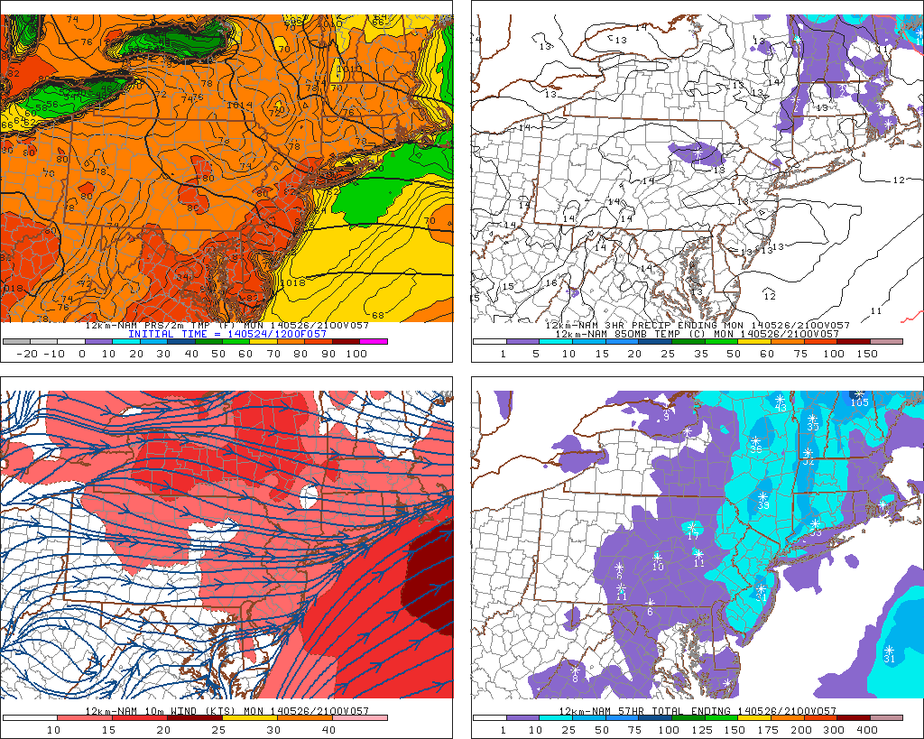
Today’s NAM model valid for Memorial Day shows widespread 80s for the entire region, even down by the shore (PSU E-Wall).

Sunday should generally expect sunny conditions with highs around 80 or in the low 80s, with light westerly winds. There is the slight risk of an afternoon shower, but nothing like what we saw yesterday.

Memorial Day should have wall-to-wall sunshine with temperatures in the mid and perhaps even upper 80s in some locations, with westerly winds as well.

Tuesday has the potential to be the warmest of all three days, but there may be a backdoor front approaching. We will most likely remain on the warm side of the front, but an increase in clouds could keep things a tad cooler. Regardless, Tuesday could still hit 80 degrees, and if the clouds hold off, mid to upper 80s are possible once again. The chance of an afternoon shower or thunderstorm exists as the front approaches. This will cool things off a tad once we hit Wednesday.

Along the shore, there will be a bit of a sea breeze developing due to daytime heating, but the westerly winds will act to fight it off somewhat. Thus, temperatures may be a few degrees cooler at times, but generally it will not feel much cooler than inland areas.

EF3 Tornado Confirmed in Duanesburg, NY on Thursday: This town is located about 10 miles northwest of Albany, NY, and a damage survey taken by the National Weather Service indicated EF3 damage, as a house was nearly completely destroyed. More information from the survey can be found here.

In case you are wondering how rare of an event this is, we took a look at data from the National Climatic Data Center, and it showed that in the 20-year period from 1991-2010, there is an annual average of 0.2 EF3 – EF5 tornadoes in New York. This means that a tornado of this strength occurred about once every five years in that period. In other words, although Thursday’s event was certainly an anomalous weather event, and quite impressive to say the least, it has fit the bill of climatology in the past twenty five years.


Major meteor shower possible tonight: Things to know

A few days ago, we detailed the upcoming Camelopardalid meteor shower. The day (and night) is finally here! With the new, potentially major meteor shower peaking Friday Night into Saturday morning, there are still many questions to be answered. We do our best to answer them, provide additional information, and inject our weather knowledge into the potential amazing celestial event — to try and forecast whether or not our area will be able to view it.

The Basics

The new meteor shower was discovered and timed by scientists last year — and was known to be possible before that. It is occurring, as most meteor showers do, as the Earth passes hrough the debris path of a comet. For instance, Earth has been passing through Comet Swift-Tuttle debris to create the Perseid meteor shower for thousands of years.This time, it’s Comet 209P/LINEAR which is causing the meteor shower — and Earth has never crossed paths with its debris before. When Earth passes through the debris fields of comets, the bunches of rock (of varying density) crash through the Earth’s atmosphere, burning up as they do so and creating an amazing spectacle known as shooting stars, or meteors.

Accordingly, on the night of Friday May 23rd into Saturday May 24th, scientists have been able to pinpoint the interaction between Earth and Comet 209P/LINEAR’s debris field. The debris field just so happens to be quite dense, and this has scientists wondering if the meteor shower just may reach “storm level” — or at the very least provide a very strong meteor shower.

Read more

Beautiful this afternoon, thunderstorms midweek, delightful Memorial Day weekend

This afternoon and tonight: The large upper level cold pool which triggered clouds on Sunday and Monday afternoons has scooted out to sea, allowing a ridge to build in. This has resulted in warmer temperatures, and will also preclude any significant cloud formation. The rest of this afternoon looks great, with temperatures in the upper 70s and sunny skies. Continued downsloping westerly and northwesterly winds will prevent any seabreeze from forming, so an evening trip to the beach should be a great idea. There will be a few moderate breezes from time-to-time, but nothing that would ruin going outdoors or going for a walk on a beach boardwalk.

Moving forward to tonight is when the weather will start to change, as a shortwave and area of vorticity will be running along the top of the ridge and head towards us from the north and west. This will allow for an increase in clouds tonight, keeping our low temperatures a bit warmer — generally in the upper 50s. Any rain, however, should hold off until tomorrow, and perhaps even as late as tomorrow afternoon.  Read more