This week’s outlook: Pleasant start, unsettled middle and end

After plenty of rain on Friday, a cold front crossed the region, drying our weather and leading to a pleasant weekend. This trend is expected to continue through Tuesday, but conditions will start to deteriorate on Wednesday.

The two main features dominating our weather pattern currently are a surface high pressure just to our west, and an upper level cold pool over New England.

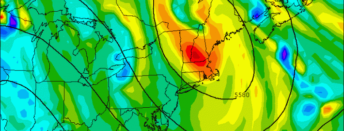
When the cold front crossed the region, a surface high pressure system built in, as is typical behind a cold front, leading to plenty of sunshine. This sunshine heats the ground quite efficiently. However, the passage of the cold front was also associated with a large upper level cold pool of air. The featured image above this post shows Monday’s NAM at 500mb valid for 2:00pm this afternoon shows a closed contour/trough of lower heights (cold air) centered directly over New England. This will help to generate cold temperatures in the middle and upper portions of the atmosphere, leading to instability (weather.cod.edu)


This cold pool does two things: it reinforces westerly and northwesterly winds behind it, which generates a downsloping flow, helping to warm our daytime temperatures to just below average, despite the chilly airmass and chilly nights behind the cold front. While this downsloping flow initially also helps to provide a lot of sunshine, the fact that we now have sun heating the ground beneath very cold upper level temperatures generates plenty of atmospheric instability, allowing air to rise quickly, generating clouds. This is called self-destructive sunshine — the sun heating the ground generates the warmth at the ground and the instability to generate clouds — this is typical when we are under the influence of an upper level cold pool, and explains why at times we had plenty of dark, cumulus clouds on Sunday afternoon, after an initially clear sky.

Monday’s weather: This cold pool will actually be a bit stronger than it was on Sunday, as the 500mb heights show a closed off contour, whereas on Sunday, it was still an open trough. Thus, although Monday’s weather should be very similar to Sunday’s in that the day will start off beautiful, but have an increase in cumulus clouds during the afternoon, the cumulus clouds may actually result in a few scattered showers this time around. The showers should be light and isolated in nature, however, so an umbrella should still not be needed.

Regardless, high temperatures should be in the upper 60s to lower 70s — even at area beaches since the downsloping westerly and northwesterly winds will block any seabreezes. Winds may pick up during the afternoon, however, being sustained at 10mph with some gusts to 20mph, because of strong atmospheric mixing that occurs when we have unstable conditions — the stronger winds from just above the ground can “mix” with the surface, generating stronger winds.

Moving forward to tonight and Tuesday: the upper level cold pool will slowly move out to sea, helping temperatures warm a tad.  Read more

Foggy Friday followed by heavy rain Friday night

A slow-moving cold front, along with a weak warm front that crossed the region on Thursday, will combine to create interesting changes to our weather — namely the potential for heavy rain on Friday afternoon. The warm frontal passage brought the introduction of a warmer, moist airmass — increasing dew points and precipitable water values. As the cold front shifts toward the area during mid-day on Friday, lifting in the atmosphere will gradually increase which will help to generate heavy rain and even the chance of a thunderstorm come Friday Night.

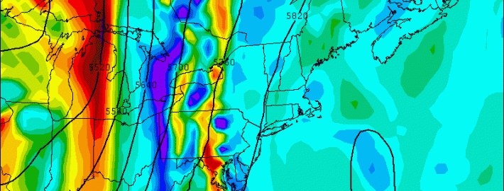
A large ridge in the Western Atlantic will act to provide plenty of clockwise flow increasing our warmth and moisture. Additionally, to the west, we have a potent trough and associated cold front with plenty of lift. The large ridge is what initially makes the front slow to move eastward, prolonging our fetch of moisture. This is a weather pattern we had often during the beginning of last summer, which is why we had such humid conditions. The initial slower movement of the cold front will keep the heaviest rain to the west of our area during the morning on Friday — but a slow shift eastward is expected.  Read more

Unsettled trend brings heavy rain, cold front

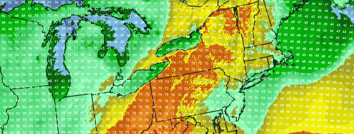
The backdoor cold front which we discussed a few days ago lived up to expectations throughout the area this week. Although not exciting by any means, the front brought cooler air and more clouds as it was expected to — essentially ending the brief period of warmth which saw temperatures on Monday reach into the mid 80’s. The east winds off cooler ocean waters are expected to keep temperatures in the 50’s and 60’s on Wednesday. Additionally, some low level moisture could lead to drizzle in many places, adding to the damp and dreary feel already in the air.

As a storm system approaches our area from the west later this week, the backdoor front will begin to lose some of its grip on the area’s weather. But the damage will have already been done in terms of spoiling what otherwise would’ve been a glorious period of warmth. Thursday looks likely to feature warmer temperatures in the 60’s and 70’s, but a continued trend of unsettled weather including clouds and some showers thanks to a southeasterly wind direction.

Read more

Warm, but unsettled weather this week

Often, meteorologists pay close attention to the progression of the pattern very early in the Spring season. Although not backed by any statical research, it is often found that the patterns and trends in regards to frontal boundaries and airmass progression early in the Spring season can foreshadow how those very same boundaries will behave later in the season. This year has been no exception.

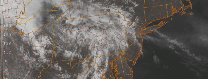
Early this Spring, warm fronts struggled to move northward from the Mid Atlantic, yielding instead to the cooler ocean waters and troughiness to our north and east. This very same thing occurred this past weekend, as warm front struggled northward from the Washington, DC area. Additionally, backdoor cold fronts have had plenty of push towards our area from New England — with marine air overtaking the pattern. This very same thing will occur on Tuesday, temporarily pushing out the warm airmass in place on Monday.

Read more