Long range pattern changes largely dependent on the Pacific

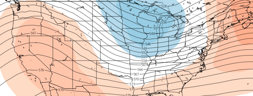
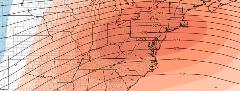
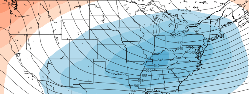
“Consistently inconsistent”. We’ve used the phrase a few times in our products over the past few days, and there’s good reason for that: The weather pattern over the past two months has struggled to find any sort of rhythm. Typical of weak La Nina conditions, the hemispheric weather pattern continues to undergo fluctuations, with transitions from warmer to colder patterns occurring every 10 to 15 days. The warmer patterns have the edge so far this year in terms of anomalies throughout much of the Northeast US.

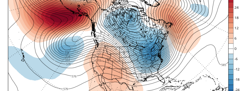
An analysis of the hemispheric pattern “Scorecard” so far this year will bring you to one simple conclusion: The pattern in the Pacific Ocean has, by and large, been the driving force behind the weather observed here in the Northeast US. For some, it’s still hard to comprehend how the weather pattern thousands of miles to our west, in a seemingly harmless part of the world, can have such an impact. But when considering the atmospheres wave pattern, it becomes easier to understand. What happens downstream, to our west, affects the waves and wavelengths that transpire further east.

Read more

The return of cold and unreliability of forecast models

So far this month, Central Park is running two degrees below average as a result of an impressive North Pacific wave-breaking event that shifted the cold from Siberia into North America and the US. The cold has since generally retreated northward as a result of an expanding Pacific Jet that collapsed the ridge in Alaska and brought a Pacific airmass into the US. Additionally, the stratospheric Polar Vortex strengthened again, which further bottles cold air northward. However, these Pacific wave-breaking events tend to repeat themselves, especially when it’s already been established that there is a wave-train of ridges and troughs in the Pacific rather than a purely zonal flow. And while the cold air is bottled northward, it is still on our side of the globe, so any shift back to cold can theoretically occur quicker.

Starting around late next week, we’ll see the first in a series of wave-breaking ridges enter the North Pacific as the Pacific Jet retracts and slows down. This will allow the “train” to come to a halt and thus allow this ridge to build somewhat poleward, while the wave train to the west continues. However, there is still not enough to necessarily sustain this ridge, especially considering the extremely low heights from the Polar Vortex. This is when we will need more atmospheric “help” via a jolt to the Polar Vortex from both Scandinavia and another wave-breaking event in the Pacific on the heels of the first one. This should occur in early January and help to sustain -EPO ridging. The video below explains this process.

Read more

How long will Winter’s hiatus last? Look to the Pacific

Before the warmth has even arrived, signals of a changing weather pattern have begun once again. This is, honestly, par for the course in the hemispheric pattern that we have been locked into over the past several months. The progressive nature of the pattern itself has not allowed any particular regime to become stagnant. In other words, the pattern is changing quite consistently, and no overly cold or overly warm regime has become established locally.

While this idea fits within our overall winter forecast, there is something to be said for emerging signals of a return to a colder, more active pattern before a warmer pattern has already begun. Lets not get confused, though — the warmer than normal pattern is still on the way. In fact, temperatures are likely to average above seasonal normals in the Northeast US for quite some time from late this week through Christmas and into the first week of January.

Read more

Southeast ridge will flex its muscles late month

All things considered, after much conversation and discussion, meteorological winter came in cold and active during the month of December. Multiple shots of arctic air and several winter weather events, particularly in the interior, have given us a December much different than the past few years, when warm air dominated the Eastern United States’ weather pattern. That very same cold and active pattern looks likely to take a hiatus over the next few weeks.

The hemispheric pattern is undergoing changes once again — this time, pulling back the reigns on an active, amplified pattern which saw polar air drop into New England last week. This time, the stratospheric polar vortex will tighten and strengthen near the North Pole, pulling back much of the arctic air and reforming the vortex near its usual whereabouts. For much of the Northeast US, this means that arctic air will gradually become less available over the next two weeks.

Read more