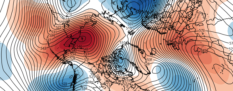
Aleutian ridge, cross polar flow will lead to more wintry pattern

A pattern change discussed for several weeks is already underway, and will kick into high gear over the next several days. A much discussed ridge over Alaska will build northward later this week towards the North Pole. We call this a “poleward reaching” ridge — effectively named — as it develops towards the Arctic and polar regions from the North Pacific and Alaska. This is important for several reasons; but mainly because it helps to dislodge cold air which is typically bottled up in the arctic regions.

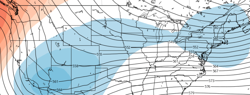
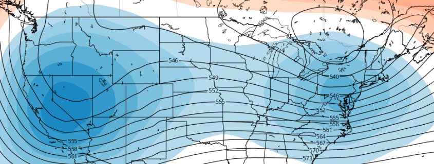
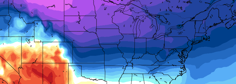
The ridge north of Alaska will continue to build this weekend into early next week — a very anomalous feature, even globally — and cold air will surge southward on its east end into the West and Central United States. This very same cold will eventually seep eastwards towards the Ohio Valley and East Coast. It won’t come all at once, in fact it likely will be in multiple rounds, but the cold will be anomalous.

Read more

The importance of a cross polar flow and Aleutian ridge in December

Multiple ensemble guidance indicate a major pattern change over the Pacific region. A ridge will builds near Aleutians then poleward into the Bering Strait and the Artic Ocean next week. This will cause cross-polar flow to finally setup over the North America.  All the anomalous cold air that is has been over much of Eurasia for the last several weeks with finally see an open gateway into North America. Temperatures departures are forecast to between 10 to 20 below average over parts of the Rockies and Northern and Central Plains over next weeks.

Read more

What the stratosphere and tropical Pacific can tell us about December

For the better part of the last three weeks, our forecasters have been discussing and monitoring the potential for a pattern change throughout the hemisphere. Medium range model guidance has often been gung-ho with the pattern changing within 7 days. As is often the case, forecast models were too quick to change the pattern. Much of this has to do with poor forecasting of the stratosphere and tropical Pacific ocean. Not coincidentally, these two features can give us clues as to where the pattern is heading in the weeks ahead.

As it stands this afternoon, model guidance and ensembles are in good agreement that a -NAO (North Atlantic Oscillation) pattern will develop over the next two weeks. This pattern is often defined by large ridges or higher than normal heights in the atmosphere over Greenland and the North Atlantic Ocean. -NAO patterns can allow cold air to be displaced farther south into the Northern 1/3 of the United States, particularly the Central and Eastern United States.

Read more

Premium: Active pattern to begin December, but uncertainties remain

The hemispheric pattern will continue to undergo changes as the month of December approaches, and this comes as no surprise to those who have been following our long range forecasts for the past few weeks. The main changes in the pattern are unfolding throughout the Pacific Ocean, where a large vortex in the Gulf of Alaska is being gradually replaced by a propensity for ridging. This causes a domino effect downstream towards the United States.

However, questions still remain in regards to the results of this change in terms of sensible weather. The source of cold air, speed of the pattern, and strength of individual storm systems are the main concerns; most stemming from the uncertainties in regards to the pattern in the higher latitudes from Canada towards the North Pole.

Read more