Afternoon Video Update: NAO Blocking Signal Grows

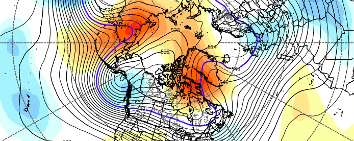
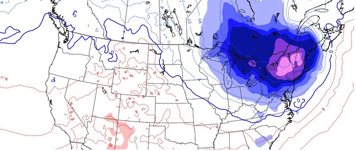
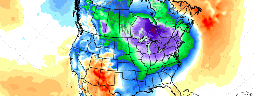
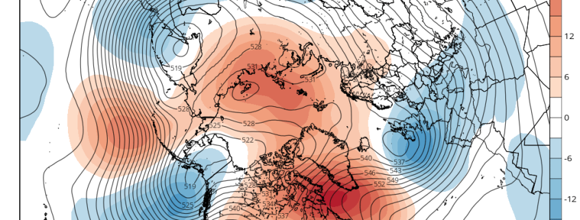
Good afternoon! The well-advertised signal of high-latitude blocking developing in the 2nd half of November continues to grow. It all starts with an amplification and slowing down of a Pacific wave train, which helps to pump latent heat towards the Poles, further leading to ridging extending towards the Poles. Subsequently, this changes the background state of the Arctic to the point where North Atlantic blocking becomes more feasible, and thus the entire Arctic is able to see blocking. This has big implications as we head into late November and December.

We explain and discuss all of this in our latest video update. For more written content regarding the blocking episode please refer to this article. For more context as to why this blocking is so important for cold in the East, please refer to this article.

The next step is figuring out how long exactly this blocking episode will last. We will keep you updated on our findings over the next few days!

Why is high latitude blocking a key for sustained cold in the East?

For quite some time now, we have been discussing the critical pieces that go into our Winter Forecast. The puzzle starts with current conditions – from the tropical Pacific to the Atlantic and Indian Oceans and everywhere in between. The current ENSO state has a huge impact on the forecast for any season, so understanding how these processes are impacting the global circulations is key.

There are secondary processes, however, that have a huge impact on the sensible weather experienced throughout the United States on any given day, week, or throughout a month. Understanding how these work are the meat and bones behind any seasonal forecast, and can make or break a forecast – even one that was founded on a correct forecast of larger scale processes (ENSO, etc).

Read more

Cold risks emerging to end November

There is something about this time of year that features more fanfare than the rest. Maybe it’s the approach of winter, or the first surge of cold air into the middle latitudes. Either way, it seems that the first week of November almost always features a bit more drama to the forecast than most weeks, and this year is no different. Forecast models have offered hints this week that the pattern may be set to undergo some significant changes as we look towards the end of Autumn. 

As most are aware, the middle latitude pattern in the Northern Hemisphere has been stagnant for quite some time now. Granted, there have been periods of colder than normal air – especially recently in the Northern Plains where departures neared -10 F on a 7 day average. But for the most part, East of the Mississippi River, temperatures have averaged above normal as a Southeast Ridge anomaly has remained stout, owing to La Nina background forcing from the tropical Pacific Ocean. 

Read more

Cold shot increasingly likely in the Northeast this weekend

A few weeks ago, while stagnant warmth continued to sit stubbornly East of the Mississippi River, the hemispheric weather pattern underwent a significant change. A pattern in the Pacific Ocean that had (not coincidentally) also been stagnant, finally budged. A large-scale retrogression of the wave pattern resulted in a dramatically changed pattern both in the Pacific and throughout the United States.

Two weeks later, an anomalous ridge has formed in the North/Central Pacific Ocean (known more affectionately as a -EPO) and has effectively dislodged arctic air from the higher latitudes into British Columbia, Western Canada, and the Northwestern United States. This has resulted in a large, persistently colder than normal temperature anomaly across these regions.

Read more