-2")
Understanding the difference between potential and hype
I think I personally hit a bit of a breaking point today. Around 6:00am this morning, we received an inquiry regarding the potential winter weather events next week. This is nothing terribly unusual — our email inbox is normally filled with these and we do our best to try and answer them and keep people informed. The title of the email read “Information Regarding Blizzard Feb 8” and the contents essentially asked us for our snowfall forecast for the upcoming “Blizzard” which the mailer was under the assumption was going to arrive next week. In the email was a model image, produced by Weatherbell Analytics, which showed the snowfall totals from a ECMWF Ensemble Control run at 200+ hours. It was then that I realized we had a big problem on our hands.
This is nobody’s fault. Not the mailer, nor the company which produced the map. It isn’t our fault, your fault, or any meteorologists. In fact — nobody is to blame. But it is a problem, because the image went viral on social media and many in the general public took it as fact. And so, as meteorologists, it is our job to source back this issue and try to figure out how to avoid it happening again. Similar things have occurred during storms in the past, as recently as a month ago, and the end result is never pretty.
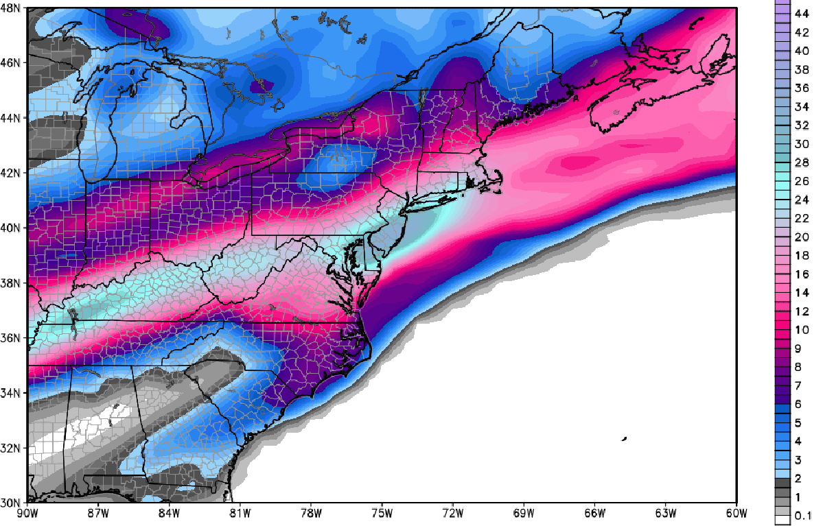
This snowfall total map, which went viral yesterday, is a snowfall forecast from an ensemble member of the ECMWF model.