Winter Forecast 2017-2018

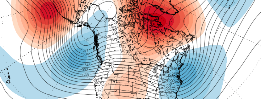
Seasonal forecasting is quite the challenge, but one we always look forward to. It seems every year we learn something new about the atmosphere. It is critical to have a fundamental understanding of how the atmosphere works, and the implications that changes from its base state can have on the weather pattern.

Instead of focusing on individual numerical indexes and their verbatim values, we are going to try to paint a picture of the atmosphere and what it will be doing over the next few months based on these phenomena:

  1. ENSO (El Nino Southern Oscillation) and tropical forcing
  2. High latitude behavior and blocking
  3. Analog years based on global pattern evolution

Read more

High latitude blocking increasingly likely through November

Good afternoon! Autumn like weather is in place as we speak across much of the Northeastern United States, with relatively seasonable temperatures. Enjoy it while it lasts. It will feel much more like winter very soon, as an arctic blast is set to arrive from Friday into Saturday. Very quickly, temperatures will fall 15 to 25 degrees below normal for this time of year, with record low temperatures possible over reporting climatology sites in the Northeast states. While this intensity of cold air will be short lived, colder than normal air will remain persistent.

A vigorous polar disturbance inside a shortwave trough will be swinging through the Great Lakes and Northeast tonight and Friday. This feature will amplify into a small closed low over Quebec later on Friday Night. The result will be a frigid airmass from Northern Canada swinging southward with a vengeance and reaching the Northeast USA from Friday into Friday Night. This type of southward movement of polar/arctic air is unusual this early in the season.

Read more