Confidence increasing in development of cold, active pattern in Eastern US

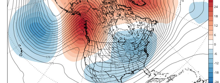
Good morning and happy Wednesday, everyone! Anomalous warmth has currently spread across a large majority of the United States, well forecast in is breadth and timing, but impressive nonetheless. Since the beginning of the week, much of the Midwestern United States has been blanketed by temperatures several degrees above normal averages for this time of year. The mid and upper level ridge in the atmosphere that is responsible for this warmth will continue its trek eastward over the next few days, allowing warmer temperatures to gradually move towards the Eastern United States.

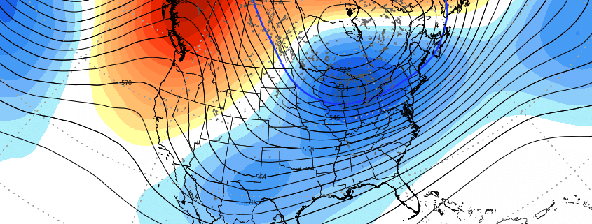
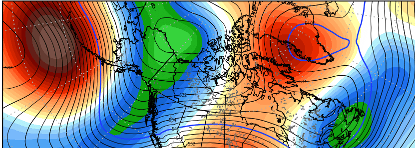
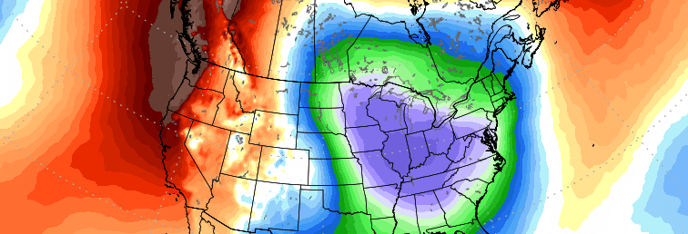
As we speak, thousands of miles away, in the North Pacific Ocean, a major change to the hemispheric weather pattern is underway. This fundamental change will mark the end of the anomalous warmth across the aforementioned regions, working in tandem with several other global circulations to support the development of an anomalously cold pattern. In fact, by the middle of next week, temperatures will fall well below average across a large portion of the Mississippi River Valley and East Coast. This will obviously have a large impact on the markets, and Gas Weighted Heating Degree Days are expected to quickly jump above the 10 and 30 year averages. Lets break down why this is happening and how we can expect things to evolve.

Read more

Midday Long Range: Transient warmth followed by big changes

Good afternoon and Happy Monday! Transient warmth remains the story during the better part of this ongoing week. In our morning briefing we discussed the evolution of a broad ridge, which will develop across the Western and Central United States this week. This ridging will shift eastward over the next 5 to 7 days, bringing anomalous warmth eastward with it. Warmer than normal temperatures are expected across a large portion of the United States this week, particularly in the Central and Northern Plains.

With the movement of this ridge eastward, as progressive as it may be in its overall nature, will come a steadily lower than normal GWHDD when compared to 10 and 30 year averages. This has been well reflected in the latest model data and in our forecast packages. We only made minor tweaks to our going forecast in the next 5 days or so. The major changes to the forecast look likely to come during the middle of December.

Read more

Signals strengthening for Mid December pattern change

Good afternoon! After a long and relaxing Thanksgiving weekend, the meteorological community almost always looks ahead to the weeks to come as December quickly approaches What lies ahead are some of the more critical weeks for many sectors, including construction, energy, natural gas and agriculture just to name a few. The weather pattern that occurs during this time frame is often critical to the winter forecast – not just in the short term, but also in the weeks beyond.

As you may recall, when we released our Winter Forecast in early November, we spoke of the December pattern as “higher than normal” confidence. The anticipated shot of cooler than normal air and episodes of higher latitude blocking have occurred, and we now approach an anticipated period of moderation. What happens beyond this, however, is the key piece to a forecast that features a flip to colder than normal temperatures across the United States. The evolution of the pattern throughout the hemisphere is beginning to fall into place – so lets discuss!

Read more

Why might forecast models be diverging with the long range pattern?

Good morning! The past several days have been quite active in the meteorological community.We began last week on the tail end of a pattern featuring stagnant warmth, with ridging in the Eastern United States and cold air bottled up in Western Canada and the Pacific Northwest. A well advertised change has occurred since that time, however, with cold air surging southeastward into the Great Lakes and Northeast States.

Read more