Heat wave, severe storms highlight upcoming weekend

Stock up on the sunscreen.

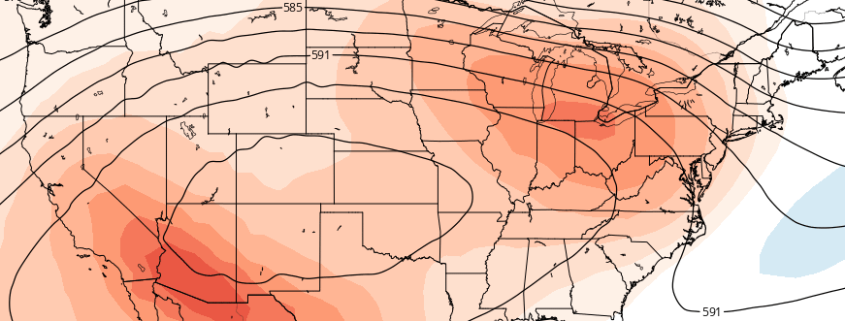
Forecast models are in good agreement that a large, anomalous ridge over the Central United States will build eastward toward the Mid Atlantic and Northeast states during the middle to latter part of this week. As it does so, very warm temperatures in the mid and low levels of the atmosphere will surge toward the area, and high temperatures at the surface will climb fairly rapidly as the weekend approaches — a heat wave.

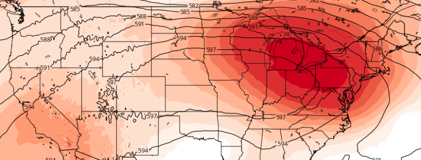
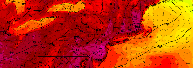
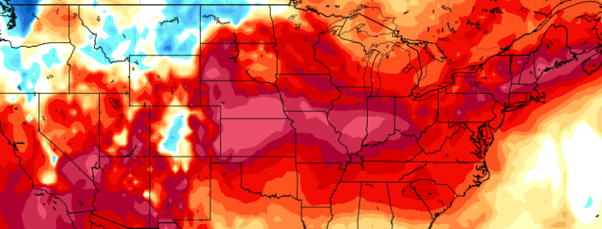
By the weekend itself, high temperatures may approach or exceed 100 degrees in many locations, with a piece of the core of the aforementioned ridge settling overhead. West winds — even with a northwesterly component at times — will help to suppress any seabreeze or ocean influence, and keep the air extremely hot, and even dry for a day or two.

Read more

Bouts of heat, multiple MCS threats to end July

The hot weather is here — and as we have mentioned in our posts for the past week or so, it isn’t expected to go anywhere any time soon. While the pattern will remain somewhat transitional this weekend, a tremendous mid level ridge is forecast to build across the Central United States by the middle part of this upcoming week. This ridge will become the dominant feature in the jet stream and weather pattern throughout the Contiguous United States during this time frame.

The core of the ridge, and the center of the big-time heat, is likely to stay well to our west. The ridge center is expected to drift from the Mississippi River Valley westward toward the Plains states during the week ahead. However, the breadth of the ridge is likely to grow during this time frame, with rising mid level heights extending all the way to the Northeast United States.

Read more

Alt

Heat, storms increasingly likely the next two weeks

A large and anomalous heat ridge is forecast by most mid-range operational and ensemble model guidance to build over the Central United States. The process will actually begin by early next week, as heights in the mid and upper levels of the atmosphere rapidly increase over the Central United States. Troughing over the Northwest United States will act to enhance this ridging, with mid and upper level heights approaching anomalous levels by the middle to end of next week.

Medium range ensemble support, at this range, is actually quite remarkable. Both the GFS and ECMWF ensemble means (the averages of multiple-member ensemble runs) show a tremendous ridge over the Central US, pulsing and expanding northeastward toward the Great Lakes and Northeast. While the brunt of the unbearable heat will likely miss our area to the south and west, the heat will still be felt. More notably, however, is the fact that our area will likely lie along the periphery of this ridge, in the path of multiple atmospheric disturbances.

Read more

Building ridge will bring heat, severe wx chances through July

Within a pattern which has been well discussed for a week or more, changes are afoot during the middle to latter part of this week. The troughing and cooler air, which had become a mainstay over the Northeast US over the past several weeks, will be replaced by increased atmospheric ridging. Warmer air and heat, with temperatures over 90 F, is expected to push into the area by the middle part of this week, and last through the weekend.

This airmass will be marked by mid level temperatures warming up quite dramatically. Temperatures at the 850mb level, or 5000 feet above the ground, will warm to 20 C or above – often times the “demarcation line” for a heatwave in this part of the country. On both Wednesday and Thursday, 850mb temperatures will approach or exceed this 20 C threshold over parts of the area, and not surprisingly forecast models have indicated temperatures in the mid 90’s on both days.

Read more